- Chakragil
-
Chakragil Location in China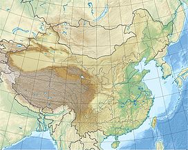
 Chakragil
Elevation 6,760 m (22,178 ft) [1][2] Prominence 2,934 m (9,626 ft) [1] Listing Ultra Location Location Xinjiang, China Range Kunlun Mountains Coordinates 38°51′57″N 75°06′30″E / 38.86583°N 75.10833°ECoordinates: 38°51′57″N 75°06′30″E / 38.86583°N 75.10833°E[1][3] Climbing First ascent September 1, 1988 by Misao Hirano, Minoru Hachisu, Kenji Nakayama Easiest route glacier/snow climb Chakragil (or Chagragil, Chakar Aghil, Kingata Tagh [or Kingata Tagh II, see below]) is a major mountain in Xinjiang, China. It is located about 100 kilometres (60 mi) southwest of Kashgar, about 60 kilometres (40 mi) due north of Muztagh Ata, and 37 kilometres (23 mi) northwest of Kongur.[4] It is in the subrange known as the Kingata Shan, at the extreme northwest end of the Kunlun Mountains, near the Pamir Mountains, and is sometimes considered part of the latter. The Gez River flows just south of the mountain.[5]
Due to its remote location, Chakragil is a little-visited peak. It was attempted by the famed mountaineering pair of Eric Shipton and Bill Tilman in September, 1948. However they only reached a height of about 5,200 m (17,000 ft). On September 1, 1988, Japanese leader Misao Hirano, together with Minoru Hachisu and Kenji Nakayama, made the first ascent of the mountain.[4] The peak was climbed again in 2000 by Mark Newcomb, alone, via the west ridge.[6] The Himalayan Index lists no other ascents or attempts.
Names of peaks and ranges in this area are often uncertain. Chakragil is one of the peaks in the Kingata Shan, but it is unclear which of these peaks it should be identified with. For the purposes of this article (in particular the topographic prominence value), we are treating Chakragil as identical with Kingata Tagh, the highest peak of the Kingata Shan. If this identification is incorrect (in particular, Chakragil may actually be Kingata Tagh II), it is unclear what peak(s) were climbed in 1988 and 2001, and it is unclear whether Kingata Tagh has been climbed.[7] A map of Central Asia published by Map Link shows a 6760 meter mountain north of the Gez river which it calls 'Karabekter Tagh'. It shows Chakragil as a small lake to the southwest. The mountain is just north of the Karakorum Highway.
Notes
- ^ a b c Xinjiang ultra-prominent peaks on PeakList.org
- ^ Other sources give the height as 6,725 m (22,064 ft); see the AAJ 1989 reference and the Tilman reference. Also see the discussion about Kingata Tagh.
- ^ Note that the Himalayan Index has a seriously incorrect latitude for this peak.
- ^ a b "Chagragil", American Alpine Journal, 1989, p. 293.
- ^ H. W. Tilman, China to Chitral (1951), in The Seven Mountain-Travel Books (The Mountaineers, 2003), ISBN 0-89886-960-9, pp. 712-726.
- ^ "Chakragil, West Ridge", American Alpine Journal, 2001, p. 403.
- ^ A detailed discussion of the range appears at the Kingata Tagh page on Summitpost.
Categories:- Mountains of China
- Geography of Xinjiang

Wikimedia Foundation. 2010.