- Quebec City
-
Quebec City – Windsor Corridor — Region — 
Country  Canada
Province  Ontario,
  Quebec
Population (2006 est.) – Total 18,000,000 Time zone EST (UTC−5) – Summer (DST) EDT (UTC−4) Postal code prefixes G, H, J, K, L, M, N Area code(s) 226, 289, 343, 416, 418, 438, 450, 514, 519, 579, 581, 613, 647, 705, 819, 905 Quebec City – Windsor Corridor is the most densely-populated and heavily-industrialized region of Canada. As its name suggests, it extends from Quebec City in the east to Windsor, Ontario in the west, spanning 1,150 kilometres (710 mi). With more than 18 million people, it contained 51% of the country's population and three of Canada's four largest metropolitan areas according to the 2001 Census. In its relative importance to the country's economic and political infrastructure, it has many similarities to the Northeast megalopolis in the United States. The name was first popularized by Via Rail, which runs frequent passenger rail service in the Quebec City – Windsor Corridor on its route named "The Corridor".
Contents
Geography
The corridor extends from Quebec City, Quebec in the northeast to Windsor, Ontario in the southwest, running north of the Saint Lawrence River, Lake Ontario and Lake Erie.
Significant urban areas along the corridor include:
Other significant urban areas along the corridor include: Lévis, Cornwall, Brockville, Kingston, Belleville, Mississauga, Niagara Falls, Chatham-Kent, Sherbrooke, Laval, Gatineau, Peterborough, Guelph, Brantford, Barrie, and Sarnia.

Cities located in neighbouring American regions (such as Western New York and Southeast Michigan) are not considered part of the corridor but have many significant cultural, economic, and political ties with urban areas on or near the border such as the Detroit-Windsor area.
For most of its length, the corridor runs through a narrow strip of farmland with the Canadian Shield to the north and the Appalachian Mountains or the Great Lakes to the south. A drive of only a few minutes north from many of the corridor's cities or towns will show an abrupt change from flat farmland and limestone bedrock to the granite hills of the shield. The highways often run right on the boundary of the shield, and it is possible to observe the frequent change from limestone to granite in rockcuts along the way. There are, however, several wider areas of flat farmland, including the southwestern Ontario peninsula between Lake Huron and Lake Erie, the eastern Ontario delta from Ottawa to the junction of the Ottawa and St. Lawrence Rivers at Montreal, and the Eastern Townships southeast of Montreal. There is also a minor Great Lakes corridor of stratified limestone called the Niagara Escarpment.
Because of the moderating influence of the Great Lakes and the frequent influx of warm, moist air from the Gulf of Mexico, the corridor—particularly the western half—has a markedly warmer climate than the rest of central Canada. The rich soil and the warm climate mean that the flora and fauna in the corridor are similar to those in the deciduous forests of the eastern United States as far south as Virginia, rather than the evergreen boreal forest that covers most of central Canada up to the Arctic. The forest in southwestern Ontario is often referred to as Carolinian forest.
The majority of the Canadian population is situated along this corridor. For example, according to the 2006 Canadian Census, more than 67% of Ontario's population live in its portion of the corridor. Similarly, nearly half of Quebec's population live in or close to Montreal and Quebec City. About half of Canada's total population live between Quebec City and Windsor.[1]
History
Early history
During the French colonization, this area of New France was named Canada and was a single administrative unit under the governor-general (with regional deputy governors in some cities). However only the eastern third of the corridor, from Quebec City to Montreal, was heavily settled. The major cross-country route used by voyageurs in the fur trade continued west from Montreal through the Canadian Shield along the Ottawa Valley to Lake Nipissing and Georgian Bay, passing far to the north of what would later become the Ontario part of the corridor. The lack of good farmland made that route unsuitable for settlement, however, and the frequent portages made transportation in boats larger than canoes difficult.
Revolutionary War
When the English-speaking United Empire Loyalists arrived in Canada after the American Revolution, they naturally settled along the narrow strip north of the St. Lawrence River and lower Great Lakes, where good farm land was available and larger boats could be used for transportation, and these people formed the English-speaking nucleus of what would later be Ontario (by contrast, many of the Ontario towns along the old fur-trading and logging route to the north, through the Ottawa Valley and westward, still have small French-speaking populations). Initially, Kingston was the principal city of the English half of the corridor, but eventually Toronto outgrew it.
During both the North American part of the Seven Years' War between Great Britain and France and the War of 1812 between United Kingdom and the United States, settlements along the corridor were at the centre of the conflicts. Ottawa was eventually chosen as Canada's capital by Queen Victoria precisely because it was further inland and thus less vulnerable to attack, though it is now also considered part of the corridor. The Rideau Canal was constructed to provide a way to bypass the most vulnerable part of the corridor, from Cornwall to Kingston, where it lies directly on the U.S. border.
The construction of the Saint Lawrence Seaway during the late 1950s made it possible for some ocean-going vessels to travel the full length of the corridor and beyond to the upper Great Lakes, but resulted in the destruction of several villages in the Eastern Ontario portion of the corridor.
Transportation
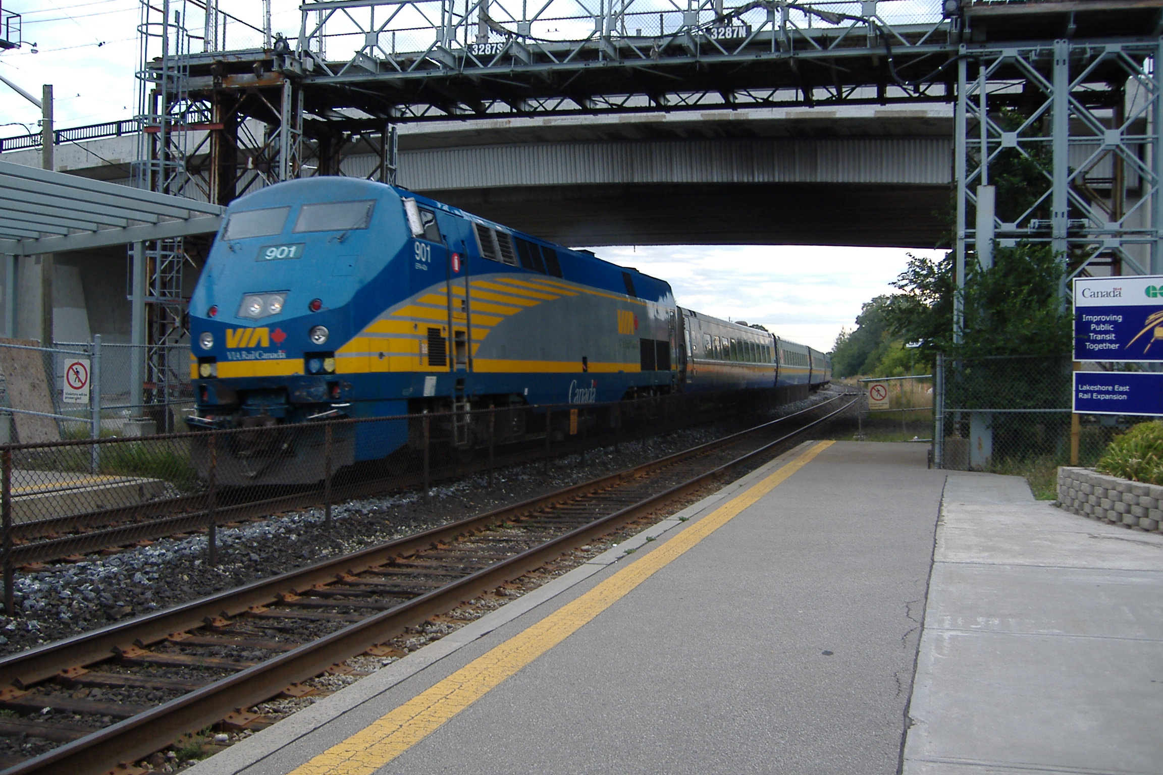
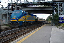 Via Rail Corridor Train.
The corridor is held together by a series of major transportation routes—water, road, rail, and air—all running close together and sometimes overlapping each other. These routes are anchored by Highway 401, the busiest highway in North America[2] from Windsor leading into Quebec Autoroute 20 to Quebec City.
Waterways
The oldest transportation route is the St. Lawrence River and Great Lakes, where the series of channels and locks that make up the St. Lawrence Seaway allow ocean-going vessels and lake freighters to travel the entire length of the corridor.
Roadways
The Ontario portion of the corridor was originally joined by Highway 2 (often known locally by names such as "Montreal Road," "Toronto Road," "Dundas Street," or "Kingston Road") following the routes of older stagecoach roads and the paths and trails that predated them. Highway 2 still forms the main street of many of the corridor's Ontario towns and cities (which were built around it), but large parts of the highway are now maintained by counties or municipalities rather than the province. From 1938 to 1968 the province of Ontario built Highway 401, a freeway that bypasses most of the town and city centres. Highway 401 is now the main transportation route of the corridor up to the Quebec border, where it becomes Autoroute 20 and continues east through the Quebec part of the corridor to Quebec City.
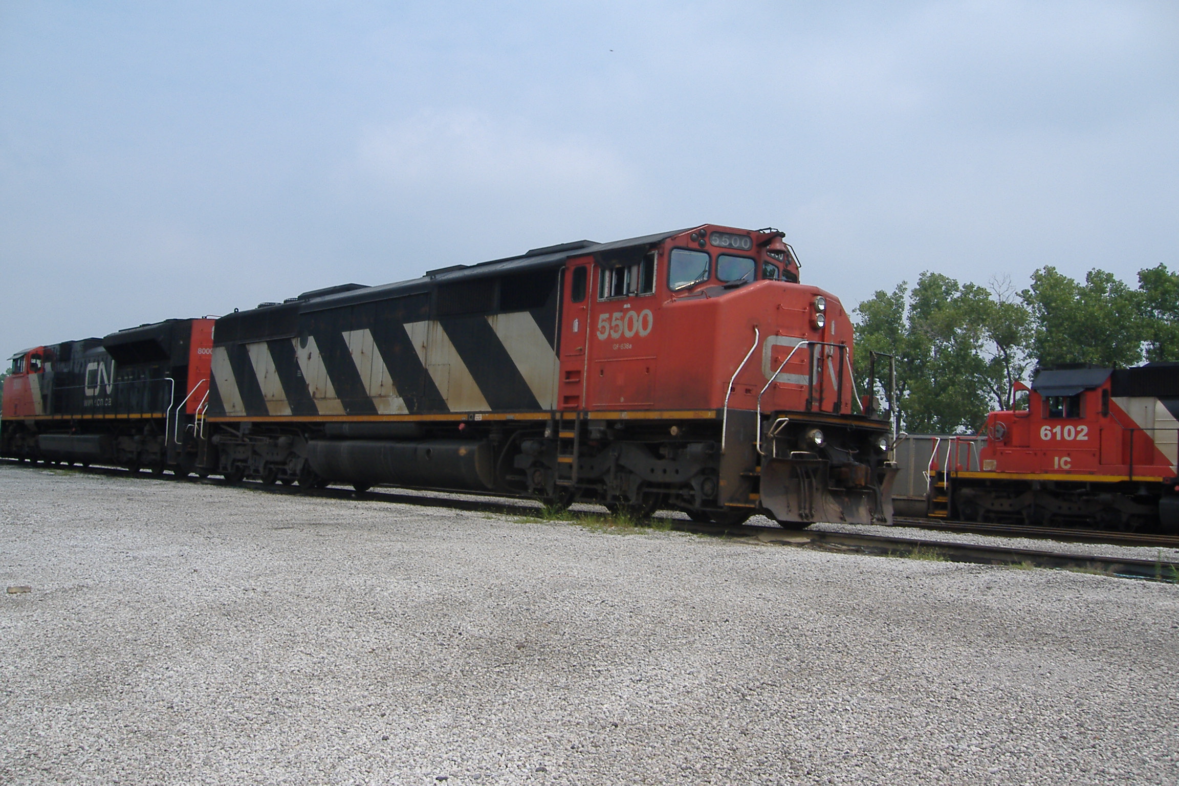
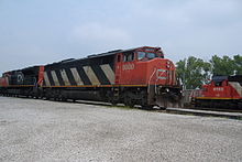 CN is a predominant freight railroad in the corridor.
Rail
Both the Canadian National Railway (CN) and the Canadian Pacific Railway (CP) have extensive freight railway lines along the length of the Quebec City – Windsor Corridor. Intercity passenger railway service is provided by Via Rail throughout the region, mostly using CN freight lines. Referred to in Via Rail's published timetables as simply the Corridor, the Quebec City – Windsor Corridor is the busiest portion of the Via system, accounting for the majority of Canada's intercity passenger trains and ridership. About 67% of Via Rail's total revenue is earned on the Quebec City – Windsor Corridor.
Other inter-city trains from outside the region originate and terminate at cities in the Corridor, such as Via's Canadian, Montreal – Gaspé train and Ocean, and ONR's Northlander. Amtrak offers an international inter-city passenger railway service along parts of the corridor between Toronto and New York City and Montreal and New York City.
Prior to Via's formation in 1978, both CN and CP operated Corridor services. Proposals have been advanced to build a high-speed rail link in this corridor. On November 14, 2011, the governments of Ontario, Quebec and Canada have officially released the final report of a high-speed rail study for this corridor.[3]
Airports
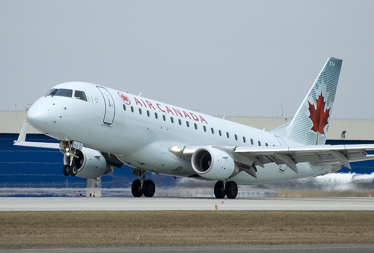
 Air Canada operates a large portion of the flights in the corridor
The major passenger airports along the corridor are Toronto Pearson International Airport (ranked 20th globally for International passenger traffic and 18th for aircraft traffic), Montréal-Pierre Elliott Trudeau International Airport (ranked 2nd in Canada for total passengers and aircraft traffic), Ottawa Macdonald-Cartier International Airport, Québec/Jean Lesage International Airport, Hamilton/John C. Munro International Airport (ranked 2nd in Canada for cargo traffic) and the military airbases at CFB Trenton and CFB Petawawa. There are roughly 90 flights between Montreal, Ottawa and Toronto every work day, making it the busiest air route in Canada and 15th busiest air route in the world.
Other civilian corridor airports with scheduled airline service include Windsor Airport, Sarnia (Chris Hadfield) Airport, London International Airport, Region of Waterloo International Airport, Toronto City Centre Airport, Kingston/Norman Rogers Airport, Lake Simcoe Regional Airport and Gatineau-Ottawa Executive Airport. Montréal-Mirabel International Airport is a large facility near Montreal that is mainly used for cargo flights but is also home to MEDEVACs[4] and general aviation[5][6] flights.
Inside the corridor, the busiest area of travel is the Toronto–Ottawa–Montreal triangle. Air Canada serves the three cities with its Rapidair service, offering hourly flights, and its principal competitor WestJet offers similar service. Porter Airlines runs frequent commuter flights from Toronto City Centre Airport to Ottawa and Montreal, while Air Canada Jazz offers commuter flights connecting many of the smaller airports to Toronto, Ottawa, and Montreal. Recently Bearskin Airlines began running commuter flights between Ottawa and Kitchener. In addition to scheduled air service, some of the airports along the corridor also have frequent charter flights like Air Transat and Sunwing to popular tourist destinations.
See also
References
- ^ "2006 Census analysis series". 2.statcan.ca. 2009-10-13. http://www12.statcan.ca/census-recensement/2006/as-sa/index-eng.cfm. Retrieved 2009-11-20.
- ^ http://alphabet-city.org/issues/fuel/articles/the-post-carbon-highway
- ^ High-Speed Passenger Rail Study Released
- ^ It's liftoff for AirMédic ambulance
- ^ Mirabel redécolle
- ^ Canada Flight Supplement. Effective 0901Z 20 October 2011 to 0901Z 15 December 2011
External links
- General information
- Making Transportation Sustainable: A Case Study of the Quebec City – Windsor Corridor from Environment Canada, including information about the population and extent of the corridor.
- Transportation in Quebec: Economic Overview from Transport Canada, describing the population and transportation clustering along the corridor in Quebec.
- Air pollution in the Windsor – Quebec City corridor: the price of the automobile?, from Environment Canada
- Population distribution in Ontario from the Canadian Encyclopedia
- Population distribution Canada from Stats Canada
- Transportation
- Discussion of pros and cons of jet trains in the corridor
- Via Rail
- AMT
- O Train
- GO Transit
- Air Canada's RapidAir service
Coordinates: 44°20′N 77°05′W / 44.34°N 77.08°W
Great Lakes of North America Main lakes 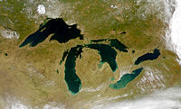
Secondary lakes Waterways Detroit River • Erie Canal • French River • Great Lakes Waterway • Niagara River • Nipigon River • St. Clair River • Saint Lawrence River • Saint Lawrence Seaway • St. Marys River • Soo Locks • Straits of Mackinac • Trent–Severn Waterway • Welland CanalLists of islands Historic geology Lakeshores Related topics Basin • Bays of the Great Lakes • Great Lakes region • Georgian Bay • Great Lake ships • Isle Royale • Lake effect • Manitoulin Island • Megalopolis • Quebec City – Windsor Corridor • Settlements • Shipwrecks • Tall shipsCategories:- Geographic regions of Ontario
- Geography of Quebec
- Metropolitan areas of Canada


Wikimedia Foundation. 2010.