- Clayton, Alabama
-
Clayton, Alabama — Town — Courthouse Square in Clayton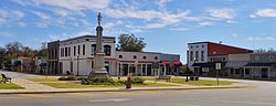 Location in Barbour County and the state of Alabama
Coordinates: 31°52′39″N 85°26′56″W / 31.8775°N 85.44889°W Country United States State Alabama County Barbour Area – Total 5.5 sq mi (14.1 km2) – Land 5.5 sq mi (14.1 km2) – Water 0 sq mi (0 km2) Elevation 591 ft (180 m) Population (2000[1]) – Total 1,475 – Density 268.2/sq mi (104.6/km2) Time zone Central (CST) (UTC-6) – Summer (DST) CDT (UTC-5) ZIP code 36016 Area code(s) 334 FIPS code 01-15376 GNIS feature ID 0116206 Clayton is a town in and the county seat of Barbour County, Alabama, United States. The population was 1,475 at the 2000 census.[1]
Contents
History
County Seat of Barbour County Clayton has been the county seat since 1834, two years after the creation of Barbour County. Clayton is located geographically in the center of the county. The town was located at the headwaters of the Pea and Choctawhatchee rivers on the historic road from Hobdy's Bridge over the Pea River to Eufaula on the Chattahoochee River. By 1818, there were a few settlers in the area around Clayton but settlement began in earnest around 1823. The town was named for Augustine S. Clayton, a Georgia jurist and congressman. Clayton became the county seat of Barbour County in 1833 and was laid out on a central courthouse square plan. The first Circuit Court was held in Clayton on September 23, 1833. The Clayton post office was established in September 1835 with John F. Keener as postmaster. Clayton, with a population of 200, was incorporated on December 21, 1841 by the Alabama Legislature. Its first mayor, after incorporation, was John Jackson.
Clayton has a rich heritage with four properties listed on the National Register of Historic Places. Clayton is also known for its Whiskey Bottle Tombstone, which was featured in Ripley's Believe It or Not!. [2]
Governor George Wallace was born in nearby Clio, Alabama and began his legal and political career in Clayton.
Geography
Clayton is located at 31°52'39.014" North, 85°26'56.486" West (31.877504, -85.449024).[3]
According to the U.S. Census Bureau, the town has a total area of 5.4 square miles (14 km2), all of which is land.[4]
Demographics
As of the census[5] of 2000, there were 1,475 people, 593 households, and 393 families residing in the town.[1] The population density was 270.5 inhabitants per square mile (104.4 /km2). There were 704 housing units at an average density of 129.1 per square mile (49.8 /km2). The racial makeup of the town was 63.93% Black or African American, 34.85% White, 0.20% Native American, 0.41% from other races, and 0.61% from two or more races. 1.36% of the population were Hispanic or Latino of any race.[1]
There were 593 households out of which 30.9% had children under the age of 18 living with them, 36.1% were married couples living together, 27.2% had a female householder with no husband present, and 33.6% were non-families. 31.5% of all households were made up of individuals and 16.4% had someone living alone who was 65 years of age or older. The average household size was 2.37 and the average family size was 2.95.[1]
In the town the population was spread out with 26.0% under the age of 18, 8.8% from 18 to 24, 26.2% from 25 to 44, 22.4% from 45 to 64, and 16.5% who were 65 years of age or older. The median age was 36 years. For every 100 females there were 86.2 males. For every 100 females age 18 and over, there were 83.4 males.[1]
The median income for a household in the town was $18,750, and the median income for a family was $25,750. Males had a median income of $29,583 versus $20,417 for females. The per capita income for the town was $11,791. About 29.3% of families and 31.8% of the population were below the poverty line, including 43.5% of those under age 18 and 29.8% of those age 65 or over.[1]
Education
Clayton is served by Barbour County Schools. Barbour County High School, Clayton Elementary School, and Barbour County Primary School are located in the town of Clayton.
Notable natives
- Tyrone 'Ty' Adams (born 1949) - playwright (Conecuh,Wallace: The Clayton Years)
- George W. Andrews (1906–1971) - U.S. House of Representatives
- Billy Beasley (born 1940)- Alabama House of Representatives
- Jere Beasley (born 1935)- Two term Lieutenant Governor of Alabama and acting Governor of Alabama
- Bertram Tracy Clayton (1862–1918)- U.S. House of Representatives representing New York and U.S. Army officer killed in World War I.
- Henry Delamar Clayton,Jr. (1857–1929) - U.S. House of Representatives , author of the Clayton Act regulating antitrust behavior.
- Henry De Lamar Clayton, Sr. (1827–1889) - major general in the Confederate army; President of the University of Alabama
- Preston C. Clayton (d. 1996)- Alabama State Senate and Associate Justice of State of Alabama Supreme Court
- Travis Grant (born 1950) - college and professional basketball player
- Draffus Lamar Hightower (1899–1993)- photographer, reocrded changes to Barbour County through the 20th Centrury[6]
- Clarence Clemet Hodge (1893–1967) - Major League Baseball pitcher
- John E. Horne (1908–1985) - Administrator of the U.S. Small Business Administration
- Ann Lowe (1899–1981)- Designer of wedding dress for Jacqueline Bouvier Kennedy Onassis for her marriage to John F. Kennedy.
- James Sammons (1927–2001) - Chairman of the Board of Trustees and later Executive Vice Presidentof the American Medical Association
- George Wallace (1919–1998) - Governor of Alabama and U.S. President candidate
- George C. Wallace, Jr. (born 1951) - Alabama State Treasurer
- Lurleen Wallace (1926–1968) - Governor of Alabama 1926-1968
- James J. Winn (born 1907- ?) - Colonel in U.S. Army; Chief military aide to Gen. George C. Marshall during World War II
Gallery
-
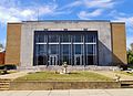
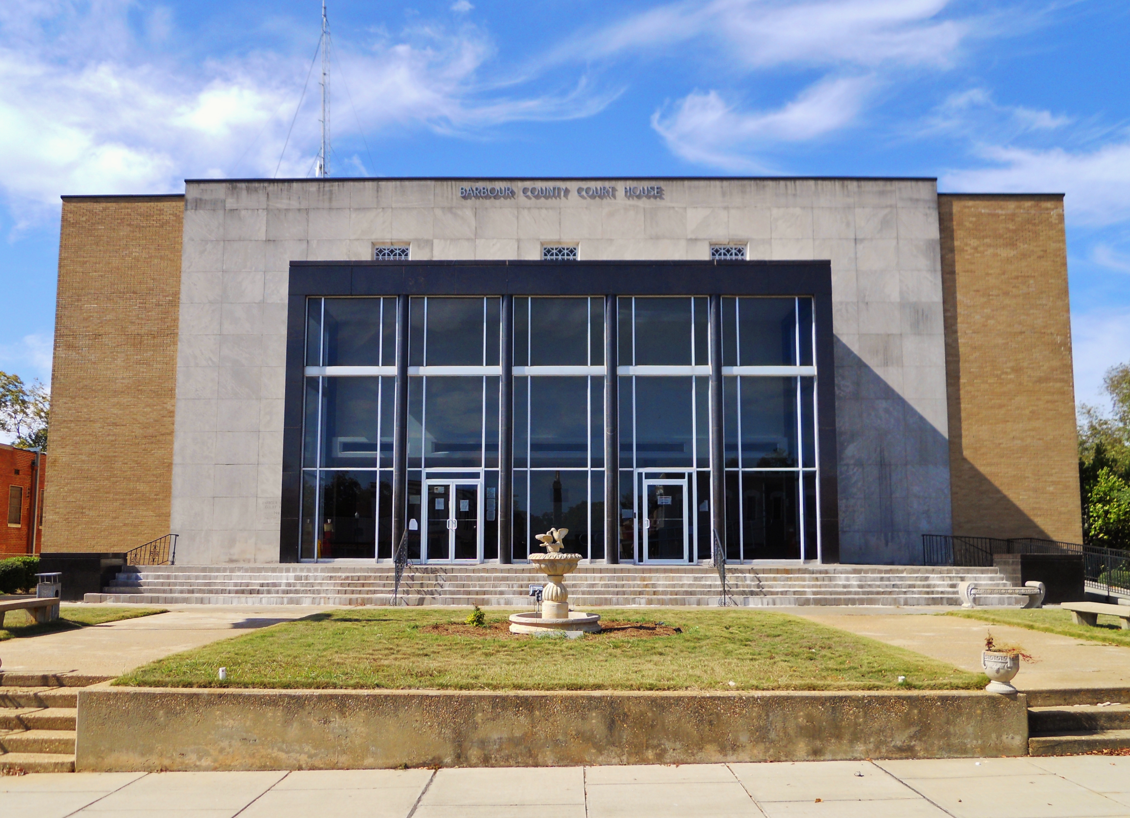
The Barbour County Courthouse is located in Clayton which is the county seat of Barbour County.
-
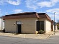
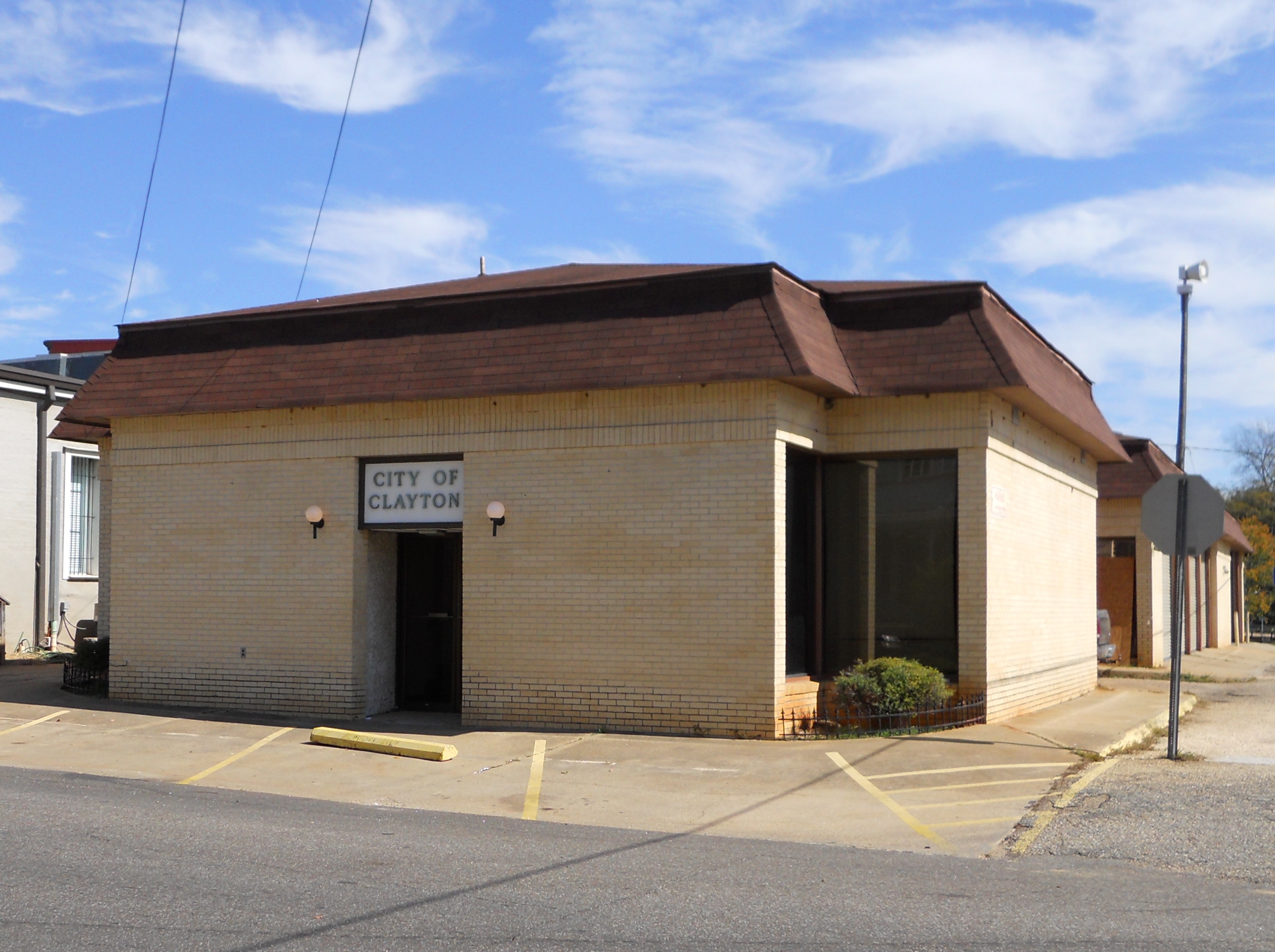
Clayton City Hall
-
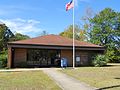
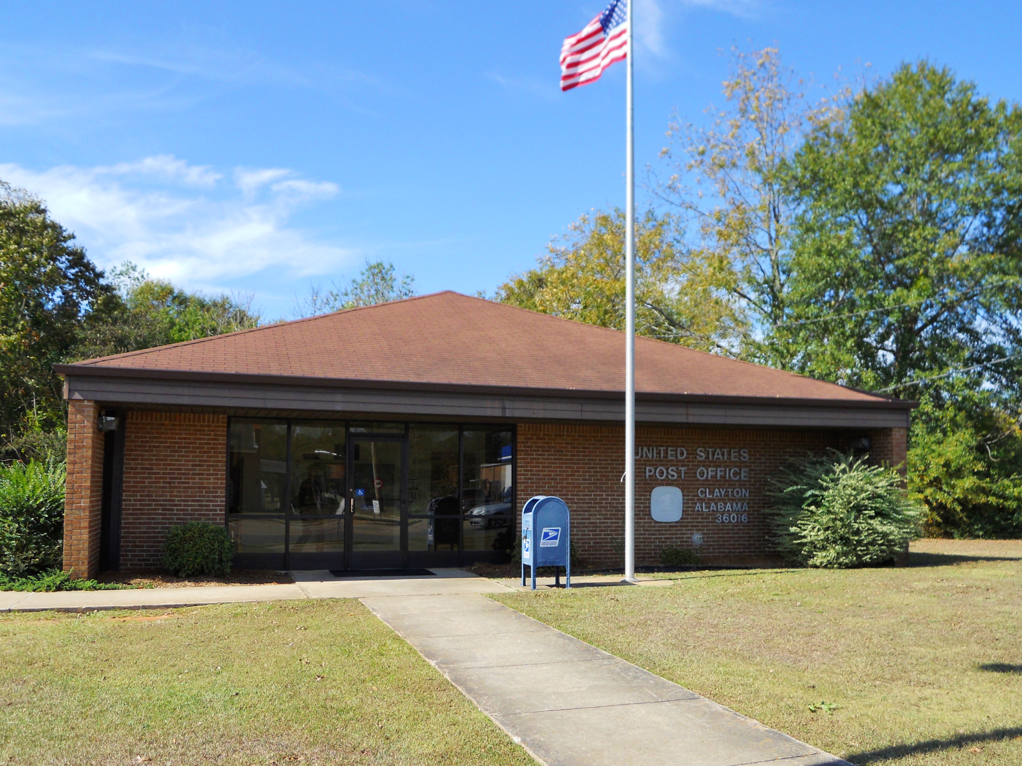
The post office in Clayton (ZIP Code: 36016).
-

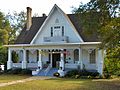
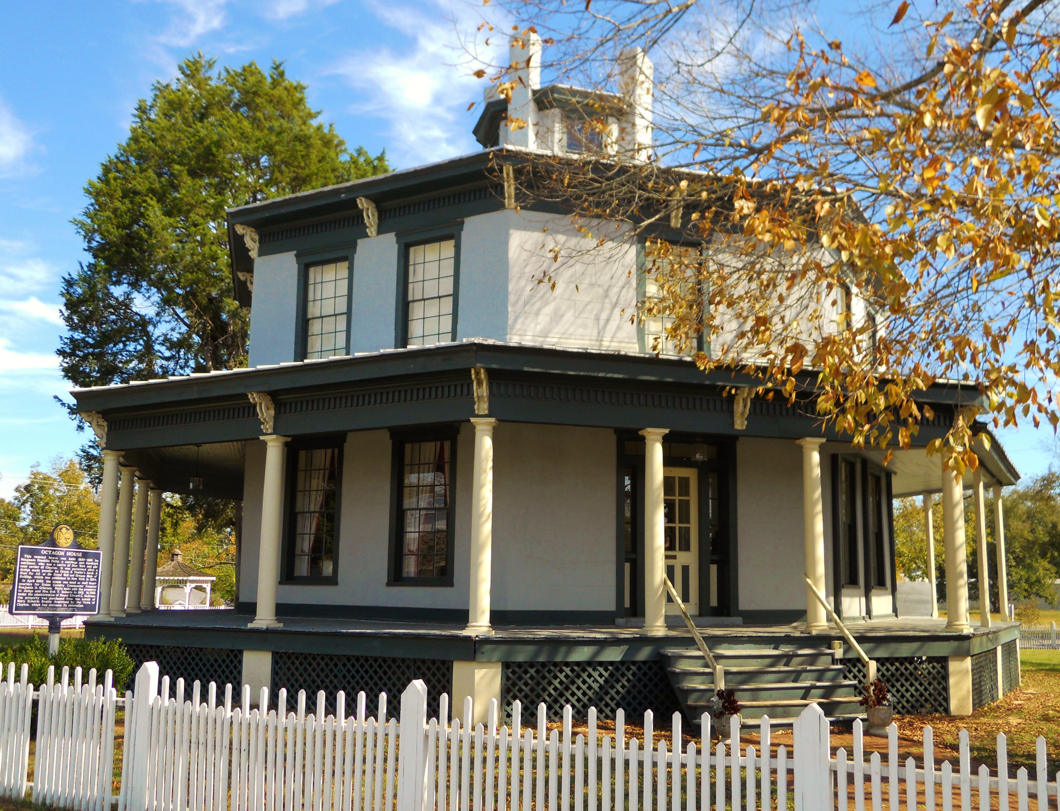
The Petty-Roberts-Beatty House is an Octagon House built in 1861 by Benjamin Franklin Petty. It is one of only two antebellum octagonal houses built in Alabama and the only one to survive. It was added to the National Register of Historic Places on January 21, 1974
-
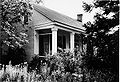
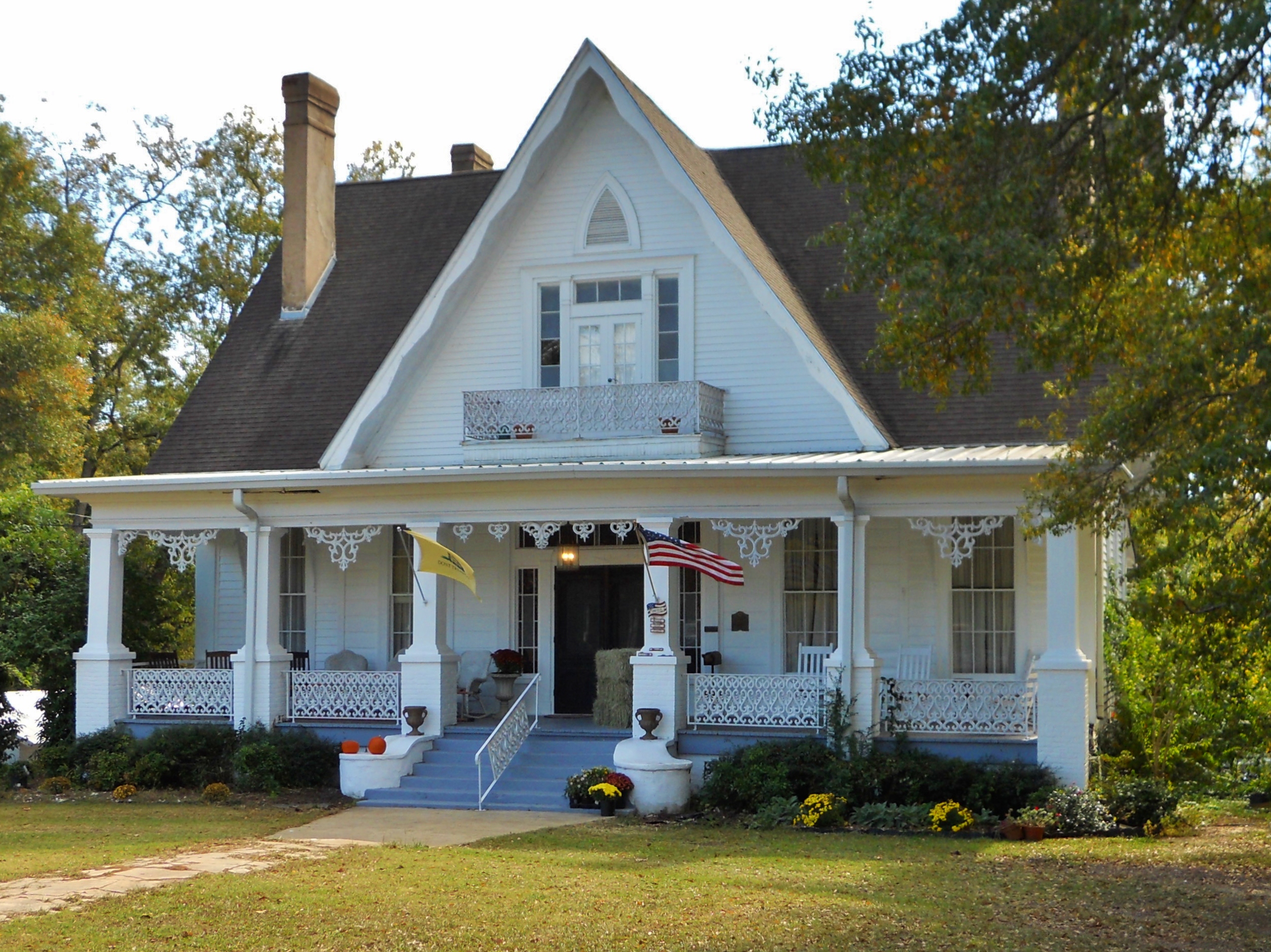
The Miller-Martin Town House was built in 1859 by John H. Miller. this Gothic Revival townhouse is noteworthy for its hand-painted murals on the entrance hall ceiling which depict the four seasons as well as other designs on the parlor and dining hall ceilings. It was added to the National Register of Historic Places on December 16, 1974
-
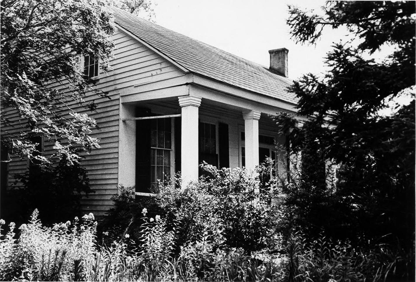
The Henry D. Clayton House was built around 1850 and served as the home of both Confederate General Henry D. Clayton, Sr., former President of the University of Alabama as well as his son Henry D. Clayton, Jr., a legislator, a judge and the author of the Clayton Antitrust Act of 1914. It was added to the National Register of Historic Places on December 8, 1976
-

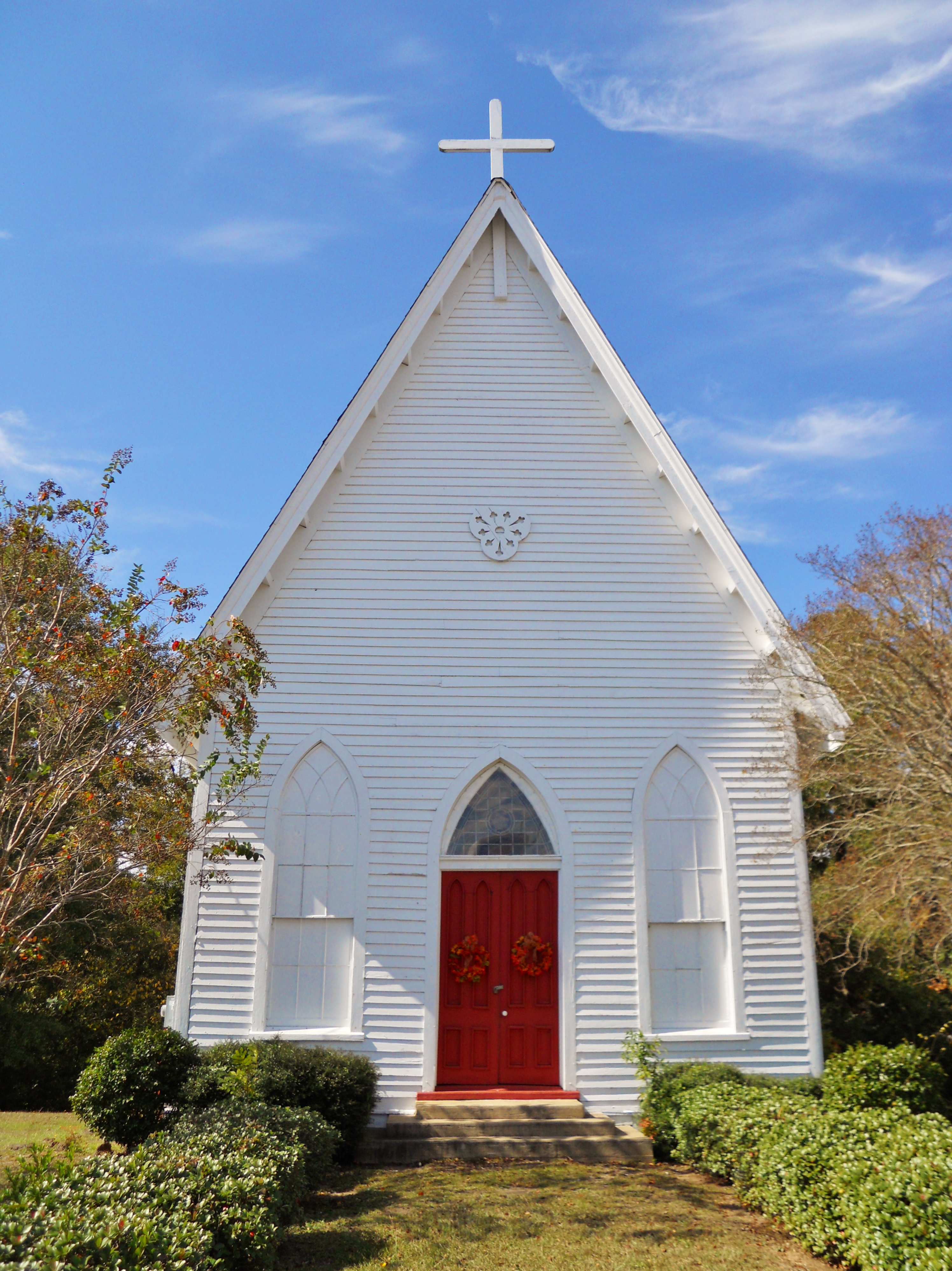
The Grace Episcopal Church is a Gothic Revival style building. It was completed on February 26, 1876 at which time the property was deeded by the Clayton Family to the Protestant Episcopal Church of the State of Alabama. Bishop Richard J. Wilmer formally consecrated the church on November 14, 1876. It was added to the National Register of Historic Places on September 22, 1995
References
- ^ a b c d e f g "Fact Sheet: Clayton town, Alabama". American Fact Finder. United States Census Bureau. http://factfinder.census.gov/servlet/SAFFFacts?_event=Search&geo_id=&_geoContext=&_street=&_county=clayton&_cityTown=clayton&_state=04000US01&_zip=&_lang=en&_sse=on&pctxt=fph&pgsl=010&show_2003_tab=&redirect=Y. Retrieved 6 January 2010.
- ^ Small Town Historic Markers, Alabama Tourism Department, http://www.alabama.travel/homecoming/, retrieved 2011-10-31
- ^ "US Gazetteer files: 2010, 2000, and 1990". United States Census Bureau. 2011-02-12. http://www.census.gov/geo/www/gazetteer/gazette.html. Retrieved 2011-04-23.
- ^ "Geographic Comparison Table- Alabama". American Fact Finder. United States Census Bureau. http://factfinder.census.gov/servlet/GCTTable?_bm=y&-geo_id=04000US01&-_box_head_nbr=GCT-PH1&-ds_name=DEC_2000_SF1_U&-format=ST-7. Retrieved 6 January 2010.
- ^ "American FactFinder". United States Census Bureau. http://factfinder.census.gov. Retrieved 2008-01-31.
- ^ To Remember a Vanishing World: D.L. Hightower's Photography of Barbour County, Alabama, 1930 - 1965. Thomason, Michael V.R. and Michael Thomason,University of Alabama Press (1997) ISBN 0945477112
External links
Coordinates: 31°52′39″N 85°26′56″W / 31.877504°N 85.449024°W
Municipalities and communities of Barbour County, Alabama County seat: ClaytonCities 
Towns Blue Springs | Clayton | Louisville
Unincorporated
communitiesComer | Elamville | Mt. Andrew
Categories:- Towns in Alabama
- Populated places in Barbour County, Alabama
- County seats in Alabama
- Populated places in Alabama with African American majority populations


Wikimedia Foundation. 2010.