- Combpyne
-
Coordinates: 50°43′33″N 3°00′26″W / 50.72575°N 3.00727°W
Combpyne 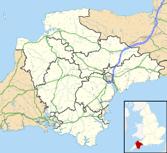
 Combpyne
Combpyne shown within DevonOS grid reference SY289922 Shire county Devon Region South West Country England Sovereign state United Kingdom Post town AXMINSTER Postcode district EX13 Police Devon and Cornwall Fire Devon and Somerset Ambulance South Western EU Parliament South West England UK Parliament East Devon List of places: UK • England • Devon Combpyne is a hamlet in East Devon off the A3052 road between Colyford and Lyme Regis in Dorset.
Situated in a Devon combe, this scattered hamlet includes a medieval manor house, a 12th century church and a village pond known as 'The Harbour'. It is in a parish that also includes the village of Rousdon to the south.
Combpyne once had a railway station on the Lyme Regis branch line that closed in 1965. Traces of the dismantled railway including the large Cannington Viaduct can be seen nearby.
External links
 Media related to Combpyne at Wikimedia Commons
Towns, villages and hamlets in the East Devon District of Devon, England 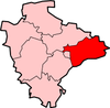 Alfington · Axminster · Beacon · Beer · Bowd · Branscombe · Broadhembury · Buckerell · Budleigh Salterton · Church Green · Colyford · Colyton · Combpyne · Exmouth · Farway · Feniton · Honiton · Kilmington · Marsh Green · Membury · Musbury · Northleigh · Offwell · Ottery St Mary · Pinhay · Rousdon · Salcombe Regis · Seaton · Shute · Sidford · Sidmouth · Smallridge · Southleigh · Stockland · Street · Uplyme · Ware · West Hill · Weston · WhitfordCategories:
- Devon geography stubs
- Villages in Devon


Wikimedia Foundation. 2010.