- Ngorongoro Conservation Area
-
"Ngorongoro" redirects here. For the district, see Ngorongoro District.
Ngorongoro Conservation Area IUCN Category VI (Managed Resource Protected Area)
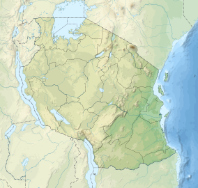

Location Arusha Region,  Tanzania
Coordinates 3°12′32″S 35°27′46″E / 3.20889°S 35.46278°ECoordinates: 3°12′32″S 35°27′46″E / 3.20889°S 35.46278°E Area 8,288 km² (3,200 mi²) Established 1959 Type: Natural Criteria: vii, viii, ix, x Designated: 1979 (3rd session) Reference #: 39 State Party: Tanzania Region: Africa The Ngorongoro Conservation Area (NCA) is a conservation area and a UNESCO World Heritage Site situated 180 km (110 mi) west of Arusha in the Crater Highlands area of Tanzania. The conservation area is administered by the Ngorongoro Conservation Area Authority, an arm of the Tanzanian government, and its boundaries follow the boundary of the Ngorongoro Division of Ngorongoro District. The Ngorongoro Crater, a large volcanic caldera, lies within the area.
Contents
History and geography
Based on fossil evidence found at the Olduvai Gorge, it is known that various hominid species have occupied the area for 3 million years. Hunter-gatherers were replaced by pastoralists a few thousand years ago. The Mbulu[1] came to the area about 2,000 years ago, and were joined by the Datooga around the year 1700. Both groups were driven from the area by the Maasai in the 1800s.[2] Massive fig trees in the northwest of the Lerai Forest are sacred to the Maasai and Datooga people. Some of them may have been planted on the grave of a Datago leader who died in battle with the Maasai around 1840.[3]
No Europeans are known to have set foot in the crater until 1892, when it was visited by Dr. Oscar Baumann. Two German brothers farmed in the crater until the outbreak of World War I, after leasing the land from the administration of German East Africa. Dr. Baumann shot three rhinos while camped in the crater, and the German brothers regularly organized shooting parties to entertain their German friends. They also attempted to drive the wildebeest herds out of the crater.[4][5]
The Ngorongoro area originally was part of the Serengeti National Park when it was created by the British in 1951. Maasai continued to live in the newly created park until 1959, when repeated conflicts with park authorities over land use led the British to evict them to the newly declared Ngorongoro Conservation Area.[6]
The Ngorongoro Conservation Area Authority is the governing body regulating use and access to the NCA. The area became a UNESCO World Heritage Site in 1979.
Land in the conservation area is multi-use: it is unique in Tanzania as the only conservation area providing protection status for wildlife whilst allowing human habitation. Land use is controlled to prevent negative effects on the wildlife population. For example, cultivation is prohibited at all but subsistence levels.
The area is part of the Serengeti ecosystem, and to the north-west, it adjoins the Serengeti National Park and is contiguous with the southern Serengeti plains, these plains also extend to the north into unprotected Loliondo division and are kept open to wildlife through trans-human pastoralism practiced by Maasai. The south and west of the area are volcanic highlands, including the famous Ngorongoro Crater and the lesser known Empakai. The southern and eastern boundaries are approximately defined by the rim of the Great Rift Valley wall, which also prevents animal migration in these directions.
The annual ungulate migration passes through the NCA, with wildebeest and zebra moving south into the area in December and moving north in June. This movement changes seasonally with the rains, but the migration will traverse almost the entire plains in search of food. The NCA has a healthy resident population of most species of wildlife, in particular the Ndutu Lake area to the west has strong cheetah and lion populations.
 Panorama view of Ngorongoro Crater.
Wildlife
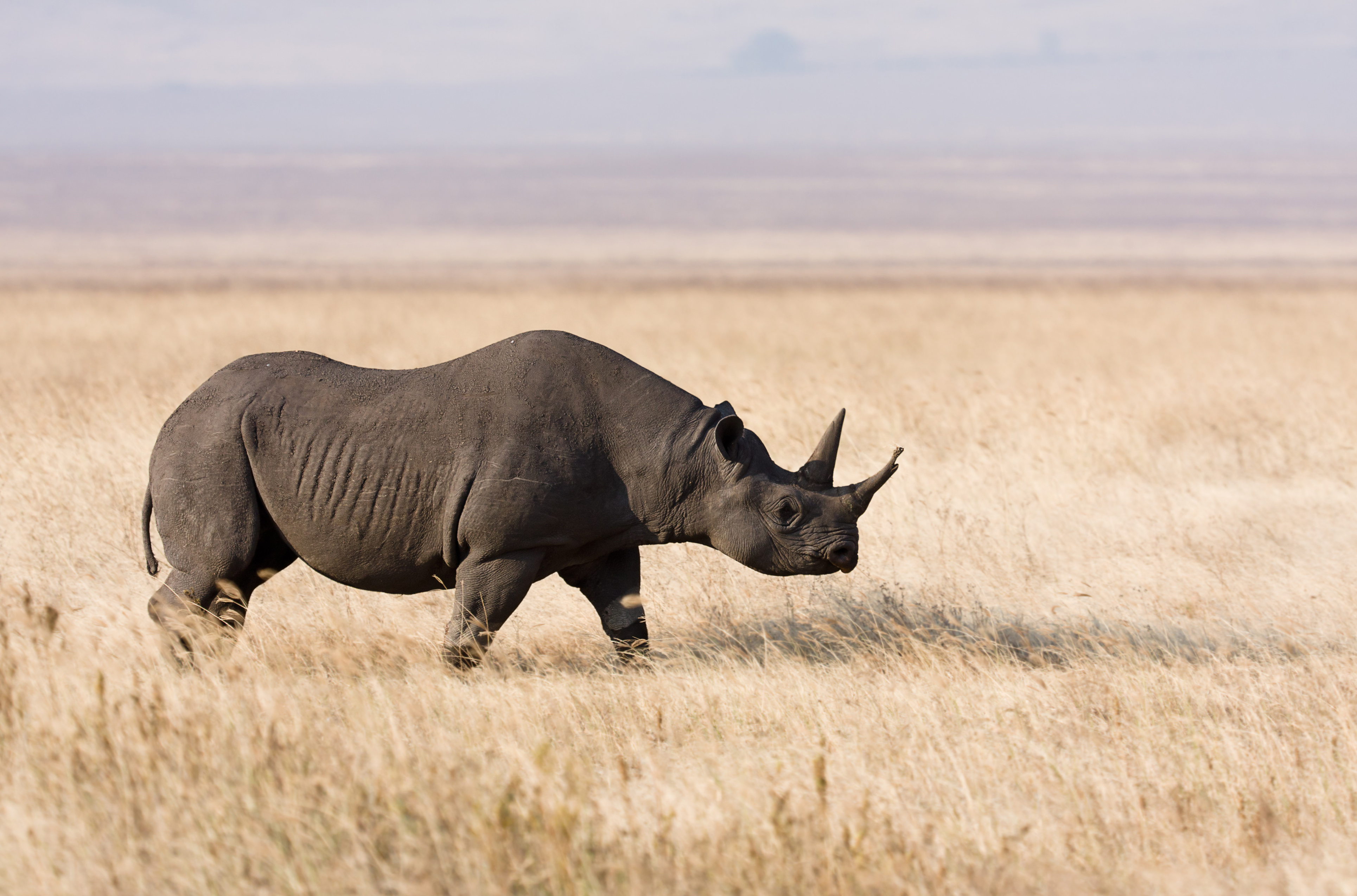
A population of approximately 25,000 large animals, largely ungulates along with reputedly the highest density of mammalian predators in Africa, lives in the crater. Large animals in the crater include the black rhinoceros, the local population of which declined from about 108 in 1964-66 to between 11-14 in 1995, and the hippopotamus, which is very uncommon in the area. There also are many other ungulates: the wildebeest (7,000 estimated in 1994), the zebra (4,000), the eland, and Grant's and Thompson's gazelles (3,000).
The crater has the densest known population of lions, numbering 62 in 2001. On the crater rim are leopards, elephants - numbering 42 in 1987 but only 29 in 1992 - mountain reedbuck, and buffalo (4,000 in 1994).
However, since the 1980s the crater's wildebeest population has fallen by a quarter to about 19,000 and the numbers of eland and Thomson's gazelle also have declined while the buffalo population has increased greatly, probably due to the long prevention of fire which favors high-fibrous grasses over shorter, less fibrous types.
In summer, enormous numbers of Serengeti migrants pass through the plains of the reserve, including 1.7 million wildebeest, 260,000 zebra, and 470,000 gazelles. Waterbuck occur mainly near Lerai Forest; servals occur widely in the crater and on the plains to the west. Common in the reserve are lions, hartebeest, spotted hyenas and jackals. Cheetahs, although common in the reserve, are scarce in the crater itself. The African Wild Dog has recently[when?] disappeared from the crater and may have declined elsewhere in the Conservation Area as well, as well as throughout Tanzania according to C. Michael Hogan.[7]
-

Inside the Ngorongoro Crater
-

-

Wildebeest and zebra in a herd
-

Female lions on the hunt in Ngorongoro Crater
-

Lioness zebras and wildbeast in Ngorongoro Crater
Ngorongoro Crater
The main feature of the NCA is the Ngorongoro Crater, a large, unbroken, unflooded volcanic caldera. The crater, which formed when a giant volcano exploded and collapsed on itself some two to three million years ago, is 610 m (2,000 ft) deep and its floor covers 260 km2 (100 sq mi).[5] Estimates of the height of the original volcano range from fifteen to nineteen thousand feet (4500 to 5800 metres) high.[8][9]
Although thought of as "a natural enclosure" for a very wide variety of wildlife, up to 20% or more of the wildebeest (Connochaetes taurinus) and half the zebra (Equus burchelli) populations vacate the Crater in the wet season. However, a side effect of this enclosure is that the population of Ngorongoro lions is significantly inbred, with many genetic problems passed from generation to generation. This is due to the very small amount of new bloodlines that enter the local gene pool, as very few migrating male lions enter the crater from the outside. Those who do enter the crater are often prevented from contributing to the gene pool by the crater's male lions, who, because of their large size (the result of an abundant and constant food source), easily expel any outside competitors. Animal populations in the crater include most of the species found in East Africa, but there are no impalas (Aepyceros melampus), topis (Damaliscus lunatus), oribis (Ourebia oribi), giraffes (Giraffa camelopardalis), or crocodiles (Crocodylus niloticus).[10]
The crater highlands on the side facing the easterly trade winds receives 800–1200 mm of rain a year and is covered largely in montane forest, while the less-steep west wall receives only 400–600 mm; this side is grassland and bushland dotted with Euphorbia bussei trees. The crater floor is mostly open grassland with two small wooded areas dominated by Acacia xanthophloea.[10]
The Munge Stream drains Olmoti Crater to the north, and is the main water source draining into the seasonal salt lake in the center of the crater. This lake is known by two names: Makat as the Maasai called it, meaning salt; and Magadi.[11] The Lerai Stream drains the humid forests to the south of the Crater, and it feeds the Lerai Forest on the crater floor - when there is enough rain, the Lerai drains into Lake Magadi as well. Extraction of water by lodges and NCA headquarters reduces the amount of water entering Lerai by around 25%.[12]
The other major water source in the crater is the Ngoitokitok Spring, near the eastern crater wall. There is a picnic site here open to tourists and a huge swamp fed by the spring, and the area is inhabited by hippopotamus, elephants, lions, and many others. Many other small springs can be found around the crater's floor, and these are important water supplies for the animals and local Masaai, especially during times of drought.
Aside from herds of zebra, gazelle, and wildebeest, the crater is home to the "big five" of rhinoceros, lion, leopard, elephant, and buffalo. The crater plays host to almost every individual species of wildlife in East Africa, with an estimated 25 000 animals within the crater.
Following the recommendations of the ad hoc committee of scientists convened after the 2000 drought, an ecological burning program was implemented in the crater, which entails annual or biannual controlled burns of up to 20% of the grasslands.[10] Maasai are now permitted to graze their cattle within the crater, but must enter and exit daily.[6]
 Due to the variety of animals present, the crater is a well known tourist attraction. Tourists looking at the animals and scenery inside the crater
-

Hook-lipped (black) rhinoceros in the crater
-

Safari vehicles in the Ngorongoro crater
-

Plains zebras in the Crater
-

Fire is being used to manage vegetation in the crater
-

Masaai herdsman with cattle inside the crater
-

Flamingos at Ngorongoro
-

Hook-lipped (black) rhinoceros in the crater
Lion death periods and Stomoxys flies
In 1961 there was a drought, and in 1962 rain continued throughout the dry season. This caused a massive build-up of the Stomoxys calcitrans biting fly by May 1962. Their demands for blood meals affected the lions so badly (draining blood, and causing skin sores which became infected) that lion numbers crashed, and took several years to build back up when the weather was back to normal. It was estimated that Ngorongoro's population of at least 70 lions had been reduced to about 10.
Drought in 2000 and continuous dry-season rain in 2001 did the same again: in March 2001 Stomoxys numbers had built up again into a devastating plague.[13].
Olduvai Gorge
Main article: Olduvai Gorge Olduvai Gorge, February 2006
The conservation area also protects Olduvai Gorge, situated in the plains area. It is considered to be the seat of humanity after the discovery of the earliest known specimens of the human genus, Homo habilis as well as early hominidae, such as Paranthropus boisei.
The Olduvai Gorge or Oldupai Gorge is a steep-sided ravine in the Great Rift Valley, which stretches along eastern Africa. Olduvai is in the eastern Serengeti Plains in northern Tanzania and is about 30 miles long. It lies in the rain shadow of the Ngorongoro highlands and is the driest part of the region.[14] The gorge is named after 'Oldupaai', the Maasai word for the wild sisal plant, Sansevieria ehrenbergii.
It is one of the most important prehistoric sites in the world and research there has been instrumental in furthering understanding of early human evolution. Excavation work there was pioneered by Mary and Louis Leakey in the 1950s and is continued today by their family. Some believe that millions of years ago, the site was that of a large lake, the shores of which were covered with successive deposits of volcanic ash. Around 500,000 years ago seismic activity diverted a nearby stream which began to cut down into the sediments, revealing seven main layers in the walls of the gorge.
References
- ^ Mbulu
- ^ Northern Tanzania with Kilimanjaro and Zanzibar by Phillip Briggs 2006 page 197, 198 ISBN 1-84162-146-3
- ^ Datago
- ^ Northern Tanzania with Kilimanjaro and Zanzibar by Phillip Briggs 2006 page 198 ISBN 1-84162-146-3
- ^ a b Africa's Great Rift Valley. Nigel Pavitt. 2001. pages 135-139. Harry N. Abrams, Incorporated, New York ISBN 0-8109-0602-3
- ^ a b Robert M. Poole. "Heartbreak on the Serengeti". National Geographic. p. 4. http://www7.nationalgeographic.com/ngm/0602/feature1/text4.html. Retrieved 2008-02-21.
- ^ C. Michael Hogan. 2009. Painted Hunting Dog: Lycaon pictus, GlobalTwitcher.com, ed. N. Stromberg
- ^ Africa's Great Rift Valley. Nigel Pavitt. 2001. page 135. Harry N. Abrams, Incorporated, New York ISBN 0-8109-0602-3
- ^ Northern Tanzania with Kilimanjaro and Zanzibar. Phillip Briggs. 2006. page 197. ISBN 1-84162-146-3
- ^ a b c R.D. Estes, J.L. Atwood, A.B. Estes (2006). "Downward trends in Ngorongoro Crater ungulate populations 1986-2005" (PDF). Biological Conservation (Elsevier). http://www.rarespecies.org/crater.pdf. Retrieved 2008-02-21.
- ^ "Ngorongoro Conservation Area - Lakes Within The Area". Utali Safari. 2006-09-02. http://www.utalii.com/Ngorongoro/Lakes_in_Ngorongoro.htm. Retrieved 2008-02-21.
- ^ "Management of Black Rhino in the Ngorongoro Crater" (PDF). African Wildlife Foundation. 2003-09-04. http://www.zgf.de/mitarbeiterbereich/pdf/NgorongoroBlackRhinoWorkshopl.pdf. Retrieved 2008-02-21.
- ^ http://www.ntz.info/gen/n01144.html
- ^ Africa's Great Rift Valley. Nigel Pavitt. 2001. pages 138. Harry N. Abrams, Incorporated, New York ISBN 0-8109-0602-3
External links
- UNEP-WCMC World Heritage Site Datasheet
- UNESCO World Heritage Site Datasheet
- Article about the Ngorongoro Crater
Further reading
- Ngorongoro Conservation Area at the UNEP World Conservation Monitoring Centre
- Tanzania Tourist Bureau website
- Ngorongoro Crater Safaris, Getting There, Treks and Culture
- Deocampo, D.M., 2004. Hydrogeochemistry in the Ngorongoro Crater, Tanzania, and implications for land use in a World Heritage Site. Applied Geochemistry, volume 19, p. 755-767
- Deocampo, D.M., 2005. Evaporative evolution of surface waters and the role of aqueous CO2 in magnesium silicate precipitation: Lake Eyasi and Ngorongoro Crater, northern Tanzania. South African Journal of Geology, volume 108, p. 493-504.
World Heritage Sites in Tanzania Kilimanjaro National Park · Kondoa Rock Art Sites · Ngorongoro Conservation Area · Ruins of Kilwa Kisiwani and Songo Mnara · Selous Game Reserve · Serengeti National Park · Stone Town of Zanzibar

National Parks of Tanzania National Parks Arusha · Gombe Stream · Jozani Chwaka Bay · Katavi · Kilimanjaro · Kitulo · Lake Manyara · Mahale Mountains · Mikumi · Mount Meru · Ruaha · Rubondo Island · Saadani · Serengeti · Tarangire · Udzungwa MountainsReserves Marine National Parks
and ReservesCategories:- IUCN Category VI
- World Heritage Sites in Tanzania
- Volcanoes of Tanzania
- Volcanic calderas
- Biosphere reserves of Tanzania
- Double-named places
- Extinct volcanoes
-


Wikimedia Foundation. 2010.