- New Jersey Route 42
-
Route 42
Black Horse Pike
North–South Freeway
Route information Maintained by NJDOT Length: 14.28 mi[1] (22.98 km) Existed: 1927 – present Major junctions South end: 


 US 322 / CR 536 Spur in Monroe Township
 AC Exwy. in Washington Township
 Route 168 in Gloucester Township
 Route 41 in Deptford Township
 Route 55 in Deptford Township
North end: 
 I-76 / I-295 in Bellmawr
Highway system New Jersey State Highway Routes
Interstate and US← Route 41Route 43  →
→Route 42 is a state highway in the U.S. state of New Jersey, in the Camden area. It runs 14.28 mi (22.98 km) from an intersection with U.S. Route 322 and County Route 536 Spur in Monroe Township, Gloucester County to an intersection with Interstate 76 and Interstate 295 in Bellmawr, Camden County. The route is a mix of freeway and divided four-lane arterial road. The southern portion of Route 42 is a local arterial route and one of several highways comprising the Black Horse Pike, a road that runs from Camden to Atlantic City. The northern portion is a six- to eight-lane freeway referred to locally as the North–South Freeway (or simply the 42 Freeway[2]) that is directly connected to the Atlantic City Expressway. Major intersections along the route include the Atlantic City Expressway and the southern terminus of Route 168 in Turnersville, another intersection with Route 168 in Blackwood, and Route 41 and Route 55 in Deptford Township.
Route 42 was originally designated in 1927 to run along the Black Horse Pike between Ferry Avenue in Camden and the present U.S. Route 40/U.S. Route 322 split in the McKee City section of Hamilton Township, Atlantic County. In 1953, the southern terminus was cut back to its current terminus in the Williamstown section of Monroe Township to avoid the concurrency it shared with U.S. Route 322. After the completion of the North–South Freeway between Bellmawr and Turnersville in 1959, Route 42 was moved to this freeway, and the Black Horse Pike north of Turnersville became Route 168. The freeway portion of Route 42 has been improved many times and is projected to see more improvements, including reconstruction of the dangerous and congested interchange with Interstate 76 and Interstate 295 in Bellmawr.
Contents
Route description
 Sign marking the beginning of northbound Route 42 on the Black Horse Pike just north of its southern terminus at US 322/CR 536 Spur
Black Horse Pike
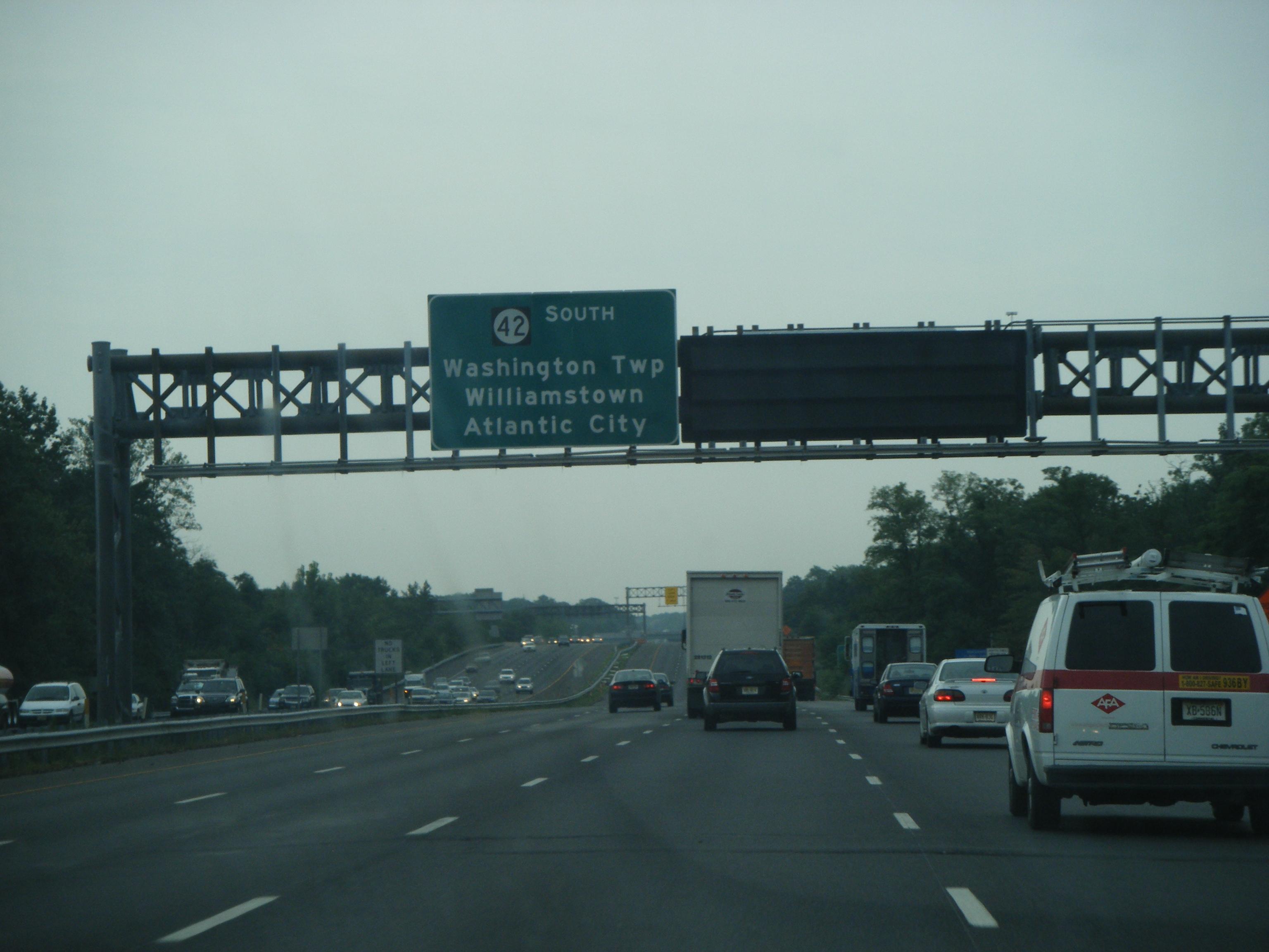
See also: Black Horse PikeRoute 42 begins at an intersection with U.S. Route 322 and County Route 536 Spur in Monroe Township, Gloucester County where it heads to the north on the Black Horse Pike.[1] For the first portion of the route, Route 42 is a divided four–lane arterial highway that intersects various local roads. Some intersections along this section feature jughandles. There are also many businesses lining the highway.[3] The route crosses County Route 689 (Berlin-Cross Keys Road) and enters Washington Township. It then intersects the northern terminus of County Route 555 (Tuckahoe Road). After the intersection with County Route 555, Route 42 intersects three more county routes: County Route 655 (Fries Mill Road), County Route 639 (Ganttown Road), and County Route 651 (Greentree Road).[1] The Atlantic City Expressway then starts to the right at an unnumbered intersection, Route 168 continues to the north on the Black Horse Pike, and Route 42 becomes the six–lane North–South Freeway.[1]
North–South Freeway

Upon becoming the North–South Freeway, Route 42 crosses into Gloucester Township, Camden County and comes to the first numbered exit for County Route 705, which provides access to Route 168.[1] Following that, the freeway reaches the County Route 673 (College Drive) interchange, serving Camden County College.[4] County Route 534 interchanges with a southbound exit and northbound entrance and then Coles Road interchanges with a northbound exit and southbound entrance.[1] Next, Route 42 encounters Exits 9B and 10A for Route 168. Exit 9B serves northbound Route 168 and provides access to the New Jersey Turnpike, and Exit 10A serves southbound Route 168. County Route 681 interchanges after Route 168, with a southbound exit and northbound entrance, and Route 42 enters Gloucester County again in Deptford Township after crossing the South Branch of Big Timber Creek.[1]
In Deptford Township, Route 41 interchanges with a northbound exit and an entrance in both directions. Past this interchange, County Route 544 interchanges with a southbound exit and an entrance in both directions.[1][3] Both of these interchanges provide access to the Deptford Mall and, in the case of the Route 41 interchange, to Route 55 from northbound Route 42 since the northbound lanes have no direct access to Route 55.[3] Route 42 meets the northern terminus of the Route 55 freeway at Exit 13 with a southbound exit and northbound entrance then widens to eight lanes.[1] Route 42 crosses the Big Timber Creek into Runnemede, Camden County, where it passes over the New Jersey Turnpike without an interchange. The freeway then enters Bellmawr, where it features right-in/right-out ramps with Leaf Avenue, that provide access to County Route 753 (Creek Road).[1] Route 42 then continues north to its terminus at Interstate 295 where the North–South Freeway becomes Interstate 76, which heads to Camden and Philadelphia .[1]
 Route 42 southbound past County Route 753 in Bellmawr
The North–South Freeway portion of Route 42 is a major route for daily commuters from southern New Jersey to Philadelphia, Pennsylvania via the Walt Whitman Bridge and Ben Franklin Bridge and weekend commuters from southeastern Pennsylvania to the southern Jersey Shore via Route 55 and the Atlantic City Expressway.[5] Route 42 sees frequent congestion on a daily basis, from the end of the Atlantic City Expressway to the I-76/I-295 interchange.[6] Even though Route 42 ends at I-295, the north–south Freeway is sometimes called "Route 42" all the way to the Interstate 76/Interstate 676 split.[7]
Snow removal, litter control, and landscaping of Route 42 between the end of the Atlantic City Expressway and Interstate 295 is performed by the South Jersey Transportation Authority.[8]
History
In 1927, Route 42 was legislated to run along the Black Horse Pike, a road that traces its origins back to 1855. In that year, the Camden and Blackwoodstown Turnpike Company was established by entrepreneurs who had helped create the White Horse Pike to build a gravel road that would run from Camden south to Blackwoodtown and eventually to Atlantic City,[9] from Ferry Avenue in Camden to Route 48 (now U.S. Route 40) in McKee City.[10][11] By 1941, U.S. Route 322 was assigned to follow the routing of Route 42 between Williamstown and McKee City.[12] With the 1953 New Jersey state highway renumbering, which eliminated long concurrencies between U.S. Routes and State Routes, the southern terminus of Route 42 was cut back to Williamstown to avoid the concurrency with U.S. Route 322.[13]
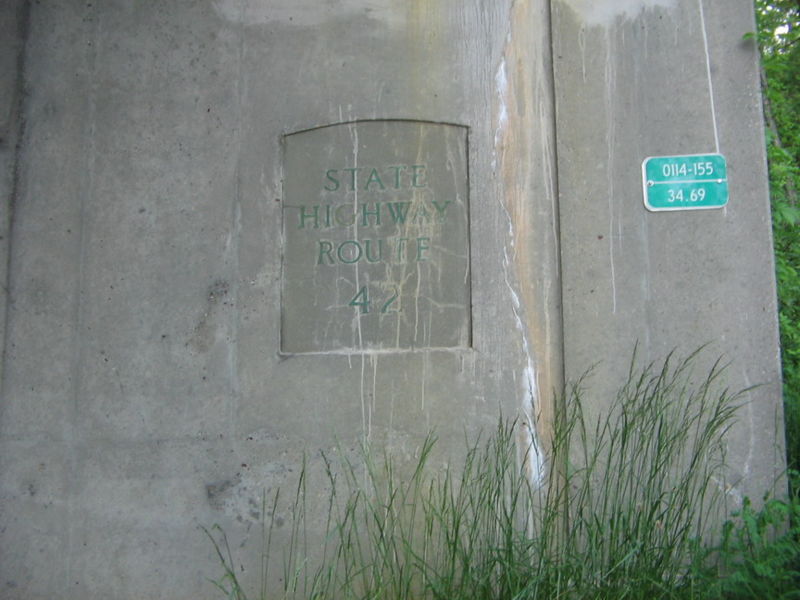
 The Route 54 bridge over the Black Horse Pike (U.S. Route 322) in Folsom, showing the former Route 42 designation used before the 1953 renumbering
The North–South Freeway portion of Route 42 was originally planned as a parkway in 1932 that would run from the Ben Franklin Bridge in Camden to Atlantic City; however, this proposal never materialized.[14] In the late 1940s, the North–South Freeway was proposed by the New Jersey State Highway Department to run from the Ben Franklin Bridge to Turnersville. In the early 1950s, right-of-way for the freeway was acquired and actual construction of the freeway followed.[15] The Route 42 freeway opened between Interstate 295 in Bellmawr and the Black Horse Pike in Blackwood in 1958. It opened between the Black Horse Pike in Blackwood and Turnersville in 1959.[16] With the completion of the North–South Freeway portion of Route 42, the Black Horse Pike north of Turnersville became Route 168.[17]
Following its completion, the North–South Freeway portion of Route 42 has seen many improvements. In 1965, the freeway was widened to six lanes for most of its length with the northernmost part being widened to eight lanes due to the completion of the Atlantic City Expressway and development occurring along the route. The route had its interchange with Route 55 open in 1985, when the Route 55 Freeway was opened from Route 42 to Route 41 to the south.[18] Between 1996 and August 1999, the route was widened to eight lanes between Interstate 295 and Route 55 in Deptford Township.[19] In the early 2000s, the interchanges with Route 41 and County Route 544 in Deptford were rebuilt at a cost of $13 million to improve movements within the area.[20] In October 2003, the New Jersey Department of Transportation (NJDOT) installed exit tabs along the stretch of the freeway portion of Route 42.[21] On August 27, 2010, an interchange opened at County Route 673 (College Drive), providing better access to Camden County College.[4]
Future
NJDOT is going to build the missing movements between Interstate 295 northbound and Route 42 southbound and Route 42 northbound to Interstate 295 southbound. They will also reconstruct the dangerous and congested Route 42/Interstate 295/Interstate 76 interchange, which currently requires traffic on I-295 to use 35 mile per hour ramps that merge onto the North–South Freeway for a short distance.[22][23] In 2007, "Alternative D" for the reconstructed interchange was selected, calling for I-295 to cross over the north–south Freeway. This interchange, which will resemble two Directional-T interchanges, is projected to cost $450 million with construction taking place between 2011 and 2015. NJDOT has long term plans for 2011–2020 to reconstruct the entire Route 42 freeway from the Atlantic City Expressway to I-295.[24]
On May 12, 2009, New Jersey Governor Jon S. Corzine and the Delaware River Port Authority, the agency which manages the PATCO Speedline, announced plans to introduce express bus service along the Route 42 freeway and the adjacent Route 55 freeway as part of a comprehensive transportation plan for South Jersey[25] that would include a diesel light rail line between Camden and Glassboro, improvements to the Atlantic City Line, and enhanced connections to the Atlantic City International Airport.[26]
Major intersections
County Location Mile[1] Exit Destinations Notes Gloucester Monroe Township 0.00
US 322 / CR 536 Spur (Sicklerville Road)Washington Township 3.51  CR 555 south (Tuckahoe Road)
South end of freeway 6.35 AC Exwy. eastCamden Gloucester Township 6.62 7  CR 705 to Route 168 – Sicklerville, Blackwood
Northbound exit and entrance Route 168 north – SicklervilleSouthbound exit and entrance 7.48 7B  CR 673 (College Drive)
Opened August 27, 2010[4] 8.81 8  CR 534 – Blackwood, Pine Hill, Clementon
Southbound exit, northbound entrance 9.48 9A Coles Road – Blenheim, Almonesson Northbound exit, southbound entrance 10.00 9B  Route 168 north to NJ Turnpike – Chews Landing
Northbound exit and entrance 10A Route 168 south – Blenheim, AlmonessonSouthbound exit and entrance 11.02 10B  CR 681 – Almonesson, Chews Landing
Southbound exit, northbound entrance Gloucester Deptford Township 11.54 12  Route 41 to Route 55 / CR 544 – Woodbury, Runnemede
Northbound exit and entrance 11.95 12 CR 544 to Route 41 – Deptford Township, Woodbury, RunnemedeSouthbound exit and entrance 12.54 13 Route 55 south – Glassboro, VinelandSouthbound exit, northbound entrance Camden Bellmawr 13.97 14  To CR 753 (Creek Road) – Bellmawr
14.28 
 I-76 / I-295 to US 130 to I-676 – Walt Whitman Bridge, Philadelphia, Trenton, Camden
Road continues as I-76 1.000 mi = 1.609 km; 1.000 km = 0.621 mi See also
 U.S. Roads portal
 New Jersey portal
References
- ^ a b c d e f g h i j k l "Route 42 straight line diagram" (PDF). New Jersey Department of Transportation. http://www.state.nj.us/transportation/refdata/sldiag/00000042__-.pdf. Retrieved 2007-03-27.
- ^ "Man injured after allegedly car surfing on I-295". WPVI-TV. July 20, 2008. http://abclocal.go.com/wpvi/story?section=news/local&id=6276126. Retrieved 2008-10-10.
- ^ a b c Google, Inc. Google Maps – overview of New Jersey Route 42 (Map). Cartography by Google, Inc. http://maps.google.com/maps?f=d&source=s_d&saddr=route+42+and+route+322+williamstown,+nj&daddr=39.732538,-75.036621+to:route+42+and+I-295+bellmawr,+nj&geocode=&hl=en&mra=dpe&mrcr=0&mrsp=1&sz=11&via=1&sll=39.772425,-75.039345&sspn=0.248042,0.439453&ie=UTF8&t=h&z=11. Retrieved 2009-04-01.
- ^ a b c Beym, Jessica (August 28, 2010). "Camden County College celebrates an easier drive". Gloucester County Times. http://www.nj.com/gloucester/index.ssf?/base/news-5/128298301120910.xml&coll=8. Retrieved August 28, 2010.
- ^ "I-295/I-76/Route 42 Direct Connection". New Jersey Department of Transportation. http://www.state.nj.us/transportation/works/studies/rt295/. Retrieved 2008-10-10.
- ^ Fischer, John. "Stuck in Traffic - Why are the highways of Philadelphia and South Jersey so congested?". About.com. http://philadelphia.about.com/od/transportation/a/traffic.htm. Retrieved 2008-10-10.
- ^ Lindsey, Nedra (January 17, 2002). "Suspect in shoplifting jailed after car chase". The Philadelphia Inquirer. pp. B12. "He was pursued back to Haddonfield-Berlin Road, onto Interstate 295, then to Route 42 and onto Route 130, police said."
- ^ "1999 Annual Report" (PDF). South Jersey Transportation Authority. pp. 9. http://www.sjta.com/sjta/reports/1999_ann.pdf. Retrieved 2008-10-10.
- ^ "Answer Guy: How did the White Horse and Black Horse Pikes get their names?". The Press of Atlantic City. August 31, 2008.
- ^ State of New Jersey, Laws of 1927, Chapter 319.
- ^ Williams, Jimmy and Sharon. "1927 New Jersey Road Map". 1920s New Jersey Highways. http://www.jimmyandsharonwilliams.com/njroads/1920s/images/1927_routes.gif. Retrieved 2008-10-08.
- ^ Mid-West Map Co. (1941). Map of Pennsylvania and New Jersey (Map). Cartography by H.M. Gousha. http://www.mapsofpa.com/roadcart/1941_1467m.jpg. Retrieved 2009-03-29.
- ^ 1953 renumbering. New Jersey Department of Highways. http://en.wikisource.org/wiki/1953_New_Jersey_state_highway_renumbering. Retrieved July 31, 2009.
- ^ Regional Plan of the Philadelphia Tri-State District. Regional Planning Federation. 1932.
- ^ Weart, William J. (April 21, 1957). "Philadelphia's New Shore Route". New York Times.
- ^ New Jersey Highway Facts. 1967. New Jersey Department of Transportation.
- ^ Chevron Oil Company (1969). Map of New Jersey (Map). Cartography by H.M. Gousha.
- ^ "Going The Extra Mile For NJ Roads". Philadelphia Inquirer. February 18, 1987.
- ^ Weisenfeld, Bernie (May 28, 1999). "South Jersey Commuting Could Be Worse". The Courier-Post.
- ^ Laughlin, Jason (April 21, 2000). "Relief Proposed for Traffic Headache". The Courier-Post.
- ^ Moroz, Jennifer (November 24, 2004). "New Jersey Promises To Untangle a Traffic Knot". The Philadelphia Inquirer.
- ^ "FY 2007-10 STATEWIDE TRANSPORTATION IMPROVEMENT PROGRAM" (PDF). New Jersey Department of Transportation. http://www.state.nj.us/transportation/capital/stip0710/sec3/routes/rt42.pdf. Retrieved 2007-06-03.
- ^ Nussbaum, Paul (March 21, 2009). "U.S. highway officials OK $900 million N.J. project". The Philadelphia Inquirer.
- ^ "Destination 2030" (PDF). Delaware Valley Regional Planning Commission. Archived from the original on September 28, 2007. http://web.archive.org/web/20070928051143/http://www.dvrpc.org/LongRangePlan/Final/Destination2030_Transportation.pdf. Retrieved 2007-08-15.
- ^ "Regional Transportation & Economic Development Initiative". Delaware River Port Authority. http://www.drpa.org/projects/regtran/. Retrieved 2009-06-19.
- ^ "Light Rail Extension Moves Forward - Gov Corzine Supports Multimodal Regional Initiative To Boost Mobility & Economic Development". Delaware River Port Authority. May 12, 2009. http://www.drpa.org/content.asp?page=News¶m=2&ItemNumber=3077. Retrieved 2009-06-19.
External links
- An enlarged view of road jurisdiction at the confluence of I-76, I-295 and NJ 42
- New Jersey Roads: Route 42
- New Jersey Highway Ends: Route 42
- Speed Limits for Route 42
Road transportation infrastructure of the metro Philadelphia area Interstates U.S. Routes Pennsylvania Routes New Jersey Routes Delaware Routes Named roads/streets Benjamin Franklin Parkway · Broad Street · City Avenue · Front Street · Girard Avenue · Market Street · Roosevelt Boulevard · South Street · Chestnut Street · Walnut Street
Pennsylvania Turnpike · New Jersey Turnpike · Delaware Turnpike · Atlantic City Expressway · Schuylkill Expressway · Delaware Expressway · Blue Route · Vine St Expressway · North South Freeway · Lancaster Avenue · Bethlehem Pike · Baltimore Pike · Black Horse PikeBridges Delaware Memorial Bridge · Commodore Barry Bridge · Walt Whitman Bridge · Ben Franklin Bridge · Betsy Ross Bridge · Tacony–Palmyra Bridge · Burlington–Bristol Bridge · Delaware River – Turnpike Toll BridgeControlled-access highways and Expressways in New Jersey Interstate Highways U.S. and state highways Toll roads and other highways Atlantic City Expressway (Brigantine Connector) • Garden State Parkway • New Jersey Turnpike • Palisades Interstate ParkwayCategories:- State highways in New Jersey
- Limited access New Jersey state routes
- Freeways in the United States
- Transportation in Camden County, New Jersey
- Transportation in Gloucester County, New Jersey


Wikimedia Foundation. 2010.