- New Jersey Route 49
-
Route 49

Route information Maintained by NJDOT Length: 53.80 mi[1] (86.58 km) Existed: 1927 – present Major junctions West end: 


 I-295 / US 40 / NJ Turnpike / US 130 in Pennsville Township
 Route 45 in Salem
 Route 77 in Bridgeton
 Route 47 in Millville
 Route 55 in Millville
East end: 
 Route 50 / CR 557 in Upper Township
Highway system New Jersey State Highway Routes
Interstate and US←  Route 48
Route 50 →Route 49 is a state highway in the southern part of the U.S. state of New Jersey. It runs 53.80 mi (86.58 km) from an interchange with the Delaware Memorial Bridge extension of the New Jersey Turnpike (Interstate 295 and U.S. Route 40) in Deepwater, Salem County, where it continues north as U.S. Route 130 southeast to Route 50 and County Route 557 in Tuckahoe, Cape May County. The route serves Salem, Cumberland, Atlantic, and Cape May Counties, passing through rural areas and the communities of Salem, Bridgeton, and Millville along the way. It is a two-lane, undivided road for most of its length.
Route 49 was established in 1927 to run from Salem to Clermont, running along its present alignment between Salem and Millville, following current Route 47 between Millville and South Dennis, and running along present-day Route 83 between South Dennis and Clermont. It replaced a branch of pre-1927 Route 6 between Salem and Bridgeton and a part of pre-1927 Route 15 between Bridgeton and South Dennis. In 1953, Route 49 was routed onto its current alignment, replacing a part of Route 44 between Salem and Deepwater and following the former alignment of Route 47 between Millville and Tuckahoe. In the 1960s, a freeway was planned for Route 49 between Deepwater and Millville; it was never built. In the 2000s, many improvements have been or are being made to bridges along Route 49.
Contents
Route description
Salem County
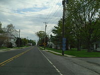
Route 49 heads south on Broadway from an interchange with the Delaware Memorial Bridge extension of the New Jersey Turnpike (Interstate 295/U.S. Route 40) in the community of Deepwater in Pennsville Township, Salem County. North of here, the road continues to the north as U.S. Route 130. Route 49 passes through residential areas of Pennsville and intersects County Route 630 (Fort Mott Road), continuing into farmland.[1][2] Route 49 then intersects the southern terminus of County Route 551 (Hook Road and County Route 632 (Lighthouse Road). It crosses the Salem River into Salem and becomes Front Street.[1]
In Salem, the route intersects County Route 657 (Griffith Street) and makes a right turn. It turns left onto Broadway and forms the main business district of the town.[1][2] In downtown Salem, Route 49 intersects County Route 625 (Chestnut Street), the southern terminus of Route 45 (Market Street), and County Route 665 (Walnut Street). It crosses County Route 658 (Keasbey Street/York Street) and enters Quinton Township, becoming Main Street and heading into agricultural areas.[1] Route 49 heads east, meeting County Route 650 (Hancocks Bridge Road) and County Route 653 (Action Station Road). It crosses the Alloway Creek into the community of Quinton, where it intersects the southern terminus of County Route 581 (Quinton Alloway Road) and County Route 654 (Sickler Street). The route leaves Quinton and intersects County Route 626 (Jericho Road), continuing southeast into wooded areas, where Route 49 crosses County Route 667 (Pecks Corner Road) and County Route 647 (Telegraph Road/Jericho Road).[1][2]
Cumberland County
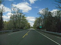
 Route 49 eastbound in Shiloh.
Route 49 crosses a stream, Sarah Run, into Stow Creek Township, Cumberland County and heads into farmland as Shiloh Pike.[1][2] Here, it crosses County Route 624 (Jericho Road) and County Route 617 (Columbia Highway). The route then intersects County Route 635 (Old Cohansey Road) and continues south along the border of Stow Creek Township to the west and Hopewell Township to the east, entering Shiloh at the intersection with Mill Road. In Shiloh, Route 49 meets County Route 620 (Roadstown Road) and County Route 753 (East Avenue/West Avenue) in the center of town and heads southeast, crossing County Route 695 (Maple Avenue/Randolph Road). The route enters Hopewell Township and intersects County Route 661 (Barretts Run Road).[1]
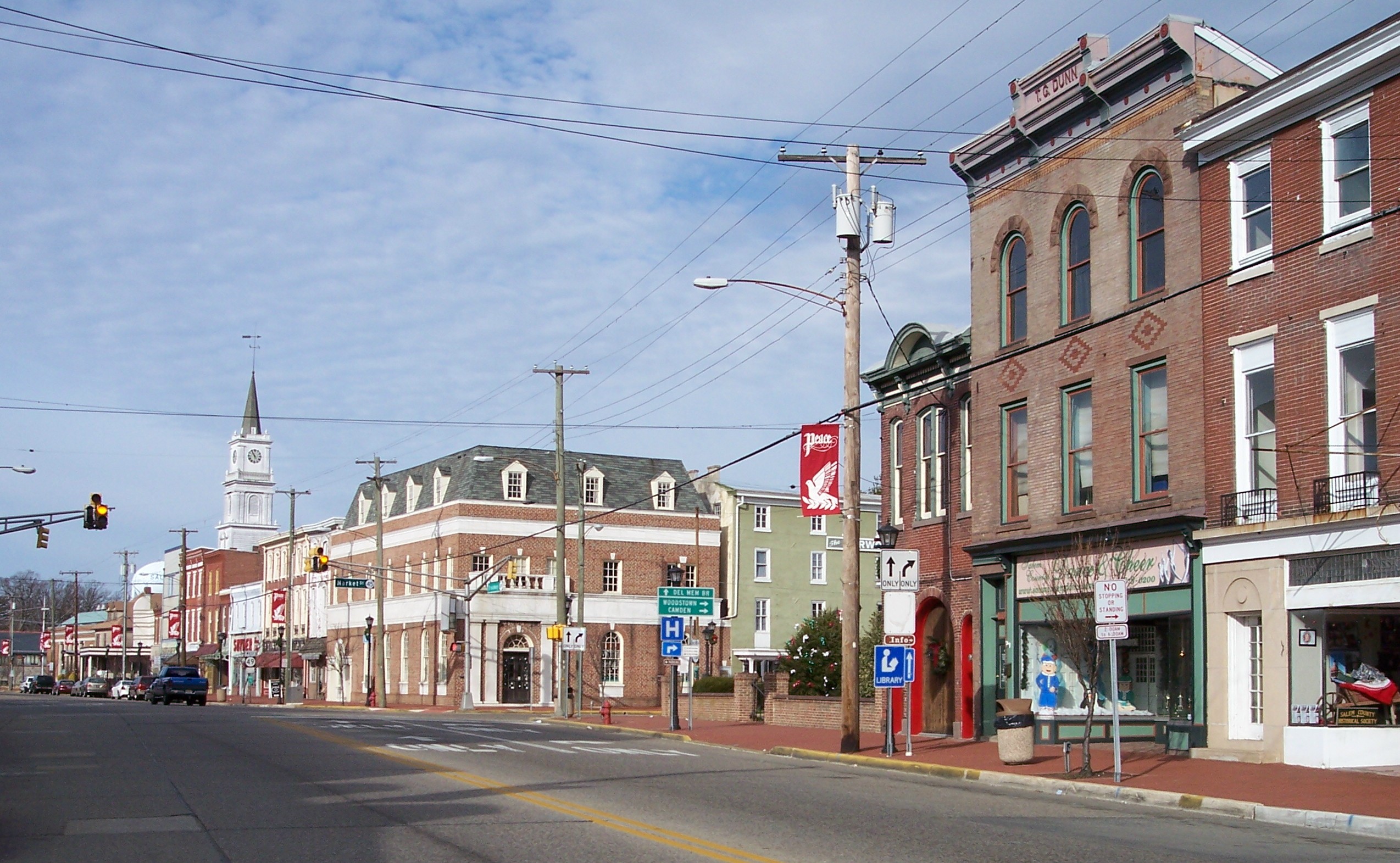
Past this intersection, Route 49 enters a more suburban landscape, crossing County Route 621 (W. Park Drive).[1][2] The route enters Bridgeton and becomes Broad Street. In Bridgeton, it intersects County Route 607 (West Avenue), County Route 650 (Fayette Street), and County Route 697 (Atlantic Street). Route 49 crosses the Cohansey River and comes to an intersection with Pearl Street, which heads to the north as Route 77 and to the south as County Route 609. Past Pearl Street, Route 49 crosses County Route 670 (Commerce Street/Buckshutem Road) and Route 49 continues to the east on Commerce Street. It crosses County Route 638 (N. Burlington Road) and enters Fairfield Township.[1]
Route 49 continues east through a mix of woods and farms, intersecting County Route 553 (Gouldtown-Woodruff Road) and County Route 675 (Fordville-Gouldtown Road).[1][2] It enters Millville and becomes Main Street, intersecting County Route 682 (Sugarman Avenue) and County Route 634 (Nabb Avenue). It intersects three more county routes, County Route 714 (Morias Avenue), County Route 625 (Hogbin Road), and County Route 712 (Reick Road), before heading into the city. It intersects County Route 608 (Carmel Road) and County Route 698 (Beech Street), County Route 667 (Sharp Street), and County Route 610 (Brandriff Avenue) before meeting County Route 555 (Cedar Street), which it forms a concurrency with. The route crosses the Maurice River and enters downtown Millville, where it intersects Route 47 (Second Street). Past Route 47, County Route 555 splits from Route 49 by turning north onto Third Street. Route 49 heads east through the eastern part of Millville, intersecting County Route 678 (Wade Boulevard) and interchanging with Route 55. Past Route 55, Route 49 heads southeast into woodland and crosses into Maurice River Township.[1][2] In Maurice River Township, Route 49 intersects County Route 671 (Union Road), County Route 646 (Port Elizabeth-Cumberland Road), and County Route 644 (Hesstown Road). Route 49 eventually forms the border of Maurice River Township to the north and Upper Township, Cape May County to the south.[1]
Atlantic and Cape May Counties
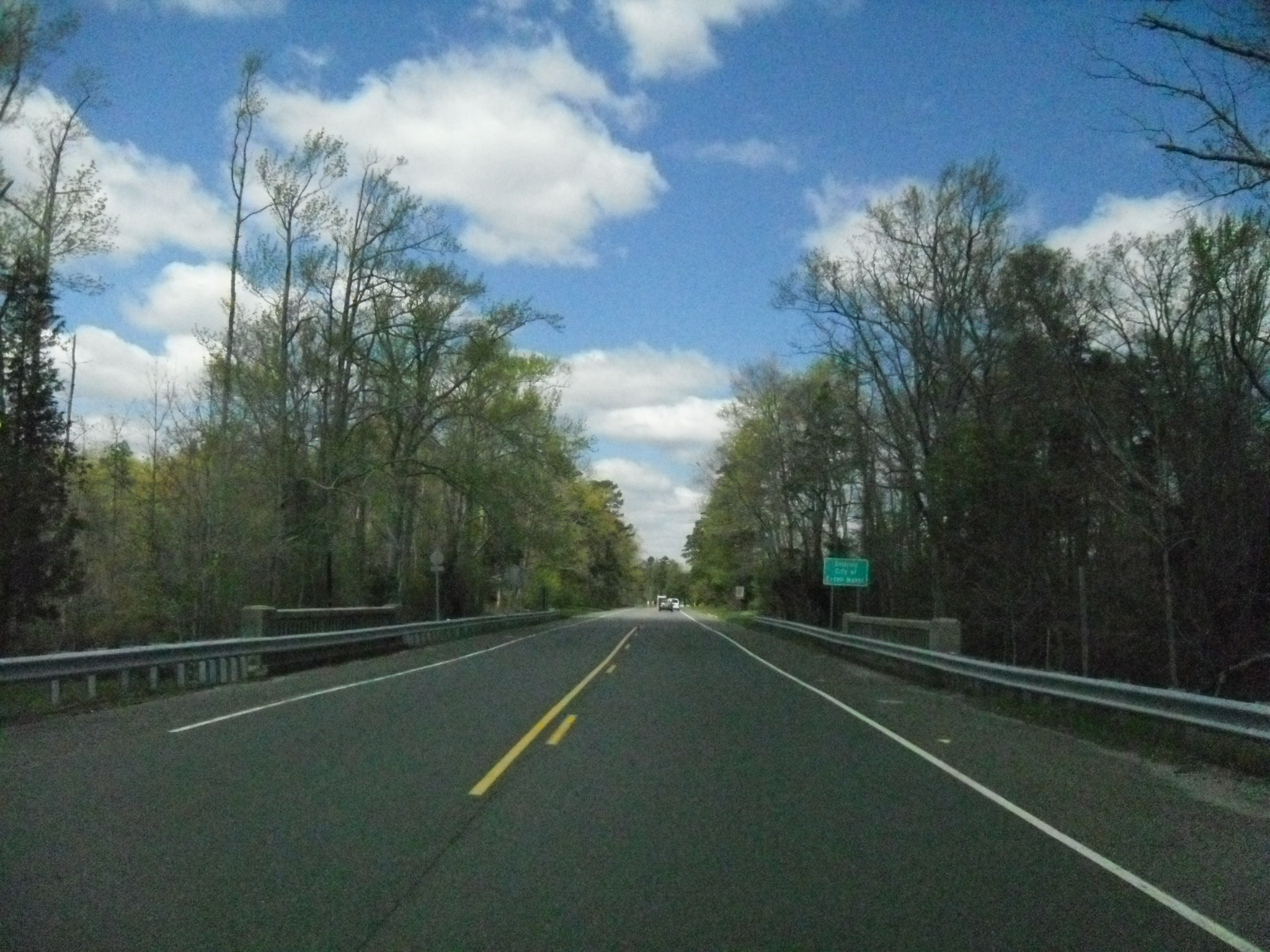
Route 49 crosses the Tuckahoe River into Estell Manor, Atlantic County. It runs a short distance to the north of the Tuckahoe River and intersects County Route 649 (Aetna Avenue) and County Route 666 (Cape May Avenue). The route crosses the Tuckahoe River into Upper Township, Cape May County and intersects the eastern terminus of County Route 548 (Tuckahoe Road), heading to the east. It intersects County Route 632 (Marshallville Road) and then comes to County Route 617 (Woodbine Road), which heads south to provide access to County Route 557. Route 49 continues east into Tuckahoe, where it intersects County Route 659 (Railroad Avenue) and ends at Route 50 and County Route 557.[1]
History
Route 49 was legislated in the 1927 New Jersey state highway renumbering to run from Route 45 in Salem to Route 4 (now U.S. Route 9) in Clermont.[3][4] The route replaced a branch of pre-1927 Route 6 between Salem and Bridgeton and a part of pre-1927 Route 15 between Bridgeton and South Dennis.[5][6] A spur route of Route 49, Route S49, was created in 1927 to run from Route 49 in South Dennis to Route 4 in Rio Grande along the remainder of pre-1927 Route 15. Route S49 was extended to Wildwood in 1938.[3][7] In the 1953 New Jersey state highway renumbering, Route 49 was extended west along what was a part of Route 44 to Deepwater to end at U.S. Route 40 and U.S. Route 130 near the Delaware Memorial Bridge. The eastern part of the route was realigned to head from Millville east to Route 50 in Tuckahoe, replacing what had been the southern part of Route 47. Meanwhile, Route 47 was realigned to head south from Millville, replacing Route 49 from Millville to South Dennis and the length of Route S49. The portion of Route 49 from South Dennis to Clermont became Route 83.[8]
A freeway was proposed for Route 49 in the early 1960s, running from Interstate 295 and U.S. Route 40 at the Delaware Memorial Bridge to Route 55 in Millville. However, this freeway was canceled by 1967 as it closely paralleled the planned Route 60 freeway, which itself was never built.[9]
In the 2000s, construction has occurred to replace many bridges along Route 49. The drawbridge over the Salem River was replaced by a fixed span in the mid-2000s.[10] On October 1, 2008, the bridge over the railroad line in Tuckahoe was closed for reconstruction and is expected to reopen in June 2009.[11][12] The bridge over the Cohansey River in Bridgeton is also being reconstructed. Construction on this bridge started in October 2008 and is expected to be completed in July 2009.[13][14]
Major intersections
County Location Mile[1] Destinations Notes Salem Pennsville Township 0.00 I-295 / US 40 / NJ Turnpike / US 130 north (Shell Road)Western terminus; continues as US 130; I-295 exit 1 5.37  CR 551 north (Hook Road)
Salem 9.05 Route 45 north (Market Street)Quinton Township 12.44  CR 581 north (Quinton Alloway Road)
Cumberland Bridgeton 25.58  Route 77 north / CR 609 south (Pearl Street)
Fairfield Township 28.31  CR 553 (Gouldtown-Woodruff Road)
Millville 36.13  CR 555 south (Cedar Street)
West end of CR 555 overlap 36.40 Route 47 (Second Street)36.48 CR 555 north (Third Street)East end of CR 555 overlap 37.84 Route 55NJ 55 exit 24 Cape May Upper Township 50.31  CR 548 west (Tuckahoe Road)
53.80 Route 50 / CR 557Eastern terminus 1.000 mi = 1.609 km; 1.000 km = 0.621 mi See also
 U.S. Roads portal
 New Jersey portal
References
- ^ a b c d e f g h i j k l m n o "Route 49 straight line diagram". New Jersey Department of Transportation. http://www.state.nj.us/transportation/refdata/sldiag/00000049__-.pdf. Retrieved 2008-11-26.
- ^ a b c d e f g Google, Inc. Google Maps – overview of New Jersey Route 49 (Map). Cartography by Google, Inc. http://maps.google.com/maps?f=d&saddr=US-130+and+RT-49+pennsville+nj&daddr=39.516755,-75.368958+to:route+50+and+route+49+tuckahoe+nj&hl=en&geocode=&mra=dpe&mrcr=0&mrsp=1&sz=10&via=1&sll=39.516755,-75.184937&sspn=0.470377,0.878906&ie=UTF8&t=h&z=10. Retrieved 2008-12-01.
- ^ a b State of New Jersey, Laws of 1927, Chapter 319.
- ^ Williams, Jimmy and Sharon. "1927 New Jersey Road Map". 1920s New Jersey Highways. http://www.jimmyandsharonwilliams.com/njroads/1920s/images/1927_routes.gif. Retrieved 2008-10-08.
- ^ Williams, Jimmy and Sharon. "NJ 1920s Route 6". 1920s New Jersey Highways. http://www.jimmyandsharonwilliams.com/njroads/1920s/route06.htm. Retrieved 2008-11-27.
- ^ Williams, Jimmy and Sharon. "NJ 1920s Route 15". 1920s New Jersey Highways. http://www.jimmyandsharonwilliams.com/njroads/1920s/route15.htm. Retrieved 2008-11-27.
- ^ State of New Jersey, Laws of 1938, Chapter 168.
- ^ 1953 renumbering. New Jersey Department of Highways. http://en.wikisource.org/wiki/1953_New_Jersey_state_highway_renumbering. Retrieved July 31, 2009
- ^ Anderson, Steve. "NJ 49 Freeway (unbuilt)". Eastern Roads. http://www.phillyroads.com/roads/NJ-49/. Retrieved 2008-11-27.
- ^ "Governor McGreevey “Celebrates New Jersey” in Salem County". New Jersey Department of Transportation. July 23, 2002. http://www.state.nj.us/transportation/about/press/2002/072302b.shtm. Retrieved 2009-03-30.
- ^ "NJDOT to replace Route 49 bridge in Upper Township". New Jersey Department of Transportation. September 30, 2008. http://www.state.nj.us/transportation/about/press/2008/093008.shtm. Retrieved 2008-11-27.
- ^ "Route 49 bridge in Upper Township to remain closed through Memorial Day weekend". New Jersey Department of Transportation. May 20, 2009. http://www.state.nj.us/transportation/about/press/2009/052009.shtm. Retrieved 2009-06-19.
- ^ "NJDOT announces traffic shift on Route 49 Cohansey River Bridge". New Jersey Department of Transportation. October 8, 2008. http://www.state.nj.us/transportation/about/press/2008/100808.shtm. Retrieved 2008-11-27.
- ^ "NJDOT reopens Route 49 Cohansey River Bridge to four lanes in Bridgeton". New Jersey Department of Transportation. June 20, 2009. http://www.state.nj.us/transportation/about/press/2009/062009.shtm. Retrieved 2009-06-30.
External links
- NJ State Highways: 41-54 - Route 49
- New Jersey Roads: Route 49
- New Jersey Highway Ends: Route 49
- NJ 49 Freeway (unbuilt)
- Enlarged view of road jurisdiction at the confluence of I-295, US 40, US 130, NJ 49, NJ 140 and the New Jersey Turnpike near Carneys Point Township
- Speed Limits for Route 49
Road transportation infrastructure of the metro Philadelphia area Interstates U.S. Routes Pennsylvania Routes New Jersey Routes Delaware Routes Named roads/streets Benjamin Franklin Parkway · Broad Street · City Avenue · Front Street · Girard Avenue · Market Street · Roosevelt Boulevard · South Street · Chestnut Street · Walnut Street
Pennsylvania Turnpike · New Jersey Turnpike · Delaware Turnpike · Atlantic City Expressway · Schuylkill Expressway · Delaware Expressway · Blue Route · Vine St Expressway · North South Freeway · Lancaster Avenue · Bethlehem Pike · Baltimore Pike · Black Horse PikeBridges Delaware Memorial Bridge · Commodore Barry Bridge · Walt Whitman Bridge · Ben Franklin Bridge · Betsy Ross Bridge · Tacony–Palmyra Bridge · Burlington–Bristol Bridge · Delaware River – Turnpike Toll BridgeCategories:- State highways in New Jersey
- Transportation in Atlantic County, New Jersey
- Transportation in Cape May County, New Jersey
- Transportation in Cumberland County, New Jersey
- Transportation in Salem County, New Jersey


Wikimedia Foundation. 2010.