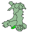
Clydach (electoral ward)

Clydach (electoral ward)
Clydach Ward
Wm swansea clydach.jpg
Ordnance Survey
OS grid reference: Maps for SS6902
Geography
Principal locality Clydach
Total population 7,320 (2001 census)
Land area (km²) 8.46 (2001 census)
Administration
Local council: City and County of Swansea
Number of councillors: 2
Nation: Wales
Post office and telephone
Postcode(s): SA6
Dialling code: +44-1792-84
Politics
Welsh Assembly: Gower
UK Parliament: Gower
European Parliament: Wales

Clydach is the name of an electoral ward, a community and a town in the City and County of Swansea, Wales, UK. The town has its own elected community council serving the community.

The electoral ward of Clydach consists of some or all of the following areas: Clydach (town), Faerdre, Glais (East), Graig Felen and Penydre in the parliamentary constituency of Gower. The ward is bounded by Mawr to the west, and Morriston and Llansamlet to the south.

The turnout for the 2008 local council elections was 37.74%. The results were:

Candidate Party Votes Status
Roger Llewellyn Smith Labour 1115 Labour hold
Paulette Bradley Smith Labour 820 Labour gain
Sylvia Mary Lewis Lib Dem 710
Julie Marlene Davies Ind 509
Janice Maureen Jarman Lib Dem 322
Janice Birch Cons 248
Barry John Stubbings Cons 226

External links


Coordinates: 50°48′10″N 3°51′37″W / 50.80271°N 3.86041°W / 50.80271; -3.86041


Wikimedia Foundation. 2010.

Игры ⚽ Нужен реферат?

Look at other dictionaries:

  • Morriston (electoral ward) — Morriston Ward Ordnance Survey OS grid reference: Maps for SS6698 Geography …   Wikipedia

  • Cwmbwrla (electoral ward) — Cwmbwrla Ward Ordnance Survey OS grid reference: Maps for SS6595 Geography Prin …   Wikipedia

  • Cockett (electoral ward) — Cockett Ward Ordnance Survey OS grid reference: Maps for SS6395 Geography Principa …   Wikipedia

  • Mynyddbach (electoral ward) — Mynydd Bach Ward Ordnance Survey OS grid reference: Maps for SS6598 Geography …   Wikipedia

  • Dunvant (electoral ward) — Dunvant Ward Ordnance Survey OS grid reference: Maps for SS5994 Geography Principa …   Wikipedia

  • Mayals (electoral ward) — Mayals Ward Ordnance Survey OS grid reference: Maps for SS6190 Geography Principal lo …   Wikipedia

  • Llansamlet (electoral ward) — Infobox swansea electoral ward Electoral Ward = Llansamlet Ward Ward GridReference = SS6998 Principal Locality = Llansamlet Total Population = 12,003 (2001 census) Land Area = 15.54 (2001 census) Local Council = City and County of Swansea… …   Wikipedia

  • Pontardawe (electoral ward) — Infobox Neath Port Talbot electoral ward Electoral Ward = Pontardawe ward Ward GridReference = SN722045 Largest Settlement= Total Population = 5,044 (2001 census) Land Area = NoofCouncillors = 1 PostCodes = SA8 DiallingCode = +44 1792… …   Wikipedia

  • Trebanos (electoral ward) — Infobox Neath Port Talbot electoral ward Electoral Ward = Trebanos ward Ward GridReference = SN717035 Largest Settlement= Total Population = 1,396 (2001 census) Land Area = NoofCouncillors = 1 PostCodes = SA8 DiallingCode = +44 1792… …   Wikipedia

  • Dyffryn Clydach — is a community of Neath Port Talbot county borough, Wales. It is coterminous with the Dyffryn electoral ward. Contents 1 Description 2 Amenities 3 Dyffryn electoral ward …   Wikipedia

Share the article and excerpts

Direct link
Do a right-click on the link above
and select “Copy Link”