- Crianlarich
-
Coordinates: 56°23′39″N 4°37′00″W / 56.394167°N 4.616667°W
Crianlarich Scottish Gaelic: A' Chrìon Làraich Scots: Crianlarich 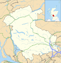
 Crianlarich
Crianlarich shown within the Stirling council areaPopulation 185 (2001 Census) OS grid reference NN385062 Council area Stirling Lieutenancy area Stirling and Falkirk Country Scotland Sovereign state United Kingdom Post town CRIANLARICH Postcode district FK20 Dialling code 01838 Police Central Scotland Fire Central Scotland Ambulance Scottish EU Parliament Scotland UK Parliament Stirling Scottish Parliament Stirling Mid Scotland and Fife List of places: UK • Scotland • Crianlarich (
 listen (help·info); Scottish Gaelic: A' Chrìon Làraich) is a village in the Stirling district and registration county of Perthshire, Scotland, about six miles north-east of the head of Loch Lomond. The village's name derives from the Gaelic for "low pass", relating to its geographical location.
The village is served by Crianlarich railway station.
Crianlarich has been a major crossroads for north and westbound journeys in Scotland since mediaeval times. In the 1750s, two military roads met in the village; in the 19th century, it became a railway junction on what is now the West Highland Line; in the 20th century it became the meeting point of the major A82 and A85 roads. As such, it is designated a primary destination in Scotland, signposted from as far as Glasgow in the south, Perth in the east, Oban in the west and Fort William in the north.
The village bills itself "the gateway to the Highlands", a not uncommon claim - for example, Pitlochry and Dunoon also do so.
The village lies in the glen of Strath Fillan at the north western extent of the Trossachs, lying in the shadow of several Munro peaks, notably Ben More, but also Stob Binnein and Cruach Ardrain. Thus Crianlarich is very popular with hillwalkers. Also the village lies halfway along the long distance footpath, the West Highland Way.
Its location makes Crianlarich a popular stop for tourists and there are a variety of types of overnight accommodation including guesthouses, B&Bs a SYHA Youth Hostel and an hotel.
In 2001, the village had a population of 185 [1].
External links
- Crianlarich on Undiscovered Scotland
- Crianlarich local community website
- Crianlarich is in the Church of Scotland Parish of Strathfillan
 Church of Crianlarich
 Crianlarich war memorial
Principal Towns Other Villages Aberfoyle · Altskeith · Ardchullarie More · Ardchyle · Ardeonaig · Arnprior · Ashfield · Auchlyne · Auchtubh · Balfron · Balmaha · Balquhidder · Bannockburn · Blair Drummond · Blairlogie · Boquhan · Boquhapple · Borestone · Brig o' Turk · Broomridge · Buchanan Smithy · Buchlyvie · Cambusbarron · Cambuskenneth · Cowie · Crianlarich · Croftamie · Dalrigh · Deanston · Drymen · Fallin · Fintry · Gargunnock · Gartmore · Hillfoots Villages · Inversnaid · Killearn · Killin · Kilmadock · Kilmahog · Kinbuck · Kippen · Plean · Port of Menteith · Rowardennan · Ruskie · Strathblane · Strathyre · Thornhill · Throsk · TyndrumCategories:- Villages in Stirling council area
- Stirling geography stubs


Wikimedia Foundation. 2010.