- Port of Hull
-
Coordinates: 53°44′17″N 0°19′55″W / 53.738°N 0.332°W
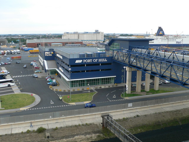
 The P&O Ferries terminal at the Port of Hull.
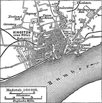
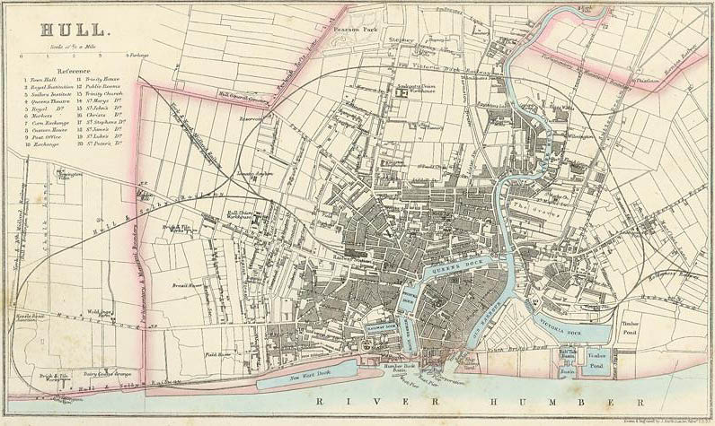
The Port of Hull is a trading port located at the confluence of the River Hull and the Humber Estuary in the city of Kingston upon Hull in the East Riding of Yorkshire. Seaborne trade can be traced to at least the 13th century.[1] As of 2010 the main port is operated by Associated British Ports and is estimated to handle one million passengers per year and is the main softwood timber importation port for the UK.[2] The Port of Hull is a constituent port of the Hull and Humber Ports City Region.
Contents
History
Background
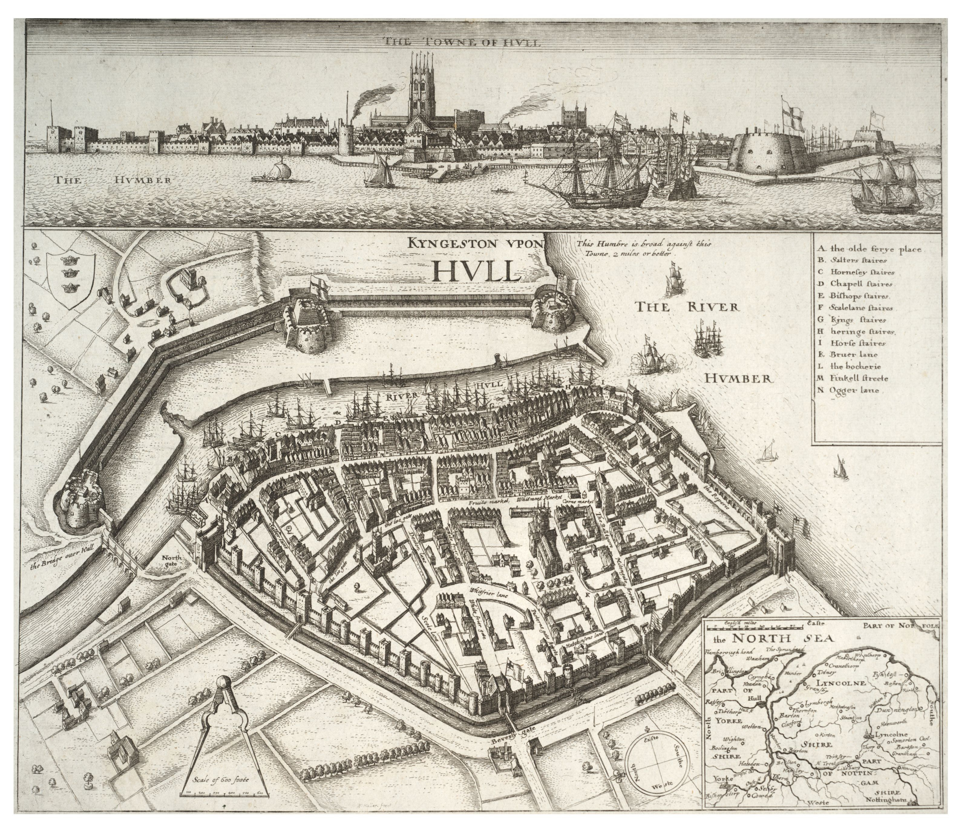
 17th century Map by Wenceslaus Hollar showing position of various staithes in the Haven, and the fortifications of the City Wall
Hull lies on a naturally advantageous position for portage, since its position on the north side of the Humber Estuary before a bend southwards gives rise to (on average) deeper water; in addition the River Hull flows out into the Humber at the same point.[3]
An important event in the history of Hull as a port was the acquisition by the crown (Edward I), followed by it becoming (in 1897) the only port from which goods could be exported overseas from the county of Yorkshire.[4] Thus in the 13th and 14th centuries Hull was a major English port for the export of wool,[note 1] much of it to Flanders, with wine being a major import.[5][note 2] During this period the river Hull was made navigable as far as the then important town of Beverley (1269), and roads built connecting Hull to Beverley, Holderness and to the via regia between Hessle and Beverley near to Anlaby (~1302).[4]
By the 15th century trade with the Hanseatic league had become important, also in the same period the growth of the English cloth industry meant that the export of cloth from Hull increased whilst wool exports decreased.[6] The 16th century brought a considerable reduction in the amount of cloth traded through the port, but the export of Lead increased.[7] By the late 17th century Hull was the third port in the realm after London and Bristol, with export of Lead and cloth, and imports of flax and hemp as well as iron and tar from the Baltic.[8]
Up till 1773 trade was conducted by the "Old harbour" (also known as The Haven) which was in effect a series of wharves upon the west bank of the river Hull,[note 3] with warehouses and the merchants houses backing on to the wharf along the High Street.[note 4]
Hull Dock Company
 The second Hull Dock Company offices (built 1820), close to the entrance to the former Queen's Dock
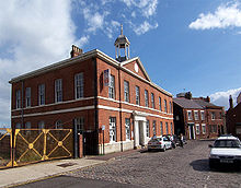
 The third Hull Dock Company offices (built 1871), at the former junction between Queen's and Prince's Dock
By the 18th century it was becoming increasingly clear that the Haven was not fit for the increasing amount of trade; not only was it narrow, but tidal and prone to build up of mud from the estuary.[9][10] An additionally stimulus was the demand for a 'legal quay' on which customs officials could easily examine and weigh goods for export without causing excessive delay to shipment.[11]
In 1773 the Hull Corporation, Hull Trinity House and Hull merchants formed the "Dock Company"[10] (the first statutory dock company in Britain),[12] the Crown gave the land which contained Hull's city walls and fortifications for a docks construction, and an act of Parliament was passed in 1774 allowing the Dock company to raise up to £100,000 by shares and loans; thus; Hull's first dock (the Old Dock): a wet dock began construction.[9][10] Three docks (known as the Town Docks) which followed the path of the town walls were constructed by the company between 1778 and 1829: The Old Dock (later Queen's Dock) (1778), Humber Dock (1809), and Junction Dock (later Prince's Dock) (1829).[13][14][15] An extension of the Town Docks: Railway Dock was built in 1846 just north of the terminus of the then recently opened Hull and Selby Railway.[13] The first dock in Hull east of the river Hull (Victoria Dock) was constructed between 1845 and 1850; this became the main dock for timber trade, and was expanded in the next two decades including the construction of large timber ponds.[16]
In 1860 a rival company the West Dock Company was formed with the purpose of promoting and building new docks suitable for the increasing amounts of trade and the increasing size of steam ships; the scheme was supported by the Hull Corporation, the Trinity House, the North Eastern Railway and various individuals in Hull. The site for the proposed dock was on the Humber foreshore to the west of the River Hull. The Dock Company then proposed a larger dock at the same position, which was sanctioned by an Act of Parliament in 1861[note 5][17] This dock was known as "the Western Dock" until its opening in 1869 when it was named "Albert Dock", an extension "William Wright Dock" was opened 1880.[18] A third dock ("St. Andrew's Dock") on the humber foreshore west of the river Hull was built in 1883.[19] All three docks where ideally suited for trans-shipment by rail as they were directly south of and parallel with the Selby to Hull railway line that terminated in the centre of Hull.
In 1885 Alexandra Dock opened, which was owned and operated by the Hull Barnsley & West Riding Junction Railway and Dock Company. This ended the monopoly the Dock Company had on dock facilities in Hull and led to price cutting competition between the two companies for dock charges; the Dock Company was operating at a loss and in 1886 began to seek to merge the company into a larger organisation - the obvious choice being the North Eastern Railway.[20] In 1891 the North Eastern Railway acquired the shares and debts of the Dock Company in exchange for its shares. Construction of a new dock was then planned to be built east of Alexandra Dock (this was to become the King George Dock, completed 1914 as a joint enterprise between the N.E.R and Hull and Barnsley Railway). Actual legal amalgamation of the Dock Company and N.E.R. took place in 1893, one of the clauses of the Act of Parliament allowing the merger was that ~£500,000 would be spent on dock improvements over the next seven years.[21]
Dock ownership (1922-)
The Hull and Barnsley railway became part of the North Eastern Railway in 1922,[22] making the docks in Hull the responsibility of a sole company once again. The grouping act of 1923 merged the N.E.R. into the London and North Eastern Railway,[22] which was nationalised in 1948 into the British Transport Commission. In 1962 the British Transport Docks Board was formed as a result of the Transport Act of 1962, in 1981 the company was de-nationalised (Transport Act 1981) and Associated British Ports was formed.
Docks
The Old Dock
The first dock in Hull, was built built between 1775 and 1778 to a design by Henry Berry, the work being finished by the engineer John Grundy. The dock was called The Dock until the construction of further docks,[23] whence it was called The Old Dock,[24] it was officially named the Queen's Dock in 1855.[note 6]
The dock entrance was on the river Hull just south of North Bridge, and the dock itself built along the path of the North Wall (westsouthwest) as far as the Beverley Gate.[note 7] Some of the work proved inadequate, requiring reconstruction later.[9] The dock walls were of local brick, whilst cement for its construction was rendered waterproof through the use of pozzolana imported from Italy. At the entrance to the dock a double drawbridge, counterbalanced for ease of use, of the Dutch, type allowed people to cross the lock.[9]
The dock was 1,703 ft (519 m) long, 254 ft (77 m) wide, and the lock 121 ft (37 m) long and 38 ft (12 m) wide, with the depth of water being between 15 ft (4.6 m) and 20 ft (6.1 m) depending on the tide.[25]
The dock closed in 1930 and was sold to the Corporation for £100,000, subsequently it was infilled and converted to an ornamental gardens known as Queen's Gardens.[26][27]
Humber Dock
 Humber Dock in 1952
Since the entrance to the Old Dock was via the river Hull there were still problems with ships accessing the dock through the crowded river; in 1781 a canal was proposed to connect the Old Dock to the Humber, additionally sea-borne trade was still in general increasing. There was some delay in making a solution, partly due to lethargy of the Dock Company, but, by 1802 a bill had been passed in Parliament for the construction of a second dock; again following the path of the City walls, this time from Hessle gate roughly northwards.[28]
Both John Rennie and William Chapman were employed as engineers,[29] John Harrap[30] was the on site engineer.[31] Construction started in 1803 and was completed in 1809 at a cost of £220,000;[32] mud from the excavations was used to make new ground on the banks of the Humber.[note 8]
The dock entrance was from the Humber via an outer basin with piers. The dock itself was 914 ft (279 m) long and 342 ft (104 m) wide, the lock was 158 ft (48 m) long and 42 ft (13 m) wide. The depth of water varied from 26 ft (7.9 m) to 21 ft (6.4 m) seasonally depending on the tides.[32]
Humber Dock closed in 1968, it re-opened in 1983 as the Hull Marina.[31]
Junction Dock
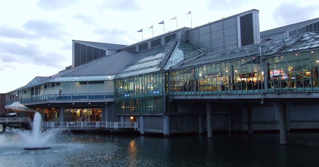
 The Princes Quay shopping centre on the Junction Dock
One stipulation of the Act of 1802 for the construction of Humber Dock was that, when the average tonnage of goods unloaded at the docks reached a certain level, the Dock Company would build a third dock between the Old and Humber docks. This continuation was satified in 1825, the Act of Parliament required had already been passed in 1824, and construction of the third dock began in 1826.[35]
This dock, Junction Dock was constructed between, and connected the Old and Humber docks; making the old town of hull an island bounded by the three docks,[24] river and estuary; it was designed by James Walker (John Timperley was resident engineer[36]) and built roughly along the lines of the old fortifications between Beverley and Myton gates.[37] The construction cost £186,000.[38]
The dock opened in 1829 and was 645 ft (197 m) long and 407 ft (124 m) wide, with a lock at each end 36 ft (11 m) wide with a bridge over each.[39] In 1855 it was renamed Prince's Dock.[note 6]
The dock closed in 1968,[40] part of the dock still exists, but without a lock connection to Humber dock; the Princes Quay shopping centre (1991)[40] was built over part of the dock on stilts, the dock now features a fountain.
Railway Dock
Permission to construct two new docks was granted in 1844, one being the "Railway Dock", the other "Victoria Dock". The Railway Dock was connected on the west side of Junction Dock (north of Kingston Street), and was smaller than the other town docks.[41] The dock of 13,130 sq ft (1,220 m2) cost something over £100,000[41] and was designed by J.B Hartley and opened in 1846.[42]
Its primary purpose was for the transfer of goods to and from the newly built Hull and Selby Railway[13] which had its passenger terminus just west of Humber Dock facing onto Railway Street, and its goods sheds north of this. Railway lines also ran from the goods shed to the Humber dock.[43]
Like Humber Dock the dock closed in 1968 and in 1984 became part of the Hull Marina.[42]
Victoria Dock
 Map showing the unextended Victoria Dock and the Town Docks
Permission to build the first dock on the east side of the River Hull was granted in 1844; construction of this new dock began in 1845 and was completed in 1850 at a cost of £300,000.[44] In its initial form the dock had an area of ~12.83 acres (51,900 m2). There were two extrances: one on the River Hull south of the entrance to the Old Dock and of Drypool Bridge had and outer lock which opened directly to a second locked area known as Drypool Basin, the second entrance was on the Humber; from an outer basin it led via two parallel locks to the Half Tide Basin,[note 9] and then to the Dock itself. The engineer was J.B. Hartley.[44]
One major use of the dock was for the trade in timber, there were also facilities for cattle import including abbatoirs and cold stores, coal was also exported through the dock.[45] In 1863 Victoria Dock was expanded by east by 8 acres (32,000 m2), and another timber pond of 12 acres (49,000 m2) added east of the humber entrance to the dock.[44]
The western boundary of the dock was defined by the Hull Citadel, which was subsequently sold to the Dock company and demolished in 1864, the site then used for timber storage,[16] Part of the former Citadel land was used by Martin Samuelson and Company (later Humber Iron Works) for shipbuilding,[46] later by Cook, Welton & Gemmell (from 1883 to 1902).[47][48] C. & W. Earle also had shipbuilding facilities (established 1851) on the banks of the Humber adjacent to and south of Victoria dock.[49]
The Dock closed in the 1970s and was infilled; the land being used for the construction of a housing estate in the late 1980s.[50] Of the dock the entrance basin on the Humber part remains though permanently sealed,[16] as does part of the entrance to the dock on the river Hull.
Albert Dock and William Wright Dock
 1866 map showing the "New West Dock" (Albert Dock) as well as the extended Victoria dock and its timber ponds
The Hull Dock Act of 1861 sanctioned the building of a new dock on the Humber foreshore - its entrance was at the eastern end close to the entrance of Humber Dock. Construction began in 1863, the engineer was John Hackshaw and the site engineer J.C. Hackshaw. The dock followed the bank of the estuary east west being 1,034 yd (945 m) long, with an area of 17 acres (69,000 m2).[17] It opened in 1869 and was named Albert Dock.[18][note 10]
In 1865 the Dock Company got permission to build a westwards extension to the dock[18] - construction began in 1873[52] and the dock opened in 1880 and was named William Wright Dock after the name of the Chairman of the Dock Company.[18] The dock was 6.75 acres (27,300 m2) in size.[53]
In 1907 the NER constructed a 2,500 ft (760 m) quay (Riverside Quay) on the humber bank on the south side of Albert dock.[54] The quay was designed for foodstuffs and other goods requiring rapid handling,[55] and also incorporated a passenger station for continental boat trains.[55][56] During the Second World War the quay was destroyed as a result of enemy bombing,[54] During the 1950s a new concrete Quay 1,065 ft (325 m) long was constructed and officially opened in 1959.[54] The south side of Albert dock modernised to a similar design as the new Riverside quay in 1964.[54][57]
Both docks were closed to commercial vessels in 1972, and converted for use as fish docks, the Hull fish fleet moved to the docks in 1975.[51] As of 2010 both docks remain in use for general cargo traffic,[58] as well as being the landing point for the much reduced Hull fishing industry.[59]
St. Andrew's Dock
 The silted dock in 2005
The most westward of the Hull docks was opened in 1883, directly to the west of William Wright Dock, and with an area of over 10.5 acres (42,000 m2).[19] It was originally to be used for coal handling but was used entirely for the fishing industry.[60]
The dock was extended in 1897 (by ~10 acres) after the Hull Dock Company was taken over by the North Eastern railway.[19]
The dock was in use until the 1975 when the fishing industry was moved to Albert Dock at which point the dock closed.[61] Partial filling in of the dock began in the 1980s. The western part has been redeveloped into the St. Andrews Quay retail park[62] whilst the eastern part has been declared a conservation area due to its social historic interest. The Dock entrance, and some shipping company buildings remain in situ, but the remains of the dock are completely silted up.[60]
Alexandra Dock
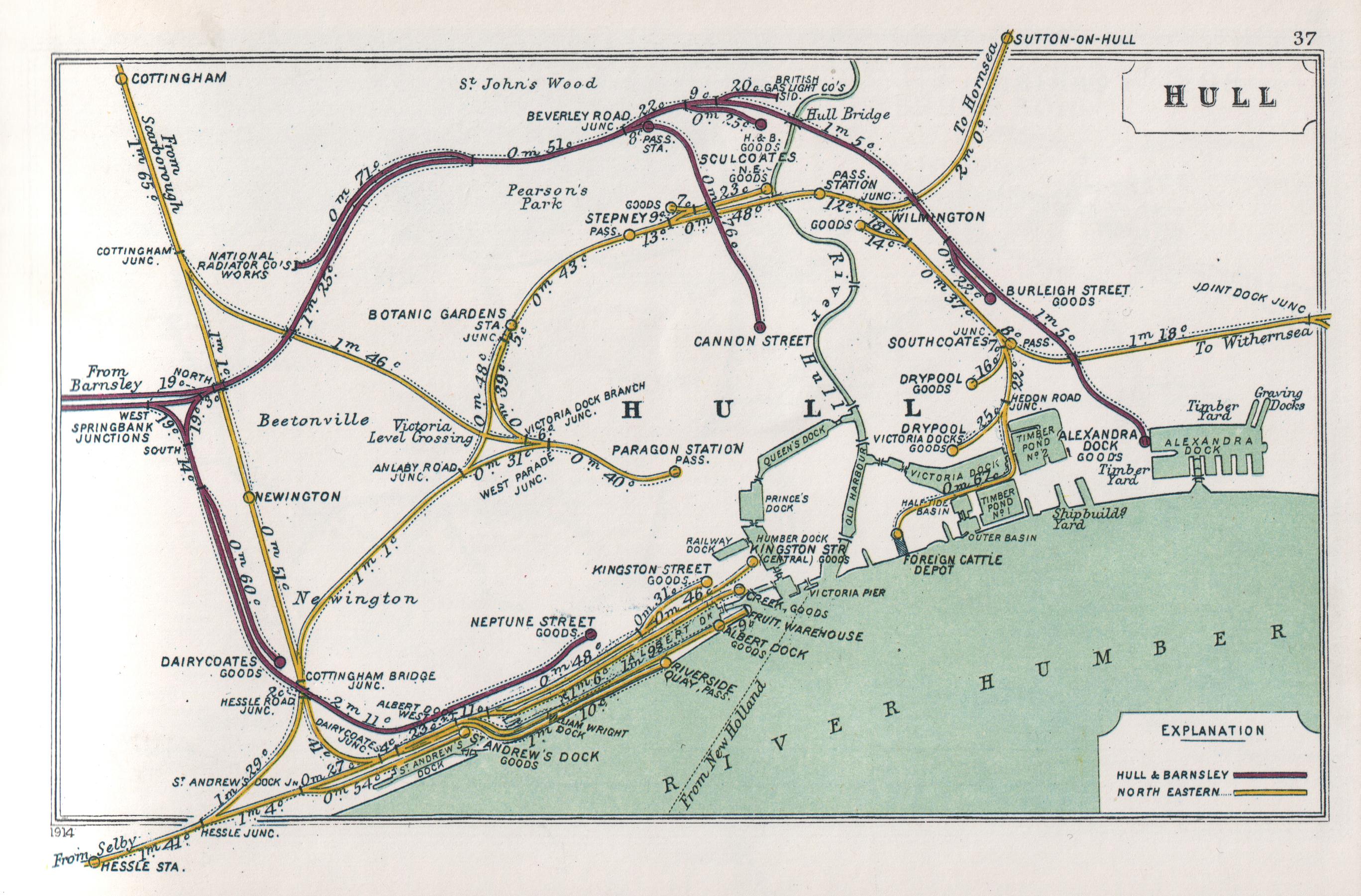
 Map of 1914 showing the Alexandra Dock, extended Victoria dock, town and west docks, and the rail systems of the H&BR and the NERSee also: Hull Barnsley & West Riding Junction Railway and Dock Company
The Alexandra Dock was built in 1885 as part of the construction of the Hull and Barnsley Railway; a railway and dock company proposed for the purpose of increasing the rail transportation and dock facilities in Hull. The dock was built to the east of Victoria Dock with an outlet to the Humber. Water to fill the dock came from drains to the north of the dock, which was intended to minimise the silting up of the dock that would be caused by ingress of water from the Humber; it had an area of 46.5 acres (188,000 m2).[63]
The entrance lock was 550 ft (170 m) long at 85 ft (26 m) wide. Two graving docks, one 500 ft (150 m) long and 60 ft (18 m) wide, the other a little bigger were also built at the northeast corner of the dock. Its primary purpose was the export of coal.[63]
In 1899/1900 the dock was expanded by 7 acres (28,000 m2).[63][64] A pier onto the Humber estuary was added in 1911,[65] the pier was 1,350 ft (410 m) with a 18 ft (5.5 m) minimum depth of water at spring tides, and was equipped with electric conveyors for the transportation of coal.[56] The area of the wharf, west of the dock entrance was proposed for a riverside container terminal in the 2000s, the project Quay 2005 gained approved in December 2005.[66]
Alexandra Dock closed in 1982[67] at which time the connection to the rail network was removed,[68] in 1991 the dock re-opened[67] but without a rail connection.[69] As of 2010 the dock handles cargoes including aggregates, bulk agricultural products and bulk chemicals, and wood. The dock also has a Ro-Ro terminal.[59]
In January 2011 Siemens and Associated British Ports signed a memorandum of understanding concerning the construction of wind energy machine manufacturing plant at Alexander Dock. The plan would require some modification of the dock to allow the ships, used for transporting the wind turbines, to dock and be loaded,[70][71][72] and would make use of the proposed Quay 2005 riverside facilities, which had already gained planning consent.[73][74] The development - known as Green Port Hull, would infill the dock west of the lock gates with ~780,000m2 of material creating additional land for operations, and 7.5ha of land would be created on the banks of the Humber for shipping;[note 11] and businesses already located in the western part of the dock would be relocated, primarily to other sites within the port of Hull.[76]
King George Dock and Queen Elizabeth Dock
 Aerial view of King George and Queen Elizabeth docks
Built as a joint development between the Hull and Barnsley Railway and the North Eastern Railway, and contracted to S. Pearson in 1906,[77] the design was undertaken by Sir Benjamin Baker and Sir John Wolfe-Barry.[78][79] King George Dock (also known as the Joint Dock) was opened in 1914 by King George V.[77][79]
The dock's entrance lock was 750 ft (230 m) long and 85 ft (26 m) wide, the unexpanded water area was 53 acres (210,000 m2). Two graving docks were also constructed in the dock in its north east corner.[56] Initially primarily used for coal a grain silo was added in 1919,[79] initially used for imports and later for export of grain, the silo was demolished in 2010/11.[80][81]
In 1965 the creation of berths for use by Roll on roll off ferries began the increasing use of Ro-Ro ferries at the dock for unit freight transport.[79] In 1968 work on an 28 acres (110,000 m2) extension to King George Dock built on reclaimed land to the south east of the dock was begun, the extension was officially opened in August 1969 by Queen Elizabeth II and named Queen Elizabeth Dock.[54] At Elizabeth dock container terminal was opened in 1971, and two Ro-Ro terminals were opened in 1973, by 1975 there were six Ro-Ro terminals in the two docks.[54][82]
In 1993 River Terminal 1 (now known as "Rotterdam terminal") a terminal for large Ro-Ro vessels was opened on the banks of humber estuary south of the King George dock, constructed at a cost of £12million.[83] A covered shed for paper products (Finland terminal) was opened in 2000, by 2006 expanded to 70,000 sq ft (6,500 m2)[84] As of 2010 other facilities at the two docks included a 24000m3 cold store, a enclosed terminal for ship to shore handling of metals, general cargo and bulk grain, and passenger services to Rotterdam and Zeebrugge; the company AarhusKarlshamn operates a large vegetable based oil products processing plant at the dock, and the Kingston Terminal located at the southeast of Queen Elizabeth dock is used for import of coal products. In 2010 there were ten Ro-Ro berths in total within the two docks.[59]
Other facilities
Dry docks
In addition to the dry docks in King George, Alexandra, and William Wright docks there were dry docks on the sides of the river Hull.[85] Hull Central Dry dock (also known as "South End Dock") on the west bank of the River Hull near to its outfall onto the Humber estuary[map 1] was the largest, being 345 ft (105 m) long with a entrance of 51 ft (16 m),[85] the dock having been extended several times.[86] Built in 1843 and later extended the dock has been disused since 1992 and is now a Grade II listed structure.[86][87][88]
On the east bank of the river Hull were Crown Dry Dock,[map 2] 104 by 21 ft (32 by 6.4 m)[85] half way between the river outfall and entrance to Victoria dock's drypool basin. Further upstream was Union Dock, 214 by 48.5 ft (65 by 14.8 m),[85] opposite the entrance to Queen's dock,[map 3] dating to the first half of the 1800s.[89] and a third dock further upstream.[map 4]
On the west bank of the river Hull there were ship repair facilities just within the city walls at North Gate on the river dating back as far as the 15th century, with slipways by the 18th century; the entrance to Queen's dock was later built in this area, and two dry docks remain North Bridge Dry Dock and No.1 Dry Dock to the north and south of Queen's dock basin respectively. North Bridge dry dock[map 5] and No.1 dry dock[map 6] were smaller dry docks of around 150 ft (46 m) long and with entrances less than 40 ft (12 m)[85] Both were extended in the latter part of the 19th centurys.[90][91] The northernmost of the two docks is a Grade II listed structure.[92] Additionally the former Queen's dock basin was converted to a enclosed dock after the main dock was infilled.[93]
Quays, wharfs and piers
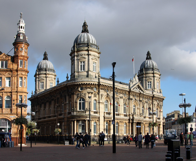
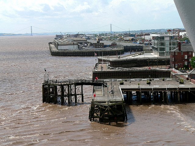
 Victoria pier, Minerva pier behind, Albert dock entrance lock and Riverside Quay in distance
In addition to the Riverside quay at Albert dock, the former pier at Alexandra dock, and the Ro-Ro river terminal at King George Dock there are other water side berths at the port, both on the Humber and on the river Hull.
Corporation Pier, first constructed in 1810 was parallel to the mainland but not direct connected to it,[94] it was converted to a "T" shaped pier in 1847,[94] used as the terminus of the Hull to New Holland ferry, initially run by the Manchester, Sheffield and Lincolnshire Railway (MS&LR), later by the LNER and British Rail, until the service ended in 1981 due to the opening of the Humber Bridge.[95] It was renamed Victoria Pier in 1854.[33][note 12][map 7] A railway booking office latterly named Hull Victoria Pier was established here c. 1849 by the MS&LR, and closed on 25 June 1981[96] with the cessation of the ferry service. The pier has been altered a number of times during its existence, a floating pontoon was added in 1877, removed in 1980;[94] an upper Promenade was added in 1882,[97] and removed in the mid 20th century; as of 2005 the primary wooden structure is "L" shaped.[94]
To the west of Victoria Pier were the "L" shaped piers enclosing the Humber dock basin,[98][99] The West Pier became defunct in the 19th century, the land to the west being reclaimed from the Humber to form Island Wharf.[100][101][note 13] The East Pier was a wooden structure, since the 1920s known as the Minerva pier;[102] it was replaced by a steel walled pier in the latter part of the twentieth century.[103][104]
As of 2010 the piers are still used to harbour vessels, but are not used for cargo handling.
The river Hull had extensive staithes, wharfs and warehouses along its length; the old harbour could accommodate vessels up to 200 ft (61 m), the river being navigable for vessels up to 180 ft (55 m) for two miles.[105] As of 2010 Cargo handling has mostly ceased in the old harbour, barges are still used for transportation of vegetable and mineral oils further upstream within the boundaries of Hull: including to Rix petroleum, the Cargil vegetable oil plant in Stoneferry, and to the Croda chemicals vegetable oil chemical processing plant.
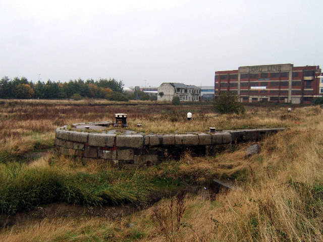
Salt End jetties
At Salt End a jetty (No.1 Oil Jetty) for the importation of bulk mineral oil was constructed in 1914 by the North Eastern and Hull and Barnsley railway companies, connected to a tank farm at Salt End. The jetty was constructed extending into the humber, giving a water depth of 30 ft (9.1 m) at low spring tides.[56] Chemical industrial development fed by the oil imports would develop into the chemical site at Salt End known as BP Saltend.
No.2 Jetty was constructed in 1928 westward of No.1, and a reinforced concrete structure No.3 Jetty was built 1958, the original No.1 jetty was demolished and replaced with a new structure in 1959.[54] No.2 jetty was demolished in 1977.[106] As of 2010 both No.1 and 3 jetties remain in use.
Disasters, accidents and war damage
Explosion of the PS Union
In 1837 the packet steamer Union exploded in the Humber dock basin,[107] resulting in the death of over twenty people including bystanders on the dock side, and a large number of injuries, the vessel itself being sunk as a result of the explosion.[108][109][110]
R38 airship disaster
Main article: R38 class airshipIn 1921 a R38 class airship broke apart whilst performing a sharp turn near to Victoria pier, the air-vessel then exploded, and the flaming wreckage crashed into the Humber near to the Victoria pier killing 45 of the 49 on board.[111]
Second world war
During the Second World War the Hull docks were actively targeted; in addition to mines in the Humber,[112] the docks in Hull were bombed; all docks were damaged during the period, and the wooden Riverside Quay at Albert dock was totally destroyed in 1941.[113]
Fires
Major fires destroyed the fish market at St. Andrews dock in 1929, and a general cargo shed at Humber dock in 1951.[114]
See also
- Arctic Corsair, Hull Maritime Museum, Spurn Lightship, Streetlife Museum of Transport; museums in Hull with exhibits relevant to the Port
References
- ^ A History of Hull, E. Gillet, K.A. MacMahon, Chapter 1 'Beginnings of the Medieval Town'
- ^ Port Hull: About www.abports.co.uk Retrieved on 24 May 2007
- ^ The Yorkshire Coast, D.B. Lewis, p. 158
- ^ a b A History of the Hull Railways, G.G. MacTurk, Chapter I "Early Approaches to Hull", 1879
- ^ A History of Hull, E. Gillett, K.A. MacMahon, Chapter 2 "The Medieval Trade of Hull"
- ^ A History of Hull, E. Gillett, K.A. MacMahon, Chapter 6 "The Market, the Ferries, and Foreign Trade
- ^ A History of Hull, E. Gillett, K.A. MacMahon, Chapter 8 "Hull in the Early 16th century"
- ^ A History of Hull, E. Gillett, K.A. MacMahon, Chapter 15 "Hull under Charles II and James II"
- ^ a b c d A History of Hull, E. Gillett, K.A. MacMahon, Chapter 17 "The Beginnings of the Modern Port", pp. 219-222
- ^ a b c The Yorkshire Coast, D.B. Lewis, Chapter 11 "Ports and Harbours" (M.J.T. Lewis), pp. 158-159
- ^ Hull in the Eighteenth Century, G. Jackson, Chapter X "The Provision of Modern Port Facilities", pp. 234-243
- ^ "Hull’s docks and trade". Hull City Council. http://www.hullcc.gov.uk/portal/page?_pageid=221,575804&_dad=portal&_schema=PORTAL. Retrieved 28 March 2010.
- ^ a b c The Yorkshire Coast, D.B. Lewis, p. 159
- ^ Humber Perspectives.., S. Ellis, D.R. Crowther, Chapter 30 "Development of the Humber during the nineteenth and twentieth centuries", J. North, p. 423
- ^ A cyclopædia of commerce, mercantile law, finance, commercial geography, and navigation, William Waterston, 1846, Publisher: Henry G. Bohn (London), p. 256, google books
- ^ a b c SPG Note 27 Heritage & Development Management at Garrison Side, Hull "Historical Background", pp. 5-6 (overall document pages 167-168), sections 27.5 to 27.13, (also historical maps of the near area, and information on the Hull Citadel), www.hullcc.gov.uk
- ^ a b General and concise history and description of the town and port of Kingston-upon-Hull, J.J. Sheahan, pp.293-295
- ^ a b c d A History of the County of York East Riding: Volume 1 - The City of Kingston upon Hull, "The Corporation and the Dock Company, 1835–70", Editor: K.J. Allison, online version
- ^ a b c North Eastern Railway, Its Rise and Development, William Weaver Tomlinson, Chapter XX "Twenty-Five Years of Progress (1880-1904)" "Developments at Hull", pp.715-716.
- ^ North Eastern Railway, Its Rise and Development, W.W. Tomlinson, pp. 707-708
- ^ North Eastern Railway, Its Rise and Development, William Weaver Tomlinson, pp. 711-715.
- ^ a b The Hull & Barnsley Railway, G.D. Parkes, The Oakwood Press, 1970 reprint, p. 6
- ^ General and concise history and description of the town and port of Kingston-upon-Hull, J.J. Sheahan, "The Docks" pp. 287-289
- ^ a b A home tour through the manufacturing districts of England: in the summer of 1835, George Head, Publisher:John Murray, London, 1836, p. 235, google books
- ^ The tourist's companion; or ..., E. Parsons, p. 219
- ^ Port of Hull, Hull Docks.. Page 1 Queens Dock, website.lineone.net
- ^ Coast Walk, Point 1: Queen's Gardens www.bbc.co.uk
- ^ A History of Hull, E. Gillett, K.A. MacMahon, pp. 222-224.
- ^ A biographical dictionary of civil engineers in Great Britain and Ireland, A.W. Skempton, "CHAPMAN, William, MRIA (1749-1832), pp. 126 and 132, google books
- ^ A biographical dictionary of civil engineers in Great Britain and Ireland, A. W. Skempton, "HARRAP, John (1769-1812)", p. 289, google books
- ^ a b A Guide to the City’s Heritage Plaques Hull City Council, No. 9 "Humber Dock", sheet 7, via www.waterfrontcommunitiesproject.org
- ^ a b The tourist's companion; or ..., E. Parsons, p. 220
- ^ a b "Coast Walk: Point 5 - Victoria Pier". www.bbc.co.uk. BBC. http://www.bbc.co.uk/humber/content/articles/2005/07/06/coast05walks_stage5.shtml.
- ^ Old Town (Southern part) Conservation Area Character Appraisal, section 6.7 ,p.4
- ^ A History of Hull, E. Gillett, K.A. MacMahon, pp. 223-225.
- ^ A biographical dictionary of civil engineers in Great Britain and Ireland, A. W. Skempton, "TIMPERLEY, John (1796-1856), p. 708, google books
- ^ A History of Hull, E.Gillett, K.A. MacMahon, "Beginnings of the Modern Port" p. 224
- ^ General and concise history and description of the town and port of Kingston-upon-Hull, J.J. Sheahan, pp. 290-291
- ^ The tourist's companion; or ..., E. Parsons, p. 221
- ^ a b A Guide to the City’s Heritage Plaques Hull City Council, No. 4 "Prince's Dock", sheet 5, via www.waterfrontcommunitiesproject.org
- ^ a b General and concise history and description of the town and port of Kingston-upon-Hull, J.J. Sheahan, p. 292
- ^ a b A Guide to the City’s Heritage Plaques Hull City Council, No. 29 "Railway Dock", sheet 19, via www.waterfrontcommunitiesproject.org
- ^ Tomlinson's North Eastern Railway - Its Rise and Development, W.W. Tomlinson, Publisher:David & Charles, 1967 edition, Chapter X "The Opening of Many Lines (1836-41)", pp. 337-343
- ^ a b c General and concise history and description of the town and port of Kingston-upon-Hull, J.J. Sheahan, pp. 292-3
- ^ Michael Thomson, Hull Docklands, "Victoria Dock 1850-1970", pp.32-5
- ^ "A Tale of Two Rivers". www.thedeep.co.uk. A History of Sammy’s Point. http://www.thedeep.co.uk/pdf/LocationHistory.pdf. Retrieved 22 February 2011. "..and when Victoria Dock was built in 1850 the dug out mud was used to reclaim even more land at the point. Martin Samuelson set up a shipyard in 1857 on this new piece of land .. 1864 the point was sold to the Humber Iron Works and Ship Building Company .. 1872 was bought by Bailey and Leetham Ship Owners .. 1903 it was bought by Thomas Wilson and Son"
- ^ "Exhibition keeps river shipyard's fame afloat". www.yorkshirepost.co.uk. Yorkshire Post. 15 March 2004. http://www.yorkshirepost.co.uk/news/around-yorkshire/local-stories/exhibition_keeps_river_shipyard_s_fame_afloat_1_2541490.
- ^ "Cook, Welton and Gemmel and their successors". www.nationalarchives.gov.uk. The National Archives. http://www.nationalarchives.gov.uk/a2a/records.aspx?cat=323-hmm2&cid=0#0.
- ^ "History of the Dock". www.vdvh.co.uk. Victoria Dock Village Hall Community Association. http://www.vdvh.co.uk/historyofthedock.html.
- ^ Kingston Upon Hull Docks Page - Two Victoria Dock, www.riverhumber.com
- ^ a b Michael Thompson, Hull Docklands, "Albert and William Wright Docks 1869", pp.36-43
- ^ John Simpson, Humber Pilots – Important Dates, "1883", p.27
- ^ A History of the County of York East Riding: Volume 1 - The City of Kingston upon Hull, "The Corporation and the Docks, 1870-1914", Editor: K.J. Allison online version
- ^ a b c d e f g Hull Docks Official Handbook 1975, "History of the Port of Hull", pp.21-25
- ^ a b The City and Port of Hull (1932), pp.69, illustration p.71
- ^ a b c d H.N. Appleby, ed (1921). "Hull Docks, Quays and Piers". The Port of Hull (Official Handbook of tides, rates, and general information). Hull and Barnsley Railway Company, Hull. pp. 17–22.
- ^ Michael Thompson, Hull Dockyards (1990), "Albert and William Wright Docks 1869", pp.36-43
- ^ Port of Hull - facilities www.abports.co.uk
- ^ a b c "Port of Hull: Commodities". www.abports.co.uk. Associated British Ports. http://www.abports.co.uk/custinfo/ports/hull/commodities.htm. Retrieved 22 February 2011.
- ^ a b Urban Conservation and Design St. Andrews Dock www.hullcc.gov.uk
- ^ Michael Thompson, Hull Docklands, "St. Andrews Dock", pp.44-9
- ^ The Junction, St Andrews Quay, Retail Park, Clive Sullivan Way, Hull, HU3 4SA www.thejunction-uk.com
- ^ a b c The Hull & Barnsley Railway, G.D. Parkes, The Oakwood Press, 1970 reprint, "Docks and Piers", pp. 12–13
- ^ "16 Shipping and Trade, pp.81". The East Riding of Yorkshire ( with York) [Cambridge County Geographies]. http://books.google.co.uk/books?id=3hU9AAAAIAAJ&lpg=PA81&vq=Alexandra%20Dock&pg=PA81#v=onepage&q&f=false.
- ^ "Kingston upon Hull City Docks Page Three, River Humber.com". www.riverhumber.com. Alexandra Dock. http://www.riverhumber.com/index12d.htm. Retrieved 20 February 2011.
- ^ "Hull Port Project Gets Go-ahead". www.gov-news.org. 21 December 2005. http://www.gov-news.org/gov/uk/news/hull_port_project_gets_go_ahead/16703.html. Retrieved 20 February 2011.
- ^ a b John Simpson, Humber Pilots – Important Dates, "1885, 16th July", p.28
- ^ The train now standing (Vol1) : The Life and Times of the Hull and Barnsley Railway, Ted Dodsworth, Hutton Press, 1990, p. 21.
- ^ Railway Memories No.12 : The Hull & Barnsley Railway, Stephen Chapman, Bellcode Books, 1999 pp. 7–10. also pp. 46, 51
- ^ Andrew Bounds (20 January 2011). "Hull for wind turbine plant". www.ft.com. Financial Times. http://www.ft.com/cms/s/0/a5458a4a-2499-11e0-8c0e-00144feab49a.html#axzz1BkAKAYY3. Retrieved 22 January 2011.
- ^ Siemens selects ABP as preferred bidder for UK wind turbine factory. . www.siemens.co.uk (Siemens). 20 January 2011. http://www.siemens.co.uk/en/news_press/index/news_archive/siemens-selects-abp-as-preferred-bidder-for-uk-wind-turbine-factory.htm. Retrieved 22 January 2011.
- ^ Tim Webb (20 January 2011). "Siemens chooses Hull for wind turbine plant generating 700 jobs". www.guardian.co.uk. The Guardian. http://www.guardian.co.uk/business/2011/jan/20/siemens-associated-british-ports-wind-turbines. Retrieved 22 January 2011.
- ^ "Green Port Hull to transform the Humber economy". www.hull.co.uk. 6 December 2010. http://www.hull.co.uk/news.asp?pageid=74&MediaCategoryId=3&NewsID=1518&MediaType=news.
- ^ "Green Port Hull aims to transform economy". www.maritimejournal.com. 8 December 2010. http://www.maritimejournal.com/features101/marine-civils/marine-renewable-energy/green-port-hull-aims-to-transform-economy.
- ^ "The Associated British Ports (Hull) Harbour Revision Order 2006", www.legislation.gov.uk (The National Archives), 2006, http://www.legislation.gov.uk/uksi/2006/1135/contents/made
- ^ URS / Scott Wilson (March 2011), "Green Port Hull, Environmental Impact Assessment Scoping Report (Final)", www.marinemanagement.org.uk: pp. i-vi, 3, 5, fig. 3.1, 2.4, http://www.marinemanagement.org.uk/licensing/public_register/eia/documents/screening_scoping/hull.pdf
- ^ a b A History of Hull, E. Gillett, K.A. MacMahon, Chapter 25 "Pre War" p. 355
- ^ Obituary, Sir Benjamin Baker Proceedings of the Institution of Civil Engineers, pp. 377-383, London, 1907
- ^ a b c d "Engineering Timelines - King George Dock, Hull". www.engineering-timelines.com. http://www.engineering-timelines.com/scripts/engineeringItem.asp?id=1043.
- ^ "Final days for King George Dock grain silo that helped feed the world". www.thisishullandeastriding.co.uk. 27 December 2010. http://www.thisishullandeastriding.co.uk/news/Final-days-King-George-Dock-grain-silo-helped-feed-world/article-3041514-detail/article.html.
- ^ "End of an era for silos used in Geldof's famine relief". www.humberbusiness.com. 5 January 2011. http://www.humberbusiness.com/news/End-era-silos-used-Geldof-s-famine-relief/article-3062787-detail/article.html.
- ^ Hull Docks Official Handbook (1975), "Unit Load", pp. 43-7
- ^ Hull Port & Commercial Handbook, 1995, pp. 11-12
- ^ ABP INVESTS £4.8 MILLION IN NEW DEVELOPMENTS FOR PORT OF HULL’S FINLAND TERMINAL. . www.abports.co.uk (Associated British Ports). 30 March 2006. http://www.abports.co.uk/news20064956.htm.
- ^ a b c d e The Port of Hull, official handbook (1921), "Table of Dry Dock Information", pp. 28
- ^ a b Paul Gibson, The Origins of Hull's Dry Docks, South End Graving Dock
- ^ "Central Dry Dock/ Sand Southend Wharf, Kingston Upon Hull". www.britishlistedbuildings.co.uk. http://www.britishlistedbuildings.co.uk/en-469845-central-dry-dock-sand-southend-wharf-kin.
- ^ Old Town (Southern part) Conservation Area Character Appraisal, section 14.13, p. 20
- ^ "Conservation list - Hull City Council". www.hullcc.gov.uk. http://www.hullcc.gov.uk/pls/portal/docs/PAGE/HOME/PLANNING/CONSERVATION/LOCAL%20BUILDINGS%20LIST/CURRENT_LOCAL_LIST_0108.PDF. Retrieved 20 February 2011.
- ^ Paul Gibson, The Origins of Hull's Dry Docks, No.1 Dry Dock
- ^ Paul Gibson, The Origins of Hull's Dry Docks, North Bridge Yard
- ^ "Dry Dock on South Side of Charlotte Street, Kingston Upon Hull". www.britishlistedbuildings.co.uk. http://www.britishlistedbuildings.co.uk/en-387546-dry-dock-on-south-side-of-charlotte-stre.
- ^ Paul Harrop. "TA1029 : Former dry dock, Hull". www.geograph.org.uk. http://www.geograph.org.uk/photo/2227727. "The 11 acre Queen's Dock was opened in 1778 and closed in 1930. The main dock was filled in to create Queen's Gardens and the dock basin was reused as a dry dock from 1957 up until the end of the 20th century."
- ^ a b c d Old Town (Southern part) Conservation Area Character Appraisal, section 14.12 : 4 "Victoria Pier" ,p.19
- ^ Nick Catford; Mark Dyson. "Disused Stations: Hull Corporation Pier". www.disused-stations.org.uk. http://www.disused-stations.org.uk/h/hull_corporation_pier/index.shtml.
- ^ Butt, R.V.J. (1995). The Directory of Railway Stations. Yeovil: Patrick Stephens Ltd. p. 125. ISBN 1 85260 508 1. R508.
- ^ Philip C. Miles, Hull's Waterfront, "Victoria Pier and the Humber Ferries", pp.58-63
- ^ Handbook for travellers in Yorkshire. John Murray, London. 1867. pp. 91. http://books.google.co.uk/books?id=VtcHAAAAQAAJ&vq=Humber%20Dock&pg=PA91#v=onepage&q&f=false.
- ^ Ordanance Survey Map, 1856-7, 1:1056
- ^ Ordnance Survey Map, 1891-3, 1:2500
- ^ a b Old Town (Southern part) Conservation Area Character Appraisal, section 14.11, p. 18
- ^ Ordnance Survey maps, 1:2500, (1910 and 1928 editions), also The City and Port of Hull (1932), p.62
- ^ Old Town (Southern part) Conservation Area Character Appraisal, section 14.12 : 5 "Minerva pier", p. 19
- ^ "Minerva Pier & Island Wharf - Hull". www.alandwood.co.uk. http://www.alanwood.co.uk/pdf/Minerva-Pier-and-Island-Wharf-Hull.pdf.
- ^ The City and Port of Hull (1932), "The River Hull", pp.73-4
- ^ Michael Thompson, Hull Docklands, "Salt End Oil Jetties 1914", pp.82-84
- ^ "Packet Boats and Steamers". www.humberpacketboats.co.uk. P.S. Union. http://www.humberpacketboats.co.uk/packetboats.htm.
- ^ "June 7 "Dreadful Explosion of a Steam Vessel, Hull"". Dodsley's annual register (1837) 79: 53–4. 1838. http://books.google.co.uk/books?id=L3VIAAAAYAAJ&vq=Union%20Hull&dq=union%20steam%20explosion%20hull&pg=RA1-PA53#v=onepage&q&f=false.
- ^ Henry Schroder (1851). "Explosion of a Steam Packet Boiler at Hull". The annals of Yorkshire from the earliest period to the present time (Crosby & Co., Leeds) 1: 303–4. http://books.google.co.uk/books?id=UtcuAAAAMAAJ&pg=PA303#v=onepage&q&f=false.
- ^ "Abstract of the evidence at the inquest relating to the explosion of the bolier of the "Union" steam packet at Hull". The Mechanics' magazine, museum, register, journal, and gazette (W.A. Robertson, London) 27: 189–192. 1837. http://books.google.co.uk/books?id=CwsAAAAAMAAJ&vq=Union%20Hull&pg=PA189#v=onepage&q&f=false.
- ^ "Humber airship accident". www.bbc.co.uk. BBC Humberside. http://www.bbc.co.uk/humber/content/articles/2008/08/18/r38_feature.shtml.
- ^ John Simpson, Humber Pilots – Important Dates, "1940" to "1945" pp.52-3
- ^ Michael Thompson, Hull Docklands, Chapter 7 "The 1939-45 War", pp.126-131
- ^ Michael Thompson, Hull Docklands, Chapter 8 "Dock Estate Fires at the Port of Hull", pp.132-136
Sources
- A History of Hull, Edward Gillet, Kenneth A. MacMahon, Oxford University Press, 1980
- The Yorkshire Coast, David B. Lewis, Normandy Press, 1991, Chapter 11 "Ports and Harbours" (M.J.T. Lewis), pp. 156–161
- Humber Perspectives: A Region throughout the Ages, Editors: S. Ellis, D.R. Crowther, Hull University Press, 1990.
- The tourist's companion, or, The history of the scenes and places on the route by the rail-road and steam-packet from Leeds and Selby to Hull, Edward Parsons, 1835, Chapter IX "Hull continued" pp. 211–223, (online version via google books) 1835 account of three docks then extant, and related subjects including the Trinity House
- General and concise history and description of the town and port of Kingston-upon-Hull, James Joseph Sheahan, Publisher:Simpson, Marshall and Co. (London), 1864, pp. 275–298 "The Port". (online version via www.archive.org)
- A biographical dictionary of civil engineers in Great Britain and Ireland, Volume 1: 1500-1830, A. W. Skempton, Thomas Telford Publishing Limited on behalf of the Institute of Civil Engineers, 2002.
- A History of the County of York East Riding: Volume 1 - The City of Kingston upon Hull, Editor: K.J. Allison, 1969, detailed history of Hull, (online version via www.british-history.ac.uk)
- Hull in the Eighteenth Century:A study in economic and social history, Gordon Jackson, Oxford University Press, 1972, includes detailed history of the events leading to the construction of the Old and Humber docks, as well as detailed statistics of imports and exports
- North Eastern Railway, Its Rise and Development, William Weaver Tomlinson, Publisher: David & Charles, Chapter XX : "Twenty-Five Years of Progress (1880-1904)" "Developments at Hull", pp. 703–721. (online 1914 version via www.archive.org)
- H.N. Appleby, ed (1921). The Port of Hull (Official Handbook of tides, rates, and general information). Hull and Barnsley Railway Company, Hull.
- John Simpson (1 August 2009). "Humber Pilots – Important Dates". www.humberpilots.com. http://www.humberpilots.com/Humber_Historical_Chronology.pdf. Retrieved 20 February 2011.
- Paul Gibson. "The Origins of Hull's Dry Docks". www.paul-gibson.com. http://www.paul-gibson.com/history/dry-docks.php. Retrieved 20 February 2011.
- Michael Thompson (1990). Hull Docklands : An Illustrated History of the Port of Hull. Hutton Press. ISBN 187216708X.
- Hull Docks Official handbook (British Transport Docks Board). 1975.
- H.R. Wright, ed (1932). The City and Port of Hull. A. Browns & Sons Ltd..
- "Old Town (Southern part) Conservation Area Character Appraisal". www.arc-online.co.uk. Hull City Council. November 2005 (proposals adopted). http://www.arc-online.co.uk/retrieve/290c488330b5a7c6253040538e124644.
- Hull Port & Commercial Handbook. Lloyd's of London Press Ltd.. 1995. ISBN 1859780210.
Maps and landmark coordinates
- ^ 53°44′22″N 0°19′56″W / 53.73931°N 0.332125°W Hull Central Dry Dock (disused)
- ^ 53°44′34″N 0°19′44″W / 53.742867°N 0.328809°W Crown Dry Dock, no longer extant, but lock gates remain as frontage onto the river Hull as of 2010
- ^ 53°44′48″N 0°19′42″W / 53.746528°N 0.328345°W Union dry dock, as of 2010 still extant but completely silted, the entrance to the dock is crossed by steel footbridge along the river Hull east bank footpath
- ^ 53°44′57″N 0°19′51″W / 53.749218°N 0.330899°W No longer visible.
- ^ 53°44′49″N 0°19′48″W / 53.746981°N 0.330007°W North Bridge dry dock
- ^ 53°44′47″N 0°19′46″W / 53.746252°N 0.329402°W No.1 dry dock
- ^ 53°44′16″N 0°20′02″W / 53.737703°N 0.333852°W Corporation or Victoria pier
Notes
- ^ Much from the North Yorkshire moors then called Blackhower Moor, additionally wheat, corn, lead, leather were exported, later (14th century) also cloth.
- ^ Also dyestuffs - Madder, Woad as well as Alum for mordant, as well as wood, iron and iron ore and a wide variety of foreign goods.
- ^ The east of the river not being developed until later
- ^ The High Street still contains merchant buildings, most from a later date, Wilberforce House dates to 1660, and was once used for this purpose. Wilberforce House and Hull's High Street www.hullcc.gov.uk
- ^ One clause of the Hull Docks Act of 1861 was that the Dock Company could be converted to a municipally owned dock trust by the Hull Corporation, additionally the dividends paid by the company were restricted: the Dock Company had been created as a private 'for profit' company, and was subject to widespread prejudice in the town of Hull that it better served the interests of the shareholders rather than the port itself; the shareholders were characterised as being uninterested in the development of the port. see A History of the County of York East Riding: Volume 1 - The City of Kingston upon Hull, "The Corporation and the Dock Company, 1835–70", Editor: K.J. Allison, online version
- ^ a b The docks were renamed in honour of Queen Victoria's and the Prince Consort's (Prince Albert) visit to Hull in 1854, during which the Royal Party made a tour of the docks on the steam-yacht "Fairy". Source: General and concise history and description of the town and port of Kingston-upon-Hull, J.J. Sheahan, pp. 190 and 289.
- ^ The walls were demolished, but not all the gate, which was subsequently rediscovered in the 20th century - the part occupying the gap between the constructions of Queen's and Prince's Dock Coast Walk: Point 8 - Beverley Gate www.bbc.co.uk
- ^ The land made was in the area of the Victoria pier, southeast of the dock,[33] creating Nelson Street, and to the south and west of the dock, creating Wellington Street.[34]
- ^ One lock was narrower and used for barges. Source: List of historically interesting structures in Hull via web5.hullcc.gov.uk (Hull City Council)
- ^ Opened by Albert Edward (Prince of Wales) later Edward VII of the United Kingdom.[51]
- ^ A development roughly in the location of the derelict West wharf quay formerly used for coal and later oil shipping, formerly known as the 'Quay 2005' proposal, the plan authorised by The Associated British Ports (Hull) Harbour Revision Order 2006.[75]
- ^ Both names were commonly used
- ^ Island Wharf was separated from the mainland by a channel known as Albert Channel, the channel was filled in in the 1960s.[101] Since 2007 Island wharf is the site of the World Trade Centre Hull & Humber
External links
- Modern
- "Port of Hull". www.abports.co.uk. Associated British Ports. http://www.abports.co.uk/custinfo/ports/hull.htm.
- "World Port Source - Port of Hull". www.worldportsource.com. http://www.worldportsource.com/ports/GBR_Port_of_Hull_1001.php. Retrieved 21 February 2011.
- "Hull". www.ports.org.uk. http://www.ports.org.uk/port.asp?id=34.
- Historical
- T. Brigham (2008). "Hull marina gateway site, Fruit market strategic development area, Kingston upon Hull : Assessment of Archaeological Potential (Humber Archaeology Report No.262)". web.hullcc.gov.uk. Humber Field Archaeology. http://web.hullcc.gov.uk/WAM/doc/Report-283191.pdf?extension=.pdf&id=283191&location=VOLUME1&contentType=application/pdf&pageCount=1.
- Nicholas J. Evans (1999). "Migration from Northern Europe to America via the Port of Hull, 1848-1914". www.norwayheritage.com. http://www.norwayheritage.com/articles/templates/voyages.asp?articleid=28&zoneid=6.
- Images
- "Hull". www.humber.com. Associated British Ports, Humber Estuary Services. http://www.humber.com/Estuary-Information/Estuary-Photos/hull.asp.
- Philip C. Miles (1990). Hull's Waterfront. Dalesman. ISBN 1855680076.
- "Postcards of Hull". www.hullwebs.co.uk. http://www.hullwebs.co.uk/content/p-postcards/postcards.htm.
Ayr · Barrow · Barry · Cardiff · Fleetwood · Garston · Goole · Port of Grimsby · Hams Hall Distribution Park · Port of Hull · Port of Immingham · Ipswich dock · King's Lynn · Lowestoft · Newport · Plymouth · Port Talbot · Tilbury Container Services · Silloth · Port of Southampton · Swansea · Teignmouth · Troon ·
Categories:- Ports and harbours of England by city
- Ports and harbours of the Humber
- Kingston upon Hull
- Port of Hull


Wikimedia Foundation. 2010.