- Balkanabat
-
Balkanabat
БалканабатBalkanabat lies at the foot of the Balkan Daglary mountain range Location in Turkmenistan
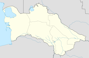
 Balkanabat
Coordinates: 39°31′00″N 54°22′00″E / 39.5166667°N 54.3666667°ECoordinates: 39°31′00″N 54°22′00″E / 39.5166667°N 54.3666667°E Country  Turkmenistan
Province Balkan Province Elevation 17 m (56 ft) Population (2006) – Total 87,822 Area code(s) (00993) 222 X XX XX Balkanabat (Балканабат), formerly Nebit Dag, is a city in western Turkmenistan, and the capital of Balkan Province. It is located at 39°31′0″N 54°22′0″E / 39.516667°N 54.366667°E, at an altitude of 17 meters, some 400 kilometers from Ashgabat. As of 2006, the city had an estimated population of 87,822. [1] Balkanabat lies at the foot of the Balkan Daglary mountain range. Balkanabat is about a four-hour taxi ride west of Ashgabat and a two-hour taxi ride east of the port city of Turkmenbashi.
Contents
Name and History
The former name, Nebit Dag, means "Oil & Mountain" in Turkmen language, and it is named for the reserves of oil and large mountains of the Balkan mountain range. The town was founded in 1933, as a settlement along one of the stations of Trans-Caspian Railway. There is a large monument on the far eastern side of the city called "monument to the desert explorers" which depicts a camel and several men struggling to walk through the windy desert. Nebit Dag was renamed to Balkanabad (Balkan=from name of Balkan mountains, abad=city) in 2001 by the decree of former President of Turkmenistan Saparmurad Niyazov. The city has now a "health path," which is a concrete path outside of the city built to give the citizens of the town a place to take a moderate hike along the mountainside. It was opened in 2004 to model a similar concrete path outside of Ashgabat. The city has 4 bazaars (markets) Gök, Jennet, Tolkuchka and bazaar on 5th microregion. Jennet bazaar is also called "12-etazhka" bazaar due to its location in the lot adjacent to a condemned apartment building. There is hotel "Nebitchi", Theatre, Museums, Restaurants and parks in Balkanabad. The north side of town contains the large "Saparmurat Turkmenbashy Park" which contains tennis courts, a life-size chess board and plenty of benches. The tennis courts are available to rent by the hour, but cannot support a serious game because the fence surrounding the courts was built directly on the base line. The Yomud tribe was historic to the Balkan region and the Yomud carpet pattern, or göl, is one of the five patterns represented on the Turkmen flag.
Industry, Economy and Transport
It is an industrial center for petroleum and natural gas production. The city is served by Balkanabat Airport. The city is connected to Ashgabat by Turkmenistan Airlines, as well as by train and bus. Buses route is from east to the west of Magtymguly shayoly (highway) and makes stops at bus station. While there is no official cab company, private citizens operate shared cabs. Almost any vehicle will pick up passengers and a ride costs under 1 manat. If the driver has already passengers in the car, then he will agree to take you if headed in the similar direction of their other available passengers. The city layout is a grid of apartment blocks, numbered by "kvartal." There are main highways called Magtymguly, Pervomayskiy and Gurbansoltan eje shayoly. There are range of banks, Turkmenpostal services in the centre by Magtymguly Shayoly, near 197 kvartal.
See also
- Balkanabat Stadium
- FC Balkan
- Railway stations in Turkmenistan
References
- ^ "Population of Balkanabat" (HTML). http://population-of.com/en/Turkmenistan/02/Balkanabat/. Retrieved 2007-11-15.
External links
Provinces of Turkmenistan Province (capital)  Cities of Turkmenistan
Capital Other cities Abadan • Akdepe • Baharly • Balkanabat • Baýramaly • Darganata • Daşoguz • Esenguly • Gyzyletrek • Kerki • Kunya Urgench • Mary • Serdar • Tagtabazar • Tejen • Turkmenabat • Turkmenbashi • ÝolötenCategories:- Populated places in Turkmenistan
- Cities and towns built in the Soviet Union
- Populated places established in 1933
- Balkan Province
- Turkmenistan geography stubs


Wikimedia Foundation. 2010.