- Maryland Route 24
-
Maryland Route 24

Route information Maintained by MDSHA Length: 25.17 mi[1] (40.51 km) Major junctions South end: Aberdeen Proving Ground near Edgewood  US 40 in Edgewood
 MD 7 in Edgewood
 I-95 near Edgewood
 US 1 near Bel Air
 MD 23 in Forest Hill
 MD 165 near Pylesville
 MD 136 near Pylesville
North end: SR 2055 near Fawn Grove, PA Location Counties: Harford Highway system Maryland highway system
Interstate • US • State • Minor • Former • Turnpikes← MD 23MD 25  →
→Maryland Route 24 (MD 24) is a state highway in the U.S. state of Maryland. The state highway runs 25.17 miles (40.51 km) from an entrance to Aberdeen Proving Ground in Edgewood north to the Pennsylvania state line near Fawn Grove, Pennsylvania. MD 24 is the main north–south highway of Harford County. The southern half of the state highway connects U.S. Route 1 (US 1) and the county seat of Bel Air with Aberdeen Proving Ground, US 40, and Interstate 95 (I-95) through a suburban corridor. The northern half of MD 24 is a rural highway that passes through Rocks State Park.
The original section of MD 24, which began at MD 23 in Forest Hill and included MD 165 through Pylesville, was constructed in the late 1910s and early 1920s. MD 24 was moved to the highway to Fawn Grove after that road was built in the late 1920s and early 1930s. The highway between US 1 in Bel Air and US 40 in Edgewood was also constructed in the late 1920s and early 1930s. The state highway from US 40 south to Aberdeen Proving Ground was constructed as MD 408 around 1930. After the road from Bel Air to Forest Hill was completed in the mid-1930s, MD 24 was extended south to Edgewood.
MD 24 received its first relocation in Edgewood in the mid 1950s after assuming all of MD 408. After another relocation due to the construction of I-95 in the early 1960s, the state highway was placed on a new alignment through Edgewood in the late 1960s and early 1970s; the old alignment became MD 755. MD 24 was relocated to a divided highway from I-95 to US 1 in the late 1980s; the old highway through Bel Air became MD 924. Much of the highway through Edgewood was expanded to a divided highway in the mid 1990s.
Contents
Route description
MD 24 carries five names throughout its length. The highway is named Emmorton Road between Aberdeen Proving Ground and US 40 and Vietnam Veterans Memorial Highway from US 40 to US 1. After its short concurrency with US 1 on the Bel Air Bypass, MD 24 is known as Rock Springs Avenue from US 1 to Forest Hill, where the highway becomes Rocks Road for the remainder of its length to the Pennsylvania state line.[1] The state highway is a part of the National Highway System between Aberdeen Proving Ground and the northern end of its concurrency with US 1 in Bel Air.[2]
Edgewood to Bel Air
MD 24 begins at an entrance to the Edgewood Area of Aberdeen Proving Ground; the highway continues south into the military installation as Hoadley Road. The state highway crosses over the Amtrak Northeast Corridor and MARC's Penn Line and heads north as Emmorton Road, a two-lane controlled access highway that passes between residential subdivisions in Edgewood, where the highway intersects Trimble Road. MD 24 expands to a four-lane divided highway just south of MD 755 (Edgewood Road). The state highway heads northeast, crossing in quick succession Otter Point Creek, US 40 (Pulaski Highway), and Winters Run. Access to and from US 40 is provided via a two-way ramp between the two highways. MD 24 continues north as the Vietnam Veterans Memorial Highway, which curves back to the north and crosses over CSX's Philadelphia Subdivision before intersecting MD 7 (Philadelphia Road) in the hamlet of Van Bibber. After an intersection with Edgewood Road, which is MD 24's old alignment, the state highway meets I-95 (John F. Kennedy Memorial Highway) at a partial cloverleaf interchange.[1][3]
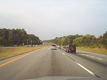 MD 24 northbound south of Bel Air
North of I-95, MD 24 has an intersection with MD 924 (Emmorton Road) and Tollgate Road that is currently being reconstructed as a diamond interchange. MD 924, which is the old alignment of MD 24, and Tollgate Road parallel MD 24 to the east and west, respectively. The two highways serve residential subdivisions bypassed by MD 24 between Edgewood and Bel Air; MD 924 serves the village of Emmorton. MD 24 also passes close to the historic home Woodside, accessed via Singer Road; Woodview, found at the west end of Plumtree Road; and Whitaker's Mill Historic District on Ring Factory Road. The state highway parallels Plumtree Run as it approaches Bel Air. MD 24 passes by Upper Chesapeake Medical Center before meeting US 1 Business (Belair Road) at an intersection surrounded by shopping centers, including the Harford Mall. The state highway crosses over the Ma and Pa Trail, a rail trail that follows the abandoned right-of-way of the Maryland and Pennsylvania Railroad, and Heavenly Waters, a tributary of Winters Run, before reaching its junction with US 1 (Bel Air Bypass). The three-way junction features long, sweeping ramps to and from the northbound direction of US 1 and an intersection with the U.S. highway to access the southbound direction.[1][3]
Bel Air to Fawn Grove
MD 24 and US 1 head northeast together as a four-lane undivided highway. The two highways pass under Vale Road before reaching the northern end of the concurrency, which is a partial cloverleaf interchange with Rock Springs Avenue. The avenue heads south toward downtown Bel Air as MD 924; MD 24 leaves US 1 and heads north on the avenue. The state highway heads north through a commercial area as a five-lane road with center turn lane. The highway reduces to two lanes and passes through another commercial area before its intersection with MD 23 (East–West Highway) in Forest Hill. At Jarrettsville Road, which is the old alignment of MD 23, MD 24's name changes to Rocks Road and enters a mix of farmland and forest. The state highway crosses Stirrup Run before beginning to closely parallel Deer Creek. MD 24 passes through several sharp curves as the highway enters Rocks State Park, where the state highway passes through the gorge that Deer Creek has cut through Rock Ridge.[4] The state highway crosses Deer Creek and passes the access road to the Gladden Farm before leaving the state park.[1][3]
MD 24 continues north through farmland, crossing several branches of Deer Creek and intersecting Holy Cross Road, which leads west to the Col. John Streett House and east to the village of Street. At Bush's Corner, the highway meets MD 165 (Federal Hill Road/Pylesville Road) at a roundabout. MD 24 passes close to Kilgore Falls, the second highest waterfall in Maryland; the falls on the Falling Branch of Deer Creek are accessed via St. Marys Road. Just to the north at Five Forks, the state highway intersects Clermont Mill Road and MD 136, which heads west as Harkins Road and east as Whiteford Road. MD 24 continues northwest to its terminus at the Pennsylvania state line.[1][3] Rocks Road continues north as SR 2055 to PA 851, the Main Street of Fawn Grove.[5]
History
MD 24 was originally constructed between 1917 and 1938. While the portion of the state highway north of Bel Air has seen limited improvements since the 1930s, the highway south of Bel Air has been fully relocated, in some places multiple times, and expanded to a divided highway for much of its length.
Original construction and early improvements
MD 24 was one of the original state-numbered highways designated in 1927. The state highway originally began at MD 23 in Forest Hill and followed its current course along Rocks Road north to Bush's Corner, then followed Pylesville Road (which later became MD 165) through Pylesville to the Pennsylvania state line at Cardiff.[6] The portion of Pylesville Road between Graceton Road (now MD 624) and the village of Pylesville was paved with macadam by 1910.[7] MD 24 from just north of Forest Hill to Graceton Road was built with a 15-foot (4.6 m) wide concrete surface in four sections, with construction underway by 1917 and completed by 1921.[8][9] The state highway just north of Forest Hill and the highway from Pylesville northeast to the state line were completed with a macadam surface by 1923.[10]
MD 24 from Bush's Corner toward Fawn Grove began construction in 1926.[11] The concrete highway was completed to St. Marys Road by 1927 and to Five Forks in 1928.[6][12] The third section, from Five Forks to about 1 mile (1.6 km) south of the state line, was started in 1929 and completed in 1930.[13][14] The final section to the state line at Fawn Grove was started in 1930 and completed by 1933.[13][15] Around the time the highway was completed, MD 24 was switched from Pylesville Road to Rocks Road north of Bush's Corner; MD 165 was extended from Bush's Corner to Cardiff in MD 24's stead.[15] MD 24 received a new bridge over Deer Creek within Rocks State Park in 1934.[16] Since the 1930s, the only notable improvement to the original length of MD 24 was the construction of the roundabout at the MD 24 – MD 165 intersection in 2000.[17]
Construction on what became MD 24 between Van Bibber and Bel Air got underway with the construction of a 1-mile (1.6 km) section of macadam road from Ring Factory Road south to Plumtree Road near Emmorton between 1925 and 1927.[6][11] Another macadam segment was completed from Emmorton south to Singer Road at Norris Corner in 1928.[12] A concrete highway from Norris Corner toward US 40 at Van Bibber was started in 1929.[13] The first section was completed to approximately the location of I-95 in 1930 and to Van Bibber by 1933.[14][15] Two county highway gaps in the state highway from Van Bibber to Bel Air were resurfaced with macadam and brought into the state system in 1933.[15][16]
The two remaining portions of the MD 24 corridor to be built were completed through Edgewood and north of Bel Air in the 1930s. In 1930, Edgewood Road was built as a concrete road from US 40 just west of Van Bibber south to its entrance to Aberdeen Proving Ground at its Pennsylvania Railroad crossing (now Amtrak).[14] Edgewood Road, which was originally designated MD 408, was constructed with a width of 16 feet (4.9 m) but was proposed for widening to 20 feet (6.1 m) as early as 1934 since it was the main entrance to the Edgewood Arsenal.[16] MD 408 received an underpass of the Baltimore & Ohio Railroad (now CSX) and approaches to the grade separation in 1939.[18]
Rock Spring Avenue north of Bel Air was improved as a macadam road starting in 1929.[13] The improved road extended from the county seat north to the location of the Bel Air Bypass in the community of Frogtown in 1930 and was extended to about 1 mile (1.6 km) south of Forest Hill by 1933.[15] The gap south of Forest Hill remained under county control until the highway was resurfaced with macadam around 1938.[19] MD 24 was extended south from Forest Hill through Bel Air to MD 7 at Van Bibber in 1938.[20] Through Bel Air, MD 24 followed Main Street, which was widened to 40 feet (12 m) in width around 1940.[18][20]
Relocations and expansions
The first post-war project on MD 24 was the reconstruction of the highway from Norris Corner to Van Bibber starting in 1950.[21] By the time the project to resurface the highway in bituminous concrete ended in 1952, MD 24 was extended south through Edgewood, replacing MD 408 from MD 7 to Aberdeen Proving Ground.[22][23] MD 24 was widened and resurfaced with bituminous concrete from Norris Corner to Bel Air starting in 1954 and from Bel Air to Forest Hill beginning in 1956.[24] The Norris Corner – Bel Air project included the highway's first relocation at Emmorton, leaving behind Old Emmorton Road.
Another relocation occurred in 1956 to remove MD 24's staggered intersections at MD 7 in Van Bibber. Edgewood Road was extended north to tie into Emmorton Road just south of the interchange with I-95; this project bypassed Van Bibber Road.[25] MD 24 was relocated again near Van Bibber when the highway's interchange with I-95 was constructed in 1963.[26][27] This relocation left behind the roadways now marked as Walton Road and Woodside Road in the southeast and northeast quadrants, respectively, of the original diamond interchange.[28]
The next relocation in the Edgewood area occurred in two sections starting in 1967.[29] MD 24 was moved to its present alignment from just south of the I-95 interchange to Edgewood Road south of US 40 in 1970.[30] The bypass included a bridge over US 40; access between the two highways was provided by Edgewood Road, which was designated MD 755. The new alignment of MD 24 was extended south to a new entrance to Aberdeen Proving Ground in 1974; MD 755 was extended south along MD 24's old alignment to the pre-existing entrance next to the Edgewood MARC station.[31] MD 24 from I-95 to MD 755 was expanded to a divided highway around 1997; this project included the construction of a two-way ramp between MD 24 and US 40 to add the direct access that had not been provided in 1970.[32]
MD 24's interchange with US 1 north of Bel Air was constructed in 1964 along with the rest of the Bel Air Bypass.[33][34] The interchange was originally a diamond interchange; a loop ramp was added from northbound US 1 to northbound MD 24 in 1983.[35][36] Construction of the Vietnam Veterans Memorial Highway from I-95 to US 1 in Bel Air began in 1986.[37] The four-lane divided highway was completed in 1987.[38] MD 24 was also expanded to a divided highway through the I-95 interchange, which was transformed into its modern partial cloverleaf.[38][39] The original alignment of MD 24 between I-95 and Bel Air was planned to become another section of MD 755 in 1986 but was designated MD 924 in 1987.[37][38]
In autumn 2008, the Maryland Transportation Authority began a project to build a diamond interchange at MD 24's junction with MD 924 and Tollgate Road just north of I-95. The interchange is expected to open in autumn 2011.[40] The Maryland State Highway Administration has long-term plans to expand the Bel Air Bypass to a divided highway from Winters Run to US 1 Business south of Hickory.[41] The Bel Air Bypass is already a four-lane divided highway between MD 147 and Winters Run and around Hickory, but is a three- to four-lane undivided highway from Winters Run to US 1 Business south of Hickory.[1] The Bel Air Bypass would be expanded to a four-lane divided highway from Winters Run to MD 24 and a six-lane divided highway along the US 1 – MD 24 concurrency. The US 1 – MD 24 intersection would be reconstructed as a trumpet interchange. The planning phase of the project was completed in 2001, but engineering, right-of-way acquisition, and actual construction are on hold until funding becomes available.[41]
Junction list
The entire route is in Harford County.
Location Mile
[1]Destinations Notes Edgewood 0.00 Entrance to Aberdeen Proving Ground Southern terminus 1.70  MD 755 (Edgewood Road) – Edgewood
2.36 To US 40 (Pulaski Highway) – Aberdeen, JoppatowneOfficially MD 24D; two-way ramp between US 40 and MD 24 2.86 MD 7 (Philadelphia Road) – Abingdon3.65 I-95 (John F. Kennedy Memorial Highway) – Baltimore, New YorkI-95 Exit 77 4.23  MD 924 north (Emmorton Road) / Tollgate Road north
Interchange under construction Bel Air 9.14  US 1 Bus. (Belair Road) – Perry Hall
10.01 US 1 south (Belair Bypass) – BaltimoreSouth end of concurrency with US 1 11.55 US 1 north (Belair Bypass) / MD 924 south (Rock Spring Avenue) – Bel Air, PhiladelphiaPartial cloverleaf interchange; north end of concurrency with US 1 Forest Hill 13.35 MD 23 (East–West Highway) – Jarrettsville, Hickory21.04 MD 165 (Pylesville Road/Federal Hill Road) – Jarrettsville, PylesvilleRoundabout 22.95 MD 136 (Harkins Road/Whiteford Road) – Norrisville, Whiteford25.17 SR 2055 north (Rocks Road) – Fawn Grove Northern terminus; Pennsylvania state line 1.000 mi = 1.609 km; 1.000 km = 0.621 mi Auxiliary routes
MD 24 has three existing auxiliary routes.
- MD 24D is the designation for the Otter Creek Ramp, a 0.23-mile (0.37 km) long four-lane divided ramp that connects MD 24 with US 40.[1][42] MD 24D was built in 1997.[32]
- MD 24E is the designation for the unnamed 0.85-mile (1.37 km) ramp from northbound MD 24 to northbound US 1.[1][43] This ramp was built in 1987 as part of the construction of the Vietnam Veterans Memorial Highway and designated MD 24E in 2001.[44][45]
- MD 24F is the designation for the unnamed 0.52-mile (0.84 km) ramp from northbound US 1 to southbound MD 24.[1][46] Like MD 23E, MD 24F was built in 1987 and received its designation in 2001.[44][45]
References
- ^ a b c d e f g h i j k "Highway Location Reference: Harford County" (PDF). Maryland State Highway Administration. 2009. http://www.marylandroads.com/Location/2009_HARFORD.pdf. Retrieved 2011-02-25.
- ^ Federal Highway Administration (August 2003) (PDF). National Highway System: Aberdeen-Havre de Grace-Bel Air MD (Map). http://www.fhwa.dot.gov/planning/nhs/maps/md/aberdeen_md.pdf. Retrieved 2011-02-26.
- ^ a b c d Google, Inc. Google Maps – Maryland Route 24 (Map). Cartography by Google, Inc. http://maps.google.com/maps?f=d&source=s_d&saddr=Hoadley+Rd&daddr=MD-24+N%2FRocks+Rd%2FSt+Clair+Bridge+Rd&hl=en&geocode=FQdeWQId8Lhz-w%3BFZYYXgId4JRx-w&mra=ls&sll=39.722801,-76.439481&sspn=0.01492,0.038581&ie=UTF8&t=h&z=10. Retrieved 2011-02-25.
- ^ "Rocks State Park". Maryland Department of Natural Resources. http://www.dnr.state.md.us/publiclands/central/rocks.asp. Retrieved 2011-02-26.
- ^ Pennsylvania Department of Transportation (PDF). General Highway Map: York County, Pennsylvania (Map) (2009 ed.). ftp://ftp.dot.state.pa.us/public/pdf/BPR_pdf_files/Maps/GHS/Roadnames/york_GHSN.pdf. Retrieved 2011-02-26.
- ^ a b c Maryland Geological Survey. Map of Maryland: Showing State Road System and State Aid Roads (Map) (1927 ed.).
- ^ Maryland Geological Survey. Map of Maryland (Map) (1910 ed.).
- ^ Report of the State Roads Commission of Maryland. 1916-1919. Baltimore: Maryland State Roads Commission. January 1920. p. 39. http://www.archive.org/details/annualreportsofs1916mary. Retrieved 2011-02-25.
- ^ Maryland Geological Survey. Map of Maryland: Showing State Road System and State Aid Roads (Map) (1921 ed.).
- ^ Maryland Geological Survey. Map of Maryland: Showing State Road System and State Aid Roads (Map) (1923 ed.).
- ^ a b Report of the State Roads Commission of Maryland. 1924-1926. Baltimore: Maryland State Roads Commission. January 1927. pp. 44–45, 84. http://www.archive.org/details/annualreportsofs1924mary. Retrieved 2011-02-25.
- ^ a b Maryland Geological Survey. Map of Maryland: Showing State Road System and State Aid Roads (Map) (1928 ed.).
- ^ a b c d Report of the State Roads Commission of Maryland. 1927-1930. Baltimore: Maryland State Roads Commission. 1930-10-01. p. 214. http://www.archive.org/details/reportofstateroa1927mary. Retrieved 2011-02-25.
- ^ a b c Maryland Geological Survey. Map of Maryland Showing State Road System: State Aid Roads and Improved County Road Connections (Map) (1930 ed.).
- ^ a b c d e Maryland Geological Survey. Map of Maryland Showing State Road System: State Aid Roads and Improved County Road Connections (Map) (1933 ed.).
- ^ a b c Report of the State Roads Commission of Maryland. 1931-1934. Baltimore: Maryland State Roads Commission. 1934-12-28. pp. 22, 39, 338. http://www.archive.org/details/reportofstateroa1931mary. Retrieved 2011-02-25.
- ^ "Highway Location Reference: Harford County" (PDF). Maryland State Highway Administration. 2000. http://www.marylandroads.com/Location/2000_HARFORD.pdf. Retrieved 2011-02-26.
- ^ a b Report of the State Roads Commission of Maryland. 1939-1940. Baltimore: Maryland State Roads Commission. 1941-03-15. p. 104. http://www.archive.org/details/reportofstateroa1939mary. Retrieved 2011-02-25.
- ^ Report of the State Roads Commission of Maryland. 1937-1938. Baltimore: Maryland State Roads Commission. 1939-03-04. pp. 117–118. http://www.archive.org/details/reportofstateroa1937mary. Retrieved 2011-02-25.
- ^ a b Maryland State Roads Commission. Map of Maryland Showing State Road System (Map) (1938 ed.).
- ^ Report of the State Roads Commission of Maryland. 1949-1950. Baltimore: Maryland State Roads Commission. 1950-12-20. p. 140. http://www.archive.org/details/reportofstateroa1949mary. Retrieved 2011-02-26.
- ^ Report of the State Roads Commission of Maryland. 1951-1952. Baltimore: Maryland State Roads Commission. 1952-12-15. p. 160. http://www.archive.org/details/reportofstateroa1951mary. Retrieved 2011-02-26.
- ^ Maryland State Roads Commission. Maryland: Official Highway Map (Map) (1952 ed.).
- ^ Report of the State Roads Commission of Maryland. 1955-1956. Baltimore: Maryland State Roads Commission. 1956-11-02. pp. 163, 165. http://www.archive.org/details/reportofstateroa1955mary. Retrieved 2011-02-26.
- ^ Maryland State Roads Commission. Maryland: Official Highway Map (Map) (1956 ed.).
- ^ "NBI Structure Number: 300000H-X765012". National Bridge Inventory. http://nationalbridges.com/nbi_record.php?StateCode=24&struct=300000H-X765012. Retrieved 2011-02-26.
- ^ Maryland State Roads Commission. Maryland: Official Highway Map (Map) (1964 ed.).
- ^ Maryland State Highway Administration. Maryland: Official Highway Map (Map) (1972 ed.).
- ^ "NBI Structure Number: 100000120062012". National Bridge Inventory. http://nationalbridges.com/nbi_record.php?StateCode=24&struct=100000120062012. Retrieved 2011-02-26.
- ^ Maryland State Roads Commission. Maryland: Official Highway Map (Map) (1970 ed.).
- ^ Maryland State Highway Administration. Maryland: Official Highway Map (Map) (1974 ed.).
- ^ a b Maryland State Highway Administration. Maryland: Official Highway Map (Map) (1997 ed.).
- ^ "NBI Structure Number: 100000120015010". National Bridge Inventory. http://nationalbridges.com/nbi_record.php?StateCode=24&struct=100000120015010. Retrieved 2011-02-26.
- ^ Maryland State Roads Commission. Maryland: Official Highway Map (Map) (1965 ed.).
- ^ Maryland State Highway Administration. Maryland: Official Highway Map (Map) (1978 ed.).
- ^ Maryland State Highway Administration. Maryland: Official Highway Map (Map) (1983-84 ed.).
- ^ a b "Traffic Volume Map" (PDF). Maryland State Highway Administration. 1986. http://www.marylandroads.com/Traffic_Volume_Maps/86_Traffic_Volume_Maps.pdf. Retrieved 2011-02-27.
- ^ a b c "Traffic Volume Map" (PDF). Maryland State Highway Administration. 1987. http://www.marylandroads.com/Traffic_Volume_Maps/87_Traffic_Volume_Maps.pdf. Retrieved 2011-02-27.
- ^ "NBI Structure Number: 300000H-X765011". National Bridge Inventory. http://nationalbridges.com/nbi_record.php?StateCode=24&struct=300000H-X765011. Retrieved 2011-02-26.
- ^ "I-95/MD 24 Interchange Improvement Project". Maryland Transportation Authority. http://www.mdta.maryland.gov/I95MD24/195MD24Home.cfm. Retrieved 2011-02-26.
- ^ a b "Project Information: US 0001 BELAIR ROAD MD 152 TO MD 147". Maryland State Highway Administration. http://apps.roads.maryland.gov/WebProjectLifeCycle/ProjectInformation.asp?projectno=HA8882112. Retrieved 2011-02-26.
- ^ Google, Inc. Google Maps – Maryland Route 24D (Map). Cartography by Google, Inc. http://maps.google.com/maps?f=d&source=s_d&saddr=Unknown+road&daddr=Unknown+road&hl=en&geocode=FSTLWQIdsMxz-w%3BFTrTWQIdjsFz-w&mra=ls&sll=39.438149,-76.294899&sspn=0.014981,0.038581&ie=UTF8&ll=39.440386,-76.296079&spn=0.00749,0.01929&t=h&z=16. Retrieved 2011-02-25.
- ^ Google, Inc. Google Maps – Maryland Route 24E (Map). Cartography by Google, Inc. http://maps.google.com/maps?f=d&source=s_d&saddr=Unknown+road&daddr=Unknown+road&hl=en&geocode=FfU3WwIdEspy-w%3BFbFfWwIdJbNy-w&mra=ls&sll=39.541638,-76.366299&sspn=0.00374,0.009645&ie=UTF8&t=h&z=15. Retrieved 2011-02-25.
- ^ a b Maryland State Highway Administration. Maryland: Official Highway Map (Map) (1987 ed.).
- ^ a b "Highway Location Reference: Harford County" (PDF). Maryland State Highway Administration. 2001. http://www.marylandroads.com/Location/2001_HARFORD.pdf. Retrieved 2011-02-25.
- ^ Google, Inc. Google Maps – Maryland Route 24F (Map). Cartography by Google, Inc. http://maps.google.com/maps?f=d&source=s_d&saddr=Unknown+road&daddr=Unknown+road&hl=en&geocode=FegjWwIdpbZy-w%3BFW00WwIdgsxy-w&mra=ls&sll=39.538006,-76.365066&sspn=0.01496,0.038581&ie=UTF8&ll=39.528606,-76.359959&spn=0.014962,0.038581&t=h&z=15. Retrieved 2011-02-25.
External links
Roads in Harford County, Maryland State highways 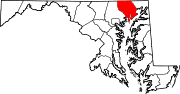
U.S. Highways Interstate Highways Categories:- State highways in Maryland
- Roads in Harford County, Maryland


Wikimedia Foundation. 2010.