- Cinco Ribeiras
-
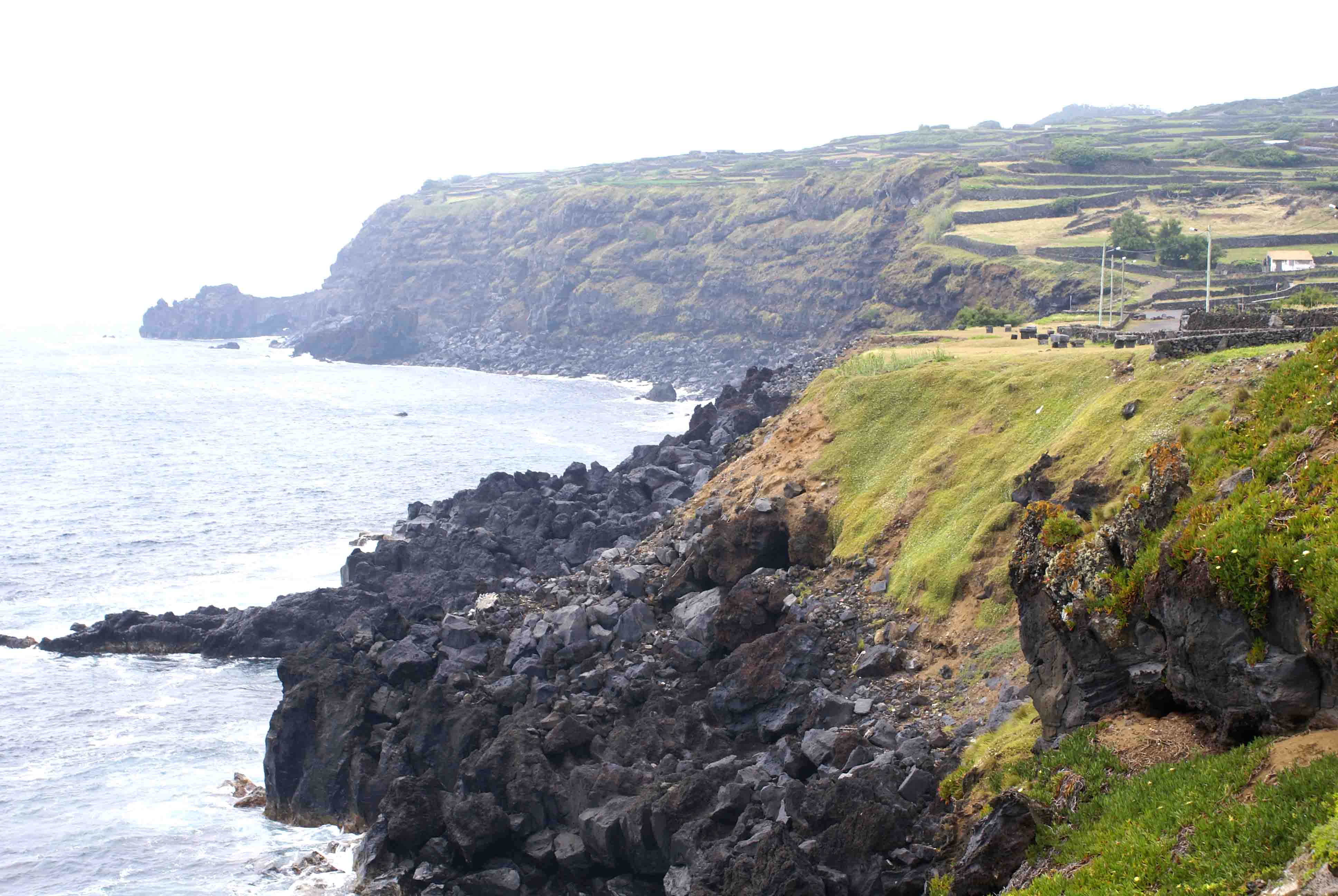
Cinco Ribeiras Nossa Senhora do Pilar Civil Parish (Freguesia)  The coastline along the southern frontier of Cinco Ribeiras near the Grote of the same name
Official name: Freguesia das Cinco Ribeiras Name origin: cinco ribeiras Portuguese compound word for five ravines Country  Portugal
Autonomous Region  Azores
Group Central Island Terceira Municipality Angra do Heroísmo Center Nossa Senhor do Pilar - elevation 121 m (397 ft) - coordinates 38°41′0″N 27°19′1″W / 38.683333°N 27.31694°W Highest point Santa Bárbara - location Serra da Santa Bárbara, Cinco Ribeiras, Angra do Heroísmo - elevation 987.04 m (3,238 ft) - coordinates 38°43′50″N 27°18′50″W / 38.73056°N 27.31389°W Lowest point Sea Level - location Atlantic Ocean Length 7.3 km (5 mi), North-South Width 2.31 km (1 mi), West-East Area 10.8 km2 (4 sq mi) - land 10.66 km2 (4 sq mi) - urban .14 km2 (0 sq mi) Population 684 (2001) Density 63.3 / km2 (164 / sq mi) Settlement fl. 1800 - Parish c. 1867 - Civil Parish c. 1879 LAU Freguesia/Junta Freguesia - location Estrada Monsenhor José Machado Lourenço, Cinco Ribeiras, Angra do Heroísmo President Junta José Cipriano Sousa Martins President Assembleia Regina de Fátima Rocha Dias Cardoso Timezone Azores (UTC-1) - summer (DST) Azores (UTC0) ISO 3166-2 code PT- Postal Zone 9700-321 Cinco Ribeiras Area Code & Prefix (+351) 292 XXX-XXXX Demonym Terceirense Patron Saint Nossa Senhora do Pilar Parish Address Estrada Monsenhor José Machado Lourenço, 34
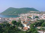
9700-321 Cinco RibeirasWikimedia Commons: Cinco Ribeiras (Angra do Heroísmo) Website: http://www.jf5ribeiras.com/ Statistics from INE (2001); geographic detail from Instituto Geográfico Português (2010) Cinco Ribeiras is a parish in the municipality of Angra do Heroísmo on the island of Terceira in the Azores. The population in 2001 was 684, its population density was 63.3/km², and the land area is 10.8 km².
Parishes Altares · Cinco Ribeiras · Doze Ribeiras · Feteira · Nossa Senhora da Conceição · Porto Judeu · Posto Santo · Raminho · Ribeirinha · Santa Bárbara · Santa Luzia · São Bartolomeu de Regatos · São Bento · São Mateus da Calheta · São Pedro · Sé · Serreta · Terra Chã · Vila de São Sebastião
Natural
LandmarksAlgar do Carvão · Baía de Angra do Heroísmo · Baía das Pontas · Baía da Salga · Baía do Refugo · Furna de Água · Galerias da Feteira · Gruta Brisa Azul · Gruta das Mercês · Gruta do Zé Grande · Gruta das Cinco Ribeiras · Gruta das Agulhas · Gruta dos Ratões · Ilhéus das Cabras · Lagoa do Negro · Monte Brasil · Parque de Campismo das Cinco Ribeiras · Porto das Cinco Ribeiras · Ponta do Queimado · Prainha · Serra do Morião ou da Nasce Água · Serra da Ribeirinha · Serra de Santa Bárbara · Zona Balnear do Negrito · Zona de Protecção Especial do Ilhéu das Cabras
Man-made
LandmarksCentro Histórico de Angra do Heroísmo · Cais da Alfândega · Cais da Silveira · Cemitério das Âncoras · Convento de São Gonçalo · Fortaleza de São João Baptista · Forte de São Sebastião · Forte do Negrito · Forte Grande de São Mateus da Calheta · Forte do Terreiro · Forte da Maré · Forte da Má Ferramenta · Forte de São João ou do Biscoitinho · Forte das Cinco Ribeiras · Forte de Santa Catarina das Mós · Forte do Açougue · Forte de Santo António · Forte de São Benedito · Forte de São Francisco · Castelo dos Moinhos · Reduto dos Dois Paus · Reduto dos Três Paus · Forte de Santo António · Reducto da Salga · Forte da Salga · Forte da Igreja · Forte de São Fernando · Forte de São Sebastião · Forte das Caninas · Forte das Cavalas · Forte da Greta · Forte do Zimbreiro · Igreja Velha de São Mateus da Calheta · Jardim Duque da Terceira · Miradouro da Amoreira · Miradouro do Pico das Cruzinhas · Miradouro da Ponta do Queimado · Miradouro do Pico Matias Simão · Miradouro da Serreta · Miradouro das Veredas · Mata da Serreta · Palácio Bettencourt · Parque Municipal do Relvão (Angra do Heroísmo) · Parque Arqueológico Subaquático da Baía de Angra do Heroísmo · Parque de Campismo das Cinco Ribeiras · Porto das Cinco Ribeiras · Solar da Madre de Deus · Câmara Municipal de Angra do Heroísmo
Categories:- Azores geography stubs
- Parishes of Angra do Heroísmo

Wikimedia Foundation. 2010.