- Dykh-Tau
-
Gora Dykh-Tau 
Elevation 5,205 m (17,077 ft) Prominence 2,002 m (6,568 ft) Listing Seven Second Summits
UltraLocation Location of Dykh-Tau in the Caucasus mountains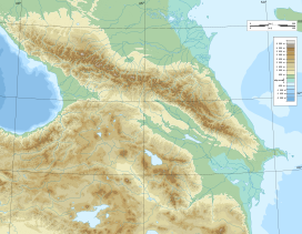
 Gora Dykh-Tau
Location Kabardino-Balkaria, Russia Range Caucasus Mountains Coordinates 43°3′N 43°8′E / 43.05°N 43.133°ECoordinates: 43°3′N 43°8′E / 43.05°N 43.133°E Topo map Map and Guide to the Caucasus: Bezingi, Bashil, Adaikhokh [1] Dykh-Tau or Dykhtau (Russian: Дыхтау, Karachay-Balkar: Дых тау which means Jagged Mount), is a mountain located in Kabardino-Balkaria, Russia; its peak stands about 5 km (3 mi) north of the border with Georgia. The mountain is the second highest of the Caucasus Mountains, after Mount Elbrus.
Contents
Access
Dykh-Tau is best accessed from the north (Russia). Bezingi village may be reached from Nalchik in Kabardino-Balkaria with infrequent public transport, here a 4WD vehicle must be hired. Thus Bezingi Alpine Camp is reached at 2180m. From here it takes a further 2 days to reach the base of the climb. [2]
Climbing routes
This is one of the great Caucasian Peaks, facing the magnificent Bezingi Wall across the Bezingi Glacier. The first ascent in 1888 by Mummery and Zarfluh was a major achievement at the time. Their route up the SW Ridge is no longer used as the normal route which is now the North Ridge graded 4b (Russian Grading).
Starting from Misses Kosh the ridge is gained by first crossing the West Ridge of Misses-Tau then continuing to the Russian Bivouac located by a hanging glacier descending from the North Ridge of Dykhtau, 4 hours from Misses-Kosh. Once a notch between Misses-Tau and Dykhtau is gained, the North Ridge is followed to the summit. Allow 2 days from the Russian Bivouac, there are several good bivouac sites on the North Ridge. Details and map
Mapping
Various maps of Soviet military origin may be found on the internet. These are in Cyrillic. Two maps cover the area.[1]
References
- ^ a b EWP/WCP (1994). Map and Guide to the Caucasus: Bezingi, Bashil, Adaikhokh (Map). 1:100,000 with mountaineering information. Cartography by EWP (1st ed.). ISBN 0-906227-53-4. http://www.ewpnet.com/bzngimap.htm.
- ^ Robin Collomb and Andrew Wielochowski (1993). Caucasus from Elbrus to Kazbek (Map). 1:200,000 with general information. Map Guides. Cartography by EWP (1st ed.). ISBN 906227-54-2. http://www.ewpnet.com/CAUCCMAP.HTM.
External links
- "Gora Dykh-Tau, Russia". Peakbagger.com. http://www.peakbagger.com/peak.aspx?pid=10403.
- summitpost.org: Dykhtau
Seven Second Summits Asia K2 (8,611 m/28,251 ft)
South America Ojos del Salado (6,893 m/22,615 ft)
North America Mount Logan (5,959 m/19,551 ft)
Africa Mount Kenya (5,199 m/17,057 ft)
Europe Dykh-Tau (5,205 m/17,077 ft) • or Monte Rosa (4,634 m/15,203 ft)Antarctica Mount Tyree (4,852 m/15,919 ft)
Australia (Oceania) Puncak Trikora (4,730 m/15,518 ft) • or Mount Townsend (2,209 m/7,247 ft)
Ultra prominent peaks of Europe Scandinavia Galdhøpiggen • Kebnekaise • Jiehkkevárri • Snøhetta • Store Lenangstind • Sarektjåhkkå — On islands: Beerenberg • Hvannadalshnúkur • Newtontoppen • Novaya Zemlya HPWestern Europe Atlantic islands Alps Mont Blanc • Grossglockner • Finsteraarhorn • Wildspitze • Bernina • Hochkönig • Monte Rosa • Hoher Dachstein • Marmolada • Viso • Triglav • Barre des Écrins • Säntis • Ortler • Baldo • Gran Paradiso • Coca • Cima Dodici • Dents du Midi • Chamechaude • Zugspitze • Antelao • Arcalod • Grintovec • Großer Priel • Grigna Settentrionale • Bondone • Presanella • Birnhorn • Col Nudo • Pointe Percée • Montasch • Polinik • Tödi • Birkkarspitze • Wilder Kaiser • Grande Tête de l'Obiou • Cima Tosa • Hochtor • Grimming • Grand Combin • Tournette • Zirbitzkogel • KeschItaly Eastern Europe Carpathians: Gerlachovský štít • Parângu Mare • Moldoveanu • Peleaga — Crimea: Roman-Kosh — Urals: NarodnayaBalkans Mediterranean islands Caucasus Elbrus • Bazardüzü • Kazbek • Tebulosmta • Aragats • Dykh-Tau • Dyultydag • Kapudzhukh • Gora Addala Shukgelmezr • Shani • ShahdaghCategories:- Mountains of Russia
- Kabardino-Balkaria
- Seven Second Summits
- Northern Caucasus geography stubs


Wikimedia Foundation. 2010.