Manordeifi

Manordeifi
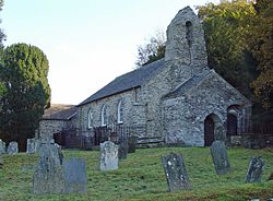
The old parish church of St. David at Manordeifi

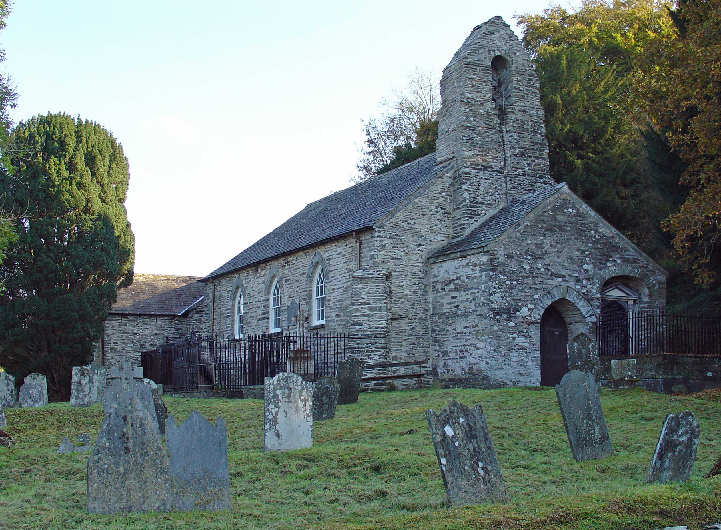
Manordeifi (Welsh: Maenordeifi) is a parish and community in the hundred of Kilgerran, in the northeast corner of Pembrokeshire, Wales. The population of the community (2001) was 478. Together with the community of Cilgerran, it makes up Cilgerran electoral ward.

In addition to scattered settlement, the parish contains the villages of Abercych and Newchapel (Welsh: Capelnewydd). There was an unusually large number of substantial mansions in the parish, perhaps because of the picturesque scenery and good angling in the area. These included Clynfyw, Ffynone (or Ffynnonau) and Pentre.

The old parish church, situated in the edge of the River Teifi floodplain52°03′30″N 4°35′08″W / 52.05846°N 4.58557°W / 52.05846; -4.58557, was abandoned in favour of a new church built on the hill top in the nineteenth century. The old church (mainly 13th-14th century) preserves many old features[1]. A coracle hangs in the porch, providing a means of escape during floods.

The population of the parish was: 745 (1801): 956 (1851): 631 (1901): 602 (1951): 402 (1981). The percentage of Welsh speakers was: 87 (1891): 94 (1931): 74 (1971).

External links

Coordinates: 52°03′N 4°35′W / 52.05°N 4.583°W / 52.05; -4.583


Wikimedia Foundation. 2010.

Игры ⚽ Поможем сделать НИР

Look at other dictionaries:

  • Manordeifi Old Church — from the northwest …   Wikipedia

  • Manordeifi Old Church — 52.0584 4.5855 Koordinaten: 52° 3′ 30″ N, 4° 35′ 8″ W …   Deutsch Wikipedia

  • Friends of Friendless Churches — St Andrew’s Church, Woodwalton …   Deutsch Wikipedia

  • Pembrokeshire — Pembrokeshire …   Wikipedia

  • Cilgerran — Coordinates: 52°03′12″N 4°38′02″W / 52.05322°N 4.63396°W / 52.05322; 4.63396 …   Wikipedia

  • Coracle — Coracles on the River Teifi, West Wales 1972. The two people pictured are John (forefront) and Will Davies of Cenarth the last two legitimate Coracle fishermen in Cenarth. They are both using the single arm method of propulsion a way of gliding… …   Wikipedia

  • Middleholm — Middleholm, also known as Midland Island, is a small island lying off southwest Pembrokeshire in Wales, southeast of Skomer. The island is known for its seabirds, including Manx Shearwaters and Atlantic Puffins, and for its plants, including Red… …   Wikipedia

  • Milford Haven — This article is about the town. For the waterway, see Milford Haven Waterway. Coordinates: 51°42′51″N 5°02′34″W / 51.71418°N 5.04274°W / …   Wikipedia

  • Newport, Pembrokeshire — Newport and the Nyfer estuary from Carn Ingli Coordinates …   Wikipedia

  • Tenby — Coordinates: 51°40′28″N 4°42′16″W / 51.6745°N 4.7044°W / 51.6745; 4.7044 …   Wikipedia

Share the article and excerpts

Direct link
Do a right-click on the link above
and select “Copy Link”