- Anniston, Alabama
Infobox Settlement
official_name = Anniston, Alabama
settlement_type =City
nickname = The Model City
motto =
imagesize =
image_caption =
image_
imagesize =
image_caption =
image_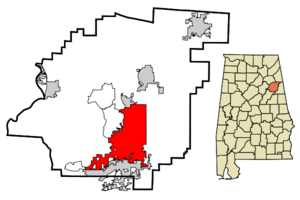
mapsize = 250px
map_caption = Location inAlabama
mapsize1 =
map_caption1 =
subdivision_type = Country
subdivision_name =United States
subdivision_type1 = State
subdivision_name1 =Alabama
subdivision_type2 = County
subdivision_name2 = Calhoun
government_type =
leader_title =Mayor
leader_name = Hoyt W. “Chip” Howell, Jr.
established_title = Settled
established_title2 = Incorporated
established_date = April 1872
established_date2 = 3 July 1883
area_magnitude =
area_total_km2 = 116.5
area_total_sq_mi = 45
area_land_km2 = 117.7
area_land_sq_mi = 45.4
area_water_km2 = 0.1
area_water_sq_mi = 0
area_water_percent =
area_urban_km2 =
area_urban_sq_mi =
area_metro_km2 =
area_metro_sq_mi =
elevation_m = 219 219
elevation_ft = 719 719
latd = 33 |latm = 39 |lats = 46 |latNS = N
longd = 85 |longm = 49 |longs = 35 |longEW = W
population_as_of =2007
population_total =23689
population_note =
population_footnotes = cite web | date = June 21, 2006 | url = http://www.census.gov/popest/cities/files/SUB-EST2005-04-01.csv | title = Annual Estimates of the Population for All Incorporated Places in Alabama | format = CSV | work = 2005 Population Estimates | publisher = U.S. Census Bureau, Population Division | accessmonthday = November 9 | accessyear = 2006] cite web|url=http://www.census.gov/popest/cities/tables/SUB-EST2007-04-01.csv|title=Annual Estimates of the Population for Incorporated Places in Alabama|publisher=United States Census Bureau |date=2008-07-10|accessdate=2008-07-14]
timezone = Central (CST)
utc_offset = -6
timezone_DST = CDT
utc_offset_DST = -5
postal_code_type =ZIP code
postal_code = 36201-36207
area_code = 256
blank_name = FIPS code
blank_info = 01-01852
blank1_name = GNIS feature ID
blank1_info = 0159066
footnotes =
website =
population_total = 23689
population_metro = 112240
population_urban =
population_density_km2 = 203.8
population_density_sq_mi = 534.4
timezone = Central
utc_offset = -6
timezone_DST = Central
utc_offset_DST = -5
latd = 33 |latm = 39 |lats = 47 |latNS = N
longd = 85 |longm = 49 |longs = 36 |longEW = W
elevation_m = 219
elevation_ft = 719
website = [http://www.ci.anniston.al.us www.ci.anniston.al.us]
footnotes =Anniston is a city in Calhoun County in the state of
Alabama ,United States . As of the 2000 census, the population of the city is 24,276. According to the 2005U.S. Census estimates, the city had a population of 23,741.cite web | date = June 21, 2006 | url = http://www.census.gov/popest/cities/files/SUB-EST2005-04-01.csv | title = Annual Estimates of the Population for All Incorporated Places in Alabama|format = CSV | work = 2005 Population Estimates | publisher = U.S. Census Bureau, Population Division | accessmonthday = November 9 | accessyear = 2006
timezone = Central (CST)
utc_offset = -6
timezone_DST = CDT
utc_offset_DST = -5
postal_code_type =ZIP code
postal_code = 36201-36207
area_code = 256
blank_name = FIPS code
blank_info = 01-01852
blank1_name = GNIS feature ID
blank1_info = 0159066
footnotes =
website = ] The city is thecounty seat of Calhoun County and one of two urban centers/principal cities of and included in the Anniston-Oxford Metropolitan Statistical Area.Named the The Model City by
Atlanta newspapermanHenry W. Grady for its careful planning in the late 1800s, the city is situated on the slope of Blue Mountain, and it has always been a small town.History
Though the surrounding area was settled long before, it wasn't until the civil war that anyone exploited the mineral resources under Anniston's dirt. During that time, the Confederate States of America established and operated an [http://www.spiritofanniston.org/historic_photos.html iron furnace] near present day downtown Anniston, until the furnace was destroyed by victorious Union troops in 1865. Later, clay pipe for sewer systems became the focus of Anniston's industrial output. Clay pipe, also called soil pipe, was popular until the advent of cheaper and better plastic pipe in the 1960s.
As Anniston took baby steps to becoming a small town, the largest city in the state became a boom town for the steel industry 60 miles southwestward in Birmingham. In 1872, Anniston's
Woodstock Iron Company organized bySamuel Noble and Union Gen.Daniel Tyler (1799-1882), rebuilt a furnace on a much larger scale, as well as a planned community.Iron andsteel manufacturing boomed during the post-Civil War period in the central part of Alabama. Birmingham 60 miles (100 km) became a major new US city overnight. Anniston maintained its company town demeanor where a few families governed the hierarchy of Southern gentilism. Though it was not opened for general settlement until twelve years later, Anniston was chartered as a "company town" in 1879. The community name reportedly derives from Annie's Town, named for Annie Scott Tyler, wife of railroad presidentAlfred L. Tyler .Though the roots of the town's economy were in
Iron andsteel and clay pipe, planners ironically pushed it as a health resort, attracting a handful of hotels to set up shop. Schools appeared. The Noble Institute, a school for girls, [Located [http://maps.google.com/maps?f=q&hl=en&geocode=18321017201244668582,33.657879,-85.824970&q=33.657835,+-85.825807&ie=UTF8&ll=33.657884,-85.825807&spn=0.002192,0.003433&t=h&z=18 along Leighton Ave] , on the corner of Leighton Ave and E 11th St., facing Christine Ave.] established in 1886, and the Alabama Presbyterian College for Men founded in 1905. Planning and easy access to rail transportation helped make Anniston the fifth largest city in the state from 1890's to 1950's.In 1917, the
United States Army established a training camp atFort McClellan during the start ofWorld War I . On the other side of town, theAnniston Army Depot opened in theWorld War II years as a major storage and maintenance site, a role it continues to serve as incineration progresses. Most of the old site of Fort McClellan was incorporated into Anniston in the late 1990s. As the northernmost edge of town, McClellan is hoped to become the star of Anniston's future.Anniston has been a center of national controversy in the past. During the
American civil rights movement , a group known as theFreedom Riders was riding an integrated bus in protest of southern segregation laws. One of the buses was fire-bombed outside of Anniston onMother's Day Sunday May 14, 1961. As the bus burned, the mob held the doors shut, intent on burning the riders to death. An exploding fuel tank caused the mob to retreat, allowing the riders to escape the bus. The Riders were viciously beaten as they fled the burning bus, and only warning shots fired into the air by highway patrolmen prevented the riders from being lynched on the spot. [cite web|url=http://www.npr.org/templates/story/story.php?storyId=5149667|title=Get On the Bus: The Freedom Riders of 1961|publisher=NPR |accessdate=2008-07-30] The site is now home to a marker along Alabama Highway 202 west about five miles west of downtown. [ [http://www.jsu.edu/news/jan_june2007/05142007c.html JSU News Wire ] ]The Army closed the fort in 1999, as part of the
Base Realignment and Closure round of 1995. Some of the old Fort McClellan property is now being redeveloped for civilian use. The Anniston Eastern Bypass will officially stop construction in 2009, so McClellan may never have the highly anticipated easy access to I-20 that Oxford has. Unfortunately, the project is stalled with no foreseeable restart date. All of the federal and state money for the bypass was used up purchasing right-of-way and grading about half the roadbed. It now sits silent with the exception of the occasional bulldozer pushing debris around or combatting the effects of drougth and erosion. With gas tax revenues sinking as American's use less fuel, experts do not anticipate any rejuvenation in federal support for highway projects.According to The Wall Street Journal in July 2008, federal gas tax revenues are the primary support for highway projects.
"But, coupled with a rapid shift away from gas-guzzling vehicles, it also means consumers are paying less in federal fuel taxes, which go largely to help finance highway and mass-transit systems. As a result, many such projects may have to be pared down or eliminated," the newspaper reports.
Chemical Contamination
As the environmental controversy settled into smolder during the early days of the 21st century, Anniston residents began class action suits against [http://www.chemicalindustryarchives.org/dirtysecrets/annistonindepth/intro.asp Monsanto] .
Monsanto had knowingly dumpedPCBs into the local water supply and all over Anniston's land. The [http://www.connectotel.com/gmfood/cb101102.html aftermath] included poisoning surrounding groundwater, wildlife, air and residents. Many residents have yet to see one dime in recompense as attorneys for Monsanto's offshoot, Solutia, continue to delay disbursements of damages.The most significant news about Anniston and the talk of the town is a CBS 60 Minutes investigation [http://www.cbsnews.com/stories/2002/11/07/60minutes/main528581.shtml?source=search_story] that revealed Anniston to be among the most toxic cities in the country. The source of local contamination was a Monsanto chemical factory, which closed years ago, but left a legacy of cancer-causing PCBs in the local dirt, air and water. The current lead-in on CBS' website states:
"Imagine a place so saturated with toxic, cancer-causing chemicals that it's in the dirt people walk on, the air they breathe - even the blood that pumps through their veins.
The 24,000 people living in Anniston, Ala., don't have to imagine this. Many of them are living it. In fact, they have been living it for decades - they just didn't know it. The company responsible didn't tell them, and neither did the Environmental Protection Agency."
Monsanto Corporation isn't the only source of chemicals in the area, though it is the only source of proven contamination. After the closure of the US Army's Military Police Headquarters and Chemical School Headquarters at Fort McClellan (which borders Anniston), the U.S. government built an incinerator in Anniston to burn large stockpiles of chemical munitions including nerve gas and mustard gas. These chemical weapons were stored for decades in a secured manner by the US Army for potential use in warfare. Anniston is one of nine areas in the US that housed such stockpiles. A portion of the remaining Fort McClellan, which is used for Alabama National Guard training and the US Homeland Security anti-terrorism department, houses the nation's only "live agent" training center. That means military and emergency responder personnel from all over the world come to Fort McClellan to use actual nerve gas, blister agents and other chemical and biological weapons in a real-time, monitored setting. Destruction of most of the stored munitions around Anniston has gone without a hitch, and is expected to be completed during the next decade.
The documented contamination left by the Monsanto factory will last lifetimes. Even this year, the Monsanto debacle continues to make headlines all over the nation. The West Palm Beach TV station, WPTV, in July 2008 reported how Anniston is used by medical researchers studying a potential link between PCBs and diabetes. [http://www.wptv.com/content/health/mb/story.aspx?content_id=c25e345a-53a1-43a1-8ccb-df592266c50e]
An excerpt from the TV report:
"Researchers came to Anniston to conduct studies to document the effects of PCB contamination. 'It was just dumped into the ground, so every time there is a flood, the stuff is spread throughout the community and then the pigs and cows, vegetables, everything becomes a source,' Allen Silverstone, Ph.D., an immunologist at SUNY Upstate Medical University in Syracuse, N.Y., told Ivanhoe. 'Diabetes is one thing that can happen and that probably happens because these chemicals can affect glucose metabolism,' he said. The study found that residents of Anniston who live near the old plant had levels of PCBs that were four times greater than other people throughout the United States and had "two to four times greater the risk of developing diabetes"."
Needless to say, banks and medical offices are popping up like weeds along Anniston's beautiful main corridor, Quintard Avenue, and the parallel Leighton Avenue. Unfortunately, the city's only hospital, Northeast Alabama Regional Medical Center, known as RMC, lost its accreditation in August 2007 from the Joint Commission on Accreditation of Healthcare Organizations [http://www.qualitycheck.org/qualityreport.aspx?hcoid=7927] .
In 2003, the
Anniston Army Depot began the process of destroying nerve agents it had stored over the years. The incinerator was built to destroy thechemical weapons stockpile ofSarin and VX nerve agent and mustard blister agent stored at the depot. The depot, along with associated defense contractors, is now Anniston's largest employer.The fact of PCB contamination belies the natural beauty of Anniston-Oxford's environment at the foothills of the Blue Ridge Mountain chain. As the southernmost length of the Blue Ridge at one end of the
Appalachian Mountains , the world's oldest mountain range, Anniston's environment is home to diverse species of birds, reptiles and mammals. Part of the former Fort McClellan is now operating as Mountain Longleaf National Wildlife Refuge to protect endangered Southern Longleaf Pine species.Geography
Anniston is located at coor dms|33|39|46|N|85|49|35|W|type:city (33.663003, -85.826664)GR|1.
According to the
U.S. Census Bureau , the city has a total area of 45.5square mile s (117.7km² ), of which, 45.4 square miles (117.7 km²) of it is land and 0.04 square miles (0.1 km²) of it (0.07%) is water.In 2003, part of the town of Blue Mountain was annexed into the city of Anniston, while the remaining portion reverted to unincorporated sections of Calhoun County, thus Blue Mountain no longer exists [ [http://www.census.gov/popest/geographic/boundary_changes/index.html US Census change list] ]
Government
Anniston is governed by Alabama's "weak mayor" form of city government. Four city council members are elected to represent the city's four wards, and the mayor is elected at-large. Day-to-day functions of city government are managed by the city manager, who is appointed by the mayor and city council.
Anniston is the
county seat ofCalhoun County, Alabama . Circuit and districtcourts for the county and thedistrict attorney 's office are located in the Calhoun County Courthouse at the corner of 11th Street and Gurnee Avenue. Other county administrative offices are in the Calhoun County Administrative Building at the corner of 17th and Noble streets.A United States Courthouse, part of the U.S. Alabama Northern District Court, is located at the corner of 12th and Noble streets.
People and culture
Demographics
USCensusPop
1880=942
1890=9998
1900=9695
1910=12794
1920=17734
1930=22345
1940=25523
1950=31066
1960=33320
1970=31533
1980=29135
1990=26623
2000=24276
estyear=2007
estimate=23689As of thecensus GR|2 of 2000, there were 24,276 people, 10,447 households, and 6,414 families residing in the city. Thepopulation density was 534.4 people per square mile (206.3/km²). There were 12,787 housing units at an average density of 281.5/sq mi (108.7/km²). The racial makeup of the city was 48.71% White, 48.69% Black or African American, 0.27% Native American, 0.78% Asian, 0.07% Pacific Islander, 0.61% from other races, and 0.86% from two or more races. 1.68% of the population were Hispanic or Latino of any race.There were 10,447 households out of which 24.3% had children under the age of 18 living with them, 38.0% were married couples living together, 20.0% had a female householder with no husband present, and 38.6% were non-families. 34.8% of all households were made up of individuals and 15.6% had someone living alone who was 65 years of age or older. The average household size was 2.26 and the average family size was 2.91.
In the city the population was spread out with 23.6% under the age of 18, 8.7% from 18 to 24, 25.7% from 25 to 44, 23.3% from 45 to 64, and 18.7% who were 65 years of age or older. The median age was 39 years. For every 100 females there were 83.9 males. For every 100 females age 18 and over, there were 78.5 males.
The median income for a household in the city was $27,385, and the median income for a family was $36,067. Males had a median income of $31,429 versus $21,614 for females. The
per capita income for the city was $18,769. About 20.1% of families and 22.8% of the population were below thepoverty line , including 35.2% of those under age 18 and 16.2% of those age 65 or over.Culture, events and attractions
Anniston has long strived to be a cultural center for northeastern Alabama. The
Alabama Shakespeare Festival was founded in the city in 1972, but it moved to Montgomery in 1985 because it needed more robust support. [http://www.knoxconcert.org The Knox Concert Series] regularly brings world-renowned musical and dance productions to the area. The city also is home to theAnniston Museum of Natural History and the [http://www.bermanmuseum.org Berman Museum of World History] . These quaint institutions house mummies, dioramas of wildlife and artifacts from a bygone age in an understandable fashion. TheAlabama Symphony Orchestra since 2004 has performed a summer series of outdoor concerts, [http://www.musicatmcclellan.org Music at McClellan] , in Anniston at the formerFort McClellan . Organizers have said they hope to make the concerts the center of an arts community.The city has many examples of Victorian-style homes, some of which have been restored or preserved. Many others have been destroyed or are in dilapidated conditions. Several of the city’s churches are architecturally significant or historic, including the gorgeous [http://www.stmaaa.org Church of St. Michael and All Angels] , [http://www.graceanniston.org Grace Episcopal Church] , and [http://www.parkermemorial.com Parker Memorial Baptist Church] . [http://al005.urj.net/ Temple Beth EL] , dedicated in 1893, has the oldest building in the state continuously and currently being used for Jewish worship.
After decades of decay,
Noble Street , is seeing a rebirth as a downtown shopping and dining district in the heart of downtown. All of the large shopping centers in the area are in Oxford, the boom town on Interstate 20 that borders south Anniston. Oxford completed its Western Bypass before federal money ran out, and it houses theQuintard Mall and the toney, upscaleOxford Exchange .Restaurants
Anniston is home to many restaurants ranging from American, Italian, Greek, Cajun, Mexican, and Chinese cuisines, as well as Barbecue and Southern flavored cuisines. Many locally owned dining establishments are located in the downtown CBD (along Noble Street and Quintard Ave.), as well as Buckner Circle (McClellan), Lenlock, the south Quintard area, and the Golden Springs area.
Media
Anniston is served by two daily newspapers: " [http://www.al.com/birminghamnews/ The Birmingham News] " statewide edition, and the local morning paper,
The Anniston Star , which also covers and is delivered to about 25,000 subscribers in the surrounding five-county region comprising 167,000 individuals. Commercial radio stations with broadcast facilities in the city includeWHMA 95.5-FM ,WHMA 1390-AM andWDNG 1450-AM . The Anniston paper owns and operates advertising supported newspapers in nearby Jacksonville and Talladega.Television station with broadcast facilities -WJXS-TV , is the only station that directly broadcasts from Anniston (area), but many Birmingham stations as have towers and news bureaus here, such asWJSU-TV (WJSU is a local broadcast station for Birmingham-based ABC 33/40),WBRC-TV (FOX ), andWVTM-TV (NBC ). Alabama Public Television erected its tallest tower atop Mount Cheaha a dozen miles away from Anniston.Anniston is a part of the Birmingham-Anniston-Tuscaloosa
designated market area when it comes to television. Radio stations are divided up into three sub markets within that market, where Anniston is in the Anniston-Gadsden -Talladega radio sub market.Transportation
The
Anniston Metropolitan Airport is ageneral aviation facility, south of the city proper, in Oxford. Its single asphalt runway is 7,000 feet (2,100 m) long and 150 feet (46 m) wide.Amtrak 's Crescent train connects Anniston with the cities of New York, Philadelphia, Baltimore, Washington, Charlotte, Atlanta, Birmingham and New Orleans. The Amtrak station is situated at the Southern Railway Depot (which was built in 1926), located at 126 West 4th Street. The city purchased the station in 2001 for $430,000 from federal grants for the restoration, in hopes of turning the building into a multi modal transportation hub for the city. It will be served byAmtrak (train), Greyhound (bus), and local taxi and bus services if all goes as planned.Street and Highways
*Noble Street runs through downtown, lined with office buildings, specialty shops and restaurants. A major revitalization effort in 2003 made this street more pedestrian friendly. The old four lane thoroughfare was gutted, and turn-of-the-century trolley tracks were removed to help resurface the street. The road was converted to two lane traffic with wider sidewalks.*
Quintard Avenue runs parallel two blocks east ofNoble Street . It serves as the main north/south traffic corridor for Anniston. The road is six lanes from East P street to 18th Street, the rest four lanes. It connects central Oxford to the south and Jacksonville, Gadsden, and the McClellan area of Anniston to the north. Traffic is relatively heavy on this road around downtown and in Oxford as well. Since the early 90’s, bypasses have been planned on both sides of town to alleviate traffic.*The Western Bypass runs from I-20 in Oxford (the Coldwater exit) and runs north into the present AL 202. It is five lanes wide (handling Anniston Army Depot traffic). Future plans will extend it on the present County road 109 by widening it to connect with US 431.
*The Eastern Bypass is a stalled project of the Alabama Department of Transportation to build a four lane highway in Calhoun County. Also, it is the largest influx of federal money into the local economy since Fort McClellan closed. More than $21 million has been earmarked for this project. [http://earmarks.omb.gov/authorization_earmarks/earmark_184417.html] "(See Page 124 of Public Law 109-59-Aug. 10, 2005 as enacted by the US Congress)." The bypass project may resume if residents of Anniston and surrounding Calhoun County agree to higher local taxes or road tolls or some other funding mechanism. However, it may be indefinitely stalled because there are no longer any federal or state funds available for the ill-fated roadwork. All funding expires in 2009, and has already been spent. Funding was used up acquiring right-of-way and bulldozing a section of the proposed bypass from Oxford to the community of Golden Springs. That section now is a level, but undriveable clay dirt road. The only action on the eastern bypass project now is the occasional sound of a bulldozer pushing debris around or counteracting the impact of recent cycles of erosion and drougth.
Military
Anniston is home to the
United States Army 'sAnniston Army Depot which is used for the maintenance of most Army tracked vehicles. The depot houses a major chemical weapons storage facility, theAnniston Chemical Activity , and a program to destroy those weapons, theAnniston Chemical Agent Disposal Facility .Fort McClellan , former site of the U.S. Army Military Police Training Academy and Chemical Warfare training center, was de-commissioned in the 1990s. A portion of the former fort is now home to the Alabama National Guard Training Center. Another 9000 acres (36 km²) of the fort were set aside for theMountain Longleaf National Wildlife Refuge in 2003. The Department of Homeland Security also uses a portion of the de-commissioned fort for training and fieldwork.Education
Public schools in Anniston are operated by
Anniston City Schools . There is also a public, four-year institution of higher learning,Jacksonville State University , located in nearbyJacksonville, Alabama . Anniston is also home to some satellite campuses ofGadsden State Community College at the former Fort McClellan and the Ayers campus in southern Anniston. There are also someprivate schools in Anniston. These include aChristian school called Faith Christian, a longstandingRoman Catholic school at the former Fort McClellan called Sacred Heart of Jesus Catholic School, and a K-12 college prep school called The Donoho School.Notable Residents and Former Residents
*
George T. Anderson , Civil War general.
*Michael Biehn , actor
*Anne Braden , Civil Rights activist
*June Burn , author
*Red Byron ,NASCAR driver
*Asa Earl Carter ,Segregationist , speech writer, and author of "The Education of Little Tree "
*Quinton Caver , AmericanNFL football player
*B. B. Comer , Governor of Alabama.
*Louie Crew , gay rights activist and college professor.
*Michael Curry , NBA player
*Cow Cow Davenport ,Boogie-woogie pianist
*Eric Davis, NFL corner back.
*William Levi Dawson , (b. 23 September 1899), composer ofNegro Folk Symphony.
*Bobby Edwards , country singer
*Kevin Greene , retired AmericanNFL football player
*Audrey Marie Hilley , famous for poisoning her husband and trying to poison her daughter.
*Thomas Kilby , Governor ofAlabama .
*Perry Lentz , author and professor of English
*Lucky Millinder ,Rhythm and blues and swing band leader and singer.
*Will Owsley, singer-songwriter.
*John L. Pennington , Newspaper publisher, governor ofDakota Territory .
*Patrick J. Que Smith ,Grammy winning songwriter
*Shannon Spruill , professional wrestler
*David Satcher , former Surgeon General
*Vaughn Stewart , formerNFL football player.References
tom sims
*
* The Model City of the New South: Anniston, Alabama 1872-1900, Grace Hooten Gates, Tuscaloosa: University of Alabama Press, 1996.External links
* [http://www.isjl.org/history/archive/al/anniston.html Institute of Southern Jewish Life's History of Anniston]
Wikimedia Foundation. 2010.