- Maryland Route 358
-
Maryland Route 358
Jacksonville Road 
Route information Maintained by MDSHA and City of Crisfield Length: 1.13 mi[1] (1.82 km) Major junctions South end:  MD 413 in Crisfield
North end: End of state maintenance near Alfred J. Lawson Road Location Counties: Somerset Highway system Maryland highway system
Interstate • US • State • Minor • Former • Turnpikes←  MD 357
MD 359  →
→Maryland Route 358 (MD 358) is a state highway in the U.S. state of Maryland. Known as Jacksonville Road, the state highway runs 1.13 miles (1.82 km) from MD 413 in Crisfield north to the end of state maintenance near Alfred J. Lawson Road. MD 358 connects Crisfield with Janes Island State Park and Crisfield Municipal Airport. MD 358 was constructed on the south side of Crisfield in the mid 1920s. What is now MD 358 north of MD 413 was originally MD 475, which was built in the early 1930s. MD 358 was extended north through Crisfield in the 1940s, taking over MD 475. The portion of MD 358 south of MD 413 was later returned to the city of Crisfield and Somerset County.
Contents
Route description
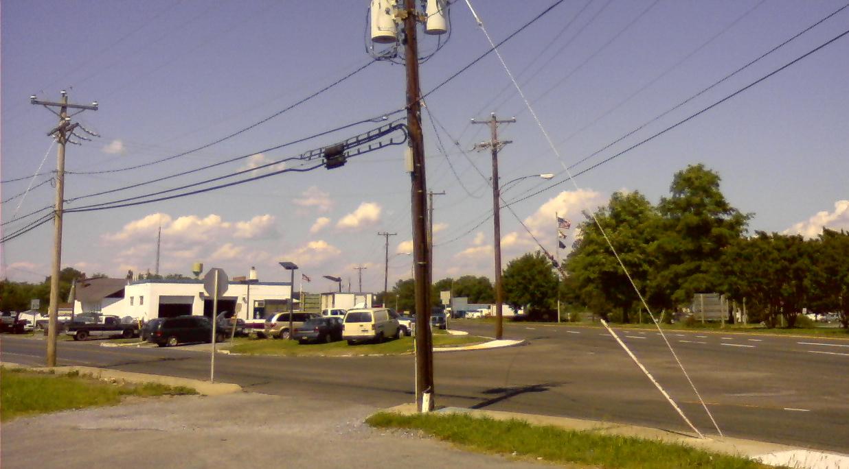
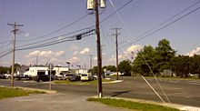 The beginning of MD 358 (left), where it intersects MD 413
MD 358 begins at an intersection with MD 413 in the city of Crisfield. MD 413 is formed by a one-way pair—Richardson Avenue running northbound and Maryland Avenue running southbound—around a median that once featured the Crisfield Secondary track of the Pennsylvania Railroad. Somerset Avenue, which was once part of MD 358, heads south from the junction as a city street toward Crisfield Academy and High School and the Crisfield Historic District. MD 358 heads north as two-lane Jacksonville Road. The state highway is maintained by the city of Crisfield for 0.09 miles (0.14 km) north to the city limits, where state maintenance begins. MD 358 passes through a residential area that transitions to farmland as the highway approaches Box Iron Road, which is the old alignment of MD 358 and is now unsigned MD 358A. Immediately beyond Box Iron Road, the state highway intersects Alfred J. Lawson Road, which leads to the main entrance to Janes Island State Park, then reaches its northern terminus at the end of state maintenance. Jacksonville Road continues north as a county highway toward Crisfield Municipal Airport.[1][2]
History
MD 358 was first constructed in 1925 along Somerset Avenue south from the Crisfield city limits and east along Asbury Road to Lawsonia Road, which later became MD 380.[3][4] The Asbury Road segment connected Crisfield with Sackertown Road, which was once MD 360.[5] Another section of MD 358 was paved from the Pennsylvania Railroad (now the MD 413 corridor) to its present northern terminus in 1933; this segment was originally designated MD 475.[6][5] MD 358 was extended north along Somerset Avenue to Chesapeake Avenue (MD 667) by 1939 and to its present northern terminus by 1946, assuming MD 475.[5][7] The state highway along Somerset Avenue was widened from Main Street to MD 413 around 1954.[8] MD 358 was removed from the state highway system south of MD 413 by 1995.[9] The state highway was relocated at Box Iron Road to eliminate two sharp curves between 1988 and 1999.[10][11]
Junction list
The entire route is in Somerset County.
Location Mile[1] Destinations Notes Crisfield 0.00 Somerset Avenue south Southern terminus; Somerset Avenue is former MD 358; MD 413 is Richardson Avenue northbound and Maryland Avenue southbound MD 413 (Maryland Avenue/Richardson Avenue) – Princess Anne1.11 Alfred J. Lawson Road west – Janes Island State Park 1.13 Jacksonville Road north – Crisfield Municipal Airport Northern terminus 1.000 mi = 1.609 km; 1.000 km = 0.621 mi References
- ^ a b c "Highway Location Reference: Somerset County" (PDF). Maryland State Highway Administration. 2009. http://www.marylandroads.com/Location/2009_SOMERSET.pdf. Retrieved 2010-10-25.
- ^ Google, Inc. Google Maps – Maryland Route 358 (Map). Cartography by Google, Inc. http://maps.google.com/maps?f=d&source=s_d&saddr=Jacksonville+Rd&daddr=Jacksonville+Rd&hl=en&geocode=FaKzQwId8Ld6-w%3BFX3tQwIdTs16-w&mra=ls&sll=37.998735,-75.84088&sspn=0.015523,0.038581&ie=UTF8&t=h&z=15. Retrieved 2010-10-25.
- ^ Report of the State Roads Commission of Maryland. 1924-1926. Baltimore: Maryland State Roads Commission. January 1927. pp. 27, 98. http://www.archive.org/details/annualreportsofs1924mary. Retrieved 2010-10-25.
- ^ Maryland Geological Survey. Map of Maryland: Showing State Road System and State Aid Roads (Map) (1927 ed.).
- ^ a b c Maryland State Roads Commission. General Highway Map: State of Maryland (Map) (1939 ed.).
- ^ Maryland Geological Survey. Map of Maryland Showing State Road System: State Aid Roads and Improved County Road Connections (Map) (1933 ed.).
- ^ Maryland State Roads Commission. Maryland: Official Highway Map (Map) (1946-47 ed.).
- ^ Report of the State Roads Commission of Maryland. 1953-1954. Baltimore: Maryland State Roads Commission. 1954-11-12. pp. 136–137. http://www.archive.org/details/reportofstateroa1953mary. Retrieved 2010-10-25.
- ^ Maryland State Highway Administration. Maryland: Official Highway Map (Map) (1995 ed.).
- ^ United States Geological Survey (1988-07-01). 3 km NE of Crisfield, Maryland, United States (Map). Topo Map. http://msrmaps.com/image.aspx?T=2&S=12&Z=18&X=533&Y=5258&W=1&qs=. Retrieved 2010-10-25.
- ^ "Highway Location Reference: Somerset County" (PDF). Maryland State Highway Administration. 1999. http://www.marylandroads.com/Location/1999_SOMERSET.pdf. Retrieved 2010-10-25.
External links
Roads in Somerset County, Maryland State highways 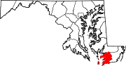
U.S. Highways Categories:- Crisfield, Maryland
- State highways in Maryland
- Roads in Somerset County, Maryland


Wikimedia Foundation. 2010.