- Montaillou
-
Montaillou

 Montaillou
Administration Country France Region Midi-Pyrénées Department Ariège Arrondissement Foix Canton Ax-les-Thermes Intercommunality Vallées d'Ax Mayor Jean Clergue
(2008–2014)Statistics Elevation 1,181–1,806 m (3,875–5,925 ft)
(avg. 1,325 m/4,347 ft)Land area1 8.61 km2 (3.32 sq mi) Population2 25 (2008) - Density 3 /km2 (7.8 /sq mi) INSEE/Postal code 09197/ 09110 1 French Land Register data, which excludes lakes, ponds, glaciers > 1 km² (0.386 sq mi or 247 acres) and river estuaries. 2 Population without double counting: residents of multiple communes (e.g., students and military personnel) only counted once. Coordinates: 42°47′20″N 1°53′56″E / 42.7888888889°N 1.89888888889°E
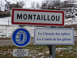
Montaillou (occitan Montalhon) is a commune in the Ariège department in southwestern France.
Contents
History

The town is best known for being the subject of Emmanuel Le Roy Ladurie's pioneering work of microhistory, Montaillou, village occitan. It analyzes the town in great detail over a thirty-year period from 1294 to 1324. Then a village of some 250 people, the daily routines of the people are in the records of Jacques Fournier, later Pope Benedict XII.
Montaillou was one of the last bastions of the Albigensian belief also known as Catharism, considered heresy by the dominant Roman Catholic powers. The then local bishop, Fournier, launched an extensive inquisition involving dozens of lengthy interviews with the locals, all of which were faithfully recorded, such as the arrest of the entire village in 1308. When Fournier became Pope he brought the records with him and they remain in the Vatican Library.
- For details of the castle, see Château de Montaillou.
Population
Historical population of Montaillou 1962 1968 1975 1982 1990 1999 2008 41 45 37 20 27 14 25 See also
References
- Emmanuel Le Roy Ladurie, Montaillou: The Promised Land of Error. translated by Barbara Bray. New York: G. Braziller, c1978.
- (French) Emmanuel Le Roy Ladurie, ed., Autour de Montaillou - un village occitan; histoire et religiosité d'une communauté villageoise au Moyen Âge. Actes du colloque de Montaillou (25-26-27 août 2000). Castelnaud la Chapelle, 2001.
Categories:- Communes of Ariège
- Catharism


Wikimedia Foundation. 2010.