- Florala, Alabama
Infobox Settlement
official_name = Florala, Alabama
settlement_type =City
imagesize =
image_caption =
image_
imagesize =
image_caption =
image_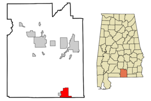
mapsize = 250px
map_caption = Location in Covington County and the state ofAlabama
mapsize1 =
map_caption1 =
subdivision_type = Country
subdivision_type1 = State
subdivision_type2 = County
subdivision_name =United States
subdivision_name1 =Alabama
subdivision_name2 = Covington
government_type =
leader_title =
leader_name =
established_date =
area_magnitude =
area_total_km2 = 28.3
area_total_sq_mi = 10.9
area_land_km2 = 27.2
area_land_sq_mi = 10.5
area_water_km2 = 1.1
area_water_sq_mi = 0.4
elevation_ft = 262
elevation_m = 80
population_as_of = 2000
population_footnotes =
population_total = 1964
population_metro =
population_density_km2 = 69.4
population_density_sq_mi = 180.2
timezone = Central (CST)
utc_offset = -6
latd = 31 |latm = 0 |lats = 27 |latNS = N
longd = 86 |longm = 19 |longs = 29 |longEW = W
timezone_DST = CDT
utc_offset_DST = -5
postal_code_type =ZIP code
postal_code = 36442
area_code = 334
blank_name = FIPS code
blank_info = 01-26848
blank1_name = GNIS feature ID
blank1_info = 0159617
footnotes =
website =Florala is a city in Covington County,
Alabama ,United States . At the 2000 census the population was 1,964.Geography
Florala is located at coor dms|31|0|28|N|86|19|30|W|city (31.007712, -86.324957)GR|1.
According to the
U.S. Census Bureau , the city has a total area of 10.9square mile s (28.3km² ), of which, 10.5 square miles (27.2 km²) of it is land and 0.4 square miles (1.1 km²) of it (3.93%) is water.Demographics
As of the
census GR|2 of 2000, there were 1,964 people, 898 households, and 527 families residing in the city. Thepopulation density was 187.0 people per square mile (72.2/km²). There were 1,103 housing units at an average density of 105.0/sq mi (40.6/km²). The racial makeup of the city was 80.75% White, 15.68% Black or African American, 0.87% Native American, 0.61% Asian, 0.66% from other races, and 1.43% from two or more races. 2.65% of the population were Hispanic or Latino of any race.There were 898 households out of which 23.9% had children under the age of 18 living with them, 40.5% were married couples living together, 14.3% had a female householder with no husband present, and 41.3% were non-families. 36.4% of all households were made up of individuals and 21.6% had someone living alone who was 65 years of age or older. The average household size was 2.19 and the average family size was 2.86.
In the city the population was spread out with 21.8% under the age of 18, 7.8% from 18 to 24, 24.6% from 25 to 44, 24.2% from 45 to 64, and 21.5% who were 65 years of age or older. The median age was 42 years. For every 100 females there were 82.5 males. For every 100 females age 18 and over, there were 76.3 males.
The median income for a household in the city was $17,377, and the median income for a family was $21,176. Males had a median income of $27,569 versus $15,625 for females. The
per capita income for the city was $11,495. About 29.3% of families and 32.4% of the population were below thepoverty line , including 38.8% of those under age 18 and 26.6% of those age 65 or over.Famous Natives
Dwight Stone, who played for the NY Jets, Carolina Panthers, Pittsburgh Steelers was born in Florala on January 28, 1964.
Also, Sgt.
Rodney J. Evans , who was awarded theMedal of Honor after being killed in Vietnam while exposing himself to enemy fire in order to protect his men. ( B. 17 July 1948, D. 18 July 1969)Florala Police Officer Todd Monroe Spikes was fired after bringing weapons to what he thought would be a meeting with a 13-year-old girl on NBC's "Dateline - To Catch a Predator." Police say Spikes drove almost five hours to Flagler Beach in a sport utility vehicle filled with video cameras, handguns, an assault rifle and a shotgun to have sex with the girl — who was really a decoy. Police say Spikes also planned to have sex with her mother so he could secretly continue to have sex with the child.
Origin of Name
The name Florala is said to have come from the city's bisection by the Florida-Alabama border. A significant part of the town lies in Florida, and thus the town was named by combining the names of Florida and Alabama.
Historical Fact
Since 1870, the City of Florala, through Florala’s Fidelity Masonic Lodge #685, (beginning with Chapel Hill and Lake City Lodge #377), and Chapter #441 of the Order of the Eastern Star, has served as the home of the World’s Oldest Consecutive Annual Masonic Day Celebration. The Celebration is in honor of St. John’s Day, June 24, 1717, when the first Grand Masonic Lodge in England was established. Each year on the Friday before the 24th of June and concluding on the Saturday after the 24th.
References
External links
Wikimedia Foundation. 2010.