- Columbiana, Alabama
-
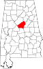
Columbiana, Alabama — City — Old Shelby County Courthouse in Columbiana Location in Shelby County and the state of Alabama
Coordinates: 33°11′0″N 86°36′33″W / 33.183333°N 86.60917°W Country United States State Alabama County Shelby Area – Total 15.2 sq mi (39.4 km2) – Land 15.2 sq mi (39.3 km2) – Water 0 sq mi (0.1 km2) Elevation 525 ft (160 m) Population (2010) – Total 4,197 – Density 218.2/sq mi (84.2/km2) Time zone Central (CST) (UTC-6) – Summer (DST) CDT (UTC-5) ZIP code 35051 Area code(s) 205 FIPS code 01-16768 GNIS feature ID 0157923 Website http://www.cityofcolumbiana.com/ Columbiana is a city in Shelby County, Alabama, United States. At the 2010 census the population was 4,197. The city is the county seat of Shelby County[1].
Contents
History
Columbiana, originally called Columbia, was selected as the county seat of Shelby County in 1826 over rivals Calera and Montevallo. After the selection as the county seat, Columbiana celebrated by drilling holes in a large pine tree and packing it with gunpowder. The tree was blown up and the sound could be heard for miles. Later in 1826, the courthouse was moved to an old school building in Columbiana.
An act of the Alabama Legislature officially changed the name of Shelby County’s county seat to Columbiana on January 13, 1832. Columbiana was incorporated on December 5, 1837 with corporate limits one-quarter of a mile in each direction from the public square.
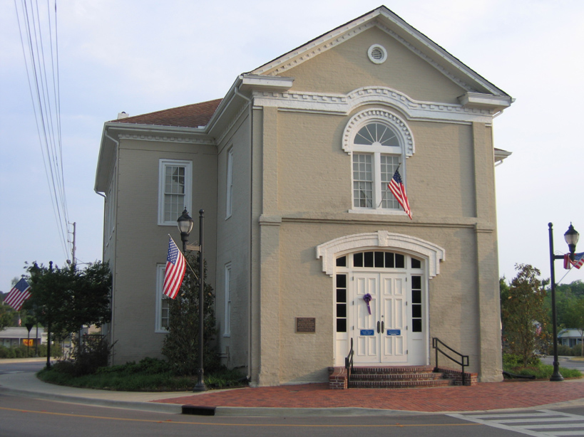
In 1854, the decision was made to build a larger courthouse at the south end of “Silk Stocking Road”, now Main Street. From 1854 to 1908 several additions and changes were made to the courthouse. (Photo - above/right)
Moving the courthouse to Columbiana was not necessarily popular in 1826 and there have been numerous attempts to relocate the county seat over the years. In 1901, the Alabama Constitutional Convention addressed the issue by including Section 41 in the new state constitution. Section 41 prohibited a move of the Shelby County seat from Columbiana unless a vote of the people was held, the only county in Alabama with such a designation.
To further solidify Columbiana’s claim to the county seat, in 1905 construction began two blocks north of the existing courthouse on a new marble courthouse at a cost of $ 300,000. The new courthouse was completed in 1908 and has been renovated and enlarged on a number of occasions. The new courthouse has served Shelby County for over 100 years.
The “Old Courthouse” is now home to the Shelby County Museum and Archives.
Today, Columbiana is home to the Shelby County Board of Education, the Shelby County Sheriff's Office, the Shelby County Jail, and Harrison Regional Library, which is the main office for the Shelby County Library System. Columbiana holds the annual Liberty Day celebration on the last weekend in June, which was first held in 1986 to honor the 100th anniversary of the Statue of Liberty. The current mayor is Allan Lowe.[2]
Geography
 Columbiana and surrounding area.
Columbiana is located at 33°11′1″N 86°36′34″W / 33.18361°N 86.60944°W (33.183545, -86.609365)[3].
According to the U.S. Census Bureau, the city has a total area of 15.2 square miles (39.4 km2), of which, 15.2 square miles (39.3 km2) of it is land and 0.04 square miles (0.1 km2) of it (0.26%) is water.
City Government
GENERAL: The City of Columbiana, Alabama is a municipal corporation organized under the laws of the State of Alabama. The City is located in Shelby County, Alabama, which is approximately 25 miles (40 km) southeast of Birmingham. According to the 2010 census conducted by the U.S. Department of Commerce, the population of Columbiana was 4,197. There are 16.86 square miles (43.7 km2) within the corporate limits of Columbiana.
GOVERNMENT: The City of Columbiana, Alabama is governed under the mayor-council form of government. The mayor is elected on an at-large basis for a four year term and the five council members are elected from single member districts, each for a four year term. The mayor and council serve on a part time basis. The mayor serves as chief executive officer of the City and is responsible for the daily operations of all departments of the City. The council acts as the legislative branch of the City.
Municipal operations are financed largely by sales tax, utility revenues, privilege licenses and property taxes.
ADDRESS: City of Columbiana, 107 Mildred Street, Columbiana, AL 35051
Telephone: (205) 669-5800 FAX: (205) 669-5811
Website: cityofcolumbiana.com
Elected Officials
Mayor Allan Lowe, Councilmember Frieda Abrams (District 1), Councilmember Dr. Stancil Handley (District 2), Councilmember Jim Strickland (District 3), Councilmember and Mayor Pro Tem Tom Seale (District 4), Councilmember Ouida Mayfield (District 5)
Demographics
As of the census[4] of 2000, there were 3,316 people, 1,260 households, and 868 families residing in the city. The population density was 218.5 people per square mile (84.3/km2). There were 1,372 housing units at an average density of 90.4 per square mile (34.9/km2). The racial makeup of the city was 78.59% White, 19.60% Black or African American, 0.24% Native American, 0.15% Asian, 0.03% Pacific Islander, 0.66% from other races, and 0.72% from two or more races. 1.99% of the population were Hispanic or Latino of any race.
There were 1,260 households out of which 34.0% had children under the age of 18 living with them, 51.8% were married couples living together, 13.4% had a female householder with no husband present, and 31.1% were non-families. 29.2% of all households were made up of individuals and 12.9% had someone living alone who was 65 years of age or older. The average household size was 2.50 and the average family size was 3.10.
In the city the population was spread out with 25.9% under the age of 18, 8.3% from 18 to 24, 31.6% from 25 to 44, 21.8% from 45 to 64, and 12.4% who were 65 years of age or older. The median age was 36 years. For every 100 females there were 100.5 males. For every 100 females age 18 and over, there were 93.2 males.
The median income for a household in the city was $34,034, and the median income for a family was $44,798. Males had a median income of $34,350 versus $21,193 for females. The per capita income for the city was $18,086. About 8.2% of families and 11.5% of the population were below the poverty line, including 15.3% of those under age 18 and 14.2% of those age 65 or over.
Education
Shelby County Schools operates public schools.
- Elvin Hill Elementary School- Kindergarten through fifth grade
- Columbiana Middle School- Sixth grade through eighth grade
- Shelby County High School- Ninth grade through twelfth grade. The Shelby County Wildcats school colors are now: maroon and white. The colors were changed from its original school colors of red and white, which were also used by rival Thompson High. Its sports teams are part of the Alabama High School Athletic Association Class 5A.[5]
- Shelby County School of Technology- career technical center
- Cornerstone Christian School- private school serving Pre-kindergarten through twelfth grade
1932 Tornado Outbreak
In March 1932, Columbiana, the county seat of Shelby County had a population of 1,180. It was a trading center for the surrounding agricultural areas of Central Alabama. People were optimistic that 1932 would be better than 1931. They didn’t think that 1932 could be any worse than the previous year. The newspapers said that there were definite signs that the economy would be out of the woods by December.
There were no television weather broadcasts, or NOAA weather radio stations in 1932. But people knew the weather was going to be bad that warm, windy and cloudy March 21st. As a powerful thunderstorm approached Columbiana during the afternoon, a tornado formed southwest of town about 5:10 p.m. As it reached the western part of the town its path was 200 yards wide.
In the aftermath of the tornado, bits of clothing were left in the trees in the path of destruction. The electrical plant was knocked off line, plunging the city and much of the county into darkness. Darkness and heavy rain hampered rescue efforts. The Columbiana tornado was one of fourteen devastating tornadoes that killed over 300 people across Alabama that day. Fourteen people died in Columbiana in this tornado, which would have likely been rated an EF4 using today's scale.
Notable Residents from Columbiana
- Leven Handy Ellis (April 6, 1881 - January 4, 1968) Democrat. State Senator from the Fifteenth Senatorial District from 1927 to 1931 and a member of the House of Representatives of the Alabama Legislature from 1936 to 1943, 15th Lt. Governor of Alabama 1943 to 1947. Mayor of Columbiana for two terms, delegate to the Democratic National Convention from the sixth Congressional District of Alabama in 1940 and 1948, member of the Code Committee of the Alabama Legislature in 1940 and a member of the State Board of Education. Chairman of the Shelby County Executive Committee (Democratic Party); Member Columbiana Methodist Church; Shriner; Elk and an Eagle.
- Robert J. Bentley (Born February 3, 1943) Alabama Republican Governor (2011 - ). Was inaugurated at 12 Noon on January 17, 2011 in Montgomery, becoming Alabama's 53rd governor. Graduate, Shelby County High School (Columbiana, AL) 1961. Graduate, University of Alabama (Tuscaloosa, Alabama).
References
- ^ "Find a County". National Association of Counties. http://www.naco.org/Counties/Pages/FindACounty.aspx. Retrieved 2011-06-07.
- ^ http://www.cityofcolumbiana.com/Default.asp?ID=5.
- ^ "US Gazetteer files: 2010, 2000, and 1990". United States Census Bureau. 2011-02-12. http://www.census.gov/geo/www/gazetteer/gazette.html. Retrieved 2011-04-23.
- ^ "American FactFinder". United States Census Bureau. http://factfinder.census.gov. Retrieved 2008-01-31.
- ^ http://www.ahsaa.com/Schools/Classification/tabid/67/Default.aspx.
External links
Coordinates: 33°11′01″N 86°36′34″W / 33.183545°N 86.609365°W
Municipalities and communities of Shelby County, Alabama County seat: ColumbianaCities Alabaster | Birmingham‡ | Calera‡ | Chelsea | Childersburg | Columbiana | Helena‡ | Hoover‡ | Leeds‡ | Pelham | Vestavia Hills‡
Towns Harpersville | Indian Springs Village | Montevallo | Vincent‡ | Westover | Wilsonville | Wilton
CDPs Brantleyville | Brook Highland | Meadowbrook
Unincorporated
communityFootnotes ‡This populated place also has portions in an adjacent county or counties
Categories:- Cities in Alabama
- Populated places in Shelby County, Alabama
- County seats in Alabama
- Birmingham–Hoover metropolitan area


Wikimedia Foundation. 2010.