- Offenheim
-
Offenheim 
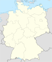
 OffenheimLocation of Offenheim within Alzey-Worms district
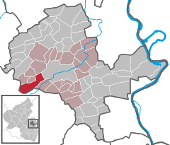
Coordinates 49°43′32″N 8°01′49″E / 49.72556°N 8.03028°ECoordinates: 49°43′32″N 8°01′49″E / 49.72556°N 8.03028°E Administration Country Germany State Rhineland-Palatinate District Alzey-Worms Municipal assoc. Alzey-Land Mayor Karl-Ludwig Becker (SPD) Basic statistics Area 13.88 km2 (5.36 sq mi) Elevation 229 m (751 ft) Population 601 (31 December 2010)[1] - Density 43 /km2 (112 /sq mi) Other information Time zone CET/CEST (UTC+1/+2) Licence plate AZ Postal code 55234 Area code 06736 Website www.offenheim.de Offenheim is an Ortsgemeinde – a municipality belonging to a Verbandsgemeinde, a kind of collective municipality – in the Alzey-Worms district in Rhineland-Palatinate, Germany.
Contents
Geography
Location
The municipality, which lies in the middle of the “Rhenish-Hessian Switzerland” has 842 ha of woodland, giving it the biggest and almost the only wooded area in Rhenish Hesse. In the Vorholzwald (forest) is found Rhenish Hesse’s highest elevation at 358 m above sea level, the Kappelberg. Offenheim belongs to the Verbandsgemeinde of Alzey-Land, whose seat is in Alzey.
History
In 786, Offenheim had its first documentary mention in Lorsch Abbey’s donation directory.
Politics
Municipal council
Town council
The council is made up of 12 council members, who were elected at the municipal election held on 7 June 2009, and the honorary mayor as chairman.
The municipal election held on 7 June 2009 yielded the following results[2]:
SPD LINKE BfO FWG Total 2009 5 1 4 2 12 seats 2004 4 - 5 3 12 seats Coat of arms
The municipality’s arms might be described thus: Argent an oak eradicated leafed of eleven vert, fretted in the boughs a bow unstrung in fesse Or on each end of which an inescutcheon, the dexter sable in bend sinister charged with a lion rampant sinister Or langued and crowned gules, and the sinister gules in bend charged with the head of a bishop’s crozier Or, the point of the crook in the shape of a trefoil in bend sinister.
References
- ^ "Bevölkerung der Gemeinden am 31.12.2010" (in German). Statistisches Landesamt Rheinland-Pfalz. 31 December 2010. http://www.statistik.rlp.de/fileadmin/dokumente/berichte/A1033_201022_hj_G.pdf.
- ^ Kommunalwahl Rheinland-Pfalz 2009, Gemeinderat
External links
- Municipality’s official webpage (German)
- Offenheim in the collective municipality’s Web pages (German)
- This article incorporates information from the German Wikipedia.
Albig · Alsheim · Alzey · Armsheim · Bechenheim · Bechtheim · Bechtolsheim · Bermersheim · Bermersheim vor der Höhe · Biebelnheim · Bornheim · Dintesheim · Dittelsheim-Heßloch · Eckelsheim · Eich · Ensheim · Eppelsheim · Erbes-Büdesheim · Esselborn · Flomborn · Flonheim · Flörsheim-Dalsheim · Framersheim · Freimersheim · Frettenheim · Gabsheim · Gau-Bickelheim · Gau-Heppenheim · Gau-Odernheim · Gau-Weinheim · Gimbsheim · Gumbsheim · Gundersheim · Gundheim · Hamm am Rhein · Hangen-Weisheim · Hochborn · Hohen-Sülzen · Kettenheim · Lonsheim · Mauchenheim · Mettenheim · Mölsheim · Monsheim · Monzernheim · Mörstadt · Nack · Nieder-Wiesen · Ober-Flörsheim · Offenheim · Offstein · Osthofen · Partenheim · Saulheim · Schornsheim · Siefersheim · Spiesheim · Stein-Bockenheim · Sulzheim · Udenheim · Vendersheim · Wachenheim · Wahlheim · Wallertheim · Wendelsheim · Westhofen · Wöllstein · Wonsheim · Wörrstadt Categories:
- Municipalities in Rhineland-Palatinate
- Alzey-Worms geography stubs


Wikimedia Foundation. 2010.