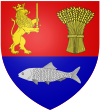
Dăbuleni

Dăbuleni
Dăbuleni
—  Town  —
Dăbuleni is located in Romania
Dăbuleni
Location of Dăbuleni
Coordinates: 43°48′04″N 24°05′31″E / 43.80111°N 24.09194°E / 43.80111; 24.09194Coordinates: 43°48′04″N 24°05′31″E / 43.80111°N 24.09194°E / 43.80111; 24.09194
Country  Romania
County Dolj County
Status Town
Government
 – Mayor
Population (2002)
 – Total 13,888
Time zone EET (UTC+2)
 – Summer (DST) EEST (UTC+3)

Dăbuleni (Romanian pronunciation: [dəbuˈlenʲ]) is a town of Dolj County, known for the sandy areas surrounding it, since the 1980s have become part of an 80,000 hectares (800 km², 310 mi²) desert, known as the Oltenian Sahara. The town is the only place in Europe where an official Sand Museum exists. It was declared a town in 2004 (Law no. 83/2004). If the north part of the town is a desert, the south part, a Danube flooding area known as the "Melon Kingdom", from which the "Dăbuleni" melons, are famous in all Romania.

One village, Chiaşu, is administered by the town.


Wikimedia Foundation. 2010.

Игры ⚽ Поможем решить контрольную работу

Look at other dictionaries:

  • Dabuleni — Dăbuleni Hilfe zu Wappen …   Deutsch Wikipedia

  • Dăbuleni — Hilfe zu Wappen …   Deutsch Wikipedia

  • Dăbuleni — Dăbuleni …   Wikipédia en Français

  • Dabuleni — Original name in latin Dbuleni Name in other language Dabuleni, Dbuleni State code RO Continent/City Europe/Bucharest longitude 43.8 latitude 24.08333 altitude 55 Population 13641 Date 2012 06 12 …   Cities with a population over 1000 database

  • Dăbuleni — Sp Debulènis Ap Dăbuleni L P Rumunija …   Pasaulio vietovardžiai. Internetinė duomenų bazė

  • Comuna Dabuleni — Admin ASC 2 Code Orig. name Oraş Dãbuleni Country and Admin Code RO.17.72007 RO …   World countries Adminstrative division ASC I-II

  • Kreis Dolj — Lage des Kreises Dolj in Rumänien Karte des Kreises D …   Deutsch Wikipedia

  • Desertification in Oltenia — #REDIRECT Dăbuleni The Desertification in Oltenia affects parts of the Walachian Plain, in the historic Romanian province of Oltenia) covering the area between the city of Calafat to the town of Dăbuleni, spanning an area of about 80,000 hectares …   Wikipedia

  • Dolj County — Dolj   County (Judeţ)   Coat of arms …   Wikipedia

  • Oltenian Sahara — The Oltenian Sahara ( ro. Sahara Olteniei) is a recently formed desert in the western part of the Walachian Plain (in the historical Romanian province of Oltenia) and spans from the city of Calafat to the town of Dăbuleni, covering an area that… …   Wikipedia

Share the article and excerpts

Direct link
Do a right-click on the link above
and select “Copy Link”