- Chestnut Hill, Massachusetts
-
- This article is about the village in Greater Boston. See also Chestnut Hill, Belchertown, Massachusetts, and Chestnut Hill, Blackstone, Massachusetts.

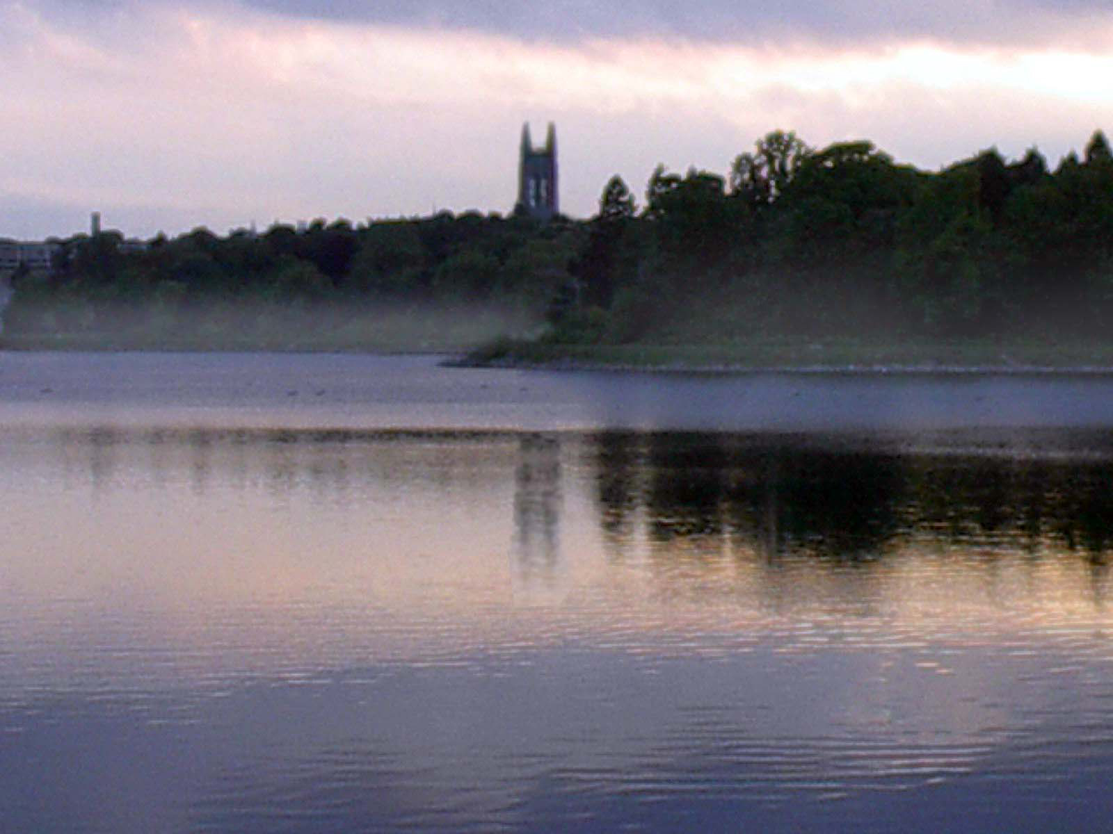
Chestnut Hill is a wealthy New England village located six miles (10 km) west of downtown Boston, Massachusetts, United States. Like all Massachusetts villages, Chestnut Hill is not an incorporated municipal entity, but unlike most of them, it encompasses parts of three separate municipalities, each of which is in a different county: the town of Brookline in Norfolk County; the city of Boston in Suffolk County (parts of its neighborhoods of Brighton and West Roxbury), and the city of Newton in Middlesex County (all of its village of Chestnut Hill). Chestnut Hill's borders are roughly defined by the Chestnut Hill, MA 02467 ZIP Code. Chestnut Hill is not strictly a topographical designation; the name refers to a series of small hills that overlook the 135-acre (546,000 m²) Chestnut Hill Reservoir rather than one particular hill. Chestnut Hill is perhaps best known as the home of Boston College, part of the Boston Marathon route, as well as the Collegiate Gothic canvas of the world famous architect, Frederick Law Olmstead.[1]
Contents
History
While most of Chestnut Hill remained farmland well into the early twentieth century, the area around the reservoir was developed, in 1870, by renowned landscape architect Frederick Law Olmsted, designer of Central Park in New York and of the Emerald Necklace in Boston and Brookline.
Because of the significance of its landscape and architecture, the National Register of Historic Places, in 1986, designated parts of Chestnut Hill as historic districts. Examples of Colonial, Italianate, Shingle, Tudor Revival, and Victorian architectural styles are evident in the village's country estates and mansions. The Boston College campus is itself an early example of Collegiate Gothic architecture.
Geographical
- Hammond Pond Reservation, an extensive forest preserve and protected wetlands (Newton)[2]
Transport
Chestnut Hill is served by three branches of the Green Line of the MBTA, Boston's light rail system. Stations include:
- B Line: Chestnut Hill Avenue, South Street, Boston College
- C Line: Cleveland Circle
- D Line: Reservoir, Chestnut Hill
Registered historic districts
- Boston College Main Campus Historic District—140 Commonwealth Ave. (in Newton)
- Chestnut Hill Historic District—roughly bounded by Middlesex Rd., Reservoir Ln., Denny Rd., Boylston St. and Dunster Rd. (added November 17, 1985) (mostly in Brookline, but includes small parts of Boston and Newton)
- Chestnut Hill Reservoir Historic District—within Boston city limits
- Old Chestnut Hill Historic District—along Hammond St. and Chestnut Hill Rd. roughly bounded by Beacon St. and Essex Rd., and Suffolk Rd. (added October 4, 1986), within Newton city limits
Notable natives
- Robert Kraft, owner of the New England Patriots
- Mary Baker Eddy, founder of the Christian Science Church (Newton, MA)
- Reginald Fessenden, called the father of broadcast radio, the Reginald A. Fessenden House in Chestnut Hill (Newton) is a US National Landmark as well as a US Historic Place.
- Theo Epstein, general manager of the Chicago Cubs
- Terry Francona, former manager of the Boston Red Sox
- Alice Hathaway Lee Roosevelt, the first wife of Theodore Roosevelt, and mother of Alice Roosevelt Longworth
- Louis K. Liggett, drugstore magnate (Newton, MA)
- Leverett Saltonstall, Governor of Massachusetts (1939–1945) and United States Senator (1945–1967)
See also
- List of Registered Historic Places in Brookline, Massachusetts
- List of Registered Historic Places in Newton, Massachusetts
- List of Registered Historic Places in Suffolk County, Massachusetts
References
Coordinates: 42°19′50″N 71°09′58″W / 42.33056°N 71.16611°W
Municipalities and communities of Norfolk County, Massachusetts Cities 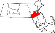
Towns CDPs Bellingham | Dover | Foxborough | Medfield | Millis-Clicquot | Sharon | Walpole
Other
villageChestnut Hill
Categories:- Villages in Norfolk County, Massachusetts
- Villages in Newton, Massachusetts
- Villages in Suffolk County, Massachusetts
- Brookline, Massachusetts
- University towns in the United States

Wikimedia Foundation. 2010.