- Crowsnest Pass, Alberta
-
For the geographic feature called Crowsnest Pass, see Crowsnest Pass.
Municipality of
Crowsnest Pass— Specialized Municipality — 
LogoLocation of Crowsnest Past in Alberta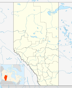
 Municipality of
Crowsnest PassCoordinates: 49°37′59″N 114°4′34″W / 49.63306°N 114.07611°WCoordinates: 49°37′59″N 114°4′34″W / 49.63306°N 114.07611°W Country  Canada
Province  Alberta
Region Southern Alberta Census division 15 Incorporated [1] - Town January 1, 1979 - Specialized municipality January 16, 2008 Government[2] - Mayor Bruce Vernon Decoux - Governing body Crowsnest Pass Municipal Council - MP Ted Menzies - MLA Evan Berger Area - Total 373.07 km2 (144 sq mi) Elevation 1,310 m (4,298 ft) Population (2006)[3] - Total 5,749 - Density 15.4/km2 (39.9/sq mi) Time zone MST (UTC-7) Postal code span T0K 0E0 Area code(s) +1-403 Website Municipality of Crowsnest Pass The Municipality of Crowsnest Pass is a specialized municipality located in the Crowsnest Pass of the Rocky Mountains in southwest Alberta, Canada. The municipality formed as a result of the amalgamation of five municipalities – the Village of Bellevue, the Town of Blairmore, Town of Coleman, the Village of Frank and Improvement District No. 5 (which included the Hamlet of Hillcrest) – on January 1, 1979. Today, Blairmore and Coleman remain the two largest communities while Frank is the smallest. Crowsnest, Passburg and Sentinel (Sentry) are other former communities (abandoned, or much reduced) within the municipality's boundaries.
Contents
History
The municipality owes its existence to coal mining, the area's primary industry since the first mine opened in 1900. Its ethnic and cultural diversity comes from the many European and other immigrants attracted to the area by the mines. Through the years coal mining suffered from fluctuating coal prices, bitter strikes, and underground accidents, and all the mines on the Alberta side closed throughout the 20th century as cheaper, safer open-pit mines opened on the British Columbia side of the pass. There is an operating coal mine just across the B.C. border in Sparwood which continues to provide significant employment for the Municipality of Crowsnest Pass.
Crowsnest Pass is known for tragedy. In 1903 the tip of Turtle Mountain broke loose and decimated part of the Village of Frank (the Frank Slide). In 1914, the Hillcrest mine disaster occurred in the Hillcrest Mine, killing 189 men. Serious spring floods occurred in 1923 and 1942. Periodic forest fires have swept the valley, including one in the summer of 2003 that threatened the entire municipality.
The area was a centre for "rum-running" during the prohibition of 1916 - 1923, when liquor was illegally brought across the provincial border from British Columbia. This legacy is celebrated each July during Rum-Runner Days, which includes a parade, many civic and sporting events, and a fireworks display called Thunder In the Valley that attracts tens of thousands of visitors from nearby communities.
Today, the Municipality of Crowsnest Pass has much to offer visitors. In addition to its spectacular natural setting, the municipality is rich in human history, and tourism promises to become a significant industry.
Points of interest
Within the Municipality of Crowsnest Pass one can find the Frank Slide Interpretive Centre, an interpretive display at Leitch Collieries Provincial Historic Site, underground tours of the Bellevue Mine Provincial Historic Site, and the Crowsnest Museum in downtown Coleman where pamphlets for self-guided historical driving tours of the municipality are also available. The area offers hiking and fishing in the summer, and in winter snowmobiling, a downhill ski hill, and a groomed cross-country ski area, and is about 70 kilometres (43 mi) from major ski hills at both Fernie Alpine Resort and Castle Mountain Resort.
Demographics
In 2006, Crowsnest Pass had a population of 5,749 living in 3,004 dwellings, an 8.2% decrease from 2001. The municipality has a land area of 373.07 km2 (144.04 sq mi) and a population density of 15.4 /km2 (40 /sq mi).[3]
In 2001, the population of the Municipality of Crowsnest Pass was 6,262.[4]
Trivia
- Blairmore elected Canada's first Communist town council under mayor Bill Knight during the Great Depression.[5][6] (See Blairmore, Alberta for more information)
- Crowsnest Pass was the site of the last train robbery in Canada (1920).
- Alberta's first female mayor, Clemence Jepson (1914-2010), was elected in Bellevue in November 1963.
- The gravy recipe for Colonel Sanders' Kentucky Fried Chicken was developed here.[7]
- The frontier town in Disney's 1985 film The Journey of Natty Gann was shot here.
See also
- List of communities in Alberta
- Specialized municipalities of Alberta
References
- ^ Alberta Municipal Affairs (2010-09-17). "Municipal Profile – Municipality of Crowsnest Pass". http://www.municipalaffairs.alberta.ca/cfml/MunicipalProfiles/index.cfm?fuseaction=BasicReport&MunicipalityType=SMUN&stakeholder=361&profileType=HIST&profileType=CONT&profileType=STAT&profileType=FINA&profileType=GRAN&profileType=TAXR&profileType=ASSE. Retrieved 2010-10-02.
- ^ Alberta Municipal Affairs: Municipal Officials Search
- ^ a b Statistics Canada (Census 2006). "Crowsnest Pass - Community Profile". http://www12.statcan.ca/english/census06/data/profiles/community/Details/Page.cfm?Lang=E&Geo1=CSD&Code1=4815007&Geo2=PR&Code2=48&Data=Count&SearchText=Crowsnest%20Pass&SearchType=Begins&SearchPR=01&B1=All&GeoLevel=&GeoCode=4815007. Retrieved 2007-06-11.
- ^ Crownset Pass Community Profile - Statistics Canada 2001 Census
- ^ CBC article - Blairmore elections
- ^ Blairmore the Red - Crowsnest Pass Promoter, Nov. 9 2007
- ^ Crowsnest And Its People, Crowsnest Pass Historical Society, 1979
External links
- Municipality of Crowsnest Pass
- Live in Crowsnest Pass
- Crowsnest Pass Chamber of Commerce
- Crowsnest Pass Promoter
- Crowsnest Pass Golf & Country Club
- Nippon Institute of Technology Inter-Cultural Campus

Elkford Longview Claresholm Cranbrook 
Cowley  Crowsnest Pass

Fernie Waterton Lakes National Park Pincher Creek  Canadian Rockies
Ranges - Ball
- Bare
- Beaverfoot
- Blue
- Bow
- Crowsnest
- Elk
- Fairholme
- Flathead
- High Rock
- Kananaskis
- Livingstone
- Lizard
- Maligne
- Massive
- Misty
- Morrissey
- Palliser
- President
- Queen Elizabeth
- Rainbow
- Ram
- Sawback
- Sentinel
- Sir Winston Churchill
- Slate
- South Jasper
- Sundance
- Terminal
- Tower of London
- Vermilion
- Victoria Cross
- Waputik
- Continental Ranges
- Hart Ranges
- Muskwa Ranges
Mountains Passes Glaciers Parks and protected areas World Heritage Sites- Canadian Rocky Mountain Parks World Heritage Site
- Waterton-Glacier International Peace Park
National- Parks: Banff
- Jasper
- Kootenay
- Yoho
- Waterton Lakes
- Historic Sites: Jasper House
- Jasper Park Information Centre
- Yellowhead Pass
- Athabasca Pass
- Howse Pass
- Kootenae House
- Kicking Horse Pass
- Skoki Ski Lodge
- Twin Falls Tea House
- Abbot Pass Refuge Cabin
- Cave and Basin
- Banff Park Museum
- Sulphur Mountain Cosmic Ray Station
- First Oil Well in Western Canada
Provincial (AB)- Parks: Bow Valley
- Bragg Creek
- Elbow-Sheep
- Ghost River
- Kananaskis
- Peter Lougheed
- Sheep River
- Siffleur
- Spray Valley
- White Goat
- Willmore
- Historic Sites: Frank Slide
Provincial (BC)Ski resorts - Castle Mountain
- Fernie
- Fortress Mountain
- Lake Louise
- Little Mac
- Marmot Basin
- Mount Norquay
- Nakiska
- Powder King
- Sunshine Village
Communities - Banff
- Canmore
- Crowsnest Pass
- Elkford
- Fernie
- Field
- Jasper
- Lake Louise
- Sparwood
- Tumbler Ridge
- Valemount
- Waterton Park
See also: Geography of Canada portal Categories:

Wikimedia Foundation. 2010.