- Mesa, Arizona
-
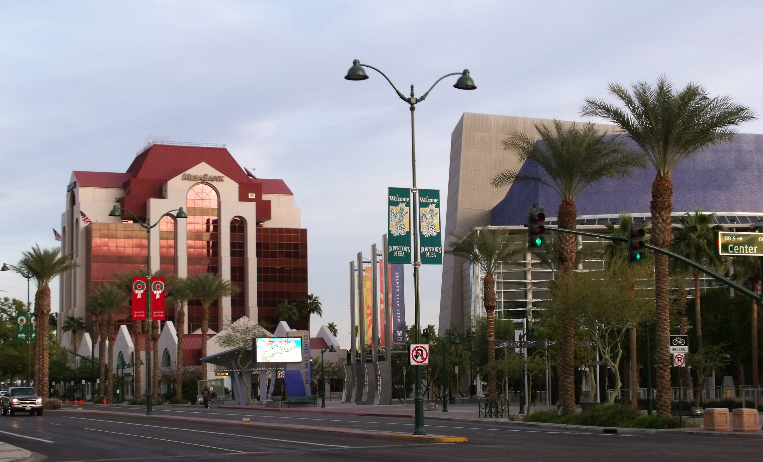
Mesa — City — Mesa Bank and Mesa Arts Center building in downtown Mesa

Flag
SealLocation in Maricopa County and the state of Arizona Location in the United States
 Mesa
MesaCoordinates: 33°24′54″N 111°49′53″W / 33.415°N 111.83139°WCoordinates: 33°24′54″N 111°49′53″W / 33.415°N 111.83139°W Country United States State Arizona County Maricopa Founded 1878 Government - Mayor Scott Smith Area - Total 133.13 sq mi (324.2 km2) - Land 132.93 sq mi (323.7 km2) - Water 0.2 sq mi (0.6 km2) Elevation 1,243 ft (378 m) Population (2010)[1][2] - Total 439,041 - Density 3,536.6/sq mi (1,365.6/km2) Time zone MST (no DST) (UTC-7) ZIP codes 85200-85299 Area code(s) 480 FIPS code 04-46000 Website http://www.mesaaz.gov/ Mesa (
 /ˈmɛsə/ mes-ə) is a city in Maricopa County, in the U.S. state of Arizona and is a suburb located about 20 miles (32 km) east of Phoenix. Mesa is in the East Valley section of the Phoenix Metropolitan Area. It is bordered by Tempe on the west, the Salt River Pima-Maricopa Indian Community on the north, Chandler and Gilbert on the south, and Apache Junction on the east. As of the 2010 Census Mesa became Arizona's center of population.[3]
Mesa is the third-largest city in Arizona, after Phoenix and Tucson, the 38th-largest city and largest suburb in the US[clarification needed]. Despite being home to 439,041 as of 2010, reported by the Census Bureau, making its population larger than more recognizable cities such as Atlanta, Miami, Minneapolis, St. Louis, and Cleveland,[4] Mesa is decidedly a bedroom community. Mesa is home to the Polytechnic campus of Arizona State University.
Contents
History
The history of Mesa dates back at least 2,000 years to the arrival of the Hohokam people. The Hohokam, whose name means "All Used Up" or "The Departed Ones", built the original canal system. The canals were the largest and most sophisticated in the prehistoric New World. Some were up to 90 feet (27 m) wide and ten feet deep at their head gates, extending for as far as 16 miles (26 km) across the desert. By A.D.1100 water could be delivered to an area over 110,000 acres (450 km2), transforming the Sonoran Desert into an agricultural oasis. By A.D.1450, the Hohokam had constructed hundreds of miles of canals many of which are still in use today.[5]
After the disappearance of the Hohokam and before the arrival of the early settlers little is known, as explorers did not venture into this area. By the late 19th century near present-day Mesa, U.S. Army troops subdued the Apache opening the way for settlement.
Daniel Webster Jones led an expedition to found a Mormon settlement in Arizona. Leaving St. George, Utah in March 1877, Jones and others arrived at Lehi, an area within the northern edge of present-day Mesa. Jones had been asked by LDS officials to direct a party of people in establishing a settlement in Arizona. This settlement was initially known as Jonesville and Fort Utah and did not receive the name of Lehi until 1883, when it was adopted on the suggestion of Brigham Young, Jr.[6]
At the same time, another group dubbed the First Mesa Company arrived from Utah and Idaho. Their leaders were named Francis Martin Pomeroy, Charles Crismon, George M. Sirrine and Charles I. Robson. Rather than accepting an invitation to settle at Jones' Lehi settlement, they moved to the top of the mesa that serves as the city's namesake. They dug irrigation canals, some of which were over the original Hohokam canals, and by April 1878, water was flowing through them.[7] The Second Mesa Company arrived in 1879 and settled to the east of where the First Mesa Company settled in 1880, due to lack of available farmland. This settlement was called Stringtown.[8]
On July 17, 1878, Mesa City was registered as a 1-square-mile (2.6 km2) townsite. The first school was built in 1879. In 1883, Mesa City was incorporated with a population of 300 people. Dr. A. J. Chandler, who would later go on to found the city of Chandler, worked on widening the Mesa Canal in 1895 to allow for enough flow to build a power plant. In 1917, the city of Mesa purchased the utility company. The revenues from the company provided enough for capital expenditures until the 1960s. During the Great Depression, WPA funds provided paved streets, a new hospital, a new town hall and a library.[9]
With the opening of Falcon Field and Williams Field in the early 1940s, more military personnel began to move into the Mesa area. With the advent of air conditioning and the rise of tourism, population growth exploded in Mesa as well as the rest of the Phoenix area. Industry — especially early aerospace companies — grew in the 1950s and 1960s. As late as 1960, half of the residents of Mesa made a living with agriculture, but this has declined substantially as Mesa's suburban growth continued on track with the rest of the Phoenix metro area.[10]
Demographics
Historical populations Census Pop. %± 1900 722 — 1910 1,692 134.3% 1920 3,036 79.4% 1930 3,711 22.2% 1940 7,224 94.7% 1950 16,790 132.4% 1960 33,772 101.1% 1970 63,049 86.7% 1980 152,404 141.7% 1990 288,104 89.0% 2000 396,375 37.6% 2010 439,041 10.8% According to the 2010 Census, the racial composition of Mesa was as follows:[11]
- White: 77.1% (Non-Hispanic Whites: 64.3%)
- Hispanic or Latino (of any race): 26.54%
- Black or African American: 3.5%
- Two or more races: 3.4%
- Native American: 2.4%
- Asian: 1.9% (0.5% Filipino, 0.3% Chinese, 0.3% Vietnamese, 0.3% Indian, 0.1% Korean, 0.1% Japanese)
- Native Hawaiian and Other Pacific Islander: 0.4%
- Some other race: 5.8%
As of the census[12] 2001 estimate, there were 442,445 people, 146,643 households, and 99,863 families residing in the city. The population density was 3,171.3 people per square mile (1,224.4/km²). There were 175,701 housing units at an average density of 1,405.7 per square mile (542.8/km²).
The racial make-up of the city was 81.6% White, 2.4% Black or African American, 2.2% Native American, 2.00% Asian, 0.10% Pacific Islander, 9.3% from other races, and 1.30% from two or more races. 24.0% of the population were Hispanic or Latino of any race.
There were 146,643 households out of which 33.4% had children under the age of 18 living with them, 52.7% were married couples living together, 10.6% had a female householder with no husband present, and 31.9% were non-families. 24.2% of all households were made up of individuals and 9.1% had someone living alone who was 65 years of age or older. The average household size was 2.68 and the average family size was 3.20.
The age distribution was 27.3% under 18, 11.2% from 18 to 24, 29.7% from 25 to 44, 18.4% from 45 to 64, and 13.3% who were 65 or older. The median age was 32 years. For every 100 females there were 98.2 males. For every 100 females age 18 and over, there were 95.6 males.
The median income for a household in the city was $42,817, and the median income for a family was $49,232. Males had a median income of $35,960 versus $27,005 for females. The per capita income for the city was $19,601. About 6.2% of families and 8.9% of the population were below the poverty line, including 10.7% of those under age 18 and 7.1% of those age 65 or over. Mesa's residents exhibit a great deal of economic diversity[citation needed], with low-income areas constructed somewhat close to high-scale neighborhoods with expensive custom homes. The neighborhood "Marlborough Mesa", along with many other neighborhoods, has won a community award.
Mesa is the largest city in the United States that is not a consolidated city-county or a county seat.[citation needed]
Defining East and West Mesa
Due to Mesa's extremely long east to west travel distance, in excess of 18 miles (29 km)[13] and large land area 133.13 square miles (344.8 km2), locations in Mesa are often referred to as residing within either East Mesa or West Mesa.[14][15][16]
Commonly accepted boundaries
Center St
Mesa employs a grid system for street numbering that is different from that used in Phoenix and other portions of the metropolitan area. Center Street, running north to south bisects Mesa into eastern and western halves and serves as the east and west numbering point of origin within Mesa. Streets west of Center St., such as W. University Drive or W. Main St. are considered to be in West Mesa; whereas, streets east of Center St., such as E. University or E. Main St. are considered to be in East Mesa.[17]
Mesa Drive 1/2 Mile East of Center St. (By Zip code)
Mesa Drive, running north to south and bisecting Mesa into east and west sections, is located one half mile(800m) east of Center Street, and serves as the zip code boundary between the 85281, 85201, 85202, and 85210 zip codes of Western Mesa and the 85203, 85204, 85205, 85206, 85207, 85208, 85209, 85212, 85213, 85215, 85220, and 85242 zip codes of Eastern Mesa.[18]
Country Club Drive 1/2 Mile West of Center St. (By US Congressional district)
Country Club Drive, running north to south and bisecting Mesa into east and west sections, is located one half mile(800m) west of Center St, and serves as the jurisdictional boundary between Arizona's 5th and 6th congressional districts.[19]
Economy
Top employers
According to the City's 2009 Comprehensive Annual Financial Report,[20] the top employers in the city are:
# Employer # of Employees 1 Mesa Public Schools 10,000 2 Banner Health 8,650 3 Boeing 4,000 4 City of Mesa 3,601 5 Mesa Community College 2,150 6 Wal-Mart 2,100 7 Empire Southwest 1,500 8 County of Maricopa 1,150 9 Rural/Metro 1,100 10 Bashas' 1,000 Climate
Climate data for Mesa, AZ Month Jan Feb Mar Apr May Jun Jul Aug Sep Oct Nov Dec Year Record high °F (°C) 89
(32)95
(35)99
(37)106
(41)118
(48)116
(47)119
(48)115
(46)113
(45)107
(42)97
(36)86
(30)119
(48)Average high °F (°C) 67
(19)71
(22)77
(25)85
(29)94
(34)104
(40)106
(41)104
(40)99
(37)89
(32)75
(24)67
(19)86.5
(30.3)Average low °F (°C) 41
(5)45
(7)49
(9)54
(12)61
(16)70
(21)77
(25)76
(24)70
(21)59
(15)47
(8)40
(4)57.4
(14.1)Record low °F (°C) 15
(−9)19
(−7)24
(−4)30
(−1)37
(3)43
(6)54
(12)51
(11)40
(4)30
(−1)22
(−6)17
(−8)15
(−9)Precipitation inches (mm) 1.01
(25.7)1.03
(26.2)1.19
(30.2)0.33
(8.4)0.17
(4.3)0.06
(1.5)0.89
(22.6)1.14
(29)0.89
(22.6)0.81
(20.6)0.77
(19.6)0.98
(24.9)9.27
(235.5)Source: [21] Cultural attractions
 LDS Mesa Arizona Temple
- HoHoKam Park of the Cactus League home of the Chicago Cubs during spring training, the WAC Baseball Tournament and former summer home to the now defunct Mesa Miners professional baseball team of the Golden Baseball League.
- Mesa Arts Center
- Mesa Amphitheatre
- Mesa Arizona Temple, a large LDS temple, where an Easter Pageant is held every spring.
- Museums
- Arizona Museum for Youth
- Commemorative Air Force Arizona Wing Aircraft Museum – B-17 Sentimental Journey
- Mesa Historical Museum
- Arizona Museum of Natural History
- Archeological Sites
- Mesa Grande Ruins
- Park of the Canals
- Public Libraries
- Main Library (MN)
- Dobson Ranch Branch (DR)
- Red Mountain Branch (RM)
- Water Parks
- Golfland Sunsplash waterpark on U.S. 60.
- The only skyscraper in Mesa is the Bank of America (formerly Western Savings) building near Fiesta Mall
Amenities
West Mesa
Main articles: Fiesta Mall and Mesa RiverviewThe Fiesta Mall is located in West Mesa, and owned by Westcor. The mall's anchors are Dillard's, Macy's, Sears, Best Buy, and Dick's Sporting Goods. It is located near several shopping centers, Mesa's Bank of America,[22] and other retail stores, banks, and restaurants. An expansion of Fiesta Mall has been planned.[23]
Mesa Riverview is a new outdoor destination retail center in the northwestern corner of the city, near Loop 202 and Dobson Road. At build-out the center will include of 1,300,000 square feet (120,000 m2) of retail space.[24] The anchors include Bass Pro Shops, Cinemark Theaters, Wal-Mart, and Home Depot. Mesa Riverview also includes restaurants and specialty stores, such as Toby Keith's I Love This Bar & Grill.
East Mesa
Main article: Superstition Springs CenterThe Superstition Springs Center is a shopping mall in East Mesa also owned by Westcor. It features an outdoor amphitheatre and fountain which convert to a stage. Anchor stores at the mall are Dillard's, JCPenney, Macy's, and Sears.
Transportation
 Mesa City Hall in downtown MesaMain article: Metropolitan Phoenix Freeways
Several area freeways serve the Mesa area, such as U.S. Route 60, locally known as the Superstition Freeway, which runs between Apache Junction and Phoenix. It is also served by SR 87 and bypass loops Loop 101, which skirts the western city limits as the Price Freeway, and Loop 202, which bypasses the city on the north and east. Public transportation is provided by Valley Metro with most buses running Monday through Saturday only; until July 2008, Mesa was the largest U.S. city with no public transit service on Sundays. West Mesa is connected to the METRO Light Rail line at the Dobson Road station incongruously called Main and Sycamore (Sycamore being a minor one-block-long street).
Air service in the city is provided by two airports. Falcon Field, located in the northeastern part of the area, was established as a training field for British RAF pilots during World War II and was transferred to the city at the end of the war. Boeing builds the AH-64 Apache attack helicopter at a facility adjoining Falcon Field. Phoenix-Mesa Gateway Airport is located in the far southeastern area of the city, and provides alternate but limited air service to Sky Harbor International Airport. Phoenix-Mesa Gateway was formerly Williams Gateway Airport, and before that, Williams Air Force Base, which closed in 1993. Williams Gateway was announced as a new Focus City for Allegiant Air. Service started October 25, 2007.
Walkability
A 2011 study by Walk Score ranked Mesa 35th most walkable of fifty largest U.S. cities.[25]
Education
Almost all of the city of Mesa is served by public schools operated by Mesa Public Schools; however, a small southern portion is served by the Gilbert Public Schools, and a small western portion is served by the Tempe Elementary School District and the Tempe Union High School District.
Mesa is also home to Mesa Community College, the largest of the Maricopa Community Colleges, which enrolls over 24,000 full and part time students. In addition, the Polytechnic campus of Arizona State University lies in southeast Mesa. This satellite campus enrolls over 6,000 undergraduate and graduate students in scientific and engineering fields. In addition, A. T. Still University's Arizona School of Health Sciences operates an Osteopathic Medical School in Mesa.
Sister cities
Mesa has five sister cities, as designated by Sister Cities International:
See also
- Life Teen
- Mesa Distance Learning Program
- The Church of Jesus Christ of Latter-day Saints in Arizona
- Tri City Mall
References
- ^ "Table 1: Annual Estimates of the Population for Incorporated Places Over 100,000, Ranked by July 1, 2006 Population: April 1, 2000 to July 1, 2006" (CSV). 2005 Population Estimates. United States Census Bureau, Population Division. 2007-06-28. http://www.census.gov/popest/cities/tables/SUB-EST2006-01.csv. Retrieved 2007-06-28.
- ^ "Annual Estimates of the Population for Incorporated Places in Arizona". United States Census Bureau. 2008-07-10. http://www.census.gov/popest/cities/tables/SUB-EST2007-04-04.csv. Retrieved 2008-07-14.
- ^ "2010 Census Centers of Population by State". ttp://www.census.gov. http://www.census.gov/geo/www/2010census/centerpop2010/CenPop2010_Mean_ST.txt. Retrieved 2010-04-29.
- ^ "Demographics". Mesaaz.gov. http://www.mesaaz.gov/Residents/demographics/default.aspx. Retrieved 2010-07-02.
- ^ "City of Mesa Library". Mesalibrary.org. http://www.mesalibrary.org/about_mesa/mesahistory/hohokam.aspx. Retrieved 2010-07-02.
- ^ Jenson, Andrew. Encyclopedic History of the Church of Jesus Christ of Latter-day Saints. (salt Lake City: Deseret News Press, 1941) p. 426
- ^ "Mesa History – First Mesa Company". City of Mesa Library, Mesa Historical Society. http://www.mesalibrary.org/about_mesa/mesahistory/firstmesa.aspx. Retrieved 2008-09-18.
- ^ "Mesa History – Second Mesa Company". City of Mesa Library, Mesa Historical Society. http://www.mesalibrary.org/about_mesa/mesahistory/secondmesa.aspx. Retrieved 2008-09-18.
- ^ "Mesa History – Mesa City 1878 to Depression". City of Mesa Library, Mesa Historical Society. http://www.mesalibrary.org/about_mesa/mesahistory/mesacity.aspx. Retrieved 2008-09-18.
- ^ "Mesa History – World War II to Present". City of Mesa Library, Mesa Historical Society. http://www.mesalibrary.org/about_mesa/mesahistory/wwii.aspx. Retrieved 2008-09-18.
- ^ Factfinder2census.gov
- ^ "American FactFinder". United States Census Bureau. http://factfinder.census.gov. Retrieved 2008-01-31.
- ^ Yahoo maps[unreliable source?]
- ^ "City of Mesa – Search Page". Mesaaz.gov. http://mesaaz.gov/search/default.aspx?cx=015015829240626729465%3Az3vghkx_ztm&cof=FORID%3A11%3B&ie=UTF-8&q=west+mesa&sa=Search#941. Retrieved 2010-07-02.
- ^ Transportation Advisory Board Report, April 21, 2009
- ^ "Mesa Police Department – Press Release Archive". Mesaaz.gov. http://www.mesaaz.gov/Police/media_releases/2008/barnes-rico_032508.aspx. Retrieved 2010-07-02.
- ^ http://maps.yahoo.com/#mvt=m&lat=33.414824&lon=-111.831545&zoom=15&q1=mesa%2C%20az[unreliable source?]
- ^ "Mesa ZIP codes" (PDF). http://www.mesaaz.gov/maps/pdf/zip_code_map.pdf. Retrieved 2011-05-29.
- ^ "Arizona’s 5th Congressional District & Map (AZ-5)". GovTrack.us. 1999-02-22. http://www.govtrack.us/congress/findyourreps.xpd?state=AZ&district=5. Retrieved 2010-07-02.
- ^ "City of Mesa CAFR" (PDF). http://www.mesaaz.gov/accounting/pdf/2009/Statistical.pdf. Retrieved 2011-05-29.
- ^ "Monthly Averages for Mesa, AZ (85202)". Weather.com. http://www.weather.com/outlook/travel/businesstraveler/wxclimatology/monthly/85202. Retrieved November 10, 2011.
- ^ Tim Boyle. "A Big Bang in Downtown". http://timboyle.com/writing/westernsavings.html. Retrieved 2008-04-06.
- ^ "Fiesta Mall – Center Redevelopment". http://www.shopfiesta.com/redirect.asp?p=centerredevelopment. Retrieved 2008-04-06.
- ^ "Mesa Riverview – Center Information". Archived from the original on 2008-03-12. http://web.archive.org/web/20080312020800/http://mesariverview.com/index.php?page=center-information. Retrieved 2008-04-06.
- ^ "2011 City and Neighborhood Rankings". Walk Score. 2011. http://www.walkscore.com/rankings/cities/. Retrieved Aug 28, 2011.
External links
- Mesa city government.
- Mesa Arizona Convention and Visitors Bureau – Tourism
- Mesa news, sports and things to do from The Mesa Republic newspaper
- City of Mesa Library on the Web
- Mesa Chamber of Commerce
- Mesa travel guide from Wikitravel
Phoenix Metropolitan Area Core city Largest suburbs
(over 100,000 inhabitants)Other suburbs and towns
(over 10,000 inhabitants)Anthem • Apache Junction • Avondale • Buckeye • Casa Grande • El Mirage • Eloy • Florence • Fountain Hills • Goodyear • Gold Canyon • Luke Air Force Base • Maricopa • New River • Paradise Valley • Queen Creek • San Tan Valley • Sun City • Sun City West • Sun LakesSmaller suburbs and towns
(over 5,000 inhabitants)Black Canyon City • Carefree • Cave Creek • Coolidge • Gila Bend • Guadalupe • Laveen • Litchfield Park • Superior • Tolleson • Wickenburg • YoungtownCounties  State of Arizona
Phoenix (capital) Topics Index | Climate | Delegations | Geography | History | Museums | Music | People | Transportation | Visitor Attractions
Society Culture · Demographics · Economy · Education · Politics
Regions Arizona Strip | Arizona Sun Corridor | Coconino Plateau | Colorado Plateau | Grand Canyon | Kaibab Plateau | Mogollon Plateau | Mogollon Rim | Mojave Desert | Monument Valley | North Central Arizona | Northeast Arizona | Northern Arizona | Oak Creek Canyon | Phoenix Metropolitan Area | Safford area | San Francisco Volcanic Field | Sonoran Desert | Southern Arizona | Verde Valley | White Mountains
Counties Cities Chandler | Flagstaff | Gilbert | Glendale | Kingman | Lake Havasu City | Mesa | Peoria | Phoenix | Prescott | Scottsdale | Sierra Vista | Tempe | Tucson | Yuma
50 most populous cities of the United States (2010 United States Census Bureau) Mayors of cities with populations exceeding 100,000 in Arizona - Scott Smith
(Mesa) - Boyd W. Dunn
(Chandler)
- Elaine Scruggs
(Glendale) - Jim Lane
(Scottsdale)

Other states: AL • AK • AZ • AR • CA • CO • CT • DE • FL • GA • HI • ID • IL • IN • IA • KS • KY • LA • ME • MD • MA • MI • MN • MS • MO • MT • NE • NV • NH • NJ • NM • NY • NC • ND • OH • OK • OR • PA • RI • SC • SD • TN • TX • UT • VT • VA • WA • WV • WI • WY Categories:- Cities in Arizona
- Mesa, Arizona
- Populated places established in 1878
- Populated places in Maricopa County, Arizona
- Phoenix metropolitan area


Wikimedia Foundation. 2010.