- McNeil, Arkansas
-
McNeil, Arkansas — City — Location in Columbia County and the state of Arkansas
Coordinates: 33°20′46″N 93°12′30″W / 33.34611°N 93.20833°WCoordinates: 33°20′46″N 93°12′30″W / 33.34611°N 93.20833°W Country United States State Arkansas County Columbia Area – Total 1.3 sq mi (3.5 km2) – Land 1.3 sq mi (3.5 km2) – Water 0 sq mi (0 km2) Elevation 331 ft (101 m) Population (2000) – Total 662 – Density 509.2/sq mi (189.1/km2) Time zone Central (CST) (UTC-6) – Summer (DST) CDT (UTC-5) ZIP code 71752 Area code(s) 870 FIPS code 05-43100 GNIS feature ID 0058155 McNeil is a city in Columbia County, Arkansas, United States. The population was 662 at the 2000 census. The community was named for William B. McNeil, founder of the College Hill Academy.
Geography
McNeil is located at 33°20′46″N 93°12′30″W / 33.34611°N 93.20833°W (33.346030, -93.208276)[1].
According to the United States Census Bureau, the city has a total area of 1.3 square miles (3.4 km2), all land.
Logoly State Park, part of the Arkansas State Parks System, is located in McNeil, on HWY 79. At Arkansas's first environmental education state park, interpreters present workshops on ecological/environmental topics. The park's natural resources provide a living laboratory for students and visitors. Most of Logoly's 368 acres (1.49 km2) comprise a State Natural Area that includes unique plant species and mineral springs.
Park facilities include six group tent sites (no hookups), a bathhouse with hot showers, standard pavilion (free to educational groups), picnic sites, playground, trails, and a visitor center with exhibits and an indoor classroom.[2] For generations, mineral-rich spring water welling up in the midst of Arkansas's southern woodlands has drawn people in search of cures and those offering spiritual healing. Today, Logoly State Park draws those hoping to learn to better care for such precious natural resources.
The story of the Logoly dates back more than a century ago, when people traveled to bathe in and drink from the park's Magnesia Springs. It is believed that Caddo Indians native to the area first introduced settlers to the 11 springs and their purported healing powers.
Near the turn of the century, as word of the springs spread, a small community developed. According to Linda Goza, park interpreter at Logoly since 1990, "the Magnesia Springs community had two hotels: the Duke and the Mendenhall. The Cotton Belt Railroad stopped here, and a wagon was sent to bring the tourists to the hotels."
As the popularity of Magnesia Springs grew, so, too, did its affiliation with the Methodist Church. As early as 1888, local Methodists had begun using Logoly as a gathering place. After building cabins, pious locals gathered each summer for a week of revival that revolved around of preaching, singing, socializing and shared food. According to Goza, Logoly was used by the Methodists as late as the 1930s.[3]
Demographics
As of the census[4] of 2000, there were 662 people, 237 households, and 165 families residing in the city. The population density was 493.4 people per square mile (190.7/km²). There were 280 housing units at an average density of 208.7/sq mi (80.7/km²). The racial makeup of the city was 40.33% White, 58.31% Black or African American, 0.15% Asian, and 1.21% from two or more races. 1.36% of the population were Hispanic or Latino of any race.
There were 237 households out of which 35.4% had children under the age of 18 living with them, 43.5% were married couples living together, 21.5% had a female householder with no husband present, and 30.0% were non-families. 26.2% of all households were made up of individuals and 9.7% had someone living alone who was 65 years of age or older. The average household size was 2.79 and the average family size was 3.34.
In the city the population was spread out with 31.1% under the age of 18, 11.2% from 18 to 24, 28.7% from 25 to 44, 17.8% from 45 to 64, and 11.2% who were 65 years of age or older. The median age was 30 years. For every 100 females there were 97.6 males. For every 100 females age 18 and over, there were 90.8 males.
The median income for a household in the city was $21,136, and the median income for a family was $27,188. Males had a median income of $24,135 versus $16,563 for females. The per capita income for the city was $8,986. About 26.9% of families and 32.4% of the population were below the poverty line, including 43.2% of those under age 18 and 31.5% of those age 65 or over.
References
- ^ "US Gazetteer files: 2010, 2000, and 1990". United States Census Bureau. 2011-02-12. http://www.census.gov/geo/www/gazetteer/gazette.html. Retrieved 2011-04-23.
- ^ http://www.arkansasstateparks.com/logoly/
- ^ Garrett, Amy. http://www.arkansasmediaroom.com/news-releases/listings/display.asp?id=171
- ^ "American FactFinder". United States Census Bureau. http://factfinder.census.gov. Retrieved 2008-01-31.
Municipalities and communities of Columbia County, Arkansas Cities 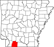
Town Unincorporated
communitiesAtlanta | Jefferson
Categories:- Cities in Arkansas
- Populated places in Columbia County, Arkansas
- Populated places in Arkansas with African American majority populations


Wikimedia Foundation. 2010.