- Cabot, Arkansas
Infobox Settlement
official_name = Cabot, Arkansas
settlement_type =City
nickname =
motto =
imagesize =
image_caption =
image_
imagesize =
image_caption =
image_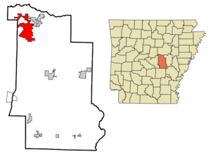
mapsize = 250x200px
map_caption =
mapsize1 =
map_caption1 =
subdivision_type = Country
subdivision_type1 = State
subdivision_type2 = County
subdivision_name =United States
subdivision_name1 =Arkansas
subdivision_name2 = Lonoke
government_type =
leader_title =Mayor
leader_name =Eddie Joe Williams
established_title = Founded
established_title2 = Incorporated
established_date = 1873
established_date2 = 1891
area_magnitude =
area_total_sq_mi = 19.2
area_total_km2 = 49.7
area_land_sq_mi = 19.1
area_land_km2 = 49.5
area_water_sq_mi = 0.1
area_water_km2 = 0.2
area_urban_sq_mi =
area_urban_km2 =
area_metro_sq_mi =
area_metro_km2 = |longm = 1 |longs = 20 |longEW = W
population_as_of = 2006, Estimate
population_note =
population_total = 21039
population_metro = 652,834(Little Rock/North Little Rock
population_urban =
population_density_km2 = 425.0
population_density_sq_mi = 1101.5
timezone = CST
utc_offset = -6
timezone_DST = CDT
utc_offset_DST = -5
latd = 34 |latm = 58 |lats = 22 |latNS = N
longd = 92
elevation_m = 91
elevation_ft = 299
website = [http://www.cabotar.gov/ www.cabotar.gov]
postal_code_type =ZIP code
postal_code = 72023
area_code = 501
blank_name = FIPS code
blank_info = 05-10300
blank1_name = GNIS feature ID
blank1_info = 0057487
footnotes =Cabot is the largest city in Lonoke County,
Arkansas ,United States . According to 2006 U.S. Census Bureau estimates, the population of the city is 21,040, ranking it as the state's 20th largest city, behind Van Buren.cite web | date =June 21 2006 | url = http://www.census.gov/popest/cities/tables/SUB-EST2005-04-05.csv | title = Annual Estimates of the Population for All Incorporated Places in Arkansas | format = CSV | work = 2005 Population Estimates | publisher = U.S. Census Bureau, Population Division | accessmonthday = November 16 | accessyear = 2006] It is part of the Little Rock–North Little Rock–Conway Metropolitan Statistical Area.Geography
According to the
United States Census Bureau , the city has a total area of 19.2square mile s (49.7km² ), of which, 19.1 square miles (49.5 km²) of it is land and 0.1 square miles (0.2 km²) of it (0.47%) is water.Demographics
As of the
census GR|2 of 2000, there were 15,261 people, 5,432 households, and 4,329 families residing in the city. Thepopulation density was 798.2 people per square mile (308.2/km²). There were 5,712 housing units at an average density of 298.8/sq mi (115.3/km²). The racial makeup of the city was 96.56% White, 0.33% Black or African American, 0.40% Native American, 0.88% Asian, 0.04% Pacific Islander, 0.49% from other races, and 1.30% from two or more races. 1.87% of the population were Hispanic or Latino of any race.There were 5,432 households out of which 47.1% had children under the age of 18 living with them, 65.7% were married couples living together, 10.7% had a female householder with no husband present, and 20.3% were non-families. 17.2% of all households were made up of individuals and 5.8% had someone living alone who was 65 years of age or older. The average household size was 2.78 and the average family size was 3.14.
In the city the population was spread out with 31.5% under the age of 18, 7.6% from 18 to 24, 34.0% from 25 to 44, 19.0% from 45 to 64, and 7.9% who were 65 years of age or older. The median age was 32 years. For every 100 females there were 95.8 males. For every 100 females age 18 and over, there were 89.9 males.
The median income for a household in the city was $49,389, and the median income for a family was $53,933. Males had a median income of $37,450 versus $26,209 for females. The
per capita income for the city was $19,020. About 5.6% of families and 7.1% of the population were below thepoverty line , including 7.9% of those under age 18 and 10.4% of those age 65 or over.History
Prior to settlement
Before the city of Cabot existed, an 1862
typhoid epidemic took the lives of about 1500 Confederate soldiers previously underAllison Nelson who were camped in the hills surrounding Cabot and nearbyAustin, Arkansas . 428 poorly marked graves were exhumed in 1905 by a group of Confederate veterans and moved to a new site atCamp Nelson Confederate Cemetery located in Cabot on Rye Drive, just off Cherry Road between Campground and Mount Carmel Roads. Marble gravestones were placed over each grave and a largemarble obelisk was erected to honor the dead. In 1982, a group of volunteers from Cabot began maintaining the cemetery, which had fallen into disrepair.Early history
The city of Cabot began as a small settlement at a refueling station on the
Cairo & Fulton Railroad . The settlement first appeared in the 1873 and is thought to have been named after a railroad surveyor. First Baptist Church was established in the late 1870s and the Bank of Cabot (now [http://communitybk.net Community Bank] ) was founded in 1903. The city of Cabot was officially incorporatedNovember 9 ,1891 as the 139th city in Arkansas.Cabot was often overshadowed in northern Lonoke County by the much larger city of Austin (originally named Oakland), which was briefly considered for the state capital. However, Cabot experienced growth during the 1950s and 1960s, due to its proximity to the
Little Rock Air Force Base in nearby Jacksonville which opened in 1955.Major transportation routes near/through Cabot are the railroad (currently owned by
Union Pacific ), the "old highway to St. Louis" (currently Arkansas Highway 367),US Highway 67 /167, andInterstate 40 . Historically, Cabot lay on the Memphis to Fort Smith spur of the Butterfield Overland Stagecoach Route.Recent history
A devastating
tornado hit downtown Cabot during the afternoon ofMarch 29 ,1976 , killing five people and destroying multiple buildings. During the rebuilding of the city, it was decided to build a new city hall, municipal courtroom, library (since relocated), and police station on the site of the debris-filled dividing point between the east and west sections of Main Street, creating City Plaza. Highway 89, which follows the same path as West Main Street in Cabot, was redirected around City Plaza along one block of Second Street, to continue its path along Pine Street just south of theCabot High School campus.Cabot has experienced phenomenal population growth from the 1980s to today. New housing starts, as seen by new subdivided developments, now cover the town. One reason for such growth was the aforementioned Air Force base, yet the more plausible explanation stems from a more complicated issue: the school district.
On
August 10 ,2006 , Cabot Junior High School North experienced a devastating fire which was believed to have started as a small electrical fire in the library caused by a faulty light bulb. There were 100 people in the building at the time, however fortunately no one was injured. The building burned from 2:30 P.M. to about 9:00 P.M., and the structure was a total loss. Cabot fire and Police Departments say that this is one of the worststructure fire s to have ever occurred in Cabot. The school was only about 8 years old.Miss USA 1983, Terri Utley, was from the city of Cabot.
White flight
In 1982, the
Little Rock School District , slow to comply to the 1954US Supreme Court caseBrown v. Topeka Board of Education , was forcibly ordered by federal courts to immediately desegregate the school district. This desegregation was ordered to achieve racial balances between white children and non-white children, which resulted in massive busing of students.The results of the court-ordered busing have been controversial. Critics claim the forced integration has destroyed the School District and any concept of "neighborhood schools": for example, black students from far east Little Rock (predominantly black), were sent to high schools in far west Little Rock (predominantly white). Supporters claim that the forced integration has fostered more diversity and better learning environments. Whatever the result, during the 1980s and 1990s Little Rock teachers repeatedly went on strike, and many residents relocated to the smaller communities around Little Rock, including Cabot, Benton, Bryant, Conway, and Maumelle. With time, new arrivals to the state chose to live in these towns (now veritable
suburb s) because, by some educational indicators, their school districts were more successful.Cabot received many families relocating during this time period. A 'commuter culture' developed as many residents lived in Cabot, sent their children to schools in Cabot, but worked in Little Rock. The Cabot School District steadily developed into one of the richest, most populous and top-performing districts in the state.
Critics of Cabot's growth, such as the Little Rock-based newspaper "
Arkansas Times ", accused these residents of "white flight ": simply giving up on an integrated Little Rock school district. While Cabot (and northernLonoke County as a whole) has historically been predominantly white, nearby towns, such as Austin, Ward, Vilonia, and Searcy, also lack diversity. The resulting "whiteness" of the area (just like theOzark Plateau or the pre-1990s Fayetteville-Springdale-Rogers area) seemingly owes itself more to historical migration patterns and historical slave ownership. Currently, the Cabot School District encompasses the north end of Lonoke County. The bulk of the county's population today can be found in approximately the same area, containing the county's most populous and fourth most populous cities — Cabot and Ward, respectively — in addition to Austin, which is among Arkansas' fastest growing communities.In recent years, Cabot has experienced rapid construction of new businesses and housing, due to its population boom. Many residents believe that this, along with a failure to add or widen roadways, is the cause of the city's traffic problems.
Culture
Culture in Cabot has largely taken cues from its growing population and their desire to avoid traveling far into the Little Rock metropolitan area for entertainment. Products of this include a movie theater and larger city library built in the late 1990s, plus a growing number of restaurants, parks, amateur sporting venues and community organizations. A top draw of the city is its golf courses adjoining Greystone Country Club in the city's north end, and near Rolling Hills Country Club in southeast Cabot. Both of the country clubs and the
Veterans of Foreign Wars post areexceptions to Cabot's legal status as part of adry county , which prohibits the sale of alcoholic beverages elsewhere in the city. One of the city's biggest events, staged in the downtown area each October, is Cabotfest — a community fair that has grown in popularity as the city's population has swelled over the years since the tornado.Notable events at the school district's campuses each year include a regional music student competition, a student musical theater production, and a community beauty pageant. The Cabot High School Band is currently directed by Joe Trusty and Mark Tenney and includes over 200 students. The band participates in many competitions, including the local Region VII and State competitions. The band has also recently been placed in a three-year rotation to represent the State of Arkansas in the National Independence Day Parade in Washington, D.C.
In addition to a strong music program, much of the family-heavy population revolves around the school system, and Friday night high school football games are always a packed, city-wide event. The football team won the AAA state championship in 1983 and the AAAAA state championship in 2000 under head coach Mike Malham, who was a 17th-round draft pick for the Chicago Bears in 1976. Now, he teaches geometry as well as coaches. In 2005, a new three story athletic complex was completed which contains an indoor practice field, weight room, and locker room, and coach offices. Also in the building is a live tv production studio in which students from Cabot Broadcasting film football games and transmit video onto the 12-foot by 12-foot jumbo tron outside.
Cabot High School has recently completed a remodeling process which includes a large new fine arts center, designed with the input from the directors of the band, drama, forensics, and art programs.
References
External links
* [http://www.cabotar.gov/ City of Cabot Official Website]
* The " [http://www.cabotstarherald.com/ Cabot Star-Herald] ", the locally-based weekly newspaper serving Cabot and northern Lonoke County
* [http://www.cabotalumni.com/ CabotAlumni.com] , The home page for Cabot High School alumni, family, and friends.
* [http://cabot.k12.ar.us/ Cabot Public Schools] , The home page for Cabot Public Schools
Wikimedia Foundation. 2010.