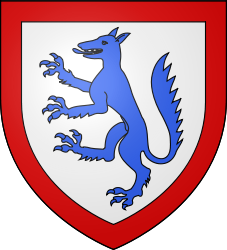
- Monieux
-
Monieux

Administration Country France Region Provence-Alpes-Côte d'Azur Department Vaucluse Arrondissement Carpentras Canton Sault Intercommunality Pays de Sault Mayor Alain Gabert
(2001–2008)Statistics Elevation 439–1,022 m (1,440–3,353 ft)
(avg. 700 m/2,300 ft)Land area1 47.12 km2 (18.19 sq mi) Population2 331 (2006) - Density 7 /km2 (18 /sq mi) INSEE/Postal code 84079/ 84390 1 French Land Register data, which excludes lakes, ponds, glaciers > 1 km² (0.386 sq mi or 247 acres) and river estuaries. 2 Population without double counting: residents of multiple communes (e.g., students and military personnel) only counted once. Coordinates: 44°04′05″N 5°21′35″E / 44.0680555556°N 5.35972222222°E
Monieux is a commune in the Vaucluse department in the Provence-Alpes-Côte d'Azur region in southeastern France.
Contents
Geography
The commune of Monieux is located on the plateau of the Mounts of Vaucluse, near to the commune of Sault. It shelters on its territory part of the classified as sites “Reserve of Biosphere” of the Ventoux Mount.
Hydrology
La Nesque flows through Monieux.
Climate
The commune is located in the zone of influence of the Mediterranean climate. The summers are hot and dry, related to the increase in altitude of the subtropical anticyclones, intersected with stormy episodes sometimes violent one. The winters are soft. Precipitations are not very frequent and rare snow. It there 275 days of sun per year.
Demography
Historical population of Monieux
(Source : INSEE[1])1962 1968 1975 1982 1990 1999 2006 139 151 122 171 158 250 323 Agriculture
It primarily confines in an activity of medium mountains of the type of Provence with a production of lavender, of lavandin, of old variety of wheat and of the derivative products. Sheep breeding and the production of honey holds also an important place.
City sites and monuments
- Vestiges of an old castel / medievale tower dated on 12th century
- Saint-Pierre Church, romane style, 12th century
- Saint Michel chapel(1643)
- Saint-Roch Chapel (1632).
- Saint-André chapel
- Distillings of lavender factories
- Gorges of Nesque
See also
References
- ^ (French) Monieux sur le site de l'Insee
Categories:- Communes of Vaucluse
- Vaucluse geography stubs
Wikimedia Foundation. 2010.


