- Geography of Greater Manchester
-
 Greater Manchester is heavily urbanised and consists of vast built up areas and many settlements.

The geography of Greater Manchester is dominated by one of the United Kingdom's largest metropolitan areas, and in this capacity the landlocked metropolitan county constitutes one of the most urbanised and densely populated areas of the country. There is a mix of high density urban areas, suburbs, semi-rural and rural locations in Greater Manchester, but overwhelmingly the land use in the county is urban.[1]
Greater Manchester is a landlocked county spanning 492.7 square miles (1,276 km²). The Pennines rise along the eastern side of the county, through parts of Oldham, Rochdale and Tameside. The West Pennine Moors, as well as a number of coalfields (mainly sandstones and shales) lie in the west of the county. The rivers Mersey and Tame run through the county boundaries, both of which rise in the Pennines. Other rivers run through the county, including the Beal, the Douglas, the Etherow, the Goyt, the Irk, the Medlock and the Roch. Black Chew Head is the highest point of Greater Manchester, rising 542 metres (1,778 ft) above sea-level, within the parish of Saddleworth.[2] Chat Moss at 10.6 square miles (27 km2) comprises the largest area of Grade 1 and 2 farmland in Greater Manchester and contains the largest block of semi-natural woodland in the county.[3] Brown Wardle Hill in Wardle is the most northerly point of Greater Manchester, and the suburb of Woodford the most southerly.
Greater Manchester has a strong regional central business district, formed by Manchester City Centre and the adjoining parts of the City of Salford and Trafford. However, Greater Manchester is also a polycentric county with ten metropolitan districts,[1] each of which has a major town centre – and in some cases more than one – and many smaller settlements. Greater Manchester is arguably the most complex urban area in the United Kingdom outside London,[1] and this is reflected in the density of its transport network and the scale of needs for investment to meet the growing and diverse movement demands generated by its development pattern.
Contents
Settlements
Main article: List of places in Greater ManchesterThe table below outlines many of the county's settlements, and is formatted according to their metropolitan borough.
Fringe and boundary
The outer boundary of Greater Manchester, roughly 130 miles (209 km), "passes through or near several areas of natural beauty".[4] To the northwest are the West Pennine Moors, and to the north and northeast the South Pennines. Parts of the Peak District National Park also cover the east and south east of Greater Manchester.
Urban Area
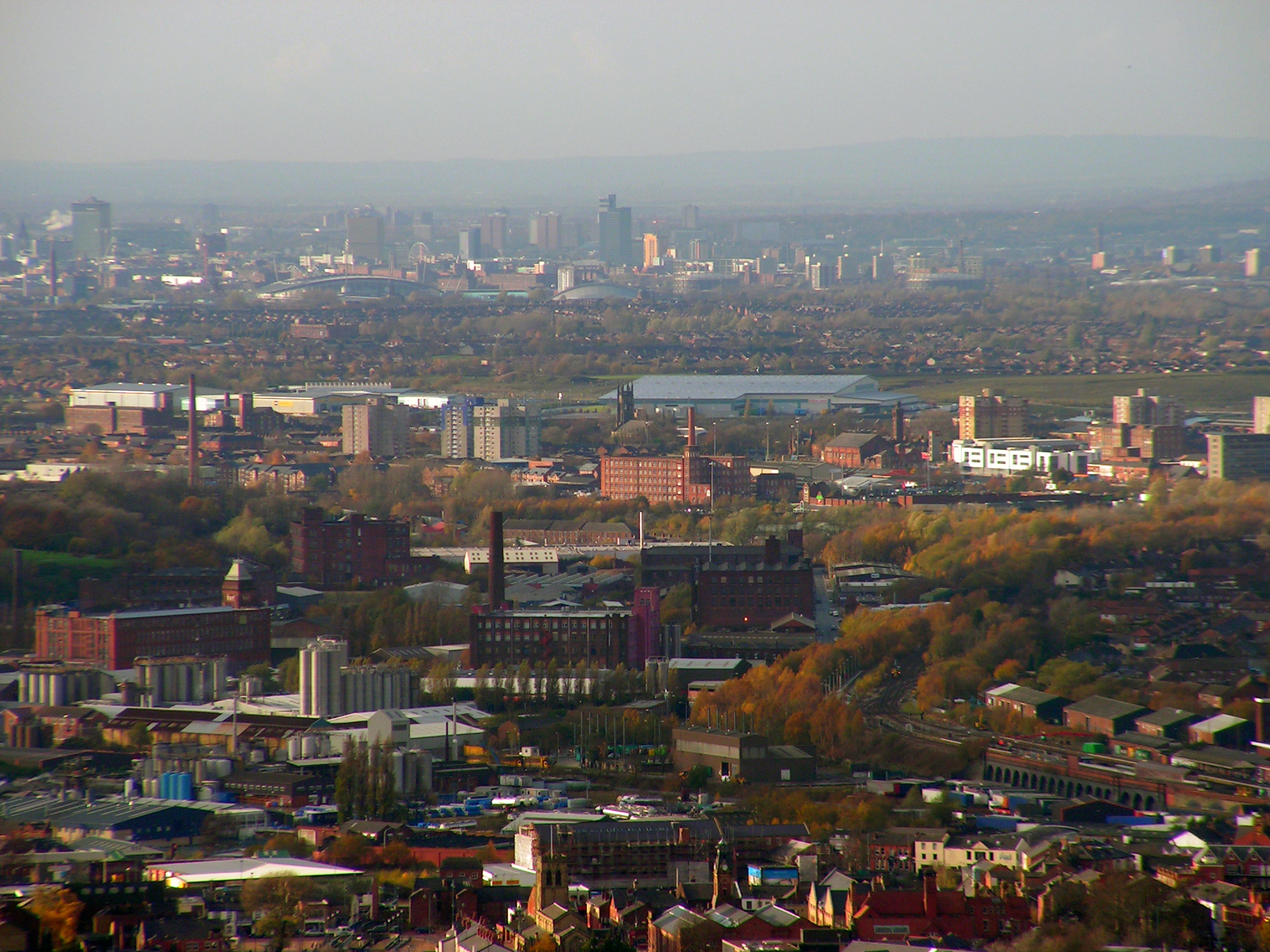
 An aerial photograph, centred on Manchester and Salford
The Greater Manchester Urban Area is the larger of two main conurbations defined by the Office of National Statistics that lie within the county boundaries, the other being the Wigan Urban Area.
The Greater Manchester Urban Area is an area of land defined by the Office for National Statistics consisting of the large conurbation surrounding and including the City of Manchester. Its territory spans much, but not all of the metropolitan county of Greater Manchester. It excludes settlements such as Wigan and Marple from the Greater Manchester county boundaries (Wigan itself forming the Wigan Urban Area), but includes some settlements which are outside of the county boundaries, such as Wilmslow and Alderley Edge in Cheshire, and Whitworth in Lancashire. Although neither the Greater Manchester county, nor the Greater Manchester Urban Area have been granted city status in the United Kingdom, European Union literature suggests that the conurbation surrounding Manchester constitutes a homogonous urban city region.[5]
Climate
Greater Manchester experiences a temperate maritime climate, like most of the British Isles, with relatively cool summers and mild winters. The county's average annual rainfall is 806.6 millimetres (31.76 in)[6] compared to the UK average of 1,125.0 millimetres (44.29 in),[7] and its mean rain days are 140.4 per annum,[6] compared to the UK average of 154.4.[7] The mean temperature is slightly above average for the United Kingdom;[8] Greater Manchester also has a relatively high humidity level, which lent itself to the optimised and breakage-free textile manufacturing which took place around the county. Snowfall is not a common sight in the built up areas, due to the urban warming effect. However, the Pennine and Rossendale Forest hills around the eastern and northern edges of the county receive more snow, and roads leading out of the county can be closed due to heavy snowfall,[9] notably the A62 road via Standedge, the A57 (Snake Pass) towards Sheffield,[10] and the M62 over Saddleworth Moor.
Climate data for Manchester (Ringway) 69m asl, 1971-2000, extremes 1960-2005 Month Jan Feb Mar Apr May Jun Jul Aug Sep Oct Nov Dec Year Record high °C (°F) 14.3
(57.7)15.2
(59.4)21.7
(71.1)23.4
(74.1)26.7
(80.1)31.3
(88.3)32.2
(90.0)33.7
(92.7)28.4
(83.1)25.6
(78.1)17.2
(63.0)15.1
(59.2)33.7
(92.7)Average high °C (°F) 6.9
(44.4)7.3
(45.1)9.5
(49.1)11.9
(53.4)15.7
(60.3)18.0
(64.4)20.3
(68.5)20.1
(68.2)17.1
(62.8)13.5
(56.3)9.6
(49.3)7.6
(45.7)13.13
(55.63)Average low °C (°F) 1.5
(34.7)1.6
(34.9)3.1
(37.6)4.5
(40.1)7.4
(45.3)10.1
(50.2)12.3
(54.1)12.1
(53.8)10.0
(50.0)7.2
(45.0)3.9
(39.0)2.3
(36.1)6.33
(43.40)Record low °C (°F) −12
(10.4)−13.1
(8.4)−9.7
(14.5)−4.9
(23.2)−1.6
(29.1)2.0
(35.6)6.0
(42.8)3.6
(38.5)0.8
(33.4)−3
(26.6)−6.8
(19.8)−13.5
(7.7)−13.5
(7.7)Rainfall mm (inches) 71.5
(2.815)51.8
(2.039)64.0
(2.52)49.1
(1.933)53.8
(2.118)66.8
(2.63)59.5
(2.343)70.9
(2.791)69.9
(2.752)86.0
(3.386)81.9
(3.224)81.4
(3.205)806.6
(31.756)% humidity 87 86 86 85 82 84 86 88 89 89 87 87 86.3 Avg. rainy days (≥ 1mm) 13.6 10.1 12.1 10.5 10.1 11.5 10.0 11.0 11.3 13.2 13.6 13.4 140.4 Avg. snowy days 9 7 5 2 0 0 0 0 0 0 2 5 30 Sunshine hours 49.6 67.0 95.2 138.9 188.8 172.5 183.8 170.5 127.2 97.7 60.6 42.8 1,394.6 Source no. 1: [11] Source no. 2: [12] References
Notes
- ^ a b c Greater Manchester Passenger Transport Authority. "The Greater Manchester Area and its Regional Context". gmltp.co.uk. http://www.gmltp.co.uk/gmltp2_html/section_123173639918.html. Retrieved 2007-04-11.
- ^ Dawson, A., (1992), The Relative Hills of Britain - Chapter 6: The County Tops, Cicerone Press, Milnthorpe, Cumbria.
- ^ Salford City Council (2007). "Chat Moss" (http). salford.gov.uk. http://www.salford.gov.uk/living/planning/naturalenvironment/landscape/chatmoss.htm. Retrieved 2007-11-13.
- ^ Phythian 1992, p. 4.
- ^ State of the English Cities: Volume 1 Produced for the Office of the Deputy Prime Minister, (2006). Online Report Accessed December 17, 2006.
- ^ a b "Manchester Airport 1971–2000 weather averages". Met Office. 2001. http://www.metoffice.gov.uk/climate/uk/averages/19712000/sites/manchester_airport.html. Retrieved 2007-07-15.
- ^ a b "UK 1971–2000 averages". Met Office. 2001. http://www.metoffice.gov.uk/climate/uk/averages/19712000/areal/uk.html. Retrieved 2007-07-15.
- ^ Met Office (2007). "Annual UK weather averages". Met Office. http://www.metoffice.gov.uk/climate/uk/averages/19712000/areal/uk.html. Retrieved 2007-04-23.
- ^ "Roads chaos as snow sweeps in Manchester". Manchester Evening News. 2005. http://www.manchestereveningnews.co.uk/news/s/147/147321_roads_chaos_as_snow_sweeps_in.html. Retrieved 2007-07-15.
- ^ "Peak District sightseer's guide – Snake Pass". High Peak. 2002. http://www.highpeak.co.uk/hp/h_snakbd.htm. Retrieved 2007-07-06.
- ^ "Climate averages 1971–2000, gathered at the weather station at Manchester Airport.". Met Office. 2008-11-19. http://www.metoffice.gov.uk/climate/uk/averages/19712000/sites/manchester_airport.html. Retrieved 2011-08-11.
- ^ "Manchester, England Climate". Myforecast.com. 2010-10-20. http://www.myforecast.com/bin/climate.m?city=60903&metric=true. Retrieved 2011-08-11.
Bibliography
- Phythian, Graham (1992). The Greater Manchester Boundary Walk. Sigma Press. ISBN 1-85058-284-X.
Ceremonial county of Greater Manchester Statutory City Region - Greater Manchester Combined Authority
- Greater Manchester Statutory City Region
Metropolitan districts Major settlements - Altrincham
- Ashton-in-Makerfield
- Ashton-under-Lyne
- Atherton
- Audenshaw
- Blackley
- Bolton
- Bury
- Cadishead
- Chadderton
- Clifton
- Denton
- Droylsden
- Dukinfield
- Eccles
- Failsworth
- Farnworth
- Golborne
- Heywood
- Hindley
- Horwich
- Hyde
- Irlam
- Kearsley
- Leigh
- Littleborough
- Manchester
- Middleton
- Milnrow
- Mossley
- Oldham
- Partington
- Pendlebury
- Prestwich
- Radcliffe
- Ramsbottom
- Rochdale
- Royton
- Sale
- Salford
- Shaw and Crompton
- Stalybridge
- Stockport
- Stretford
- Swinton
- Tottington
- Tyldesley
- Urmston
- Walkden
- Westhoughton
- Whitefield
- Wigan
- Worsley
See also: List of civil parishes in Greater Manchester
Rivers Topics - Castles
- Churches
- Demography
- Football clubs
- Geography
- Grade I listed buildings
- Grade II* listed buildings
- Museums
- Parliamentary constituencies
- People
- Places
- Schools
- SAMs
- SSSIs


Wikimedia Foundation. 2010.