- Dollis Hill House
-
Dollis Hill House 
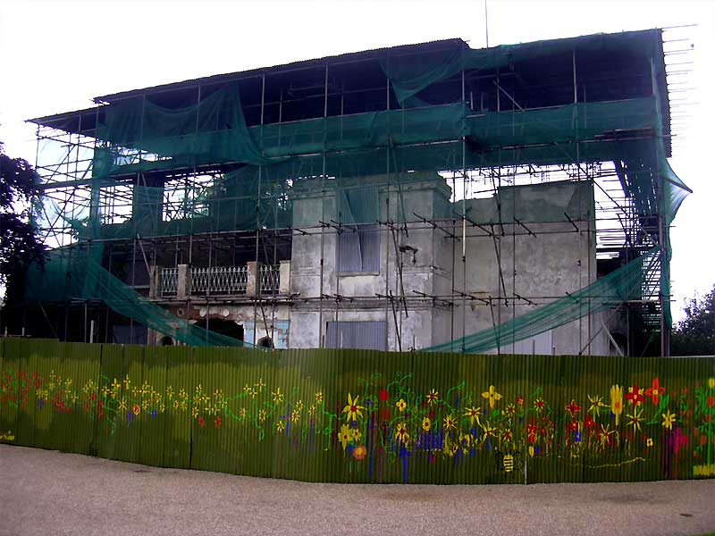
The front of Dollis Hill House, surrounded by scaffoldingGeneral information Town or city Dollis Hill, London Country United Kingdom Completed 1825 Dollis Hill House is an early Nineteenth-Century farmhouse located in the North London suburb of Dollis Hill, on the northern boundary of Gladstone Park. Noteworthy guests such as William Ewart Gladstone and Mark Twain have been entertained there. Today, the house is a derelict ruin, having been all but destroyed by fire in the 1990s. Dollis Hill House is a Grade II listed building and listed as grade A on the English Heritage Buildings at Risk Register.[1]
Contents
History
Dollis Hill House was built as a farmhouse in 1825 by the Finch family when the Dollis Hill area was still rural. It was later occupied by Sir Dudley Coutts Marjoribanks, who subsequently became Lord Tweedmouth.
 William Ewart Gladstone
In 1881 Lord Tweedmouth's daughter and her husband, Lord Aberdeen, took up residence. They often had Prime Minister William Ewart Gladstone to stay as a guest. Other guests at the house included Joseph Chamberlain, Lord Rosebery, and Lord Randolph Churchill, father of Winston Churchill.[2]
In 1897 Lord Aberdeen was appointed Governor-General of Canada and the Aberdeens moved out. When Willesden Urban District Council acquired the house and land in 1899, they named the park Gladstone Park after the old Prime Minister who had died the previous year.
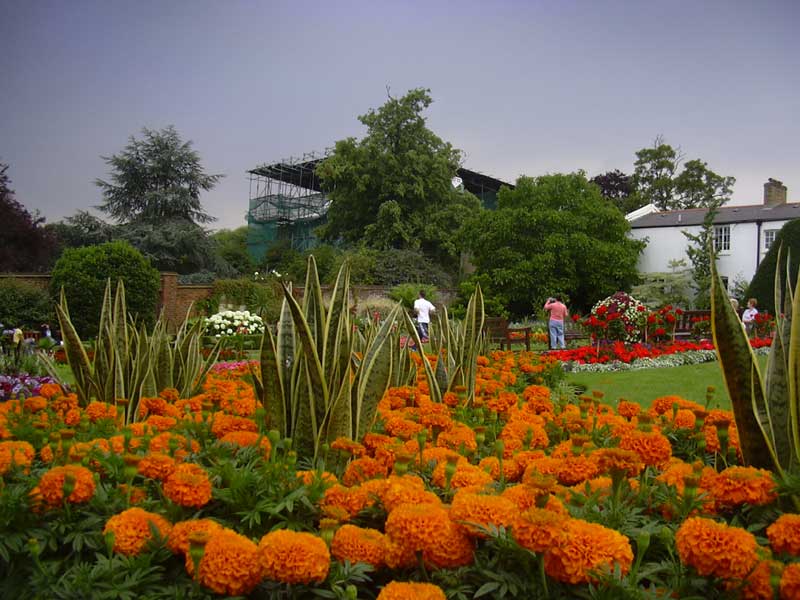
 The house as seen from the gardens
Newspaper proprietor Hugh Gilzean-Reid occupied the house after the Aberdeens moved out, and his guests included the American author Mark Twain, who stayed at Dollis Hill house in the summer of 1900. Twain wrote that he had "never seen any place that was so satisfactorily situated, with its noble trees and stretch of country, and everything that went to make life delightful, and all within a biscuit's throw of the metropolis of the world." "There is no suggestion of city here; it is country, pure and simple, and as still and reposeful as is the bottom of the sea." He later wrote "Dollis Hill comes nearer to being a paradise than any other home I ever occupied".[3]
The house was opened to the public in 1909, but it was used as a hospital during the First World War. In the Second World War, Winston Churchill's War Cabinet met there during 1941.
From 1974 the house was used for training courses for catering students, until it was closed in 1989. Two major fires in 1995 and 1996 damaged the house badly, and it is now derelict. On February 20, 2011, a third fire broke out in the basement of Dollis Hill house, the gate had been forced open, and the fire is believed to have been caused by intruders. [4]
Various proposals were made for redeveloping the house as a pub, but were rejected by local residents. [5] In 2006, Ken Livingstone (then Mayor of London) offered funding to support the renovation costs, but the funding was withdrawn by his successor, Boris Johnson. Dollis Hill House Trust has worked to find a solution in accordance with Brent Council's stipulations, teaming up briefly with social enterprise, [Training for Life]. When funding failed, the Council declared its intention to initiate an application for demolition. Rescue plans are still underway.
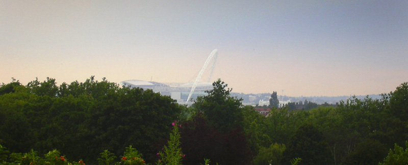
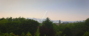 The view looking west from the house over Brent to Wembley Stadium
Future
The Dollis Hill House Trust is a charity which works to restore historic Dollis Hill House in Gladstone Park to create a vibrant community, arts and heritage centre. [1]
In June 2008 the Heritage Lottery Fund awarded match funding of £1.2 million to enable restoration of the house. All plans for the House must include community use.
In April 2011 Brent Council announced that all attempts to save Dollis Hill House had failed, and that they had been given permission by the Secretary of State for Communities and Local Government to demolish the building. [2]
References
- ^ "English Heritage Buildings at Risk Register". English Heritage. 2007. http://www.english-heritage.org.uk/server/show/ConBar.3738. Retrieved 2007-07-03.
- ^ "Brent Heritage - Gladstone Park". Brent Heritage. 2002. http://www.brent-heritage.co.uk/dollis_hill_house.htm. Retrieved 2007-07-03.
- ^ "History of Dollis Hill House". Dollis Hill House Trust. 2006. http://www.dollishillhouse.org.uk/history.htm. Retrieved 2007-07-03.
- ^ "Dollis Hill House - Fire". Dollis Hill House Org, UK. 2011-02-20. http://www.dollishillhouse.org.uk/popup.php?id=30. Retrieved 2011-09-19.
- ^ "Dollis Hill House - The Campaign". Kilburn Times. 2008-06-27. http://www.kilburntimes.co.uk/content/camden/kilburntimes/news/story.aspx?brand=KLBTOnline&category=news&tBrand=northlondon24&tCategory=newsklbt&itemid=WeED27%20Jun%202008%2011%3A12%3A30%3A317. Retrieved 2008-07-09.
External links
- Dollis Hill House in Gladstone Park on Brent Heritage
- Mark Twain on Brent Heritage
- Dollis Hill House feature on BBC Inside Out London, 24 October 2007
Coordinates: 51°33′35″N 0°14′13″W / 51.559641°N 0.237078°W
Categories:- Grade II listed buildings in London
- Buildings on the Buildings at Risk Register
- Houses in Brent
Wikimedia Foundation. 2010.