- Cherryland, California
-
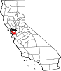
Cherryland — Census-designated place — Location in Alameda County and the state of California
Coordinates: 37°40′46″N 122°06′12″W / 37.67944°N 122.10333°WCoordinates: 37°40′46″N 122°06′12″W / 37.67944°N 122.10333°W Country  United States
State  California
County Alameda Government - State Senate Ellen Corbett (D) - State Assembly Mary Hayashi (D) - U. S. Congress Barbara Lee (D) (CA-09)
Pete Stark (D) (CA-13)Area[1] - Total 1.197 sq mi (3.101 km2) - Land 1.197 sq mi (3.101 km2) - Water 0 sq mi (0 km2) 0% Elevation 66 ft (20 m) Population (2010) - Total 14,728 - Density 12,304.1/sq mi (4,749.4/km2) Time zone Pacific (PST) (UTC-8) - Summer (DST) PDT (UTC-7) ZIP code 94541 Area code(s) 510 FIPS code 06-12902 GNIS feature ID 1867005 Cherryland is a census-designated place (CDP) in Alameda County, California, United States. The unincorporated community is located between the cities of San Leandro to the north and Hayward to the south. The population was 14,728 at the 2010 census.
Contents
Geography
According to the United States Census Bureau, the CDP has a total area of 1.2 square miles (3.1 km²), all of it land. San Lorenzo Creek runs partly through the town.
Demographics
2010
The 2010 United States Census[2] reported that Cherryland had a population of 14,728. The population density was 12,301.9 people per square mile (4,749.8/km²). The racial makeup of Cherryland was 6,035 (41.0%) White, 1,698 (11.5%) African American, 200 (1.4%) Native American, 1,404 (9.5%) Asian, 310 (2.1%) Pacific Islander, 4,016 (27.3%) from other races, and 1,065 (7.2%) from two or more races. Hispanic or Latino of any race were 7,955 persons (54.0%).
The Census reported that 14,272 people (96.9% of the population) lived in households, 277 (1.9%) lived in non-institutionalized group quarters, and 179 (1.2%) were institutionalized.
There were 4,643 households, out of which 1,963 (42.3%) had children under the age of 18 living in them, 1,850 (39.8%) were opposite-sex married couples living together, 844 (18.2%) had a female householder with no husband present, 391 (8.4%) had a male householder with no wife present. There were 447 (9.6%) unmarried opposite-sex partnerships, and 50 (1.1%) same-sex married couples or partnerships. 1,131 households (24.4%) were made up of individuals and 324 (7.0%) had someone living alone who was 65 years of age or older. The average household size was 3.07. There were 3,085 families (66.4% of all households); the average family size was 3.64.
The population was spread out with 3,956 people (26.9%) under the age of 18, 1,457 people (9.9%) aged 18 to 24, 4,728 people (32.1%) aged 25 to 44, 3,339 people (22.7%) aged 45 to 64, and 1,248 people (8.5%) who were 65 years of age or older. The median age was 32.3 years. For every 100 females there were 101.9 males. For every 100 females age 18 and over, there were 101.0 males.
There were 4,975 housing units at an average density of 4,155.5 per square mile (1,604.4/km²), of which 1,458 (31.4%) were owner-occupied, and 3,185 (68.6%) were occupied by renters. The homeowner vacancy rate was 1.5%; the rental vacancy rate was 5.4%. 4,439 people (30.1% of the population) lived in owner-occupied housing units and 9,833 people (66.8%) lived in rental housing units.
2000
As of the census[3] of 2000, there were 13,837 people, 4,658 households, and 3,018 families residing in the CDP. The population density was 11,859.2 people per square mile (4,566.2/km²). There were 4,823 housing units at an average density of 4,133.6 per square mile (1,591.6/km²). The racial makeup of the CDP in 2010 was 20.9% non-Hispanic White, 10.8% Black or African American, 0.4% Native American, 9.2% Asian, 1.9% Pacific Islander, 0.2% from other races, and 2.7% from two or more races. 54.0% of the population were Hispanic or Latino of any race.
There were 4,658 households out of which 37.2% had children under the age of 18 living with them, 41.0% were married couples living together, 16.0% had a female householder with no husband present, and 35.2% were non-families. 25.9% of all households were made up of individuals and 7.6% had someone living alone who was 65 years of age or older. The average household size was 2.87 and the average family size was 3.46.
In the CDP the population was spread out with 27.0% under the age of 18, 10.4% from 18 to 24, 35.6% from 25 to 44, 17.5% from 45 to 64, and 9.5% who were 65 years of age or older. The median age was 32 years. For every 100 females there were 105.0 males. For every 100 females age 18 and over, there were 101.0 males.
The median income for a household in the CDP was $42,880, and the median income for a family was $44,319. Males had a median income of $34,830 versus $29,724 for females. The per capita income for the CDP was $16,929. About 9.0% of families and 12.3% of the population were below the poverty line, including 13.9% of those under age 18 and 12.1% of those age 65 or over.
Government
Cherryland is an unincorporated community and thus is governed directly by the County of Alameda. The area is policed by the Alameda County Sheriff's Office.
History
Cherryland comprises largely the residential subdivision of the vast orchards (2,200 acres (8.9 km2)) of San Lorenzo pioneer William Meek, often called the "first farmer" of Alameda County. Meek Mansion is located there, which is maintained by the Hayward Area Recreation and Park District, in conjunction with the Hayward Area Historical Society.
References
- ^ U.S. Census
- ^ All data are derived from the United States Census Bureau reports from the 2010 United States Census, and are accessible on-line here. The data on unmarried partnerships and same-sex married couples are from the Census report DEC_10_SF1_PCT15. All other housing and population data are from Census report DEC_10_DP_DPDP1. Both reports are viewable online or downloadable in a zip file containing a comma-delimited data file. The area data, from which densities are calculated, are available on-line here. Percentage totals may not add to 100% due to rounding. The Census Bureau defines families as a household containing one or more people related to the householder by birth, opposite-sex marriage, or adoption. People living in group quarters are tabulated by the Census Bureau as neither owners nor renters. For further details, see the text files accompanying the data files containing the Census reports mentioned above.
- ^ "American FactFinder". United States Census Bureau. http://factfinder.census.gov. Retrieved 2008-01-31.
External links
Municipalities and communities of Alameda County, California County seat: Oakland Cities Alameda | Albany | Berkeley | Dublin | Emeryville | Fremont | Hayward | Livermore | Newark | Oakland | Piedmont | Pleasanton | San Leandro | Union City
CDPs Ashland | Castro Valley | Cherryland | Fairview | San Lorenzo | Sunol
Unincorporated
communitiesAlbrae | Altamont | Asco | Baumberg | Brightside | Brookshire | Carpenter | Dougherty | Dresser | East Pleasanton | Farwell | Hall Station | Halvern | Kilkare Woods | Komandorski Village | Lorenzo Station | Mattos | Mendenhall Springs | Midway | Mountain House | Mowry Landing | Radum | San Ramon Village | Scotts Corner | Sorenson | Verona
Former settlements Alden | Alvarado | Ann | Decoto | Drawbridge | Eden Landing | Elliot | Goecken | Greenville | Hacienda | Hayward Heath | Laddville | Larkin's Landing | Mallard | Melita | Merienda | Monte Vista | Remillard | Robert | Russell City | Stokes Landing | Tesla
Categories:- Census-designated places in Alameda County, California
- Populated places in California with Hispanic majority populations


Wikimedia Foundation. 2010.