- Durham, California
-
Durham — Census-designated place — Location in Butte County and the State of California
Coordinates: 39°38′24″N 121°47′52″W / 39.64°N 121.79778°WCoordinates: 39°38′24″N 121°47′52″W / 39.64°N 121.79778°W Country  United States
State  California
County Butte Government – N/A – State Senate Doug LaMalfa (R) – State Assembly Jim Nielsen (R) – U. S. Congress Wally Herger (R) Area[1] – Total 81.933 sq mi (212.205 km2) – Land 81.781 sq mi (211.812 km2) – Water 0.152 sq mi (0.393 km2) 0.19% Elevation 161 ft (49 m) Population (2010) – Total 5,518 – Density 67.3/sq mi (26/km2) Time zone PST (UTC-8) – Summer (DST) PDT (UTC-7) ZIP codes 95938, 95958 Area code(s) 530 FIPS code 06-20270 GNIS feature IDs 0277502; 2408696 U.S. Geological Survey Geographic Names Information System: Durham, California; U.S. Geological Survey Geographic Names Information System: Durham, California Durham is a census-designated place (CDP) in Butte County, California, United States. The population was 5,518 at the 2010 census.
Contents
Geography
According to the United States Census Bureau, the CDP has a total area of 81.9 square miles (212 km2), of which, 81.8 square miles (212 km2) of it is land and 0.14 square miles (0.36 km2) of it (0.19%) is water. Durham's main agricultural products are almonds and walnuts.
History
Durham was founded by the Durham Family. It is named for W. W. Durham, member of the California State Assembly.[2] The Durham House still stands today as a reminder of what Durham was back in its early years. Durham was a town in which a railroad ran through and still does today. The railroad is what developed this town and kept it alive. The Durham Flour Mill, which burned down several times, was an integral part of this community.
On June 1, 2011, a tornado rated at EF-1, struck south of Durham, uprooting thousands of almond trees, destroying an out building and damaging a barn.[3]
Demographics
2010
The 2010 United States Census[4] reported that Durham had a population of 5,518. The population density was 67.3 people per square mile (26.0/km²). The racial makeup of Durham was 5,088 (92.2%) White, 19 (0.3%) African American, 55 (1.0%) Native American, 35 (0.6%) Asian, 9 (0.2%) Pacific Islander, 165 (3.0%) from other races, and 147 (2.7%) from two or more races. Hispanic or Latino of any race were 614 persons (11.1%).
The Census reported that 5,509 people (99.8% of the population) lived in households, 9 (0.2%) lived in non-institutionalized group quarters, and 0 (0%) were institutionalized.
There were 2,113 households, out of which 713 (33.7%) had children under the age of 18 living in them, 1,286 (60.9%) were opposite-sex married couples living together, 181 (8.6%) had a female householder with no husband present, 103 (4.9%) had a male householder with no wife present. There were 111 (5.3%) unmarried opposite-sex partnerships, and 15 (0.7%) same-sex married couples or partnerships. 413 households (19.5%) were made up of individuals and 188 (8.9%) had someone living alone who was 65 years of age or older. The average household size was 2.61. There were 1,570 families (74.3% of all households); the average family size was 2.99.
The population was spread out with 1,303 people (23.6%) under the age of 18, 428 people (7.8%) aged 18 to 24, 1,166 people (21.1%) aged 25 to 44, 1,828 people (33.1%) aged 45 to 64, and 793 people (14.4%) who were 65 years of age or older. The median age was 43.3 years. For every 100 females there were 99.3 males. For every 100 females age 18 and over, there were 97.8 males.
There were 2,242 housing units at an average density of 27.4 per square mile (10.6/km²), of which 1,561 (73.9%) were owner-occupied, and 552 (26.1%) were occupied by renters. The homeowner vacancy rate was 1.4%; the rental vacancy rate was 3.5%. 4,089 people (74.1% of the population) lived in owner-occupied housing units and 1,420 people (25.7%) lived in rental housing units.
2000
As of the census[5] of 2000, there were 5,220 people, 1,914 households, and 1,466 families residing in Durham. The population density was 63.8 people per square mile (24.6/km²). There were 1,986 housing units at an average density of 24.3 per square mile (9.4/km²). The racial makeup of the CDP was 92.18% White, 0.13% Black or African American, 0.79% Native American, 0.61% Asian, 0.11% Pacific Islander, 3.58% from other races, and 2.59% from two or more races. 8.98% of the population were Hispanic or Latino of any race.
There were 1,914 households out of which 37.4% had children under the age of 18 living with them, 64.2% were married couples living together, 7.9% had a female householder with no husband present, and 23.4% were non-families. 18.8% of all households were made up of individuals and 7.6% had someone living alone who was 65 years of age or older. The average household size was 2.72 and the average family size was 3.10.
In Durham, the population was spread out with 28.1% under the age of 18, 7.0% from 18 to 24, 25.6% from 25 to 44, 26.4% from 45 to 64, and 13.0% who were 65 years of age or older. The median age was 39 years. For every 100 females there were 99.8 males. For every 100 females age 18 and over, there were 97.0 males.
The median income for a household in Durham was $53,306, and the median income for a family was $61,373. Males had a median income of $42,568 versus $27,885 for females. The per capita income for the CDP was $26,361. About 4.2% of families and 6.1% of the population were below the poverty line, including 5.7% of those under age 18 and 6.0% of those age 65 or over.
References
- ^ U.S. Census
- ^ Durham, David L. (1998). California's Geographic Names: A Gazetteer of Historic and Modern Names of the State. Quill Driver Books. p. 229. ISBN 9781884995149.
- ^ http://www.sacbee.com/2011/06/01/3668954/damage-assessed-from-tornadoes.html Sacramento Bee
- ^ All data are derived from the United States Census Bureau reports from the 2010 United States Census, and are accessible on-line here. The data on unmarried partnerships and same-sex married couples are from the Census report DEC_10_SF1_PCT15. All other housing and population data are from Census report DEC_10_DP_DPDP1. Both reports are viewable online or downloadable in a zip file containing a comma-delimited data file. The area data, from which densities are calculated, are available on-line here. Percentage totals may not add to 100% due to rounding. The Census Bureau defines families as a household containing one or more people related to the householder by birth, opposite-sex marriage, or adoption. People living in group quarters are tabulated by the Census Bureau as neither owners nor renters. For further details, see the text files accompanying the data files containing the Census reports mentioned above.
- ^ "American FactFinder". United States Census Bureau. http://factfinder.census.gov. Retrieved 2008-01-31.
Municipalities and communities of Butte County, California Cities and towns 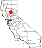
CDPs Bangor | Berry Creek | Butte Creek Canyon | Butte Meadows | Butte Valley | Cherokee | Clipper Mills | Cohasset | Concow | Durham | Forbestown | Forest Ranch | Honcut | Kelly Ridge | Magalia | Nord | Oroville East | Palermo | Rackerby | Richvale | Robinson Mill | South Oroville | Stirling City | Thermalito | Yankee Hill
Unincorporated
communitiesAnita | Barber | Big Bar | Big Bend | Blavo | Brush Creek | Camp Eighteen | Cana | Centerville | Chapmantown | Craig | Cresta | Dayton | Deadwood | DeSabla | Dodge Place | Dodgeland | East Biggs | East Gridley | Elsey | Esquon | Fagan | Feather Falls | Helltown | Hughes Place | Hurleton | Inskip | Irish Town | James | Jonesville | Junction House | Kister | Kramm | Lomo | Lovelock | Lumpkin | Mayaro | Merrills Landing | Merrimac | Mineral Slide | Nelson | Nelsons Crossing | Nimshew | Oak Grove | Old Forbestown | Oregon City | Oroleve | Oroville Junction | Paradise Pines | Parkhill | Peachton | Pentz | Poe | Powellton | Pulga | Ramada | Rancho Llano Seco | Riceton | Richardson Springs | Robinsons Corner | Roble | Rogerville | Shippee | Stirling Junction | Sunnyslope | The Pines | Toadtown | Vista Robles | Wicks Corner | Wyandotte
Ghost towns Appleton | Avon | Bagdad | Bauka | Bayu | Berdan | Bidwell | Bidwell's Bar | Big Ripples | Blinzing | Bloomer | Brush | Butte Creek | Center Ville | Chandon | Channel | Chardon | Clear Creek | Colbys Landing | Coutolenc | Craig | Crouch | David | Dawlytown | Diamondville | Dredge | Enterprise | Eskini | Evans | Evansville | Flea Valley | Gimbal | Gold Lake | Greenland | Gridley Colony Number One | Gridley Colony Number Two | Hamilton | Haselbusch | Hawk Ravine | Hokomo | Holhoto | Honcut City | Hume | Hylandville | Intake | Isaiah | Johnson | Kalkalya | Kulaiapto | Land | Las Plumas | Lava Beds | Long's Bar | Lorraine | Losee | Luce | Lynchburg | Martinsburgh | McKay Meadow | Michopdo | Mill City | Millers Ranch | Mortimer | Moseley | Mulberry | Neals Diggins | Nelson Bar | New Blinzing | Oak Arbor | Ololopa | Omit Bar | Optimo | Oregon Bar | Orloff | Ostrander | Otaki | Pacific Heights | Paki | Paradise Flat | Phillips Corner | Pipers | Platts | Pond | Potter's Bar | Powellton Meadow | Quartz | Richland | Rio Seco | Rock Creek | Savona | Soto | South Fork | Speedway | Stanwood | Summit | Sundale | Sunusi | Swayne | Swedes Flat | Sycamore Crossing | Tadoiko | Taikus | Tarr's Ranch | Tilden | Tolle's Old Diggings | Totoma | Tsuka | Virginia Mills | Wagners | Wagstaff | Ward | West Branch | Whiskey Flat (east) | Whiskey Flat (west) | Yankee Flat | Yauko | Yuman
Categories:- Census-designated places in Butte County, California


Wikimedia Foundation. 2010.