- South Norwood
-
Coordinates: 51°23′58″N 0°04′29″W / 51.3995°N 0.0747°W
South Norwood 
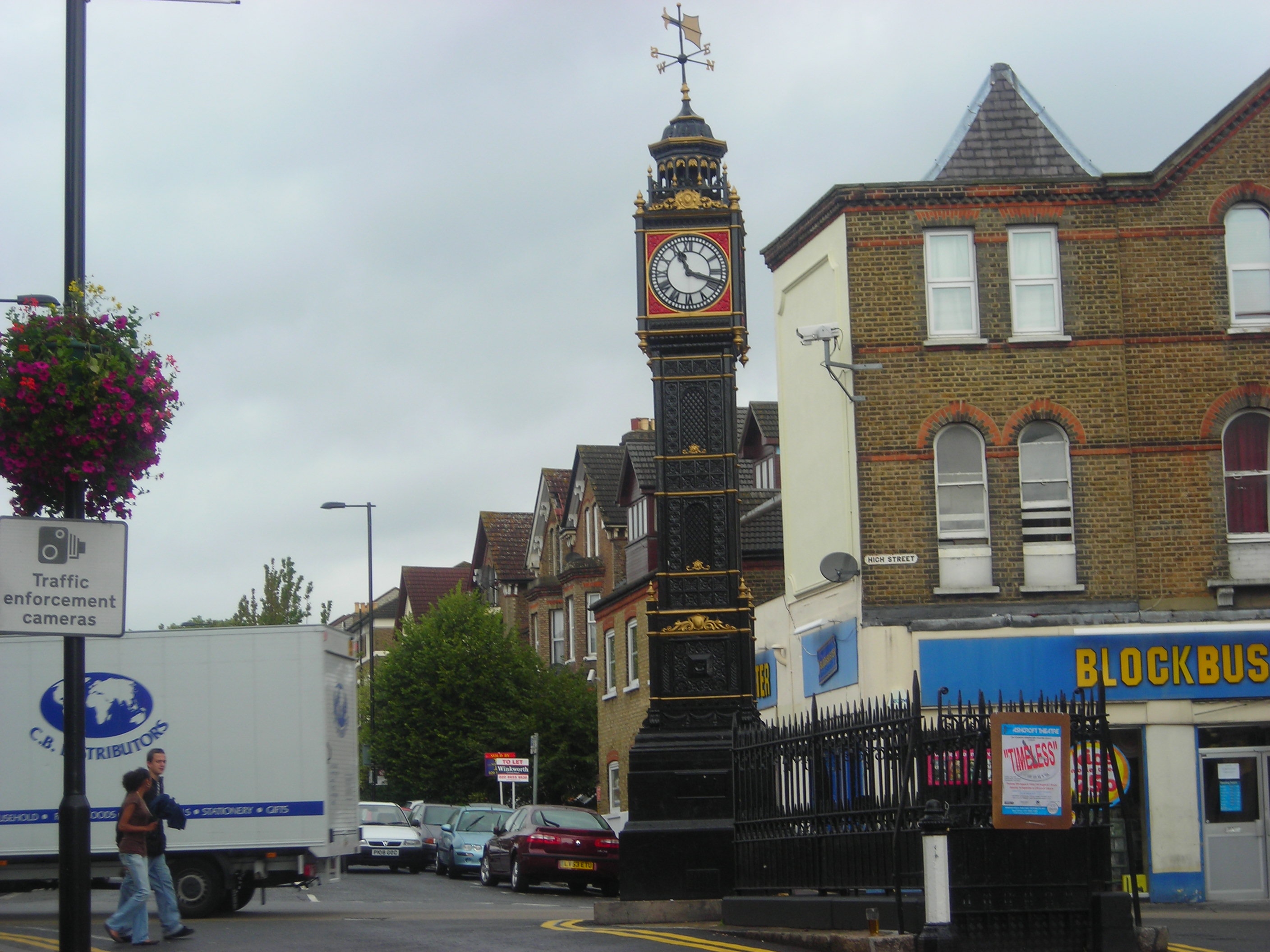
South Norwood Clock tower
 South Norwood
South Norwood shown within Greater LondonPopulation 14,835 (South Norwood ward 2007)[1] OS grid reference TQ340684 London borough Croydon Ceremonial county Greater London Region London Country England Sovereign state United Kingdom Post town LONDON Postcode district SE25 Dialling code 020 Police Metropolitan Fire London Ambulance London EU Parliament London UK Parliament Croydon Central Croydon North London Assembly Croydon and Sutton List of places: UK • England • London South Norwood is an urban town and in south London, England, in the London Borough of Croydon. It is a suburban development 7.8 miles (12.5 km) south-east of Charing Cross. South Norwood is an electoral with a resident population in 2001 of just over 14,000.[2] A tributary of the River Wandle, which rises in Merton, ends in South Norwood.
The south-eastern side of the town is dominated by the 125-acre (0.51 km2) country park which opened in 1989. At the other northern end of the town is South Norwood Lake, which was created after the reservoir for the unsuccessful Croydon Canal went out of use.[3][4] It is used by the Croydon Sailing Club and local anglers who fish for carp, bream and perch.
Together with Norwood New Town, it forms the ward of South Norwood in the local authority of Croydon. There are two secondary schools in the area along with a public leisure centre. The town has a high street which forms part of Selhurst Road which includes a number of banks, estate agents and a coffee house. It is a commuter town, with many residents travelling to either the financial and insurance districts of Croydon or the City of London for employment via the large railway station. The town and surrounding areas are covered by the London SE25 postcode.
Contents
History
Handley's Brickworks' seven chimneys once dominated the landscape of the area. It has been demolished and the site changed into grassland and a lake, called Brickfields Meadow. Over 20 pubs were to be found in a 1½ mile radius, but many of these have closed. Some of South Norwood's famous pubs, such as the Jolly Sailor and the Albert, are still busy.[5]
Arthur Conan Doyle lived on Tennison Road in South Norwood, from 1891 to 1894, but, contrary to popular belief, did not use the area as the setting for the Sherlock Holmes story The Adventure of the Norwood Builder. This story, for the most part, takes place in Lower Norwood (today known as West Norwood). The only connection between this story and South Norwood is that South Norwood's railway station Norwood Junction is used by the villain.[6] The NatWest Bank on South Norwood High Street was, in Victorian times and until the mid 1980s, the local police station and is the most likely candidate for the police station mentioned in the second Sherlock Holmes story The Sign of Four.[6]
D. H. Lawrence taught at Davidson School before the First World War. In 1966, a dog called Pickles discovered the FIFA World Cup Jules Rimet Trophy under a bush in Beulah Hill which was stolen during a public rare stamp exhibition at Westminster Central Hall.[7]
The area was originally covered by the Great North Wood which was a natural oak forest that covered four miles (6 km) of South London. Apart from South Norwood, the wood covered Upper Norwood, West Norwood (known as Lower Norwood until 1885) and the Woodside and Gipsy Hill areas reflect the past history of the area. The wood covered more of Lambeth and Southwark than Croydon, but the name Norwood is itself a reminder that it had closer connection with Croydon than with Lambeth or London.[8]
Jolly-sailor station opened in 1839 by the London and Croydon Railway. It was listed as Jolly-sailor near Beulah Spa on fare lists and timetables. The station was renamed Norwood in 1846. The station was immediately adjacent to a level crossing over Portland Road, making it slightly further north than the site currently occupied by Norwood Junction. As part of the construction works for the atmospheric-propulsion system, the worlds first railway flyover (overpass) was constructed south of Tennison Road, to carry the new atmospheric-propulsion line over the conventional steam line below.[9] In 1847, the atmospheric propulsion experiment was abandoned.
The Croydon Canal ran from New Cross to the site of West Croydon station. As it passed through South Norwood, pubs sprung up near its course. The Jolly Sailor still stands at the intersection of South Norwood Hill and High Street. The Ship, a few yards to the east, was beside the loading point for bricks from a nearby brick field across what is now High Street. The passageway through which bricks passed to the canal is still there. The Goat House pub (which has since been demolished) was said to have been named after an island in the canal on which goats were kept.
South Norwood is now unofficially divided into the less deprived area in the north west side of the railway, which was the location of a private estate, and the generally more deprived area in the north east.[10] In the south east of the borough, where workers for a former brick factory lived, the entrance to the estate was between a pair of pillars, though they have long since been demolished. However the capitals were preserved and now sit on the two brick pillars at the Selhurst Road entrance to South Norwood Recreation Ground. In 2006, South Norwood Lakes in the north of the ward was the scene of a fatal stabbing.[11]
Governance
South Norwood was part of the county of Surrey and the County Borough of Croydon until 1965, when following the enactment of the London Government Act 1963 it became part of Greater London. The town is now part of the wards of South Norwood and Woodside in the local authority of Croydon, which has the responsibility for providing services such as education, refuse collection, and tourism. Woodside ward is currently represented by Labour Councillors Karen Jewitt, Tony Newman and Paul Scott. South Norwood ward is currently represented by Labour Councillors Jane Avis, Kathy Bee and Wayne Lawlor.[12]. South Norwood Ward is part of the ethnically diverse Croydon North constituency, which had one of the largest electorates in England at the 2010 general election, whereas Woodside Ward falls within the boundaries of the Croydon Central constituency. The area also forms part of the London constituency of the European Parliament. The sitting Member of Parliament for Croydon North is Malcolm Wicks, a member of the Labour Party, whereas the sitting Member of Parliament for Croydon Central is Gavin Barwell, a member of the Conservative Party.
The police service is provided by the Metropolitan Police with the South Norwood Police Station close to High Street. The London Fire Brigade provide services for the area and Greater London as a whole. The nearest fire station is at Woodside which has only one pumping appliance.
Geography
Neighbouring areas 
Upper Norwood Anerley Elmers End Thornton Heath 
Woodside  South Norwood

Beddington Selhurst Croydon South Norwood is bordered by Anerley to the north, Selhurst to the south, Woodside due east and Thornton Heath to the west. The northernmost point of South Norwood is at Beaulieu Heights (alternatively spelt Beulah Heights, Beaulah Heights and Beulieu Heights) which contains Beulah Heights Park, overlapping with Upper Norwood and New Town. The northern part of the district is situated on the lower parts of the hill that forms Upper Norwood.
South Norwood lies on the southern slopes of the Norwood Ridge which forms the southern edge of the London Basin. This line of hills runs from north-east to south-west for about three miles (5 km) and rises to approximately 360 feet (110 m) above sea level at its highest point. It is formed by a ridge of grey silty deposits known as London Clay, capped in places with the gravel of the Claygate Beds. Because of this gravel working was an important local industry and at one time the road along Beulah Hill was called Gravel Pit Road. South Norwood Hill is the most southerly spur of this ridge and the London Clay extends at its foot to the southern edge of the South Norwood Country Park. Here a brook marks the junction with the sands and gravels of the Blackheath Beds that rise to Shirley, Addington Hills and Croham Hurst. Streams join Chaffinch Brook and the Beck to form the River Pool which eventually flows into the River Ravensbourne.[13]
Education
 South Norwood Library
There are many primary schools in the South Norwood area including Priory Special School, Heavers Farm Primary School, South Norwood Primary School, Cypress Junior School and Cypress Infant School, St. Chad's Roman Catholic Primary School, St. Mark's Primary School and Ryelands Primary School.
The former Stanley Technical High School (the legacy of local inventor and engineer William Stanley) has been replaced and turned into an academy as part of the Harris Federation. After deliberation with local residents, it was originally going to be called Harris at Stanley, but the federation changed it to Harris Academy South Norwood which came with some controversy.[14] Many local residents are upset that the name Stanley was removed from the school, as Stanley, who had the original school built in 1907, is a famous and well regarded figure in South Norwood.[15] Harris City Academy Crystal Palace is a city academy in the north west of South Norwood, but to avoid confusion with the other school it uses the Crystal Palace name.
South Norwood has also been the home of Spurgeon's College, a world-famous Baptist theological college, since 1923; Spurgeon's is located on South Norwood Hill and currently has some 1,000 students. It is one of only four further eductation establishments in the borough.
South Norwood Library is located on Selhurst Road.[16] The building is arranged over five levels split across the front and rear of the building. The front part of the building has the ground floor entrance level, which houses the reception, and the second floor which houses the children's library. The rear of the building has the basement, first and third floors. The levels are offset so that the floors in the front and rear of the building appear like mezzanine levels to each other.
Sports and leisure
See also: List of parks and open spaces in CroydonSouth Norwood F.C. were an amateur football club who were active in the 1870s and played their home matches at Portland Road.[17] They have been described as "one of the best in England at that time".[18]
Park Road, Holmesdale Road and Whitehourse Lane hold Selhurst Park where Crystal Palace FC plays. The ground was also home to Charlton Athletic FC as part of a ground sharing agreement between 1985 and 1991. It was also used by Wimbledon FC when they left Plough Lane until 2003.
South Norwood contains a leisure centre which is owned and maintained by Fusion on behalf of Sport Croydon.[19] South Norwood Leisure Centre is situated on Portland Road and reopened in late 2007 after refurbishment. It was closed in early 2006 so that it would be knocked down and construction would start on a site next to the Croydon Sports Arena. This was so that it could be redesigned from scratch like the leisure centre in Thornton Heath, which would result in a cost of around £10 million.[20]
 South Norwood Country Park
In May 2006 the Conservatives gained control of Croydon and decided that doing this would cost too much money, so they decided to refurbish the centre instead, although this decision came with controversy.[21][22] It now includes a 25m swimming pool and a gym.
South Norwood is also the home to South Norwood Country Park, a former sewage works which closed in 1966, and of a fireworks factory now converted into a nature reserve. Other parks in the local area are South Norwood Recreation Ground, Heavers Meadow, Brickfields Meadow, Beaulieu Heights, South Norwood Lake and Grounds, Woodside Green and Ashburton Park. During the 1960s, the height of the Cold War, several buildings on this site were used for mock atomic attacks to enable rescue workers to gain experience. Volunteers would use theatrical make-up and act out specific wounds while controlled fires would burn around them.
Croydon Sports Arena
Croydon Sports Arena is a multiple use sports arena in South Norwood.[23] The arena is located on the edge of South Norwood Country Park. Facilities include an eight lane 400m running track, with a centre field and training area for throwing events. The stadium is floodlit. During the winter the inner field becomes a football pitch, home to Croydon Juniors Football Club and Croydon FC.[23] In the summer the stadium is mostly used for athletic events, hosting several large meetings such as the Surrey Athletic Championships and the occasional international event.[specify] The arena is used for special events as well as serious sports and training. The stands in the sports arena can hold up to 388 people.[specify]
Other clubs who use the stadium are athletics club Striders of Croydon[24] and Croydon Harriers[25] an athletics club for all ages, all levels in track & field and road & country.[26]
Transport
Roads
Two A roads, the A215 and the A213 are in the South Norwood area. The A213 is High Street, Penge Road and Selhurst Road. The A215 is Portland Road and South Norwood Hill.
 The junction to the north of Arena. This tram is entering South Norwood Country Park
Rail
Norwood Junction railway station is situated in the centre of South Norwood just off High Street. It has 7 platforms but only 5 are in use at the present time. Southern and London Overground trains run to London Bridge and Dalston Junction. Fast trains generally take 10 minutes to reach central London and slow trains 20 minutes. Also Victoria station trains take 20 minutes. East and West Croydon stations and urban and rural stations thereafter including regular train service to Clapham Junction, Wandsworth Common, Balham, Streaham. The other nearest railway stations include Selhurst and can get direct trains to Olympia and Shepherd's Bush via a train service to Milton Keynes.
The Thameslink Programme (formerly known as Thameslink 2000), is a £3.5 billion major project to expand the Thameslink network from 51 to 172 stations[27] spreading northwards to Bedford, Peterborough, Cambridge and King's Lynn and southwards to Guildford, Eastbourne, Horsham, Hove to Littlehampton, East Grinstead, Ashford and Dartford. The project includes the lengthening of platforms, station remodelling, new railway infrastructure (e.g. viaduct) and additional rolling stock. If implemented, First Capital Connect services would call at the station.
Transport for London began work on the southern extension of the East London Line as part of the London Overground. On completion in May 2010, services run between West Croydon and Dalston Junction via London Docklands.[28]
Trains make an unpublicised stop at Selhurst from Victoria through the night to enable engineers at Selhurst to get to Gatwick and vice versa. This means that it is possible to board the train during the night all through the early hours of morning to South Norwood. However, the trains state East Croydon on the board. Trains run out of Victoria after 1.00am on the hour until the train service start up again officially.
Trams
Trams do not run through the town centre of South Norwood, however the nearest tram stop on the Tramlink network is Harrington Road tram stop. If current proposals for an extension to Crystal Palace[29] are approved, then a second stop at Penge Road will be opened. There is also another tram stop next to Croydon Sports Arena called Arena. South Norwood is served by many London bus routes.
Buses
For buses to Central London,[30] daytime routes 196 and 468 run to Elephant and Castle,[31] while night time route N68 will get you to Tottenham Court Road.[32] Route 75 runs between Croydon and Lewisham through South Norwood. There are also two bus stands in South Norwood both at Norwood Junction railway station, one on the west side of the railway lines (for the 197 and the 312 bus routes) and the east side of the lines (for the 130 and 196 bus routes). Other routes include the London Buses route 157 and 410. All of these services are operated by either Selkent, Travel London, Arriva London, Metrobus, London Central and London General.
References
- ^ "Mid-2007 Population Estimates for 2007 Wards in England". Office for National Statistics. 2009. http://www.statistics.gov.uk/statbase/Product.asp?vlnk=13893. Retrieved 8 February 2010.
- ^ "Key Figures for 2001 Census: Key Statistics". Office for National Statistics. http://neighbourhood.statistics.gov.uk/dissemination/LeadKeyFigures.do?a=3&b=5942181&c=south+norwood&d=14&e=15&g=330906&i=1001x1003x1004&m=0&enc=1. Retrieved 29 April 2007.
- ^ "South Norwood Lake & Grounds webpage". Croydon Council. http://www.croydon.gov.uk/leisure/parksandopenspaces/parksatoz/southnorwoodlake/. Retrieved 18 June 2007.
- ^ London Canals: Croydon: Norwood[dead link]
- ^ "The Jolly Sailor history and review". Random Pub Finder. http://www.randompubfinder.com/review.php?Name=The_Jolly_Sailor,_64_High_St,_South_Norwood&Pub=694. Retrieved 11 July 2008.
- ^ a b Duncan, Alistair (2009) Close to Holmes: A Look at the Connections Between Historical London, Sherlock Holmes and Sir Arthur Conan Doyle, London: MX Publishing; ISBN 1-904312-50-0
- ^ REID, ALASTAIR (10 September 1966). "The World Cup". The New Yorker. http://www.newyorker.com/archive/content/articles/060703fr_archive01. Retrieved 2 February 2007.
- ^ 'Norwood: Introduction', Survey of London: volume 26: Lambeth: Southern area (1956), pp. 167-173 British History Online
- ^ Connor, J.E. (2006). London's Disused Stations: The London Brighton & South Coast Railway. Colchester: Connor & Butler. p. 70. ISBN 978 0 947699 39 2.
- ^ Croydon Decennial Health Atlas 2004 NHS Croydon
- ^ "Girl, 16, charged with stab death". BBC News. 3 June 2006. http://news.bbc.co.uk/1/hi/england/london/5043628.stm. Retrieved 2 March 2007.
- ^ "Who are my councillors?". Croydon Council. http://www.croydon.gov.uk/democracy/elected/allcouncillors/.
- ^ "The Geology of South Norwood". Croydon Online. http://www.croydononline.org/history/topics/geology2.asp. Retrieved 11 July 2008.
- ^ "South Norwood residents demand Stanley's name is retained at new Harris Academy". Croydon Labour. http://www.croydonlabour.com/press_releases?PageId=df052888-b778-1504-c5dd-bede095be195. Retrieved 2 March 2007.[dead link]
- ^ "Harris Academy, South Norwood" (DOC). Consultation Document. Croydon Council. 17 January 2007. http://www.croydon.gov.uk/candd/consultation/npinfo/southnorwood/145322/499291/499311.doc. Retrieved 2 March 2007.[dead link]
- ^ "South Norwood Library". Croydon Council. http://www.croydon.gov.uk/leisure/libraries/croydonslibraries/snorwoodlibrary. Retrieved 29 April 2007.[dead link]
- ^ Collett, Mike (2003). The Complete Record of the FA Cup. Sports Books. p. 557. ISBN 1-8998-0719-5.
- ^ Bone, David Drummond (1890). "Famous Association Players—Past and Present". Scottish Football Reminiscences and Sketches. http://www.gutenberg.org/files/28028/28028-h/28028-h.htm. Retrieved 5 October 2011.
- ^ South Norwood Pools and Leisure Centre Croydon Council
- ^ "South Norwood Pools close". London Pools Campaign. 2006. http://www.londonpoolscampaign.com/discuss/msgReader$806. Retrieved 2 May 2007.
- ^ "Message Forum on South Norwood Pools". Croydon Guardian. 2006. http://www.yourlocalguardian.co.uk/interactive/messageforum/view.php?threadid=829.com. Retrieved 2 May 2007.
- ^ "Pool plans are approved despite 3,000 signature petition". Croydon Guardian. 2006. http://www.yourlocalguardian.co.uk/interactive/messageforum/view.php?threadid=829.com. Retrieved 2 May 2007.
- ^ a b "Croydon Sports Arena". London Borough of Croydon. Archived from the original on September 2, 2006. http://web.archive.org/web/20060902213850/http://www.croydon.gov.uk/leisure/sports/swim/croydonsportsarena/. Retrieved 20 April 2007.
- ^ "Club Information". Striders of Croydon. http://www.stridersofcroydon.co.uk. Retrieved 29 April 2007.
- ^ "Croydon Harriers". http://www.croydonharriers.com/. Retrieved 29 April 2007.
- ^ "Croydon Harriers". The Association of Running Clubs. http://www.british-athletics.co.uk/clubs/club0096.htm. Retrieved 29 April 2007.
- ^ "Good news for South London as £3.5BN Thameslink project clears major hurdle" (Press release). Network Rail. 18 October 2006. http://www.networkrailmediacentre.co.uk/Content/Detail.asp?ReleaseID=2413&NewsAreaID=2&SearchCategoryID=8. Retrieved 12 April 2007.
- ^ Full service begins on newly extended East London Line BBC News, 23 May 2010
- ^ "Croydon Tramlink Crystal Palace extension - Public consultation on route options in Anerley and Crystal Palace" (PDF). Transport for London. 19 October 2006. http://www.tfl.gov.uk/assets/downloads/Consultation-Brochure-2006-10-19.pdf. Retrieved 12 April 2007.[dead link]
- ^ "Central London Bus Map" (PDF). Transport for London. http://www.tfl.gov.uk/assets/downloads/centlond.pdf. Retrieved 12 April 2007.
- ^ "Bus Services from Norwood Junction". Transport for London. http://www.tfl.gov.uk/tfl/gettingaround/maps/buses/pdf/norwoodjunction-2195.pdf. Retrieved 12 April 2007.
- ^ "Bus Route N68". Transport for London. http://www.tfl.gov.uk/tfl/gettingaround/maps/buses/?route=N68. Retrieved 12 April 2007.
External links
- News, Sport and information - This is... Network
- Virtual Norwood
- Arthur Conan Doyle's house in South Norwood
London Borough of Croydon Districts Addington · Addiscombe · Ashburton · Broad Green · Coombe · Coulsdon · Croydon · Crystal Palace · Forestdale · Hamsey Green · Kenley · New Addington · Monks Orchard · Norbury · Norwood New Town · Purley · Sanderstead · Selhurst · Selsdon · Shirley · South Croydon · South Norwood · Thornton Heath · Upper Norwood · Waddon · Woodside
Attractions Street markets Parks and open spaces Addington Hills · Addington Park · Addington Vale · Addiscombe Railway Park · Addiscombe Recreation Ground · Apsley Road Playground · Ashburton Park · Ashburton Playing Fields · Beaulieu Heights · Brickfields Meadow · Coombe Wood · Cotelands · Duppas Hill · Grangewood Park · Great North Wood · Heavers Meadow · Mitcham Common · Park Hill · Pollards Hill · Queen's Gardens · Roundshaw · Selsdon Wood · South Norwood Country Park · South Norwood Lake and Grounds · South Norwood Recreation Ground · Woodside Green
Constituencies Other topics Architecture (Croydon Vision 2020 • Tallest buildings and structures) · Economy · People · Public art · Railway stations · SchoolsCategories:- Districts of Croydon
- Arthur Conan Doyle
- Districts of London


Wikimedia Foundation. 2010.