- Oakley, California
-
City of Oakley — City — Location in Contra Costa County and the state of California
Coordinates: 37°59′51″N 121°42′45″W / 37.9975°N 121.7125°WCoordinates: 37°59′51″N 121°42′45″W / 37.9975°N 121.7125°W Country  United States
State  California
County Contra Costa Government - Mayor Jim Frazier - Senate Mark Desaulnier (D) - Assembly Joan Buchanan (D) - U. S. Congress John Garamendi (D) Area[1] - Total 16.155 sq mi (41.842 km2) - Land 15.853 sq mi (41.059 km2) - Water 0.302 sq mi (0.783 km2) 1.87% Elevation 20 ft (6 m) Population (2010) - Total 35,432 - Density 2,193.3/sq mi (846.8/km2) Time zone PST (UTC-8) - Summer (DST) PDT (UTC-7) ZIP code 94561 Area code(s) 925 FIPS code 06-53070 GNIS feature ID 0277567 Website ci.oakley.ca.us Oakley is a city in Contra Costa County, California, United States. The population was 35,432 at the 2010 U.S. Census. Oakley is part of the East Contra Costa Bicycle Plan, which has existing facilities in Oakley as well as plans for further expansion.[2]
Contents
Geography and environment
The Oakley areas offers access to the Delta de Anza Regional Trail.[3] According to reports provided by CNN[4] Oakley experiences 21.16 inches of annual rainfall with high temperature in July of 96.0 F and low temperature in January of 40.0 F. Oakley experiences 52% clear days throughout the year.
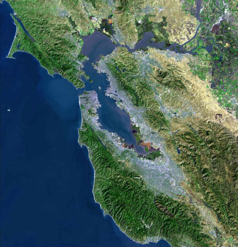
The City of Oakley is located in the eastern region of Contra Costa County and is within the nine-county San Francisco Bay Area. Oakley’s west border is situated at the intersection of Highway 4 and Highway 160, which provide access to San Francisco, San Jose, Sacramento, and the Central Valley. To the south is the city of Brentwood and to the east is the Central Valley. Oakley is a Delta community with the San Joaquin River on the northern border. The southwestern skyline is dominated by Mt. Diablo. This isolated 3,849 feet peak is visible from most of the San Francisco Bay Area and much of northern California.
Boundaries
Prior to 1963, creating a new city in California only required a petition, a public hearing (where 51 percent of the landowners could approve the desire to incorporate) and an election. During the 1950s over 50 new cities incorporated, and in Los Angeles County alone, 10 new cities incorporated in 1957. Interestingly, no thought was given as to how or who would pay the costs for the necessary services needed to sustain a city. Fire, police, water and sanitation services were often provided by a number of different and overlapping entities.
In an effort to gain control over this kluge of overlapping services and control the proliferation of incorporations, Governor Edmund G Brown, Sr. created the Commission on Metropolitan Area Problems, in 1959. The Commission was given the task of studying and making recommendations on the “misuse of land resources” and the growing complexity of overlapping local government jurisdictions.
The Knox-Nisbit Act of 1963 contained the Commission’s recommendations on local government reorganization resulting in the creation of the Local Agency Formation Commission or LAFCO, operating in every county. Additional powers were given to LAFCO in the District Reorganization Act of 1965, the Municipal Organization Act of 1977, the Cortese-Knox Local Government Reorganization Act 1985 and the Cortese-Knox-Hertz Local Government Reorganization Act of 2000.
One of the services mandated to LAFCO was to create a Municipal Service Reviews (MSRs) of all local agencies. An MSR is a comprehensive study designed to better inform LAFCO, local agencies, and the community about the provision of municipal services. Service reviews capture and analyze information about the governance structures and efficiencies of service providers and identify opportunities for greater coordination and cooperation between providers.
The last MSR for Oakley was created in 2008 and can be found here.[5]
Government
The City of Oakley is a General-Law City, as opposed to a Charter City, formed under State legislative statutes and governed by a body of laws in the State Constitution. As of July 1, 2008, there are 479 cities in California, 372 general law cities and 107 charter cities. Of the 19 cities in Contra Costa County, Richmond and San Ramon are the only cities with a charter. Only 147 of the cities in California elevate the position of mayor to a public electable position. In Contra Costa County, Antioch, Brentwood, Martinez, San Ramon and Richmond are the only cities that have chosen this route.
Oakley operates under a council-manager form of government. It was developed in an effort to avoid the corruption and inefficiency surfacing, at that time, in some eastern cities in the latter part of the nineteenth century. It has proved to be the most successful and popular model of local government in most communities across the United States. It currently represents over 100 million citizens in over 2,500 cities in the U.S.
The Oakley City Council consists of five non-partisan council members elected “at large” for staggered four-year terms each. Oakley’s City Council (as well as those council members from the other 19 cities) are considered part-time because, aside from being council members they have full-time jobs. This part-time nature of the council opens up opportunities for ordinary citizens who are working in the private sector to participate.
Annually,at the first Council meeting in December, the Mayor is selected by a majority of the City Council from among currently serving Council Members. At this time a Vice Mayor is also selected. This is the standard method among general law cities. Cal. Govt. Code § 36801: “The city council shall . . . choose one of its number as mayor, and one of its number as mayor pro tempore.” However, a general law city is permitted to have a mayor that is directly elected by the voters, if certain procedures are followed.
Oakley’s mayor presides at council meetings, appoints council members to various internal and external committees, attends community events as the council’s representative, and performs other ministerial duties. The vice mayor presides in the mayor’s absence. California’s Constitution establishes that every council member, including the Mayor has only one vote. Even a directly elected Mayor can only have one vote.
History
Native Americans Society
Archeologists have found prehistoric sites in the Oakley area. One substantial shell mound was discovered early in the twentieth century near what is now the east edge of town. The Northwest Information Center of the California Historical Resources Information System now keeps track of archeological investigations undertaken in Oakley. Around three-dozen such projects have been completed in the past 25 years, yielding only four prehistoric sites in the City. However, the information center believes there is a high possibility that other prehistoric sites remain within the City.
The first accounts of identifiable cultural community in the west delta are attributed to the Bay Miwoks, who occupied the region between 1100 and 1770 A.D. The Bay Miwok people, usually called the Julpunes or Pulpunes by European explorers, were organized into “tribelets”—political units that included several fairly permanent villages and a set of seasonal campsites arrayed across a well-defined territory.Spanish Exploration
Spanish incursions into the Oakley area began in the 1770s. The first to enter what are now the City limits was the De Anza expedition of 1775-76. However, after a failed attempt to find a route through the tule swamps to the Sierra, the De Anza expedition returned to Monterey. Subsequent expeditions by the Spanish did not result in colonization. Europeans settled in the Delta in the 1800s, but were killed by malaria and smallpox.Contemporary History
The name Oakley is of Old English origin and its meaning is “meadow of oak trees”. This aptly describes the area when first settled and to some extent even today. However, if not for the flip of a card and cribbage board the community may have been named Dewey. Instead of the Oak Leaf logo it may have been a dew drop. City founder Randolph Marsh wanted to name the city Dewey, after Admiral Dewey. Mr. Marsh was impressed with the exploits of Admiral Dewey at the Battle of Manila Bay during the Spanish-American War. His friend J.T. Whitman preferred the name “Oakley” because the terrain was largely meadows and oaks. To determine which name would prevail they battled it out over a game of cribbage. Marsh may have lost the game and the right to name the city but he ensured his immortality by choosing downtown street names whose first initials spelled “Marsh” — Main, Acme, Ruby, Star and Home.
Oakley's first post office was established in 1898,[6] and Oakley only became an incorporated city a full 101 years later, in 1999.[7] The city's motto is, "A Place for Families in the Heart of the Delta."Police Services
In the year 2000, Oakley Police took over from the Sheriff and CHP, one year after the city incorporated. Police services had been provided under a $2.5 million contract with the sheriff's office.[8] The staff presently includes twenty-eight officers, one parking enforcement officer, and two part-time clerks.[9] The department is located behind City Hall on Main St.
Traffic enforcement is the primary responsibility of all patrol officers. With the addition of two motorcycles to the mobile fleet, there are now two officers specifically assigned to traffic enforcement. Juvenile matters are handled by a full time School Resource officer. Oakley still relies on the sheriff's office for homicide, serious sexual assault, and narcotics investigations. Oakley's Traffic Unit handles collision investigations that result in the serious injury or death of a motorist or pedestrian.[10]
Funding has been made available for additional personnel. Two of these positions now make up the City’s “Problem Oriented Policing” (POP) team. POP Officers do not have “beat” responsibilities (i.e. they are not responsible for handling routine service calls). This frees them to address quality of life issues within the City. POP Officer duties include contacting homes where drug dealing is suspected and where chronic parties occur, assist in searching for wanted suspects, and address neighborhoods where the department receives an inordinate number of service calls. Using both traditional and non-traditional law enforcement techniques, the goal is to mitigate these types of neighborhood problems and find long-term solutions. The non-emergency dispatch number for the Police Department is 925-625-8855.
Demographics
2010
The 2010 United States Census[11] reported that Oakley had a population of 35,432. The population density was 2,193.2 people per square mile (846.8/km²). The racial makeup of Oakley was 22,641 (63.9%) White, 2,582 (7.3%) African American, 314 (0.9%) Native American, 2,236 (6.3%) Asian, 142 (0.4%) Pacific Islander, 4,998 (14.1%) from other races, and 2,519 (7.1%) from two or more races. Hispanic or Latino of any race were 12,364 persons (34.9%).
The Census reported that 35,329 people (99.7% of the population) lived in households, 75 (0.2%) lived in non-institutionalized group quarters, and 28 (0.1%) were institutionalized.
There were 10,727 households, out of which 5,479 (51.1%) had children under the age of 18 living in them, 6,531 (60.9%) were opposite-sex married couples living together, 1,412 (13.2%) had a female householder with no husband present, 708 (6.6%) had a male householder with no wife present. There were 747 (7.0%) unmarried opposite-sex partnerships, and 93 (0.9%) same-sex married couples or partnerships. 1,522 households (14.2%) were made up of individuals and 515 (4.8%) had someone living alone who was 65 years of age or older. The average household size was 3.29. There were 8,651 families (80.6% of all households); the average family size was 3.62.
The population was spread out with 10,808 people (30.5%) under the age of 18, 3,531 people (10.0%) aged 18 to 24, 10,149 people (28.6%) aged 25 to 44, 8,553 people (24.1%) aged 45 to 64, and 2,391 people (6.7%) who were 65 years of age or older. The median age was 32.0 years. For every 100 females there were 98.8 males. For every 100 females age 18 and over, there were 96.9 males.
There were 11,484 housing units at an average density of 710.8 per square mile (274.5/km²), of which 8,163 (76.1%) were owner-occupied, and 2,564 (23.9%) were occupied by renters. The homeowner vacancy rate was 3.4%; the rental vacancy rate was 5.5%. 26,778 people (75.6% of the population) lived in owner-occupied housing units and 8,551 people (24.1%) lived in rental housing units.
2000
As of the census[12] of 2000, there are 25,619 people, 7,832 households, and 6,461 families residing in the city. The population density is 796.4/km² (2,063.2/mi²). There are 7,946 housing units at an average density of 247.0/km² (639.9/mi²). The racial makeup of the city is 75.50% White, 3.42% Black or African American, 0.89% Native American, 2.86% Asian, 0.29% Pacific Islander, 10.58% from other races, and 6.46% from two or more races. 24.98% of the population are Hispanic or Latino of any race.
There are 7,832 households out of which 52.0% have children under the age of 18 living with them, 68.2% are married couples living together, 9.1% have a female householder with no husband present, and 17.5% are non-families. 13.0% of all households are made up of individuals and 4.1% have someone living alone who is 65 years of age or older. The average household size is 3.26 and the average family size is 3.56.
In the city the population is spread out with 34.5% under the age of 18, 7.6% from 18 to 24, 34.5% from 25 to 44, 18.0% from 45 to 64, and 5.4% who are 65 years of age or older. The median age is 32 years. For every 100 females there are 102.1 males. For every 100 females age 18 and over, there are 100.4 males.
The median income for a household in the city is $65,589, and the median income for a family is $68,888. Males have a median income of $49,883 versus $34,659 for females. The per capita income for the city is $21,895. 5.0% of the population and 2.8% of families are below the poverty line. Out of the total population, 4.7% of those under the age of 18 and 7.4% of those 65 and older are living below the poverty line.
Education
At 99.6%, nearly all students living within the City of Oakley are attending a public or private school located within City limits. The City is mainly served by Oakley Union Elementary School District (K-8) and the Liberty Union High School District.
Elementary schools
-
- Oakley Elementary School
- Gehringer Elementary School
- Laurel Elementary School
- Vintage Parkway Elementary School
- Iron House Elementary School
- Orchard Park School (Educated K-6 and adding 1 new grade each school year until the school reaches K-8.) (Antioch Unified School District)
- Almond Grove Elementary School has been constructed on Carpenter Road between Brown and Empire. However, due to the downturn in the housing market, the OUESD board of trustees has decided to postpone the opening of Almond Grove and shall reconsider opening the school in the spring of 2009.
Middle schools
-
- O'Hara Park Middle School
- Delta Vista Middle School
- Orchard Park School (Educated K-6 and adding 1 new grade each school year until the school reaches K-8.)
- A third middle school is proposed for the area along the south side of Brownstone Road. If the project ensues, it is proposed to be named R.C. Marsh Middle School.
High schools
- Freedom High School
Public libraries
The Oakley Library of the Contra Costa County Library is located in Oakley.[13]
Notable Residents
- Lisa Joann Thompson, dancer, actress, choreographer, starred in In Living Color, Fame L.A. and Motown Live, lived in Oakley during her high school years, and attended Liberty High School in Brentwood.
References
- ^ U.S. Census
- ^ East Contra Costa County Bicycle Facilitees
- ^ Delta de Anza Regional Trail reference
- ^ [1]
- ^ [2]
- ^ Durham, David L. (1998). California's Geographic Names: A Gazetteer of Historic and Modern Names of the State. Quill Driver Books. p. 674. ISBN 9781884995149.
- ^ http://www.ci.oakley.ca.us/
- ^ http://articles.sfgate.com/2000-07-03/news/17655034
- ^ http://www.ci.oakley.ca.us/subpage.cfm?id=354240
- ^ http://www.ci.oakley.ca.us/subpage.cfm?id=354240
- ^ All data are derived from the United States Census Bureau reports from the 2010 United States Census, and are accessible on-line here. The data on unmarried partnerships and same-sex married couples are from the Census report DEC_10_SF1_PCT15. All other housing and population data are from Census report DEC_10_DP_DPDP1. Both reports are viewable online or downloadable in a zip file containing a comma-delimited data file. The area data, from which densities are calculated, are available on-line here. Percentage totals may not add to 100% due to rounding. The Census Bureau defines families as a household containing one or more people related to the householder by birth, opposite-sex marriage, or adoption. People living in group quarters are tabulated by the Census Bureau as neither owners nor renters. For further details, see the text files accompanying the data files containing the Census reports mentioned above.
- ^ "American FactFinder". United States Census Bureau. http://factfinder.census.gov. Retrieved 2008-01-31.
- ^ "Oakley Library." Contra Costa County Library. Retrieved on April 1, 2010.
External links
- City of Oakley website
- Oakley Local News (Oakley Press)
- (Oakley Events EastCountyLive.com SPOTLIGHT)
- Romick in Oakley a Local Blog
Municipalities and communities of Contra Costa County, California County seat: Martinez Cities and towns 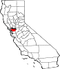
CDPs Acalanes Ridge | Alamo | Alhambra Valley | Bay Point | Bayview | Bethel Island | Blackhawk | Byron | Camino Tassajara | Castle Hill | Clyde | Contra Costa Centre | Crockett | Diablo | Discovery Bay | East Richmond Heights | El Sobrante | Kensington | Knightsen | Montalvin Manor | Mountain View | Norris Canyon | North Gate | North Richmond | Pacheco | Port Costa | Reliez Valley | Rodeo | Rollingwood | San Miguel | Saranap | Shell Ridge | Tara Hills | Vine Hill
Unincorporated
communitiesAlamo Oaks | Arbor | Avon | Bancroft | Bayo Vista | Bayview-Montalvin | Bixler | Blackhawk-Camino Tassajara | Bridgehead | Canyon | Christie | Cornwall | Crolona Heights | Diamond | Eastport | Four Corners | Franklin Canyon | Gateley | Glen Frazer | Hasford Heights | Herpoco | Hookston | Las Juntas | Los Medanos | Luzon | Maltby | Marsh Creek Springs | McAvoy | Meinert | Monsanto | Muir | Neroly | Newlove | Nichols | Oleum | Orinda Village | Orwood | Ozol | Rheem | Rock City | Selby | Shore Acres | Sobrante | Sparkle | Stege | Tassajara | Tormey | Valle Vista | Valona | Waldon | Walnut Heights | Werner
Ghost towns Acelanus | Ambrose | Atchison | Eckley | Empire | Hooper | Horse Haven | Judsonville | Junction | Nortonville | Ohmer | Point of Timber | Port Chicago | Schmidtville | Somersville | Stewartville | Tammukan | West Hartley | Winehaven
Categories:- Cities in Contra Costa County, California
- Cities in the San Francisco Bay Area
- Incorporated cities and towns in California
- Sacramento-San Joaquin Delta
-


Wikimedia Foundation. 2010.