- Crescent City, California
-
This article is about the city in Northern California. For other cities with the same name, see Crescent City (disambiguation).
Crescent City — City — Crescent City harbor
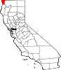
Nickname(s): "The Redwood Gate to the Golden State" Location in Del Norte County and the state of California Location in California
 Crescent City
Coordinates: 41°45′21″N 124°12′06″W / 41.75583°N 124.20167°WCoordinates: 41°45′21″N 124°12′06″W / 41.75583°N 124.20167°W Country  United States
State  California
County Del Norte Government – Mayor Kelly Schellong – Senate Doug LaMalfa (R) – Assembly Patty Berg (D) – U.S. Congress Mike Thompson (D) Area[1] – Total 2.415 sq mi (6.255 km2) – Land 1.963 sq mi (5.085 km2) – Water 0.452 sq mi (1.170 km2) 18.7% Elevation 43 ft (13 m) Population (2010) – Total 7,643 – Density 3,164.8/sq mi (1,221.9/km2) Time zone Pacific (PST) (UTC-8) – Summer (DST) PDT (UTC-7) ZIP codes 95531, 95532, 95538 Area code(s) 707 FIPS code 06-17022 GNIS feature ID 0277494 Website www.crescentcity.org Crescent City is the county seat and only incorporated city in Del Norte County, California. Named for the crescent-shaped stretch of sandy beach south of the city, Crescent City had a total population of 7,643 in the 2010 census, up from 4,006 in the 2000 census. The population includes inmates at Pelican Bay State Prison, also within the city limits, and the former census-designated place Crescent City North annexed to the city. The city is also the site of the Redwood National Park headquarters, as well as the historic Battery Point Light. Due to the richness of the local Pacific Ocean waters and the related catch, and ease of access, Crescent City Harbor serves as home port for numerous commercial fishing vessels.
The city is located on the Pacific coast in the upper northwestern part of California, about 20 miles (32 km) from the Oregon border. Crescent City's offshore geography makes it unusually susceptible to tsunamis.[2] For example, much of the city was destroyed by one generated by the Good Friday Earthquake off Anchorage, Alaska in 1964. More recently, the city's harbor suffered extensive damage and destruction due to tsunamis generated by the March 11, 2011 earthquake off Sendai, Japan. Several dozen vessels and many of the docks they were moored to were destroyed as wave cycles related to the tsunamis exceeded 8 feet.[3][4]
Contents
Geography
According to the United States Census Bureau, the city has a total area of 2.4 square miles (6.2 km2), of which 2.0 square miles (5.2 km2) (81.3%) is land and 18.7% is water.
Crescent City is about 20 miles from the border of California and Oregon.
The mouth of Elk Creek, where it flows into the Pacific Ocean, is in Crescent City.
Climate
Crescent City has a Mediterranean climate (Köppen Csb) that is sometimes classified owing to its high rainfall as an oceanic climate. It is one of the wettest places in California: the annual rainfall is 67 in (1,700 mm). The wettest months are from October to March; the wettest month is December with 11 inches (280 mm) and the driest month is July with less than 0.5 in (13 mm). The average high and low temperatures in January are 54 °F (12 °C) and 41 °F (5 °C). The average high and low temperatures in August are 66 °F (19 °C) and 51 °F (11 °C). Average number of days below 32 °F (0 °C) is 15 days.[5]
The highest temperature recorded in Crescent City was 93 °F (34 °C), observed on September 24, 1964, June 1, 1970, and October 10, 1991. The lowest temperature on record was 19 °F (−7 °C) on December 21, 1990.
The maximum monthly precipitation was 31.25 inches (794 mm) in November 1973. The maximum 24-hour precipitation was 7.73 inches (196 mm) on January 9, 1995. The highest snowfall recorded for any period from one month to 24 hours was 6.0 inches (15 cm) occurring on January 6, 1972.[6] Since 1973, snow has never fallen in Crescent City.
Climate data for Crescent City, CA Month Jan Feb Mar Apr May Jun Jul Aug Sep Oct Nov Dec Year Record high °F (°C) 75
(24)78
(26)76
(24)90
(32)92
(33)93
(34)83
(28)91
(33)93
(34)93
(34)79
(26)80
(27)93
(34)Average high °F (°C) 53.6
(12.0)54.4
(12.4)54.6
(12.6)56.6
(13.7)59.6
(15.3)62.7
(17.1)65.4
(18.6)66.0
(18.9)66.0
(18.9)63.0
(17.2)56.7
(13.7)54.0
(12.2)59.4 Average low °F (°C) 39.6
(4.2)41.2
(5.1)41.8
(5.4)43.3
(6.3)46.0
(7.8)48.4
(9.1)50.4
(10.2)50.8
(10.4)48.7
(9.3)45.4
(7.4)42.0
(5.6)38.9
(3.8)44.7 Record low °F (°C) 22
(−6)24
(−4)28
(−2)30
(−1)32
(0)37
(3)40
(4)41
(5)36
(2)32
(0)25
(−4)19
(−7)19
(−7)Rainfall inches (mm) 10.15
(257.8)9.18
(233.2)9.22
(234.2)5.13
(130.3)3.13
(79.5)1.57
(39.9)0.4
(10)0.74
(18.8)1.67
(42.4)4.56
(115.8)9.84
(249.9)11.23
(285.2)66.82
(1,697.2)Avg. rainy days (≥ 0.01 inch) 12.8 11.5 13.4 10.2 6.8 4.4 1.6 2.8 3.7 6.4 12.2 11.9 97.7 Source: NOAA[7] Tsunamis
 Battery Point Lighthouse, viewed from jetty
 Crescent City's jetty
The topography of the sea floor surrounding Crescent City has the effect of focusing tsunamis. According to researchers at Humboldt State University and the University of Southern California, the city experienced tsunami conditions 31 times between the years 1933 and 2008.[8] Although many of these incidents were barely perceptible, eleven events included wave measurements exceeding one meter, four events caused damage, and one event in particular is commonly cited as "the largest and most destructive recorded tsunami to ever strike the United States Pacific Coast."[9]
On March 27, 1964, the Good Friday Earthquake off Anchorage, Alaska, set in motion local landslide tsunamis, as well as a trans-Pacific one that sped in three hours down the U.S. West Coast to the state of Washington. Destroying docks, boats, cars, coastal dwellings and surging up rivers with the same result, the tsunami continued down the coast.
Within another 1½ hours, four waves struck over a two-hour period at Crescent City. When they had finished, 289 buildings and businesses had been destroyed; 1000 cars and 25 large fishing vessels crushed; 12 people were confirmed dead, over 100 were injured, and numbers were missing; 60 blocks had been inundated with 30 city blocks destroyed in total. Although most of the missing were later accounted for, not all were tracked down. Insurance adjusters estimated that the city received more damage from the tsunami on a block-by-block basis than did Anchorage from the initial earthquake.[10]
The tsunami raced down the U.S. West Coast with more deaths and destruction, but no location was hit as hard as this small town was. Crescent City bore the brunt, due to its offshore geography, position relative to the earthquake’s strike-line, underwater contours such as the Cobb Seamount, and the position of rivers near the city. Although houses, buildings, and infrastructure were later rebuilt, years passed before the city recovered from the devastation to lives, property, and its economy.
The city is deemed to be tsunami-ready today. Its preparedness was tested on June 14, 2005 when an earthquake measuring 7.0 on the Richter scale hit 90 miles (140 km) offshore. Reportedly, much of the city was evacuated in a matter of 20 minutes when a tsunami warning was issued, but no waves were reported.
On November 15, 2006, a magnitude 8.3 earthquake struck off Simushir Island in the Kuril Islands in the western Pacific. A tsunami warning was issued but rescinded hours later. However, a surge from that quake did hit the harbor at Crescent City causing damage to three docks and several boats. Governor Arnold Schwarzenegger declared a county state of emergency. Upon that declaration, the area affected was eligible for federal emergency relief funding to repair the damage.[11]
Parts of the city were evacuated on March 11, 2011, after a 9.0 earthquake struck Japan.[12][13] Thirty-five boats were destroyed, and the harbor suffered major damage.[3][14] Peak surge reported exceeded over 8 feet by 9:50am.[15] Five were swept out to sea, and one person killed.[16]
Politics
In the state legislature Crescent City is located in the 4th Senate District, represented by Republican Doug LaMalfa, and in the 1st Assembly District, represented by Democrat Wes Chesbro. Federally, Crescent City is located in California's 1st congressional district, which has a Cook PVI of D +10[17] and is represented by Democrat Mike Thompson.
Demographics
Historical populations Census Pop. %± 1860 638 — 1870 458 −28.2% 1890 907 — 1900 699 −22.9% 1910 1,114 59.4% 1920 955 −14.3% 1930 1,720 80.1% 1940 1,363 −20.8% 1950 1,706 25.2% 1960 2,958 73.4% 1970 2,586 −12.6% 1980 3,075 18.9% 1990 4,380 42.4% 2000 7,347 67.7% 2010 7,643 4.0% [18][19][20] 2010
The 2010 United States Census[21] reported that Crescent City had a population of 7,643. The population density was 3,164.9 people per square mile (1,222.0/km²). The racial makeup of Crescent City was 5,052 (66.1%) White, 910 (11.9%) African American, 370 (4.8%) Native American, 333 (4.4%) Asian, 7 (0.1%) Pacific Islander, 696 (9.1%) from other races, and 275 (3.6%) from two or more races. Hispanic or Latino of any race were 2,342 persons (30.6%).
The Census reported that 4,063 people (53.2% of the population) lived in households, 28 (0.4%) lived in non-institutionalized group quarters, and 3,552 (46.5%) were institutionalized.
There were 1,707 households, out of which 559 (32.7%) had children under the age of 18 living in them, 512 (30.0%) were opposite-sex married couples living together, 314 (18.4%) had a female householder with no husband present, 114 (6.7%) had a male householder with no wife present. There were 170 (10.0%) unmarried opposite-sex partnerships, and 7 (0.4%) same-sex married couples or partnerships. 614 households (36.0%) were made up of individuals and 229 (13.4%) had someone living alone who was 65 years of age or older. The average household size was 2.38. There were 940 families (55.1% of all households); the average family size was 3.13.
The population was spread out with 1,107 people (14.5%) under the age of 18, 934 people (12.2%) aged 18 to 24, 3,292 people (43.1%) aged 25 to 44, 1,725 people (22.6%) aged 45 to 64, and 585 people (7.7%) who were 65 years of age or older. The median age was 34.9 years. For every 100 females there were 250.1 males. For every 100 females age 18 and over, there were 298.5 males.
There were 1,906 housing units at an average density of 789.2 per square mile (304.7/km²), of which 532 (31.2%) were owner-occupied, and 1,175 (68.8%) were occupied by renters. The homeowner vacancy rate was 7.7%; the rental vacancy rate was 4.8%. 1,203 people (15.7% of the population) lived in owner-occupied housing units and 2,860 people (37.4%) lived in rental housing units.
2003
As of the 2003 Population Estimate from the Census Bureau, there are 7,319 people residing in the city. Census data from the year 2000 indicate that the population density is 2,252.2 people per square mile (868.9/km²). There are 1,754 housing units at an average density of 986.1 per square mile (380.5/km²). The racial makeup of the city is 78.3% White, 0.5% Black or African American, 6.1% Native American, 4.6% Asian, 0.1% Pacific Islander, 4.3% from other races, and 6.0% from two or more races. 11.0% of the population are Hispanic or Latino of any race.
There are 1,578 households out of which 35.6% have children under the age of 18 living with them, 33.4% are married couples living together, 20.5% have a female householder with no husband present, and 41.7% are non-families. 35.8% of all households are made up of individuals and 13.6% have someone living alone who is 65 years of age or older. The average household size is 2.40 and the average family size is 3.12.
In the city the population is spread out with 30.1% under the age of 18, 11.1% from 18 to 24, 26.7% from 25 to 44, 18.2% from 45 to 64, and 13.9% who are 65 years of age or older. The median age is 32 years. For every 100 females there are 85.9 males. For every 100 females age 18 and over, there are 82.4 males.
The median income for a household in the city is $20,133, and the median income for a family is $22,058. Males have a median income of $36,667 versus $19,922 for females. The per capita income for the city is $12,833. 34.6% of the population and 33.7% of families are below the poverty line. Out of the total population, 46.6% of those under the age of 18 and 4.8% of those 65 and older are living below the poverty line.
Transportation
Highway access is provided by U.S. Route 101 that runs directly through the city, connecting the Oregon Coast to the north and Eureka to the south. U.S. Route 199 begins just north of Crescent City and heads northeast to Grants Pass, Oregon.
SkyWest Airlines conducts passenger flights to and from Jack McNamara Field Airport as United Express. The majority of flights connect to San Francisco International Airport. The airport also features one daily flight to Sacramento International Airport through Arcata-Eureka Airport.
Local public transit is provided by Redwood Coast Transit and by various taxi companies, which provides access to Amtrak passenger train (via Amtrak bus) service.
The Crescent City Harbor serves as a commercial fishing port for salmon, shrimp, tuna, cod, and dungeness crab commercial fishing vessels. The Harbor is also home to multiple fishing and non-fishing related businesses and harbor governmental offices. The Crescent City Harbor also has several pleasure boat docks.
Historic ships
Crescent City was the name of a 113 ton schooner built in 1848 by Joshua T. Foster of Medford, MA.[22] A 1906 ship named Crescent City was the former Jim Butler, a 701 ton steam schooner built by Lindstrom Shipbuilding Company in Aberdeen, Washington. She was wrecked in the Channel Islands, off Santa Cruz Island, in 1927.[23]
Attractions
Crescent City proper
- Battery Point Lighthouse
- Del Norte County Historical Society Main Museum
- Ocean World
- Beachfront Park
- Crescent City Harbor
- Wreckage of the SS Emidio, the first American vessel sunk by the Japanese along California's coast during World War II
Crescent City also boasts one of the few fireworks displays for the Fourth of July holiday in the immediate geographic location.
Nearby
 Map of the area surrounding Crescent City, California
- St. George Reef Lighthouse
- Redwood National and State Parks
- Del Norte Coast Redwoods State Park
- Jedediah Smith Redwoods State Park
- Smith River National Recreation Area
- Trees of Mystery
- Pelican Bay State Prison
- Elk Valley Casino
- Del Norte Golf Course
- Lost Monarch (tree)—Largest known Coastal Redwood by volume.
Notable residents
- Buck Pierce, professional football player for Winnipeg Blue Bombers (Canadian Football League).
- Derrick Jensen, environmentalist activist and author.
- Robert Swanson, first and longest serving Hospital Administrator for Seaside Hospital (1955–1986). Along with Richard Cooper (BSN MS), Director of Nursing, established the first Hospital Intensive Care Unit in the county in 1980.
- Dr. Joseph "G.I. Joey" Gardner, Doctor of History, and Military History; also known for owning and operating "G. I. Joey's Military Surplus" in downtown Crescent City.
- Greg "Da Bull" Noll, Legendary 1960's big wave surfer.
Schools
Public schools
The public schools of Crescent City are part of the Del Norte County Unified School District (website), which encompasses all of the public schools in Del Norte County. The following are schools within Crescent City or its immediate environs.
- Del Norte High School is the only public high school in Crescent City, located on the northern edge of town. It replaced the earlier high school that was more centrally located, and which remains today as a public-access gymnasium and county offices. (website)
- Bess Maxwell Elementary School is the older of two elementary schools in the northern part of town that are located near the high school. Bess Maxwell serves grades 1–5. In its earlier years, it was a K–6 school.
- Castle Rock Charter School is a K–12 charter school that provides personalized education to students, and is the liaison school for parents who home school their children. Among other programs, it operates the Tah-Ah-Dun American Indian Magnet School to provide for the unique requirements of American Indian students that might be at risk of dropping out of school. (Tah-Ah-Dun is the Tolowa name for Crescent City, honoring the Tolowa village that once stood where Crescent City is today.) The school is accredited by the Western Association of Schools and Colleges.
- Crescent Elk Middle School is the oldest operating school site in town, centrally located in Crescent City. The site was originally a K–8 school, but slowly shed grade levels to other schools as it became a 4–6 school with a separate 7–8 program, then the 6–8 program that it is today.
- Mary Peacock Elementary School is the newer of two elementary schools that are located near the high school. The creation of Pelican Bay State Prison caused an increase in housing demand in the Crescent City area, and an increased school district population. This school was built as a result of that demand, but is not directly associated with the prison.
- Joe Hamilton Elementary School is a K–5 school located near Crescent Elk Middle School. It was founded as a K–3 school.
- Pine Grove Elementary School has been a K–6 school for many years. It serves the eastern part of Crescent City.
See also
- List of California public officials charged with crimes, Crescent City
Notes
- ^ U.S. Census
- ^ McKinley, Jesse (16 March 2011). "Sleepy California Town, and a Tsunami Magnet". New York Times. http://www.nytimes.com/2011/03/17/us/17crescent.html. Retrieved 17 March 2011. "Crescent City has long been known as one of the nation’s most susceptible spots when it comes to tsunamis, something that experts say is a result of a number of factors"
- ^ a b Johnson, C. (3 March 2011). "Tsunami sweeps 5 to sea, rips out California docks". KXTV. http://www.news10.net/news/story.aspx?storyid=127779&catid=2. Retrieved 11 March 2011.
- ^ Anton, Mike; Li, Shan (March 11, 2011). "Crescent City harbor destroyed; 4 people swept into sea, 1 feared dead". Los Angeles Times. http://www.latimes.com/news/local/la-me-crescent-city-harbor-destroyed-20110311,0,1105044.story?track=rss.
- ^ Weatherbase: Historical Weather for Crescent City, California, United States of America
- ^ http://ggweather.com/climate/crescent_city.pdf
- ^ "CRESCENT CITY 3 NNW, CA". National Oceanic and Atmospheric Administration. 2011. http://cdo.ncdc.noaa.gov/climatenormals/clim20/ca/042147.pdf. Retrieved 2011-11-07.
- ^ "The Vulnerability of Crescent City, California, to Tsunamis Generated by Earthquakes in the Kuril Islands Region of the Northwestern Pacific". Seismological Research Letters. http://www-bcf.usc.edu/~barberop/608.pdf.
- ^ "USC Tsunami Research Group". http://www.usc.edu/dept/tsunamis/alaska/1964/webpages/index.html.
- ^ Powers, 2005
- ^ Los Angeles Times article on the quake and tsunami
- ^ http://www.times-standard.com/news/ci_17600232
- ^ http://www.correctionsone.com/corrections/articles/3421202-Pelican-Bay-Sgt-describes-response-to-Tsunami/
- ^ http://www.times-standard.com/ci_17592790
- ^ http://www.sacbee.com/2011/03/11/3467662/california-coast-braces-for-tsunami.html
- ^ "5 swept out to sea, 1 killed as tsunami hits Crescent City, Cal.". International Business Times. http://uk.ibtimes.com/articles/121934/20110311/california-tsunami.htm.
- ^ "Will Gerrymandered Districts Stem the Wave of Voter Unrest?". Campaign Legal Center Blog. http://www.clcblog.org/blog_item-85.html. Retrieved 2007-10-19.
- ^ http://www.census.gov/population/www/censusdata/cencounts/files/ca190090.txt
- ^ http://factfinder2.census.gov
- ^ http://mapserver.lib.virginia.edu/
- ^ All data are derived from the United States Census Bureau reports from the 2010 United States Census, and are accessible on-line here. The data on unmarried partnerships and same-sex married couples are from the Census report DEC_10_SF1_PCT15. All other housing and population data are from Census report DEC_10_DP_DPDP1. Both reports are viewable online or downloadable in a zip file containing a comma-delimited data file. The area data, from which densities are calculated, are available on-line here. Percentage totals may not add to 100% due to rounding. The Census Bureau defines families as a household containing one or more people related to the householder by birth, opposite-sex marriage, or adoption. People living in group quarters are tabulated by the Census Bureau as neither owners nor renters. For further details, see the text files accompanying the data files containing the Census reports mentioned above.
- ^ Gleason, Hall (1937). Old Ships and Ship-Building Days of Medford. Medford, MA: J.C. Miller. p. 71.
- ^ "Crescent City, CINMS Shipwreck Database". NOAA / National Marine Sanctuaries. http://channelislands.noaa.gov/shipwreck/dbase/mbnms/crescentcity.html. Retrieved May 23, 2010.
References
- U.S. Geological Survey Geographic Names Information System: Crescent City, California
- The Raging Sea: The Powerful Account of the Worst Tsunami in U.S. History, Dennis Powers, (New York, New York: Kensington, 2005)
External links
- Local Information
- Official Crescent City website
- KHSR-FM 91.9 Crescent City-Brookings - Diverse Public Radio
- The Daily Triplicate newspaper.
- Crescent City Weekly
Municipalities and communities of Del Norte County, California County seat: Crescent CityCity Crescent City
CDPs Bertsch-Oceanview | Gasquet | Hiouchi | Klamath | Smith River
Unincorporated
communitiesAdams Station | Camp Klamath | Crescent City North | Darlingtonia | Douglas Park | False Klamath | Fort Dick | French Hill | Hoppaw | Idlewild | Klamath Glen | Pacific Shores | Patrick Creek | Requa | Rockland | Scaath | Tryon Corner | Yontocket
Indian
reservationsGhost
townsBerteleda | Khoonkhwuttunne | Khwunrghunme | Lawyers Bar | Rekwoi | Sawuara | Shakesville | Shegoashkwu | Tatlatunne | Waukell Flat
California county seats Consolidated city-county Municipalities Alturas | Auburn | Bakersfield | Colusa | Crescent City | El Centro | Eureka | Fairfield | Fresno | Hanford | Hollister | Jackson | Lakeport | Los Angeles | Madera | Martinez | Marysville | Merced | Modesto | Napa | Nevada City | Oakland | Oroville | Placerville | Red Bluff | Redding | Redwood City | Riverside | Sacramento | Salinas | San Bernardino | San Diego | San Jose | San Luis Obispo | San Rafael | Santa Ana | Santa Barbara | Santa Cruz | Santa Rosa | Sonora | Stockton | Susanville | Ukiah | Ventura | Visalia | Willows | Woodland | Yreka | Yuba City
CDPs Bridgeport | Downieville | Independence | Mariposa | Markleeville | Quincy | San Andreas | Weaverville
Categories:- Incorporated cities and towns in California
- County seats in California
- Cities in Del Norte County, California
- Populated coastal places in California
- Ports and harbors of California
- Redwood National and State Parks
- 2011 Tōhoku earthquake and tsunami


Wikimedia Foundation. 2010.