- Nahuel Huapi National Park
-
Nahuel Huapi National Park
Parque Nacional Nahuel HuapíIUCN Category II (National Park)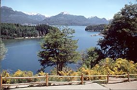
Nahuel Huapi National ParkLocation of Nahuel Huapi Bariloche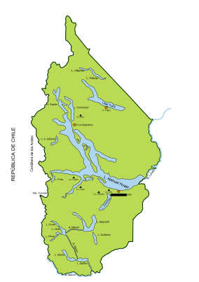
Location Río Negro and Neuquén provinces, Argentina Nearest city San Carlos de Bariloche and Villa La Angostura Coordinates 41°00′S 71°30′W / 41°S 71.5°WCoordinates: 41°00′S 71°30′W / 41°S 71.5°W Area 7,050 km2 (2,720 sq mi) Established 1934 Governing body Administración de Parques Nacionales Established in 1934, the Nahuel Huapi National Park is the oldest national park in Argentina. It surrounds Nahuel Huapi Lake in the foothills of the Patagonian Andes. The largest of the national parks in the region, it has an area of 7,050 km2 (2,720 sq mi), or nearly 2 million acres.[1] Its landscapes represent the north Patagonian Andean Zone consisting of three types, namely, the Altoandino (with perpetual snow above an altitude of 1,600 metres (5,200 ft)), the Andino-Patagónico (in the lower reaches of the hills) and the Patagonian steppe.[2][3][4]
The park and the reserve lie at an altitude of 720–3,574 metres (2,360–11,726 ft), and are designated under IUCN management categories II (National Park) and IV (Management Reserve). The park is completely protected while the reserve is partially protected.[4] The national park is dominated by the high mountain chain of the Andes, many lakes, rapid rivers, waterfalls, snow-clad peaks, glaciers and extensive forests. It is bordered by Chile on its western side.[2][4]
Contents
Etymology
The park derives its name from the lake which it surrounds, namely the "Nahuel Huapi". In the Mapuche language, nahuel means "jaguar" and huapi means "island".[5]
History
The earliest discovery of Nahuel Huapi by the non-indigenous peoples is linked to the historical legend of South America, namely, the "Ciudad de Los Cesares" and the early Jesuit settlers.[6]
In 1903, Perito Moreno donated 75 square kilometres (29 sq mi) of land in the area to the federal government. A decree of February 1, 1909 recognized that the area needed protection but it was not until October 9, 1934 that both Nahuel Huapi National Park and Iguazu National Park were established.[6][7] In the first year of the National Park Service, 1935, several regulations were implemented that affected Nahuel Huapi. These included construction code, sport fishing, standardization of drinking water sanitation, and issuance of vendor permits.[8] The area opened up for mountain climbing and other recreational activities after the park was established.[9]
Geography
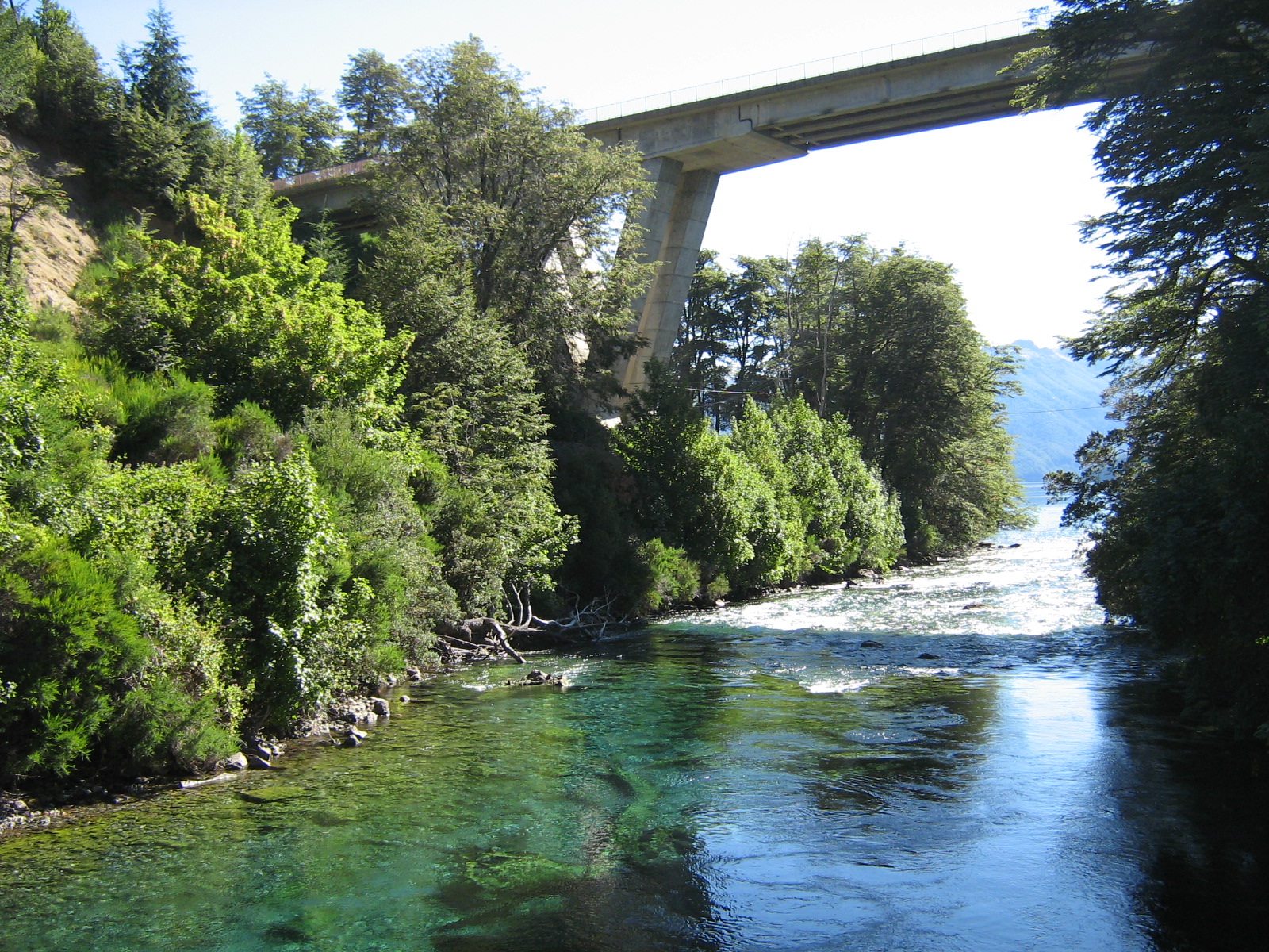
 Route 231 bridge across the Correntoso River that flows into Lake Nahuel Huapi.
The park covers approximately 7,050 square kilometres (2,720 sq mi). It is located in the southwest section of the Neuquén and northwest section of the Río Negro provinces, bordering with Chile. The park has two zones: the park and the natural reserve with development concentrated in the reserve.[4] The largest city and a base for tourism is San Carlos de Bariloche, which is surrounded by the park. San Carlos de Bariloche is the main hub when visiting the lake, and is known as the "Gateway to Patagonia", the "Chocolate Capital" and the "Honeymoon Capital" of Argentina.[4][10] However, the city and other settlements are zoned outside the limits of the park. A further subzoning into the north, south and southern zones has been implemented with an exclusive recreational area named the Cerro Cathedral. Villa La Angostura is another lakeside resort also within the boundaries of the park.[2]
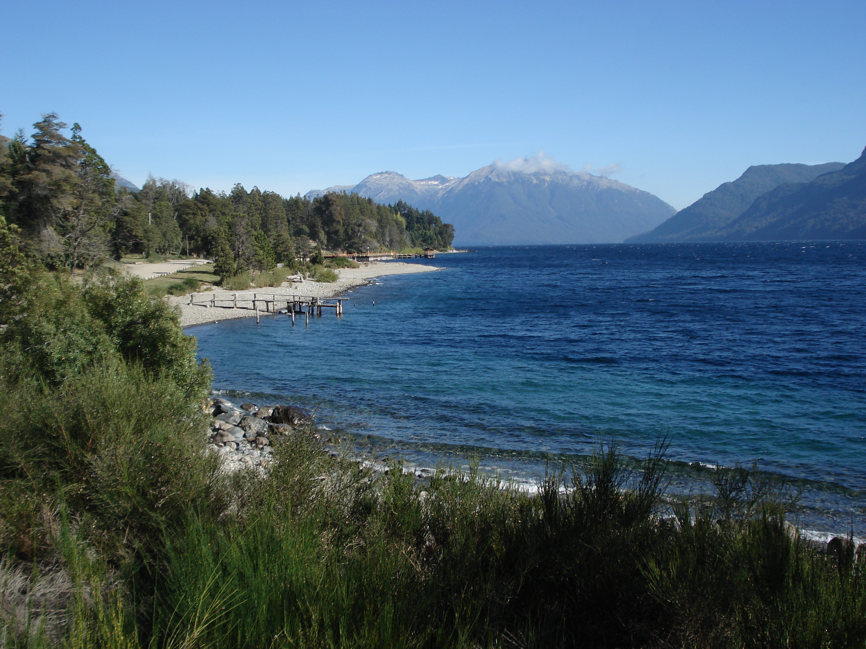
The area is known as the Argentine Lake District,[3] as there are many lakes in the park, including Nahuel Huapi, Mascardi, Gutiérrez, Traful, Guillelmo, and Perito Moreno Lakes. Cerro Catedral is a 2,388 metres (7,835 ft) high peak within the park and an important ski resort. Cerro Tronador, on the Chilean border, is the highest mountain in the park at 3,491 metres (11,453 ft). Bordering the park to the north is the Lanín National Park.[3][4]
- Geology
Geological formations in the park and the reserve are generally tertiary rocks of volcanic origin coupled with andacites and porphyrys. The cliffs of the San Pedro Peninsula depict eroded glacial features and the lakes also show many glacial effects.[4]
- Climate
The park has widely varying climatic conditions with the annual precipitation ranging between 300 and 500 millimetres (12 and 20 in).[4] It rains more towards the Chilean border.[11]
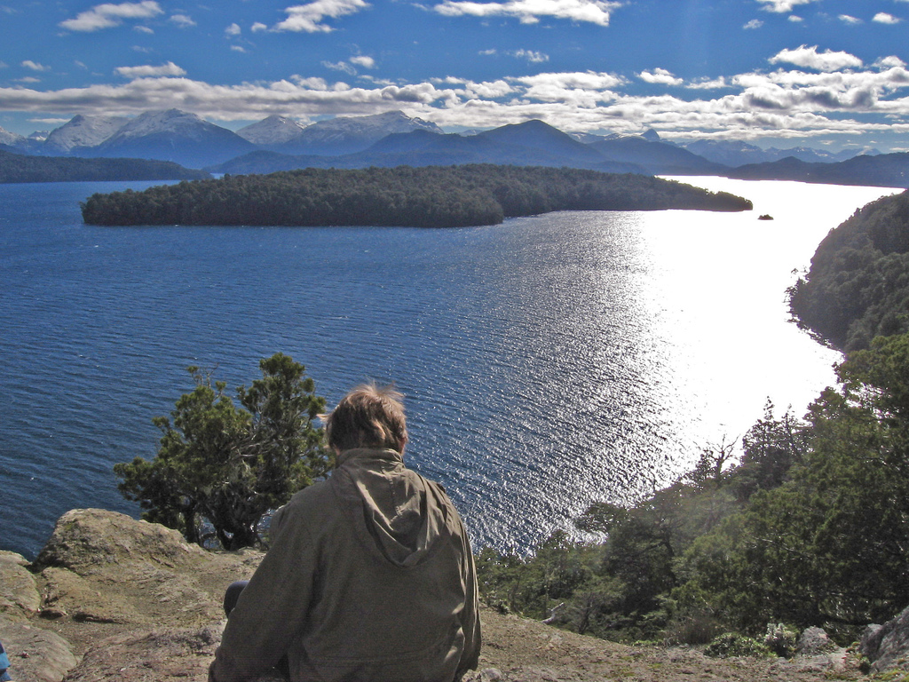
Lake Nahuel Huapi
 Left: Lago Nahuel Huapi (Bariloche, Argentina). Right: Bariloche (Argentina). Lago Nahuel Huapi
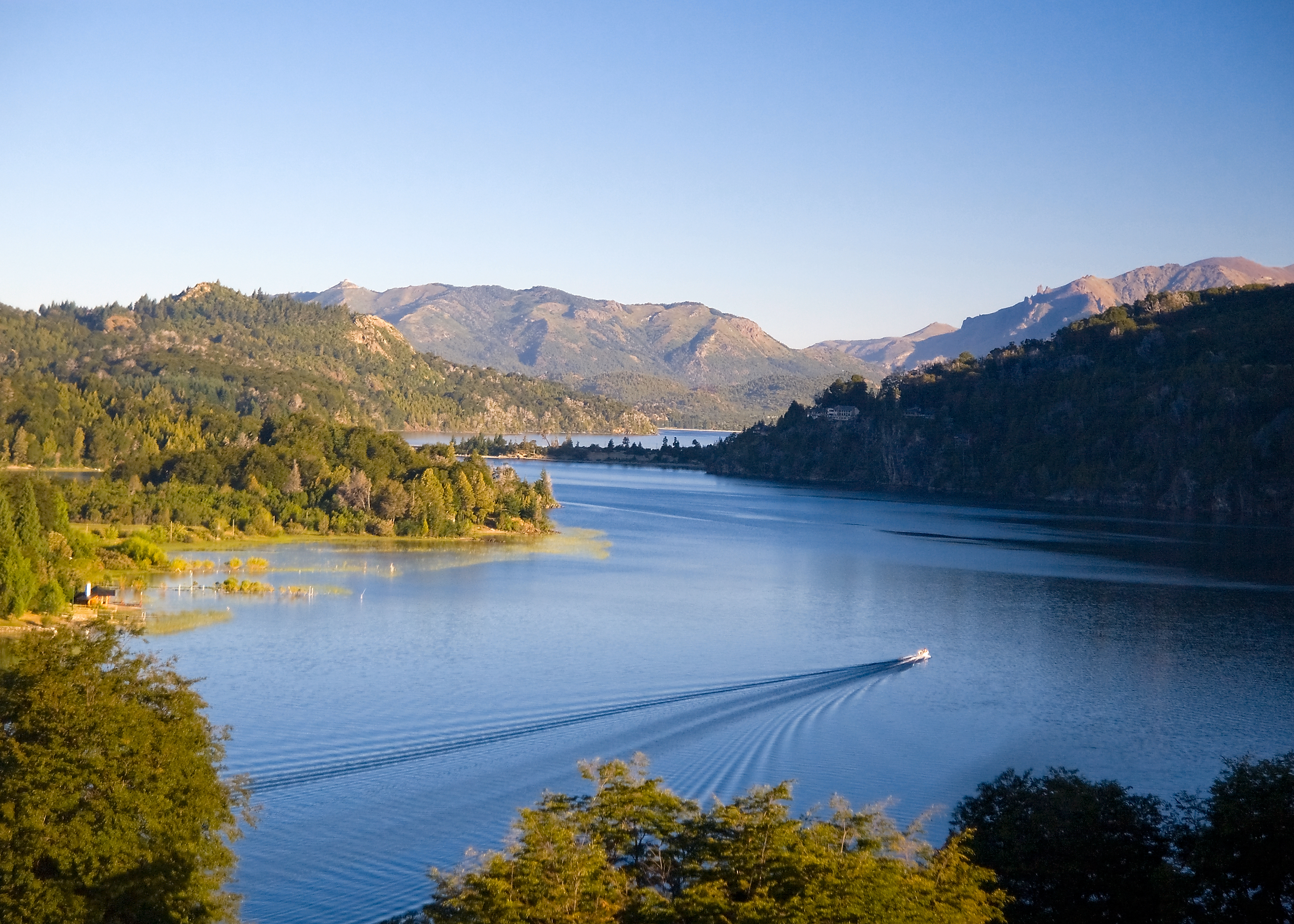
Lake Nahuel Huapi is the largest lake and deepest clear water lake, with a depth of 425 metres (1,394 ft), in the lake district of Argentina. Located at the foot of the Andes Mountains at an altitude of 767 metres (2,516 ft), it measures 544 square kilometres (210 sq mi). The lake was discovered by the Jesuit priest Nicolás Mascard in 1670 who also built a chapel on the Huemul Peninsula of the lake. The lake extends 100 kilometres (62 mi) across the border with Chile, and includes many fjords and the Valdivian temperate rain forest.[12][13][14] The southern shore of the lake has many hotels and restaurant catering to the tourist industry.[14] The Quetrihué Peninsula in the north of the lake has been set aside as a separate national park, Los Arrayanes National Park. The lake has many islands. The Forest Research station is located on one of them, Victoria Island, which is a natural reserve approachable by boats. Huemul Island hosted the Huemul Project, the Argentinean secret research project on nuclear fusion in 1949–1952.
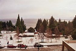
Bariloche
San Carlos de Bariloche is located on the southern shore of Lake Nahuel Huapi. The town was established in 1902. However, its importance as tourist hub grew after the 1930s when the national park surrounding it was established. It is well known as the "Honeymoon Capital of Argentina", apart from its fame for its chocolate manufacturing industry.[10][14] Its 130 kilometres (81 mi) stretch below the Andes mountains is bounded on the south by Lago Mascardi and on the north by the Villa Traful. North of the city the Seven Lakes road provides scenic vistas of landscapes. Glaciers and waterfalls, which are near to the Pampa Lenda, are located to the west of Bariloche. It is also the base for mountaineering trips to 3,554-metre (11,660 ft) high Mount Tronador (also known as the Thunderer as ice falling produces such sounds) of extinct volcanic origin. The town is well-connected by air, rail and road transport; the airport is 15 kilometres (9.3 mi) to the east of the town; and the train and bus stations are 3 kilometres (1.9 mi) to the east. The Cerro Catedral mountain peak is the snow sports center, with many skiing runs, which is 23 kilometres (14 mi) from Bariloche.[14][15]
Flora and fauna
The park's ecology consists of Patagonian steppe at lower elevations and Valdivian temperate forests at higher elevations.[16] It is notable for its rich wildlife due to its many biotopes, attributed to the varied altitude and precipitation range.
- Flora
 Patagonian flora
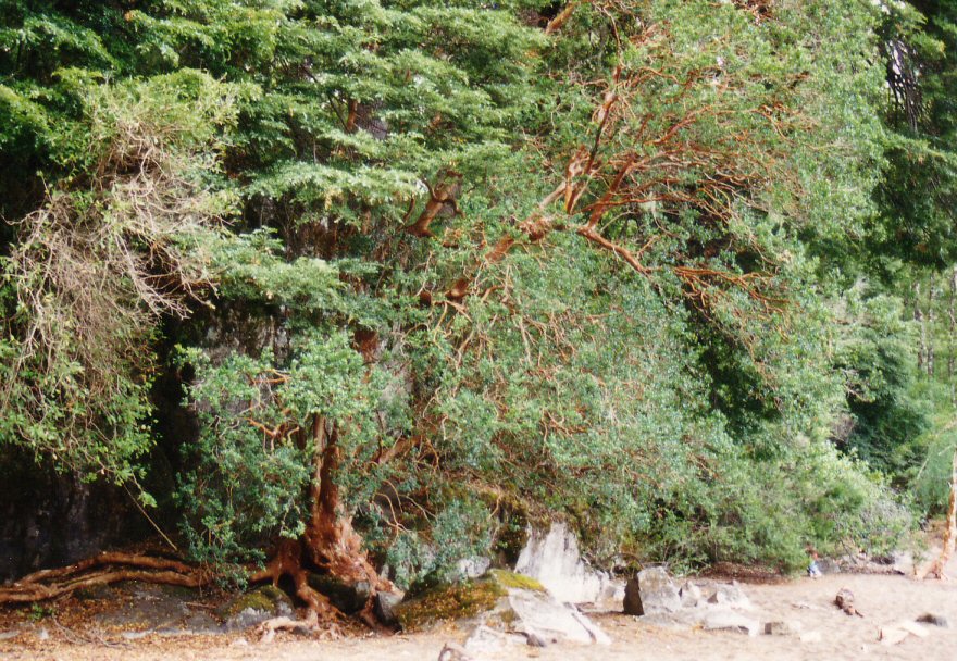
Xerophytic Patagonian flora is dominant in the eastern half of the park while the western half is covered profusely with temperate rain forests. The dominant tree species in the park are the lengas, coihue, and the ñires.[17] Other varieties of trees seen in the park are the Chilean cedar (Austrocedrus chilensis), Winter’s bark (Drimys winteri), Myrceugenella apiculata, Lomatia ferruginea, Lomatia hirsuta, Alstroemeria aurantica, Fuchsia megellanica, bamboo Chusquea culcou, Mitraria cocinea and Embothrium coccineum.[4] The alerce or Patagonian cypress is a slow-growing conifer which is also present. Other flora include arrayanes, coihues, ferns, the caña colihue reeds, amancayes and arvejillas. The llao llao fungus has irregular growth patterns on the trees and is a symbol of the area; it is also the name of the Llao Llao Hotel, a famous resort. The Valdivian rain forests is well forested with fine arrayan trees with crumbling bark. In the high rain fall zones close to the Chilean border there is profusion of 450 years old coihue trees (small leaved evergreen beeches). alerce South American Spanish name)[14] of 1500 year vintage are seen spread throughout the park. Bamboo cane grows in abundance.[14]
- Fauna
Animals include river otters (Lontra longicaudis), southern Andean huemuls (Hippocamelus bisulcus), pudus (small deer), foxes, cougars, guanacos and maras. Huillin (Lontra provocax), an endangered native otter, has been reported in the park.[3][4][14] Avifauna reported include Magellanic Woodpeckers, green Austral Parakeets, geese, ducks, swans, blue-eyed cormorants, Andean condors (Vultur gryphus) and Green-backed Firecrowns (Saphonoides sephaniodes).[4][14] Amphibian fauna reported are Hylorina sylvatica and Bufo spinolosus.[4] Five genera and 32 species of Simuliidae (black fly) have been recorded. These genera are Cnesia, Cnesiamima, Gigantodax, Paraustrasimulium, and Simulium (Pternaspatha), a subgenus of Simulium with 19 species; these account for 57% of the Simuliidae fauna found in Argentina.[18]
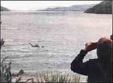 A purported sighting of Nahuelito
Nahuelito is a lake monster named after the Nahuel Huapi Lake as its sighting in the lake is reported widely. Whether it is a fact or fiction, its sighting has been reported by local people and tourists with widely varying descriptions mentioning a “giant water snake with humps and fish-like fins to a swan with a snake's head, the overturned hull of a boat, and the stump of a tree”. Its length is also reported in the range of 15–150 feet (4.6–46 m). Reported widely since the 1920s, predating Nessie and the book titled The Lost World (Arthur Conan Doyle), Nahuelito is described as “an Argentinean media star.”[19]
Recreation
 Recreation in the Nahuel Huapi Lake in Llao Llao
The park offers many avenues for recreation. Particular places of interest in this context are the Tronador, Puerto Blest, Victoria Island and the road to the 7 Lakes. Other options for recreation are available at the Cerro Catedral, Lopez and Punta Negra. Most of the recreation facility revolves around trekking of high mountain and steep hills[17] apart from rafting, skiing in Cerro Catedral, kayaking in Pura Vida,[20] mountain biking, rock-climbing, kit surfing, canopy, paragliding, golf at Llao Llao, trekking on a number of routes, ferry services from Puerto Rias.[10]
Some of the well-developed routes for mountaineering are: The climb to the Thunderer volcano, which has several trails that reach up to the large glaciers; trails to the Tronador (an extinct volcano); the trails that link the San Martin shelter and Manfredo Segre (Black Lagoon); treks to San Martín and Manfredo Segre (Laguna Negra); to Lopez and to the viewpoint of the Stone of Habsburg, the walk of Paso de las Nubes Puerto Frías linking to Pampa Linda; to the valley and the ridge of Mount Rucaco Black Gap; and to Frey and San Martín (Jakoh lagoon), which passes by the edge of Cerro Catedral.[9]
The trekking routes have accommodation facilities at several locations and the treks depend on fitness and the distance varies from a minimum of 12 kilometres (7.5 mi) to a maximum of 45 kilometres (28 mi) involving 1-2-3 and more than 4 days of trekking. The treks are graded under four categories depending on the terrain and the difficulty of climbing rugged hills of heights varying from 200 to 3,000 metres (660 to 9,800 ft).[21]
 Cerros Catedral, López and Capilla, and lakes Moreno and Nahuel Huapi, as seen from Cerro Campanario.
 Lago Correntoso
 La Angostura
 Lago Traful
References
- ^ National Parks and Conservation Association (1968). National parks & conservation magazine. National Parks & Conservation Association.. http://books.google.com/books?id=1jcvAQAAIAAJ. Retrieved 22 February 2011.
- ^ a b c "Nahuel Huapí National Park". Encyclopedia Britannica. http://www.britannica.com/EBchecked/topic/401813/Nahuel-Huapi-National-Park. Retrieved 19 February 2011.
- ^ a b c d "Nahuel Huapi National Park". Patagonia-argentina.com. http://www.patagonia-argentina.com/i/content/parques/parques4.php. Retrieved 19 February 2011.
- ^ a b c d e f g h i j k l IUCN Commission on National Parks and Protected Areas (1982). IUCN directory of neotropical protected areas. IUCN. pp. 9–10. ISBN 9780907567622. http://books.google.com/books?id=qjhlcSkdKjUC&pg=PA9. Retrieved 19 February 2011.
- ^ Adrian Room (2006). Placenames of the world: origins and meanings of the names for 6,600 countries, cities, territories, natural features, and historic sites. McFarland. pp. 260–. ISBN 9780786422487. http://books.google.com/books?id=M1JIPAN-eJ4C&pg=PA260. Retrieved 7 April 2011.
- ^ a b Kuno Thomasson (1959). Nahuel Huapi: plankton of some lakes in an Argentine national park, with notes on terrestrial vegetation. Almqvist & Wiksells boktr.. p. ii. http://books.google.com/books?id=RMARAQAAIAAJ. Retrieved 19 February 2011.
- ^ Oyola-Yemaiel, p. 74
- ^ Oyola-Yemaiel, Arthur (December 1999). The Early Conservation Movement in Argentina and the National Park Service: A Brief History of Conservation, Development, Tourism and Sovereignty. Universal-Publishers. pp. 71–. ISBN 9781581120981. http://books.google.com/books?id=LrolUeT7jhIC&pg=PA71. Retrieved 20 February 2011.
- ^ a b "PARQUE NACIONAL NAHUEL HUAPI: Parque Nacional Nahuel Huapi: Trekking Trekking". Tres Parques Guía de Turismo del Parque Nacional Lanín. http://translate.google.co.in/translate?hl=en&sl=de&u=http://de.wikipedia.org/wiki/Nahuel_Huapi&ei=_vBSTfCyKIXwrQe638WICA&sa=X&oi=translate&ct=result&resnum=1&ved=0CCQQ7gEwADgU&prev=/search%3Fq%3DNahuel%2BHuapi%2BNational%2BPark%26start%3D20%26hl%3Den%26client%3Dfirefox-a%26sa%3DN%26rls%3Dorg.mozilla:en-US:official%26prmd%3Divns. Retrieved 21 February 2011.
- ^ a b c MobileReference. Travel Buenos Aires, Argentina: Illustrated Guide, Phrasebook and Maps (Mobi Travel). MobileReference. pp. 405–406. ISBN 9781607789161. http://books.google.com/books?id=03Po53mMle8C&pg=PT405. Retrieved 19 February 2011.
- ^ "Weather In Bariloche". Dicoverytours. http://www.discoveryourtours.com/information/tours-trips.php/Bariloche/Weather-in-Bariloche/7. Retrieved 26 March 2011.
- ^ "Nahuel Huapi National Park (Parque Nacional Nahuel Huapi) Travel Guide". iexplore. http://www.iexplore.com/attractions/Nahuel_Huapi_National_Park_%28Parque_Nacional_Nahuel_Huapi%29.jhtml. Retrieved 20 February 2011.
- ^ "Lake Nahuel Huapi". Encyclopedia Britannica. http://www.britannica.com/EBchecked/topic/401807/Lake-Nahuel-Huapi. Retrieved 21 February 2011.
- ^ a b c d e f g h Christabelle Dilks (1 December 2006). Footprint Argentina. Footprint Travel Guides. pp. 388–. ISBN 9781904777724. http://books.google.com/books?id=gaLOaAP3r1wC&pg=PA388. Retrieved 19 February 2011.
- ^ Danny Palmerlee (1 August 2008). Argentina. Lonely Planet. pp. 415–417. ISBN 9781741047028. http://books.google.com/books?id=IIioAC3CZmsC&pg=PA415. Retrieved 26 March 2011.
- ^ Olson, D. M, E. Dinerstein, et al (2001). "Terrestrial Ecoregions of the World: A New Map of Life on Earth". BioScience 51 (11): 933–938. doi:10.1641/0006-3568(2001)051[0933:TEOTWA]2.0.CO;2. http://gis.wwfus.org/wildfinder/.
- ^ a b "Tourist Information on the National Parks". Tres Parques Guía de Turismo del Parque Nacional Lanín. http://translate.google.co.in/translate?hl=en&sl=de&u=http://de.wikipedia.org/wiki/Nahuel_Huapi&ei=_vBSTfCyKIXwrQe638WICA&sa=X&oi=translate&ct=result&resnum=1&ved=0CCQQ7gEwADgU&prev=/search%3Fq%3DNahuel%2BHuapi%2BNational%2BPark%26start%3D20%26hl%3Den%26client%3Dfirefox-a%26sa%3DN%26rls%3Dorg.mozilla:en-US:official%26prmd%3Divns. Retrieved 21 February 2011.
- ^ ""Jejenes" (Diptera: Simuliidae) of Nahuel Huapi National Park, Patagonia, Argentina: Preliminary Results" (pdf). scielo.org.ar/. http://www.scielo.org.ar/pdf/rsea/v68n1-2/v68n1-2a14.pdf.
- ^ "NESSIE and Other Lake Monsters". strangemag.com. http://www.strangemag.com/nahuelito.html. Retrieved 26 March 2011.
- ^ "Curso de Introduccion Al Kayaking de Travesi". Purvidapatagonia. http://www.puravidapatagonia.com.ar/. Retrieved 21 February 2011.
- ^ "Bariloche treks overview". trekbariloche.com. http://www.trekbariloche.com/treks/. Retrieved 21 February 2011.
External links
Nahuel Huapi National Park travel guide from Wikitravel
National Parks of Argentina by region Northwest Chaqueña | Mesopotamia Cuyo | Pampas San Guillermo · Talampaya · El Leoncito · Sierra de las Quijadas | Quebrada del Condorito · Lihué Calel · Predelta · Campos del Tuyú · Islas de Santa FePatagonia Laguna Blanca · Lanín · Los Arrayanes · Nahuel Huapi · Lago Puelo · Los Alerces · Perito Moreno · Los Glaciares · Monte León · Tierra del Fuegobold indicate a UNESCO World Heritage Site Categories:- IUCN Category II
- National parks of Argentina
- Río Negro Province
- Neuquén Province
- Protected areas established in 1934
- Biosphere reserves of Argentina


Wikimedia Foundation. 2010.