- Raisin City, California
Infobox Settlement
official_name = Raisin City, California
settlement_type = CDP
imagesize =
image_caption =
image_
imagesize =
image_caption =
image_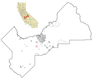
mapsize = 250x200px
map_caption = Location in Fresno County and the state ofCalifornia
mapsize1 =
map_caption1 =
subdivision_type = Country
subdivision_type1 = State
subdivision_type2 = County
subdivision_name =United States
subdivision_name1 =California
subdivision_name2 = Fresno
government_type =
leader_title = N/A
leader_name =
leader_title1 = Senate
leader_name1 =Dean Florez (D)
leader_title2 = Assembly
leader_name2 =Juan Arambula (D)
leader_title3 = U. S. Congress
leader_name3 =Jim Costa (D)
established_date =
area_magnitude =
area_total_km2 = 2
area_total_sq_mi = 0.8
area_land_km2 = 2
area_land_sq_mi = 0.8
area_water_km2 = 0
area_water_sq_mi = 0
elevation_ft = 236
elevation_m = 72
population_as_of = 2000
population_footnotes =
population_total = 165
population_metro =
population_density_km2 = 82.5
population_density_sq_mi = 206.3
timezone = PST
utc_offset = -8
latd = 36 |latm = 36 |lats = 9 |latNS = N
longd = 119 |longm = 54 |longs = 18 |longEW = W
timezone_DST = PDT
utc_offset_DST = -7
postal_code_type =ZIP code
postal_code = 93652
area_code = 559
blank_name = FIPS code
blank_info = 06-59290
blank1_name = GNIS feature ID
blank1_info = 1659457
footnotes =
website =Raisin City is a
census-designated place (CDP) in Fresno County,California ,United States . The population was 165 at the 2000 census.Geography
According to the
United States Census Bureau , the CDP has a total area of 0.8square mile s (2.0km² ), all of it land.Demographics
As of the
census GR|2 of 2000, there were 165 people, 42 households, and 37 families residing in the CDP. Thepopulation density was 214.4 people per square mile (82.7/km²). There were 46 housing units at an average density of 59.8/sq mi (23.1/km²). The racial makeup of the CDP was 60.00% White, 8.48% Native American, 6.06% Asian, 19.39% from other races, and 6.06% from two or more races. 6There were 42 households out of which 47.6% had children under the age of 18 living with them, 64.3% were married couples living together, 16.7% had a female householder with no husband present, and 11.9% were non-families. 11.9% of all households were made up of individuals and 7.1% had someone living alone who was 65 years of age or older. The average household size was 3.93 and the average family size was 4.22.
In the CDP the population was spread out with 32.1% under the age of 18, 10.9% from 18 to 24, 23.6% from 25 to 44, 20.0% from 45 to 64, and 13.3% who were 65 years of age or older. The median age was 30 years. For every 100 females there were 91.9 males. For every 100 females age 18 and over, there were 100.0 males.
The median income for a household in the CDP was $24,167, and the median income for a family was $23,958. Males had a median income of $12,083 versus $25,000 for females. The
per capita income for the CDP was $11,544. About 17.6% of families and 21.3% of the population were below thepoverty line , including 47.1% of those under the age of eighteen and none of those sixty five or over.References
External links
Wikimedia Foundation. 2010.