- Myrtletown, California
-
Myrtletown — census-designated place — Location in Humboldt County and the state of California
Coordinates: 40°47′19″N 124°07′49″W / 40.78861°N 124.13028°WCoordinates: 40°47′19″N 124°07′49″W / 40.78861°N 124.13028°W Country  United States
State  California
County Humboldt Area[1] – Total 2.181 sq mi (5.650 km2) – Land 2.099 sq mi (5.437 km2) – Water 0.082 sq mi (0.213 km2) 3.8% Elevation 112 ft (34 m) Population (2010) – Total 4,675 – Density 2,143.5/sq mi (827.4/km2) Time zone Pacific (PST) (UTC-8) – Summer (DST) PDT (UTC-7) ZIP code 95501 Area code(s) 707 FIPS code 06-50188 GNIS feature ID 1867044 U.S. Geological Survey Geographic Names Information System: Myrtletown, California Myrtletown is a census-designated place (CDP) in Humboldt County, California, United States. Myrtletown lies at an elevation of 112 feet (34 m).[2] Myrtletown is a part of the Eureka, California metropolitan area. The population was 4,675 at the 2010 census, up from 4,459 at the 2000 census.
Contents
Geography
According to the United States Census Bureau, the CDP has a total area of 2.2 square miles (5.7 km2), of which, 2.1 square miles (5.4 km2) of it is land and 0.04 square miles (0.10 km2) of it (1.39%) is water.
Demographics
2010
The 2010 United States Census[3] reported that Myrtletown had a population of 4,675. The population density was 2,143.3 people per square mile (827.5/km²). The racial makeup of Myrtletown was 3,969 (84.9%) White, 53 (1.1%) African American, 142 (3.0%) Native American, 155 (3.3%) Asian, 19 (0.4%) Pacific Islander, 126 (2.7%) from other races, and 211 (4.5%) from two or more races. Hispanic or Latino of any race were 387 persons (8.3%).
The Census reported that 4,475 people (95.7% of the population) lived in households, 106 (2.3%) lived in non-institutionalized group quarters, and 94 (2.0%) were institutionalized.
There were 1,992 households, out of which 496 (24.9%) had children under the age of 18 living in them, 777 (39.0%) were opposite-sex married couples living together, 192 (9.6%) had a female householder with no husband present, 109 (5.5%) had a male householder with no wife present. There were 158 (7.9%) unmarried opposite-sex partnerships, and 24 (1.2%) same-sex married couples or partnerships. 713 households (35.8%) were made up of individuals and 319 (16.0%) had someone living alone who was 65 years of age or older. The average household size was 2.25. There were 1,078 families (54.1% of all households); the average family size was 2.89.
The population was spread out with 914 people (19.6%) under the age of 18, 414 people (8.9%) aged 18 to 24, 1,169 people (25.0%) aged 25 to 44, 1,205 people (25.8%) aged 45 to 64, and 973 people (20.8%) who were 65 years of age or older. The median age was 41.3 years. For every 100 females there were 89.1 males. For every 100 females age 18 and over, there were 86.7 males.
There were 2,132 housing units at an average density of 977.4 per square mile (377.4/km²), of which 1,032 (51.8%) were owner-occupied, and 960 (48.2%) were occupied by renters. The homeowner vacancy rate was 0.9%; the rental vacancy rate was 3.5%. 2,413 people (51.6% of the population) lived in owner-occupied housing units and 2,062 people (44.1%) lived in rental housing units.
2000
As of the census[4] of 2000, there were 4,459 people, 1,738 households, and 1,119 families residing in the CDP. The population density was 2,097.2 people per square mile (808.3/km²). There were 1,827 housing units at an average density of 859.3 per square mile (331.2/km²). The racial makeup of the CDP was 89.35% White, 0.78% Black or African American, 2.85% Native American, 1.39% Asian, 0.07% Pacific Islander, 1.12% from other races, and 4.44% from two or more races. 4.58% of the population were Hispanic or Latino of any race.
There were 1,738 households out of which 31.1% had children under the age of 18 living with them, 47.8% were married couples living together, 11.5% had a female householder with no husband present, and 35.6% were non-families. 27.6% of all households were made up of individuals and 11.0% had someone living alone who was 65 years of age or older. The average household size was 2.42 and the average family size was 2.92.
In the CDP the population was spread out with 23.5% under the age of 18, 8.0% from 18 to 24, 27.1% from 25 to 44, 22.7% from 45 to 64, and 18.6% who were 65 years of age or older. The median age was 39 years. For every 100 females there were 86.4 males. For every 100 females age 18 and over, there were 82.5 males.
The median income for a household in the CDP was $37,417, and the median income for a family was $43,250. Males had a median income of $32,500 versus $22,161 for females. The per capita income for the CDP was $19,057. About 14.4% of families and 13.3% of the population were below the poverty line, including 25.2% of those under age 18 and 6.4% of those age 65 or over.
Politics
In the state legislature Myrtletown is located in the 2nd Senate District, represented by Democrat Noreen Evans, and in the 1st Assembly District, represented by Democrat Wesley Chesbro. Federally, Myrtletown is located in California's 1st congressional district.
References
- ^ U.S. Census
- ^ U.S. Geological Survey Geographic Names Information System: Myrtletown, California
- ^ All data are derived from the United States Census Bureau reports from the 2010 United States Census, and are accessible on-line here. The data on unmarried partnerships and same-sex married couples are from the Census report DEC_10_SF1_PCT15. All other housing and population data are from Census report DEC_10_DP_DPDP1. Both reports are viewable online or downloadable in a zip file containing a comma-delimited data file. The area data, from which densities are calculated, are available on-line here. Percentage totals may not add to 100% due to rounding. The Census Bureau defines families as a household containing one or more people related to the householder by birth, opposite-sex marriage, or adoption. People living in group quarters are tabulated by the Census Bureau as neither owners nor renters. For further details, see the text files accompanying the data files containing the Census reports mentioned above.
- ^ "American FactFinder". United States Census Bureau. http://factfinder.census.gov. Retrieved 2008-01-31.
External links
Municipalities and communities of Humboldt County, California Cities 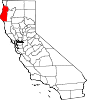
CDPs Alderpoint | Bayview | Benbow | Big Lagoon | Cutten | Fieldbrook | Fields Landing | Garberville | Humboldt Hill | Hydesville | Indianola | Loleta | McKinleyville | Manila | Miranda | Myers Flat | Myrtletown | Orick | Phillipsville | Pine Hills | Redcrest | Redway | Samoa | Scotia | Shelter Cove | Weott | Westhaven-Moonstone | Willow Creek
Unincorporated
communitiesAlton | Bayside | Blocksburg | Bracut | Brainard | Briceland | Bridgeville | Bucksport | Calville | Carlotta | Crannell | Dinsmore | Elk River | Englewood | Fairhaven | Fernbridge | Fort Seward | Freshwater | Freshwater Corners | Fruitland | Glendale | Holmes | Honeydew | Hoopa | Johnsons | King Salmon | Kneeland | Korbel | Maple Creek | Metropolitan | Moonstone | Orleans | Patricks Point | Pepperwood | Petrolia | Pine Hill | Port Kenyon | Ridgewoods Heights | Riverside Park | Rohnerville | Rosewood | Shively | Stafford | Sunny Brae | Weitchpec | Westhaven | Whitethorn
Indian
reservationsBig Lagoon Rancheria | Blue Lake Rancheria | Hoopa Valley Indian Reservation | Yurok Indian Reservation
Ghost towns Acorn | Albeeville | Apyu | Aranimokw | Arekw | Atsepar | Bald Hills | Blaine | Brock Creek | Bryan | Bryant | Buck's Port | Camp 4 Flat | Camp 19 | Camp Grant | Centerville | Chinits | Cleveland | Daby's Ferry | Dark Canyon | Dinty | Dyer Place | Eddyville | Elinor | Elk Grove | Elk Prairie | Erner | Ertlerger | Eshpeu | Frank | Gans | Hadley | Hartsook | Honsading | Humboldt City | Iaqua | Kokaman | Kworatem | Lippitt | Lockharts | Lone Star | Loolego | Luffenholtz | Mandala | Martins Ferry | McDuff | Meridian | Mountain View | Mower | Myrtle Grove | Northern Redwood Camp | Oketo | Opegoi | Ore'q | Panamenik | Pasara | Pekwan | Pekwuteu | Robinson's Ferry | Scribner | Shanamkarak | Showers Pass | Shregegon | Shumig | Skelly | Smith | Tanoak | Three Cabins | Tsofkara | Tsurau | West Humboldt | Wilder
Categories:- Eureka, California
- Census-designated places in Humboldt County, California


Wikimedia Foundation. 2010.