- Rio Dell, California
-
City of Rio Dell — City — Location in Humboldt County and the state of California
Coordinates: 40°29′57″N 124°06′23″W / 40.49917°N 124.10639°WCoordinates: 40°29′57″N 124°06′23″W / 40.49917°N 124.10639°W Country  United States
State  California
County Humboldt Area[1] – Total 2.418 sq mi (6.261 km2) – Land 2.282 sq mi (5.910 km2) – Water 0.136 sq mi (0.351 km2) 5.61% Elevation 161 ft (49 m) Population (2010) – Total 3,363 – Density 1,390.8/sq mi (537.1/km2) Time zone Pacific (PST) (UTC-8) – Summer (DST) PDT (UTC-7) ZIP code 95562 Area code(s) 707 FIPS code 06-60900 GNIS feature ID 0277614 Rio Dell (formerly, Rio Del and Eagle Prairie)[2] is a city in Humboldt County, California, United States. Rio Dell is located on the west bank of the Eel River 1 mile (2 km) north of Scotia,[2] at an elevation of 161 feet (49 m).[3] The population was 3,363 at the 2010 census, up from 3,174 at the 2000 census.
Contents
Geography
According to the United States Census Bureau, the city has a total area of 2.4 square miles (6.2 km2), of which, 2.3 square miles (6.0 km2) of it is land and 0.1 square miles (0.26 km2) of it (5.61%) is water.
History
The first post office at Rio Dell opened in 1876.[2] Rio Dell incorporated in 1965.[2]
Demographics
Historical populations Census Pop. %± 1970 2,817 — 1980 2,687 −4.6% 1990 3,012 12.1% 2000 3,174 5.4% 2010 3,368 6.1% source:[4] 2010
The 2010 United States Census[5] reported that Rio Dell had a population of 3,368. The population density was 1,393.2 people per square mile (537.9/km²). The racial makeup of Rio Dell was 2,894 (85.9%) White, 13 (0.4%) African American, 125 (3.7%) Native American, 25 (0.7%) Asian, 3 (0.1%) Pacific Islander, 140 (4.2%) from other races, and 168 (5.0%) from two or more races. Hispanic or Latino of any race were 384 persons (11.4%).
The Census reported that 3,347 people (99.4% of the population) lived in households, 21 (0.6%) lived in non-institutionalized group quarters, and 0 (0%) were institutionalized.
There were 1,367 households, out of which 440 (32.2%) had children under the age of 18 living in them, 560 (41.0%) were opposite-sex married couples living together, 199 (14.6%) had a female householder with no husband present, 85 (6.2%) had a male householder with no wife present. There were 131 (9.6%) unmarried opposite-sex partnerships, and 13 (1.0%) same-sex married couples or partnerships. 409 households (29.9%) were made up of individuals and 139 (10.2%) had someone living alone who was 65 years of age or older. The average household size was 2.45. There were 844 families (61.7% of all households); the average family size was 2.99.
The population was spread out with 803 people (23.8%) under the age of 18, 309 people (9.2%) aged 18 to 24, 824 people (24.5%) aged 25 to 44, 989 people (29.4%) aged 45 to 64, and 443 people (13.2%) who were 65 years of age or older. The median age was 38.3 years. For every 100 females there were 96.7 males. For every 100 females age 18 and over, there were 91.7 males.
There were 1,442 housing units at an average density of 596.5 per square mile (230.3/km²), of which 774 (56.6%) were owner-occupied, and 593 (43.4%) were occupied by renters. The homeowner vacancy rate was 0.6%; the rental vacancy rate was 2.8%. 1,952 people (58.0% of the population) lived in owner-occupied housing units and 1,395 people (41.4%) lived in rental housing units.
2000
As of the census[6] of 2000, there were 3,174 people, 1,221 households, and 830 families residing in the city. The population density was 1,684.2 people per square mile (651.9/km²). There were 1,434 housing units at an average density of 760.9 per square mile (294.5/km²). The racial makeup of the city was 85.63% White, 0.16% Black or African American, 3.88% Native American, 0.38% Asian, 0.03% Pacific Islander, 5.73% from other races, and 4.19% from two or more races. 10.81% of the population were Hispanic or Latino of any race.
There were 1,221 households out of which 34.4% had children under the age of 18 living with them, 48.1% were married couples living together, 13.2% had a female householder with no husband present, and 32.0% were non-families. 25.0% of all households were made up of individuals and 10.4% had someone living alone who was 65 years of age or older. The average household size was 2.59 and the average family size was 3.08.
In the city the population was spread out with 28.3% under the age of 18, 9.3% from 18 to 24, 26.5% from 25 to 44, 22.3% from 45 to 64, and 13.6% who were 65 years of age or older. The median age was 36 years. For every 100 females there were 98.6 males. For every 100 females age 18 and over, there were 94.8 males.
The median income for a household in the city was $29,254, and the median income for a family was $36,464. Males had a median income of $30,410 versus $19,688 for females. The per capita income for the city was $12,569. About 18.5% of families and 23.1% of the population were below the poverty line, including 31.1% of those under age 18 and 12.1% of those age 65 or over.
Politics
Rio Dell has a City Council - City Manager form of government. The City Council sets policy while the City Manager carries out the day-to-day business of the City. The Mayor is selected by the City Council and serves as the presiding officer at city council meetings and as the official head of the city for legislative and ceremonial purposes.
- City Manager: Jim Stretch (interim)
- Council members: R.L. "Bud" Leonard (mayor), Julie Woodall (mayor pro-tem), and council members; Melissa Marks, Mike Dunker, Marc Barsanti
- City Clerk: Karen Dunham
- Chief of Police: Graham Hill
In the state legislature Rio Dell is located in the 2nd Senate District, represented by Democrat Noreen Evans, and in the 1st Assembly District, represented by Democrat Wesley Chesbro. Federally, Rio Dell is located in California's 1st congressional district, which has a Cook PVI of D +10[7] and is represented by Democrat Mike Thompson.
See also
References
- ^ U.S. Census
- ^ a b c d Durham, David L. (1998). California's Geographic Names: A Gazetteer of Historic and Modern Names of the State. Quill Driver Books. p. 132. ISBN 9781884995149.
- ^ U.S. Geological Survey Geographic Names Information System: Rio Dell, California
- ^ "Historical Census Populations of Places, Towns, and Cities in California, 1850-2000". California Dept. of Finance. http://http://www.dof.ca.gov/research/demographic/state_census_data_center/historical_census_1850-2010/view.php. Retrieved 2011-11-12.
- ^ All data are derived from the United States Census Bureau reports from the 2010 United States Census, and are accessible on-line here. The data on unmarried partnerships and same-sex married couples are from the Census report DEC_10_SF1_PCT15. All other housing and population data are from Census report DEC_10_DP_DPDP1. Both reports are viewable online or downloadable in a zip file containing a comma-delimited data file. The area data, from which densities are calculated, are available on-line here. Percentage totals may not add to 100% due to rounding. The Census Bureau defines families as a household containing one or more people related to the householder by birth, opposite-sex marriage, or adoption. People living in group quarters are tabulated by the Census Bureau as neither owners nor renters. For further details, see the text files accompanying the data files containing the Census reports mentioned above.
- ^ "American FactFinder". United States Census Bureau. http://factfinder.census.gov. Retrieved 2008-01-31.
- ^ "Will Gerrymandered Districts Stem the Wave of Voter Unrest?". Campaign Legal Center Blog. http://www.clcblog.org/blog_item-85.html. Retrieved 2007-10-20.
Municipalities and communities of Humboldt County, California Cities 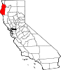
CDPs Alderpoint | Bayview | Benbow | Big Lagoon | Cutten | Fieldbrook | Fields Landing | Garberville | Humboldt Hill | Hydesville | Indianola | Loleta | McKinleyville | Manila | Miranda | Myers Flat | Myrtletown | Orick | Phillipsville | Pine Hills | Redcrest | Redway | Samoa | Scotia | Shelter Cove | Weott | Westhaven-Moonstone | Willow Creek
Unincorporated
communitiesAlton | Bayside | Blocksburg | Bracut | Brainard | Briceland | Bridgeville | Bucksport | Calville | Carlotta | Crannell | Dinsmore | Elk River | Englewood | Fairhaven | Fernbridge | Fort Seward | Freshwater | Freshwater Corners | Fruitland | Glendale | Holmes | Honeydew | Hoopa | Johnsons | King Salmon | Kneeland | Korbel | Maple Creek | Metropolitan | Moonstone | Orleans | Patricks Point | Pepperwood | Petrolia | Pine Hill | Port Kenyon | Ridgewoods Heights | Riverside Park | Rohnerville | Rosewood | Shively | Stafford | Sunny Brae | Weitchpec | Westhaven | Whitethorn
Indian
reservationsBig Lagoon Rancheria | Blue Lake Rancheria | Hoopa Valley Indian Reservation | Yurok Indian Reservation
Ghost towns Acorn | Albeeville | Apyu | Aranimokw | Arekw | Atsepar | Bald Hills | Blaine | Brock Creek | Bryan | Bryant | Buck's Port | Camp 4 Flat | Camp 19 | Camp Grant | Centerville | Chinits | Cleveland | Daby's Ferry | Dark Canyon | Dinty | Dyer Place | Eddyville | Elinor | Elk Grove | Elk Prairie | Erner | Ertlerger | Eshpeu | Frank | Gans | Hadley | Hartsook | Honsading | Humboldt City | Iaqua | Kokaman | Kworatem | Lippitt | Lockharts | Lone Star | Loolego | Luffenholtz | Mandala | Martins Ferry | McDuff | Meridian | Mountain View | Mower | Myrtle Grove | Northern Redwood Camp | Oketo | Opegoi | Ore'q | Panamenik | Pasara | Pekwan | Pekwuteu | Robinson's Ferry | Scribner | Shanamkarak | Showers Pass | Shregegon | Shumig | Skelly | Smith | Tanoak | Three Cabins | Tsofkara | Tsurau | West Humboldt | Wilder
Categories:- Incorporated cities and towns in California
- Cities in Humboldt County, California


Wikimedia Foundation. 2010.