- Trinidad, California
-
City of Trinidad — City — Trinidad, California Location in Humboldt County and the state of California
 Trinidad Coastline South; CCNM
Coordinates: 41°03′33″N 124°08′35″W / 41.05917°N 124.14306°WCoordinates: 41°03′33″N 124°08′35″W / 41.05917°N 124.14306°W Country  United States
State  California
County Humboldt Government – Type Council-Manager Government Area[1] – Total 0.671 sq mi (1.737 km2) – Land 0.485 sq mi (1.255 km2) – Water 0.186 sq mi (0.482 km2) 27.75% Elevation 174 ft (53 m) Population (2010) – Total 367 – Density 546.9/sq mi (211.3/km2) Time zone Pacific (PST) (UTC-8) – Summer (DST) PDT (UTC-7) ZIP code 95570 Area code(s) 707 FIPS code 06-80448 GNIS feature ID 1660029 Website www.trinidad.ca.gov U.S. Geological Survey Geographic Names Information System: Trinidad, California Reference #: 216 Trinidad is a seaside city in Humboldt County, located on the Pacific Ocean 8 miles (13 km) north of the Arcata-Eureka Airport and 15 miles (24 km) north of the college town of Arcata. Situated directly above its own North Coast harbor, one of California's smallest incorporated cities by population (367 residents in 2010, up from 311 residents in 2000) is noted for its spectacular coastline with ten public beaches and offshore rocks. These rocks are part of the California Coastal National Monument of which Trinidad is a Gateway City.[2] Fishing operations related to Trinidad Harbor are vital to both local tourism and commercial fishery interests in the region. Trinidad lies at an elevation of 174 feet (53 m).[3]
Contents
History
Yurok Indians settled the bluffs over the bay before 1700 AD at the village of Tsurai. The first European sighting of Trinidad Harbor was by the Portuguese navigator Sebastian Rodriguez Cermeño, who did not make landfall. The next visit was by Bruno de Heceta and Juan Francisco de la Bodega y Quadra of the Spanish Navy. Their two ships anchored in Trinidad Bay on June 9, 1775. On June 11, which was Trinity Sunday, a formal act of possession was conducted.[4] The area was named "la Santisima Trinidad".
Settlers arrived on the James R. Whitting in 1850 and founded the town, renamed Warnersville in honor of R.V. Warner, one of the settlers.[5] The first post office opened in Trinidad in 1851.[5]
Trinidad was the original county seat of Klamath County, one of California's original counties, from 1851 to 1854. At that time Trinidad became part of the newly created Humboldt County after its creation in 1853, with its county seat in Eureka. Klamath County was finally dissolved in 1874.
During the American Civil War from July to October 1863, California Volunteers fighting the local Indians in the Bald Hills War were stationed in the town, in Trinidad Camp to protect it and the coast road from Indian raids, until they were moved four miles north to Camp Gilmore.[6] Trinidad was incorporated in 1870 as a City of the State of California, USA.[7]
Climate
Trinidad has an oceanic climate and is relatively temperate compared with inland areas.[8] Annual temperatures range from approximately 40 °F (4 °C) to 60 °F (16 °C). Winter months are rainy with the average amount being around 50 inches (130 cm),[9] Although rain falls in all months of the year, it is less pronounced in the summertime.[8] Spring and fall cold fronts often form advection fog which pushes the marine layer towards the coast. In summer, low pressure troughs produced by intense heating inland can create strong pressure gradients pulling the marine layer ashore.[8] Summer fogs, moderate precipitation, and mild temperatures are characteristic of Northern California coastal forests ecoregion and are vital to the growth of local Coast Redwood.[10] Protected stands of old growth redwoods can be visited 20 miles (32 km) north of Trinidad, in Redwood National and State Parks.
Demographics
 Trinidad in 2008
2010 Census data
The 2010 United States Census[11] reported that Trinidad had a population of 367. The population density was 547.1 people per square mile (211.2/km²). The racial makeup of Trinidad was 331 (90.2%) White, 2 (0.5%) African American, 15 (4.1%) Native American, 2 (0.5%) Asian, 1 (0.3%) Pacific Islander, 1 (0.3%) from other races, and 15 (4.1%) from two or more races. Hispanic or Latino of any race were 11 persons (3.0%).
The Census reported that 366 people (99.7% of the population) lived in households, 1 (0.3%) lived in non-institutionalized group quarters, and 0 (0%) were institutionalized. There were 187 households, out of which 35 (18.7%) had children under the age of 18 living in them, 64 (34.2%) were opposite-sex married couples living together, 21 (11.2%) had a female householder with no husband present, 3 (1.6%) had a male householder with no wife present. There were 20 (10.7%) unmarried opposite-sex partnerships, and 3 (1.6%) same-sex married couples or partnerships. 73 households (39.0%) were made up of individuals and 28 (15.0%) had someone living alone who was 65 years of age or older. The average household size was 1.96. There were 88 families (47.1% of all households); the average family size was 2.64.
The population dispersal was 60 people (16.3%) under the age of 18, 25 people (6.8%) aged 18 to 24, 91 people (24.8%) aged 25 to 44, 120 people (32.7%) aged 45 to 64, and 71 people (19.3%) who were 65 years of age or older. The median age was 45.9 years. For every 100 females there were 98.4 males. For every 100 females age 18 and over, there were 98.1 males. There were 252 housing units at an average density of 375.7 per square mile (145.0/km²), of which 113 (60.4%) were owner-occupied, and 74 (39.6%) were occupied by renters. The homeowner vacancy rate was 4.2%; the rental vacancy rate was 12.9%. 212 people (57.8% of the population) lived in owner-occupied housing units and 154 people (42.0%) lived in rental housing units.
2000 Census data
Historical populations Census Pop. %± 1880 104 — 1930 107 — 1940 94 −12.1% 1950 188 100.0% 1960 289 53.7% 1970 300 3.8% 1980 379 26.3% 1990 362 −4.5% 2000 311 −14.1% 2010 367 18.0% source:[12] As of the census[13] of 2000, there were 311 people, 168 households, and 73 families residing in the city. The population density was 643.0 people per square mile (250.2/km²). There were 228 housing units at an average density of 471.4 per square mile (183.4/km²). The racial makeup of the city was 94.86% White, 1.61% Black or African American, 0.32% Native American, 0.64% Asian, 0.32% Pacific Islander, 0.32% from other races, and 1.93% from two or more races. 2.25% of the population were Hispanic or Latino of any race. There were 168 households out of which 12.5% had children under the age of 18 living with them, 36.9% were married couples living together, 5.4% had a female householder with no husband present, and 56.5% were non-families. 40.5% of all households were made up of individuals and 11.9% had someone living alone who was 65 years of age or older. The average household size was 1.85 and the average family size was 2.51.
In the city the population dispersal was 11.3% under the age of 18, 5.5% from 18 to 24, 21.9% from 25 to 44, 41.5% from 45 to 64, and 19.9% who were 65 years of age or older. The median age was 50 years. For every 100 females there were 98.1 males. For every 100 females age 18 and over, there were 100.0 males. The median income for a household in the city was $40,000, and the median income for a family was $50,357. Males had a median income of $39,583 versus $31,167 for females. The per capita income for the city was $28,050. About 2.3% of families and 8.8% of the population were below the poverty line, including 6.7% of those under age 18 and none of those age 65 or over.
Politics
In the state legislature Trinidad is located in the 2nd Senate District, represented by Democrat Noreen Evans, and in the 1st Assembly District, represented by Democrat Wesley Chesbro. Federally, Trinidad is located in California's 1st Congressional District.
Points of Interest
 Trinidad State Beach, near Trinidad
State Parks
- Little River State Beach
- Patrick's Point State Park
- Trinidad State Beach
Historic Landmarks
- Trinidad Head Light, National Registered Landmark #1720
- Trinidad Head, State Historic Landmark #146
- Town of Trinidad, State Historic Landmark #216
- Old Indian Village of Tsurai, State Historic Landmark #838
Other
- Trinidad Pier
- Fred Telonicher Marine Laboratory, Humboldt State University
- Trinidad City Cemetery includes Indian and settler graves and one unusual tombstone.
Edward Bernhardt Schnaubelt was the brother of Rudolph Schnaubelt, accused of the Haymarket Riot bombing in Chicago, Illinois and the brother-in-law of Michael Schwab, sentenced to death for his role in the riot. All three Schnaubelt brothers left Chicago shortly after the riot. Edward Schnaubelt briefly panned for gold before settling in Trinidad, opening a sawmill and buying a tract of timber to supply his mill. After Schnaubelt's mill was taken over by his rivals, he re-entered the closed mill at night to reclaim his personal tools, and was shot to death by a nightwatchman hired to protect the property. His wife chose the phrase "Murdered by Capitalism" for his marker which inspired the 2004 book by John Ross.[14]
 Edward Bernhardt Schnaubelt's tombstone in the Trinidad Cemetery
Events
- Trinidad to Clam Beach Run (February)
- Trinidad Fish Festival (June)
- Blessing of the Fleet (November)
People from Trinidad
- Henry A. Boyes - First Sergeant, Fifth Marines: Eugene Sledge, With the Old Breed: At Peleliu and Okinawa, p. 213
- Michael John Fles - poet and musician
- Howard B. Keck - businessman
- Tim McKay - environmental activist
- Don Van Vliet aka Captain Beefheart – musician and painter
References
- ^ U.S. Census
- ^ http://www.blm.gov/ca/st/en/prog/blm_special_areas/nm/ccnm/ccnm_brochures.html
- ^ U.S. Geological Survey Geographic Names Information System: Trinidad, California
- ^ Tovell, Freeman M. (2008). At the Far Reaches of Empire: The Life of Juan Francisco De La Bodega Y Quadra. University of British Columbia Press. pp. 22–23. ISBN 9780774813679. http://books.google.com/books?id=E8_LXicsIlEC.
- ^ a b Durham, David L. (1998). California's Geographic Names: A Gazetteer of Historic and Modern Names of the State. Quill Driver Books. p. 159. ISBN 9781884995149.
- ^ Trinidad Camp
- ^ http://www.trinidad.ca.gov/land_use_permits.cfm
- ^ a b c "About Humboldt County: Geography". Humboldt County, California. http://co.humboldt.ca.us/portal/about.asp. Retrieved 25 May 2011.
- ^ "Trinidad, California". City Data. City Data website. http://www.city-data.com/city/Trinidad-California.html. Retrieved 25 May 2011.
- ^ Jebens, Brandon (Fall 1999). "The Biogeography of Sequoia sempervirens". Student Paper, Geography 316: Biogeography. San Francisco State University Department of Geography. http://bss.sfsu.edu/holzman/courses/Fall99Projects/redwood.htm. Retrieved 25 May 2011.
- ^ All data are derived from the United States Census Bureau reports from the 2010 United States Census, and are accessible on-line here. The data on unmarried partnerships and same-sex married couples are from the Census report DEC_10_SF1_PCT15. All other housing and population data are from Census report DEC_10_DP_DPDP1. Both reports are viewable online or downloadable in a zip file containing a comma-delimited data file. The area data, from which densities are calculated, are available on-line here. Percentage totals may not add to 100% due to rounding. The Census Bureau defines families as a household containing one or more people related to the householder by birth, opposite-sex marriage, or adoption. People living in group quarters are tabulated by the Census Bureau as neither owners nor renters. For further details, see the text files accompanying the data files containing the Census reports mentioned above.
- ^ "Historical Census Populations of Places, Towns, and Cities in California, 1850-2000". California Dept. of Finance. http://http://www.dof.ca.gov/research/demographic/state_census_data_center/historical_census_1850-2010/view.php. Retrieved 2011-11-12.
- ^ "American FactFinder". United States Census Bureau. http://factfinder.census.gov. Retrieved 2008-01-31.
- ^ Ross, John (June 2004). Murdered by capitalism: a memoir of 150 years of life and death on the American left. Avalon Publishing Group. pp. 400. ISBN 9781560255789. http://books.google.com/books?id=n19oRU8jX3EC&lpg=PA1&dq=E.B.%20Schnaubelt%2C%20%20trinidad&pg=PA1#v=onepage.
External links
Government and Public Community Information
Individual and Private Community Information
Municipalities and communities of Humboldt County, California Cities 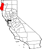
CDPs Alderpoint | Bayview | Benbow | Big Lagoon | Cutten | Fieldbrook | Fields Landing | Garberville | Humboldt Hill | Hydesville | Indianola | Loleta | McKinleyville | Manila | Miranda | Myers Flat | Myrtletown | Orick | Phillipsville | Pine Hills | Redcrest | Redway | Samoa | Scotia | Shelter Cove | Weott | Westhaven-Moonstone | Willow Creek
Unincorporated
communitiesAlton | Bayside | Blocksburg | Bracut | Brainard | Briceland | Bridgeville | Bucksport | Calville | Carlotta | Crannell | Dinsmore | Elk River | Englewood | Fairhaven | Fernbridge | Fort Seward | Freshwater | Freshwater Corners | Fruitland | Glendale | Holmes | Honeydew | Hoopa | Johnsons | King Salmon | Kneeland | Korbel | Maple Creek | Metropolitan | Moonstone | Orleans | Patricks Point | Pepperwood | Petrolia | Pine Hill | Port Kenyon | Ridgewoods Heights | Riverside Park | Rohnerville | Rosewood | Shively | Stafford | Sunny Brae | Weitchpec | Westhaven | Whitethorn
Indian
reservationsBig Lagoon Rancheria | Blue Lake Rancheria | Hoopa Valley Indian Reservation | Yurok Indian Reservation
Ghost towns Acorn | Albeeville | Apyu | Aranimokw | Arekw | Atsepar | Bald Hills | Blaine | Brock Creek | Bryan | Bryant | Buck's Port | Camp 4 Flat | Camp 19 | Camp Grant | Centerville | Chinits | Cleveland | Daby's Ferry | Dark Canyon | Dinty | Dyer Place | Eddyville | Elinor | Elk Grove | Elk Prairie | Erner | Ertlerger | Eshpeu | Frank | Gans | Hadley | Hartsook | Honsading | Humboldt City | Iaqua | Kokaman | Kworatem | Lippitt | Lockharts | Lone Star | Loolego | Luffenholtz | Mandala | Martins Ferry | McDuff | Meridian | Mountain View | Mower | Myrtle Grove | Northern Redwood Camp | Oketo | Opegoi | Ore'q | Panamenik | Pasara | Pekwan | Pekwuteu | Robinson's Ferry | Scribner | Shanamkarak | Showers Pass | Shregegon | Shumig | Skelly | Smith | Tanoak | Three Cabins | Tsofkara | Tsurau | West Humboldt | Wilder
Categories:- California Historical Landmarks
- Incorporated cities and towns in California
- Populated coastal places in California
- Cities in Humboldt County, California
- Former county seats in California
- Ports and harbors of California
- American Civil War army posts


Wikimedia Foundation. 2010.