- Olancha, California
-
Olancha — census-designated place — Location in Inyo County and the state of California
Coordinates: 36°16′55″N 118°00′23″W / 36.28194°N 118.00639°WCoordinates: 36°16′55″N 118°00′23″W / 36.28194°N 118.00639°W Country  United States
State  California
County Inyo Area[1] – Total 7.872 sq mi (20.388 km2) – Land 7.841 sq mi (20.308 km2) – Water 0.031 sq mi (0.080 km2) 0.39% Elevation[2] 3,658 ft (1,115 m) Population (2010) – Total 192 – Density 24.4/sq mi (9.4/km2) Time zone Pacific (PST) (UTC-8) – Summer (DST) PDT (UTC-7) ZIP code 93549 Area code(s) 760 FIPS code 06-53490 GNIS feature ID 0272775 Olancha (formerly, Olanche)[3] is a census-designated place in Inyo County of the U.S. state of California.[2] Olancha is located on U.S. Route 395 in California, 37 miles (60 km) south-southeast of Independence,[3] at an elevation of 3658 feet (1115 m).[2] As of the 2010 census, the population was 192, up from 134 at the 2000 census.
Located in the Owens Valley next to the now mostly dry Owens Lake, the arid settlement is home to a major bottled water plant for Crystal Geyser Natural Alpine Spring Water.[1][2]
Contents
Geography
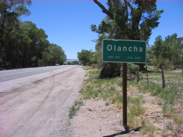
 "City" limit looking south
Olancha is an unincorporated community located in the Owens Valley on the eastern slope of the Sierra Nevada mountain range at the elevation of 3,650 feet (1,110 m), in Inyo County, California. It is on US Highway 395 near the junction of State Route 190, approximately 200 miles (320 km) northeast of Los Angeles. Owens Lake - a dry saline lakebed - lies to the northeast of Olancha. Olancha Creek flows from the slopes of nearby Olancha Peak (12,123 ft), passing near the town of Olancha, and finally towards Owens Lake. To the east of town lie some sand dunes, as well as a hot spring known as "Dirty Socks".
According to the United States Census Bureau, the CDP has a total area of 7.9 square miles (20 km2), over 99% of it land.
History
Olancha was established by Minnard Farley, who came to the area in 1860 and discovered silver ore in the nearby Coso Range. The name "Olancha" is believed to be derived from the nearby Yaudanche tribe. For processing the ore, he built a stamp mill just south of Olancha Creek. The remains of a stone wall from this mill still exists and has been designated as a California Historical Site (marker #796).
The first post office at Olancha opened in 1870.[3]
Demographics
2010
The 2010 United States Census[4] reported that Olancha had a population of 192. The population density was 24.4 people per square mile (9.4/km²). The racial makeup of Olancha was 133 (69.3%) White, 0 (0.0%) African American, 4 (2.1%) Native American, 8 (4.2%) Asian, 0 (0.0%) Pacific Islander, 38 (19.8%) from other races, and 9 (4.7%) from two or more races. Hispanic or Latino of any race were 47 persons (24.5%).
The Census reported that 192 people (100% of the population) lived in households, 0 (0%) lived in non-institutionalized group quarters, and 0 (0%) were institutionalized.
There were 78 households, out of which 23 (29.5%) had children under the age of 18 living in them, 44 (56.4%) were opposite-sex married couples living together, 1 (1.3%) had a female householder with no husband present, 5 (6.4%) had a male householder with no wife present. There were 7 (9.0%) unmarried opposite-sex partnerships, and 0 (0%) same-sex married couples or partnerships. 22 households (28.2%) were made up of individuals and 6 (7.7%) had someone living alone who was 65 years of age or older. The average household size was 2.46. There were 50 families (64.1% of all households); the average family size was 3.10.
The population was spread out with 44 people (22.9%) under the age of 18, 9 people (4.7%) aged 18 to 24, 37 people (19.3%) aged 25 to 44, 69 people (35.9%) aged 45 to 64, and 33 people (17.2%) who were 65 years of age or older. The median age was 47.2 years. For every 100 females there were 115.7 males. For every 100 females age 18 and over, there were 120.9 males.
There were 97 housing units at an average density of 12.3 per square mile (4.8/km²), of which 44 (56.4%) were owner-occupied, and 34 (43.6%) were occupied by renters. The homeowner vacancy rate was 2.2%; the rental vacancy rate was 2.9%. 108 people (56.3% of the population) lived in owner-occupied housing units and 84 people (43.8%) lived in rental housing units.
2000
As of the census[5] of 2000, there were 134 people, 50 households, and 38 families residing in the CDP. The population density was 18.4 people per square mile (7.1/km²). There were 62 housing units at an average density of 8.5 per square mile (3.3/km²). The racial makeup of the CDP was 53.73% White, 0.75% Native American, 5.97% from other races, and 9.70% from two or more races. 37.31% of the population were Hispanic or Latino of any race.
There were 50 households out of which 40.0% had children under the age of 18 living with them, 60.0% were married couples living together, 14.0% had a female householder with no husband present, and 24.0% were non-families. 20.0% of all households were made up of individuals and 4.0% had someone living alone who was 65 years of age or older. The average household size was 2.68 and the average family size was 3.13.
In the CDP the population was spread out with 32.1% under the age of 18, 3.7% from 18 to 24, 26.9% from 25 to 44, 26.9% from 45 to 64, and 10.4% who were 65 years of age or older. The median age was 37 years. For every 100 females there were 86.1 males. For every 100 females age 18 and over, there were 89.6 males.
The median income for a household in the CDP was $30,000, and the median income for a family was $46,250. Males had a median income of $31,250 versus $26,250 for females. The per capita income for the CDP was $18,124. There were 4.5% of families and 9.4% of the population living below the poverty line, including 17.2% of under eighteens and none of those over 64.
Politics
In the state legislature Olancha is located in the 18th Senate District, represented by Republican Roy Ashburn, and in the 18th Assembly District, represented by Republican Bill Maze. Federally, Olancha is located in California's 25th congressional district, which has a Cook PVI of R +7[6] and is represented by Republican Buck McKeon.
Olancha in popular culture
Part of the film Bug (2007) directed by William Friedkin, starring Ashley Judd, Michael Shannon and Harry Connick, Jr., was filmed in Olancha. [3]
Other films filmed in or near Olancha include Iron Man (2008), Panic in Motion (2005), Taxidermist (2008), and Tremors (1990). [4]
The post-punk power quartet The Owl recorded a song titled "Olancha" in 2005 inspired by guitarist Jesse Sateriale's experiences from his early childhood in the town.
Ambient composer Harold Budd (raised in the desert town of Victorville, CA) recites his "Poem: Distant Lights of Olancha Recede" on the album By the Dawn's Early Light (1991, All Saints). "Olancha Farewell" is a short synthesizer piece on Budd's album Lovely Thunder (1986, Editions EG).References
- ^ U.S. Census
- ^ a b c U.S. Geological Survey Geographic Names Information System: Olancha, California
- ^ a b c Durham, David L. (1998). California's Geographic Names: A Gazetteer of Historic and Modern Names of the State. Quill Driver Books. p. 1191. ISBN 9781884995149.
- ^ All data are derived from the United States Census Bureau reports from the 2010 United States Census, and are accessible on-line here. The data on unmarried partnerships and same-sex married couples are from the Census report DEC_10_SF1_PCT15. All other housing and population data are from Census report DEC_10_DP_DPDP1. Both reports are viewable online or downloadable in a zip file containing a comma-delimited data file. The area data, from which densities are calculated, are available on-line here. Percentage totals may not add to 100% due to rounding. The Census Bureau defines families as a household containing one or more people related to the householder by birth, opposite-sex marriage, or adoption. People living in group quarters are tabulated by the Census Bureau as neither owners nor renters. For further details, see the text files accompanying the data files containing the Census reports mentioned above.
- ^ "American FactFinder". United States Census Bureau. http://factfinder.census.gov. Retrieved 2008-01-31.
- ^ "Will Gerrymandered Districts Stem the Wave of Voter Unrest?". Campaign Legal Center Blog. http://www.clcblog.org/blog_item-85.html. Retrieved 2007-10-20.
Municipalities and communities of Inyo County, California City 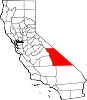
CDPs Big Pine | Cartago | Darwin | Dixon Lane-Meadow Creek | Furnace Creek | Homewood Canyon | Independence | Keeler | Lone Pine | Mesa | Olancha | Pearsonville | Round Valley | Shoshone | Tecopa | Trona | Valley Wells | West Bishop | Wilkerson
Unincorporated
communitiesAberdeen | Alabama Hills | Alico | Alta Vista | Ashford Junction | Aspendell | Badwater | Ballarat | Bartlett | Beatty Junction | Beveridge | Blackrock | Brockmans Corner | Calvada Springs | Coso | Coso Junction | Crater | Death Valley Junction | Deep Springs | Dolomite | Dunmovin | Evelyn | Fish Springs | Grant | Haiwee | Harrisburg | Homewood Canyon-Valley Wells | Indian Village | Junction Ranch | Kearsarge | Keough Hot Springs | Laws | Linnie | Little Lake | Millspaugh | Mock | Monola | Oteys Sierra Village | Owenyo | Panamint Springs | Park Village | Peterson Mill | Poleta | Reward | Rocking K | Rovana | Ryan | Scheelite | Scranton | Seven Pines | Stovepipe Wells | Sykes | Talus | Teakettle Junction | Whitney Portal | Zurich
Indian
reservationsBig Pine Reservation | Lone Pine Reservation
Ghost towns Ashford Mill | Avena | Bend City | Bradford Siding | Burnt Wagons | Carthage | Cerro Gordo Landing | Chloride City | Chrysopolis | Clark | Copperfield | Coso | Echo | Elna | Furnace | Furnace Creek Inn | Greenwater | Grestley | Horton | Intake | Jay | Kasson | Kearsarge | Lane Mill | Leadfield | Lee | Lila C | Lone Pine Station | Lookout City | Manzanar | Narka | Newburyport | Nine Mile Station | Noonday Camp | Owensville | Panamint | Reilly | San Carlos | Schwaub | Skidoo | Skyes | Sodan | Stewarts | Sunland | Swansea | Tule Station | White Mountain City
Categories:- Census-designated places in Inyo County, California
- Populated places in the Mojave Desert


Wikimedia Foundation. 2010.