- Drogowa Trasa Średnicowa
-
Drogowa Trasa Średnicowa Route information Length: 14.7 km (9.1 mi) Major junctions  Gliwice, ul. Portowa 16.7 km (10.4 mi) Ruda Śląska 18.3 km (11.4 mi) ul. Niedurnego 21 km (13 mi) Świętochłowice, ul. Bytomska 22.3 km (13.9 mi) ul. Żołnierska, ul. Nomiarki 23.3 km (14.5 mi) Chorzów, ul. Dąbrowskiego 23.8 km (14.8 mi) ul. BoWiD 25 km (16 mi) ul. Gałeczki 26 km (16 mi) Katowice, ul. Mieszka I
 bridge over ul. Bracka, 600 m (2,000 ft) long 27.5 km (17.1 mi) 28.9 km (18.0 mi) ul. Stęślickiego, ul. Grundmanna 29.4 km (18.3 mi) ul. Sokolska 29.7 km (18.5 mi) Jerzy Ziętek Rondo
 under Jerzy Ziętek Rondo, northern 657 m (2,156 ft) long, southern 650 m (2,130 ft) long
 31.3 km (19.4 mi) al. Roździeńskiego Silesian Voivodeship
Major cities: Gliwice, Zabrze, Ruda Śląska, Świętochłowice, Chorzów, Katowice Highway system  DTŚ in the Katowice city center
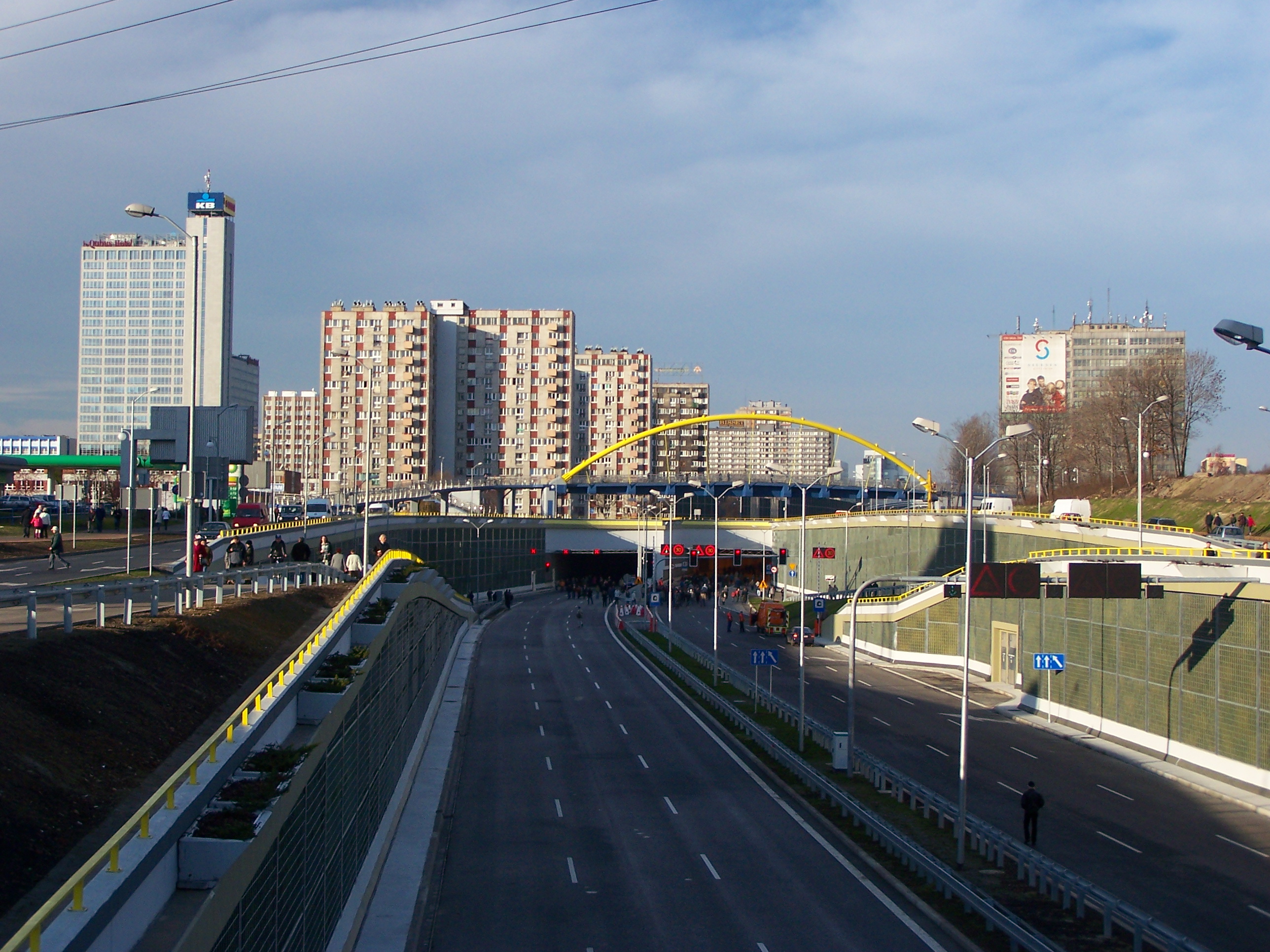
Drogowa Trasa Średnicowa (DTŚ, can be translated as diametral highway or central highway) is a highway in Silesian Voivodeship, Poland. The DTŚ is entirely a divided highway, with a minimum of 3 lanes in each direction. It is one of the most important roads of the Upper Silesian Industrial Region. The DTŚ runs most of its course parallel to A4 motorway but, unlike A4, the DTŚ provides access to the congested centers of the Upper Silesian Metropolitan Union. Currently, the DTŚ runs from Katowice, through Chorzów and Świętochłowice, Ruda Śląska and Zabrze. An extension through Zabrze is currently under construction, and continuation to Gliwice is planned where accession to A1 motorway and connection to A4 motorway is planned.[2][3]
The construction of road resulted in a considerable improvement in the traffic of the highly urbanized area of Upper Silesian Metropolitan Union. It shortened the road distance between Katowice and Gliwice by 26%, travelling time by 76%, consumption of gasoline by 47%, the number of road accidents by 82%, exploitation costs by 39%, and air pollution by 50%.[4]
Construction
The DTŚ is the largest road investment ever carried out by a local government in Poland. It has been financed in large part with Polish government funds but also using voivodeship and the local city budgets. Once completed, DTŚ should have 26 junctions (for comparison, the motorway A4 running in parallel has only 6 junctions in the same area).[4]
The construction started in 1986. In 1990, due to Polish financial problems, the work practically halted. Since 1994 the budget for construction increased thanks to the European Investment Bank (EIB) that provided a guarantee of funding. Since 1999 the construction of the DTŚ has been a shared responsibility of the Polish government, local government of the Silesian Voivodeship and of the cities through which the road runs, and work progresses steadily. So far 14.7 km (9.1 mi) were completed out of the total planned 31.3 km (19.4 mi). A local society in Gliwice has been protesting against proposed layout of the road through the city center (on ecological basis).[5]
An eastern extension of the DTŚ is planned for a more distant future. This branch would run from Katowice to Mysłowice and Zagłębie Dąbrowskie cities: Sosnowiec, Będzin and Dąbrowa Górnicza. Planned length of this part is expected to be 22.3 km (13.9 mi).
References
- ^ Discontinuity of route
- ^ "DTŚ" S.A.. "Opis trasy" (in Polish). http://www.dts-sa.pl/trasa-dts/. Retrieved July 8, 2010.
- ^ "DTŚ" S.A.. ""Połączenie autostrady A1 z autostradą A4 poprzez przebudowę ponadregionalnego układu komunikacyjnego pólnoc-południe."" (in Polish). http://www.dts-sa.pl/kolumna-lewa/projekty-inwestycyjne/opis-projektu/article/1566/usluga-konsultant-do-spraw-przygotowania-realizacji-projektu-pn-polaczen/. Retrieved July 8, 2010.
- ^ a b "Roads to Euro 2012. An Analysis of Poland's Road Infrastructure. Current Status and the Development Opportunities." American Chamber of Commerce in Poland, Warszawa, June 2007.
- ^ GdG Association (Polish)
Categories:- Roads in Poland
Wikimedia Foundation. 2010.