- Ridgecrest, California
-
City of Ridgecrest — City — View of Ridgecrest Location in Kern County and the state of California
 Sign pointing to Ridgecrest and the China Lake Naval Air Weapons Station
Coordinates: 35°37′21″N 117°40′15″W / 35.6225°N 117.67083°WCoordinates: 35°37′21″N 117°40′15″W / 35.6225°N 117.67083°W Country United States State California County Kern Government – Mayor Steve Morgan – Senate Roy Ashburn (R) – Assembly Jean Fuller (R) – U. S. Congress Kevin McCarthy (R) Area[1] – Total 21.417 sq mi (55.469 km2) – Land 20.766 sq mi (53.783 km2) – Water 0.651 sq mi (1.685 km2) 3.04% Elevation[2] 2,290 ft (698 m) Population (2010) – Total 27,616 – Density 1,289.4/sq mi (497.9/km2) Time zone PST (UTC-8) – Summer (DST) PDT (UTC-7) ZIP codes 93555-93556 Area code(s) 760 FIPS code 06-60704 GNIS feature ID 1652783 Website City of Ridgecrest Ridgecrest, formerly known as Crumville, was incorporated as a city in 1913. It is located in the Indian Wells Valley in northeastern Kern County, California, adjacent to the Naval Air Weapons Station China Lake (NAWS, or China Lake). Ridgecrest is the only incorporated city along US 395 in Kern County. The population was 27,616 at the 2010 census, up from 24,927 at the 2000 census. The city of Ridgecrest is a largely "company" oriented (China Lake, above) community big enough to provide plenty of schools, shopping and health care.
Ridgecrest is surrounded by four mountain ranges; the Sierra Nevada on the west, the Cosos on the north, the Argus Range on the east, and the El Paso Mountains on the south. It is approximately 82 miles (132 km) from the Lancaster/Palmdale area and approximately 145 miles (233 km) from both Bakersfield and San Bernardino, the three nearest major urban centers. Air travel in and out of the city is provided through the Inyokern Airport.
Ridgecrest is within two hours of the highest and the lowest points in the conterminous U.S.[3]
Contents
History
Before this little town was called "Crumville", it was a farming community. The settlement began as Crumville in 1912,[4] honoring James and Robert Crum, local dairymen.[4] The first post office opened in 1941. By 1943, Ridgecrest had grown to 115 homes and 196 residents. NOTS (Naval Ordnance Test Station) was established in November 1943, providing a strong job base for the years to come.[4]
Ridgecrest incorporated in 1963.[4] During this era the growth of Ridgecrest was governed by the continuing needs of the high tech industries coupled to the Naval Stations programs for testing arms and guidance systems.
Geography
 Overview shot of Ridgecrest, from the west on CA-178
According to the United States Census Bureau, the city has a total area of 21.4 square miles (55.4 km2), of which 20.8 sq mi (53.9 km2) is land and 0.7 sq mi (1.8 km2) of it (3.04%) is water. Ridgecrest is located in Indian Wells Valley, which is a southern extension of Owens Valley, broken up by the volcanic Coso Range.
1995 Ridgecrest earthquake
The area, associated with the Eastern California Shear Zone (ECSZ), has experienced numerous earthquake swarms in the past (groups of several thousand quakes under magnitude 6.0 or so) often with no obvious mainshock. The 1995 Ridgecrest earthquake sequence started on August 17, when a magnitude 5.5 quake, centered 18 kilometers (11 mi) north of the town of Ridgecrest, shook the area and spawned over 2,500 aftershocks over the course of the following five weeks. Then, on September 20, 1995, the second large quake struck the area: it measured magnitude 6.0, and was at that time the largest earthquake to hit southern California since the January 17, 1994 Northridge earthquake.
Demographics
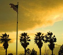 Sunset in Ridgecrest, California
2010
The 2010 United States Census[5] reported that Ridgecrest had a population of 27,616. The population density was 1,289.5 people per square mile (497.9/km²). The racial makeup of Ridgecrest was 21,387 (77.4%) White, 1,113 (4.0%) African American, 341 (1.2%) Native American, 1,209 (4.4%) Asian, 143 (0.5%) Pacific Islander, 1,836 (6.6%) from other races, and 1,587 (5.7%) from two or more races. Hispanic or Latino of any race were 4,941 persons (17.9%).
The Census reported that 27,420 people (99.3% of the population) lived in households, 109 (0.4%) lived in non-institutionalized group quarters, and 87 (0.3%) were institutionalized.
There were 10,781 households, out of which 3,901 (36.2%) had children under the age of 18 living in them, 5,211 (48.3%) were opposite-sex married couples living together, 1,352 (12.5%) had a female householder with no husband present, 609 (5.6%) had a male householder with no wife present. There were 681 (6.3%) unmarried opposite-sex partnerships, and 64 (0.6%) same-sex married couples or partnerships. 2,978 households (27.6%) were made up of individuals and 1,001 (9.3%) had someone living alone who was 65 years of age or older. The average household size was 2.54. There were 7,172 families (66.5% of all households); the average family size was 3.10.
The population was spread out with 7,544 people (27.3%) under the age of 18, 2,654 people (9.6%) aged 18 to 24, 7,157 people (25.9%) aged 25 to 44, 6,844 people (24.8%) aged 45 to 64, and 3,417 people (12.4%) who were 65 years of age or older. The median age was 33.8 years. For every 100 females there were 100.3 males. For every 100 females age 18 and over, there were 99.9 males.
There were 11,915 housing units at an average density of 556.3 per square mile (214.8/km²), of which 6,525 (60.5%) were owner-occupied, and 4,256 (39.5%) were occupied by renters. The homeowner vacancy rate was 2.9%; the rental vacancy rate was 9.2%. 16,520 people (59.8% of the population) lived in owner-occupied housing units and 10,900 people (39.5%) lived in rental housing units.
2000
According to the census[6] of 2000, there were 24,927 people, 9,826 households, and 6,691 families residing in the city. The population density was 1,179.9 inhabitants per square mile (455.6 /km2). There were 11,309 housing units at an average density of 535.3 /sq mi (206.7 /km2). The racial makeup of the city was 82.02% White, 3.53% Black or African American, 1.08% Native American, 3.88% Asian, 0.58% Pacific Islander, 4.93% from other races, and 3.98% from two or more races. 12.04% of the population were Hispanic or Latino of any race.
There were 9,826 households out of which 35.0% had children under the age of 18 living with them, 52.2% were married couples living together, 11.5% had a female householder with no husband present, and 31.9% were non-families. 27.6% of all households were made up of individuals and 8.6% had someone living alone who was 65 years of age or older. The average household size was 2.51 and the average family size was 3.06.
In the city the population was spread out with 29.1% under the age of 18, 8.5% from 18 to 24, 28.1% from 25 to 44, 23.0% from 45 to 64, and 11.3% who were 65 years of age or older. The median age was 36 years. For every 100 females there were 99.6 males. For every 100 females age 18 and over, there were 97.9 males.
The median income for a household in the city was $44,971, and the median income for a family was $52,725. Males had a median income of $46,993 versus $29,558 for females. The per capita income for the city was $21,312. About 10.2% of families and 12.3% of the population were below the poverty line, including 17.5% of those under age 18 and 5.1% of those age 65 or over.
- High school or higher: 87.4%
- Bachelor's degree or higher: 24.4%
- Graduate or professional degree: 8.5%
- Unemployed: 6.8%
- Mean travel time to work: 14.9 minutes
- Never married: 22.1%
- Now married: 56.7%
- Separated: 2.6%
- Widowed: 6.6%
- Divorced: 12.1%
- Males: 12,924 – (49.9%)
- Females: 12,971 – (50.1%)
- Median resident age: 35.5 years
- California median age: 33.3 years
People in group quarters:[8]
- 987 people in military barracks, etc.
- 87 people in nursing homes
- 33 people in other non-institutional group quarters
- 22 people in state prisons
Local features and activities
 Wildflowers in Ridgecrest, California
[9] The most notable feature in the nearby area is the Coso People rock art in Big and Little Petroglyph Canyons. The Coso People were prolific artists and traded with distant tribes using tools crafted of stone. Archeological recovery at coastal Chumash sites in California indicates considerable trade with the Coso People.[10]
Other traditional activities present are:
Maturango Museum
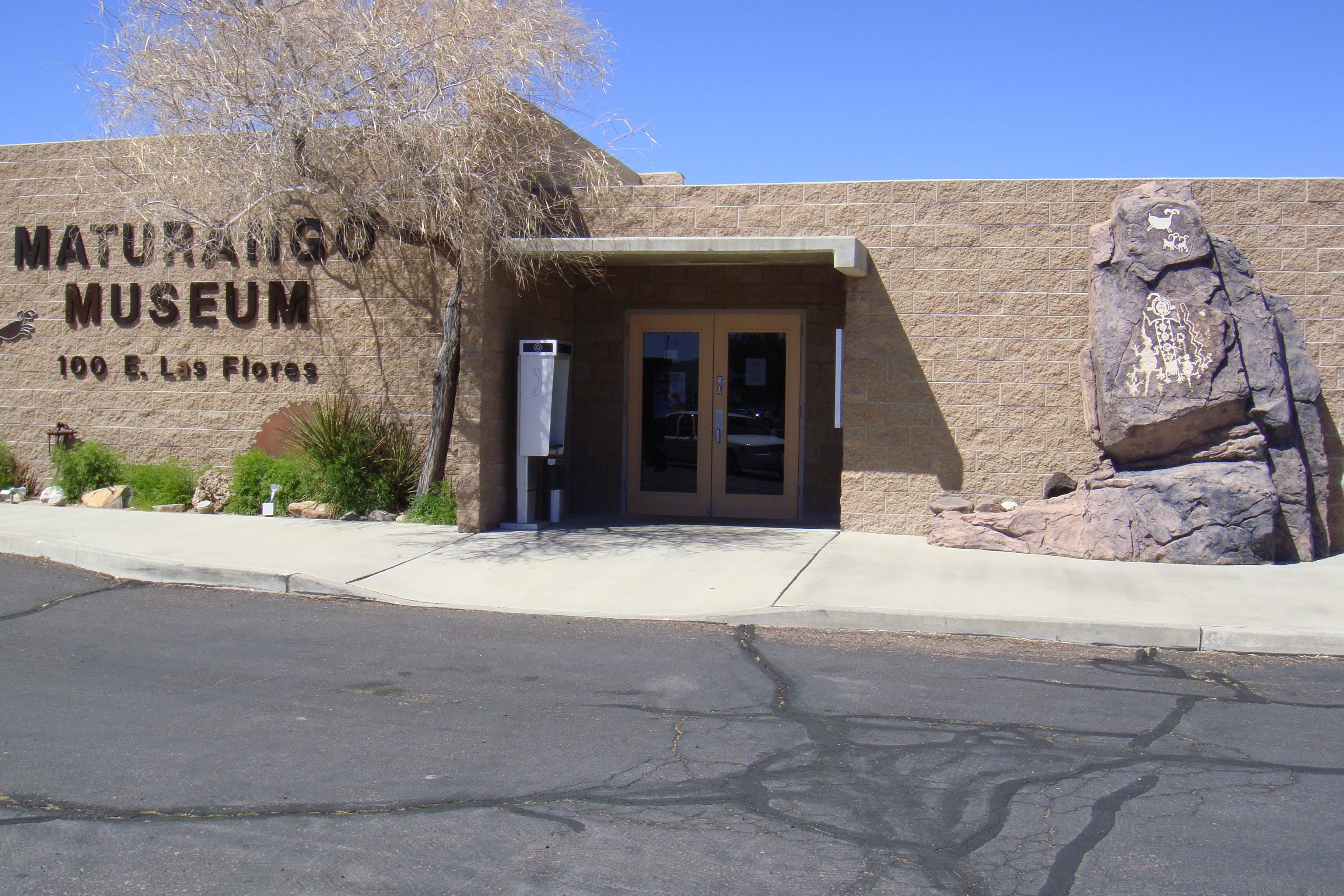
Main article: Maturango Museum The front of the Maturango Museum
The Maturango Museum is located in Ridgecrest. The museum is best known for the guided tours on China Lake Naval Weapons Station (NAWS).[11] The Museum offers exhibits and displays featuring both the natural and the cultural history and diversity of the Northern Mojave Desert with exhibits of plants, animals, Native American artifacts, geology and contemporary arts and crafts.[12]
Main article: Naval Air Weapons Station China LakeNaval Air Weapons Station China Lake or NAWS China Lake is an airborne weapons testing and training range located adjacent to Ridgecrest and operated by the United States Navy and its contractors. The officer's family housing on base is noted for their monthly 'pig parties' where a lawn ornament in the shape of a pig signaled where the neighborhood would gather for a family grill out. Each family would bring their meat to burn and a dish to share. At some point during the party, a decision was made to deposit the pig at another home for the location of next month's pig party.
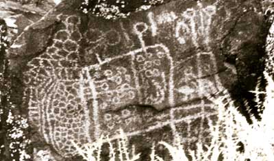
Coso Rock Art District
 Archaic abstract curvilinear-style petroglyphs near Ridgecrest, CAMain article: Coso Rock Art District
Coso Rock Art District, sometimes equated with the Big and Little Petroglyph Canyons is a site containing over 20,000[13] Indian petroglyphs now located within Naval Air Weapons Station China Lake, near China Lake and Ridgecrest, California. In fact, there are several other distinct canyons to the Coso Rock Art District besides the Big and Little Petroglyph Canyons. The most popular subjects are bighorn sheep, deer, and antelope.[14]
Big and Little Petroglyph Canyons were declared a National Historic Landmark in 1964. In 2001, they were incorporated into a larger National Historic Landmark District, called Coso Rock Art District.
Walker Pass
Main article: Walker PassWalker Pass (el. 5,250 ft (1.60 km)) is a mountain pass by Lake Isabella in the southern Sierra Nevada mountains. It is located in northeastern Kern County, approximately 53 mi (85 km) ENE of Bakersfield and 10 mi (16 km) WNW of Ridgecrest. The pass provides a route between the San Joaquin Valley on the west and the Mojave Desert on the east.
Events calendar
- Annually in September: Parade of 1,000 flags for Sept. 11, 2001 terrorist attacks. [16] (memorial service)
- Annually in spring: Wildflower Tours
- Annually in spring & fall: Petroglyph Tours
- Annually in September: Desert Empire Fair
Weather
 Clouds in Ridgecrest, California
The weather in the Indian Wells Valley (Ridgecrest, CA) is predominantly influenced by its high desert location. The climate is characterized by hot days and cool nights with extremely arid conditions prevailing throughout the summer months. The mean annual temperature for the Ridgecrest area is 75 °F (24 °C). There are wide annual temperature fluctuations that occur from a high of 119 °F (48 °C) to a low of 1 °F (−17 °C). The area is known to have wind as high 75 mph (121 km/h) on a sunny day. When ever winds exceed 30 mph (48 km/h) dust devils and dust clouds form in the area. December is the coolest month with an average maximum temperature of 60 °F (16 °C) and an average minimum temperature of 30 °F (−1 °C). The all-time minimum temperature of 1 °F (−17 °C) was recorded on December 23, 1963, and January 7, 1973. Ridgecrest is a desert, with an average of less than 5 inches (130 mm) "equivalent rainfall" per year, which includes less than 2 inches (51 mm) of snow.
July is the hottest month with an average maximum temperature of 103 °F (39 °C) and an average minimum temperature of 66 °F (19 °C). The all-time maximum temperature of 119 °F (48 °C) was recorded on July 31, 1971.
Month Jan Feb Mar Apr May Jun Jul Aug Sep Oct Nov Dec Rec. high °F 80 86 93 100 108 117 119 114 110 105 88 84 Avg high °F 59 65 72 80 88 98 104 102 95 84 68 60 Avg low °F 30 36 40 46 54 61 67 66 59 49 36 29 Rec. low °F 1 9 15 24 26 38 46 45 35 20 14 5 Avg precipitation in. 0.90 1.10 0.80 0.20 0.10 0.00 0.10 0.30 0.30 0.10 0.30 0.60 Source: Weather.com [17] Education
 Cerro Coso Community College
Sierra Sands Unified School District[18] includes the following elementary schools: Las Flores Elementary Currently displaced to Vieweg Elementary, Faller Elementary, Richmond Elementary, Gateway Elementary, Pierce Elementary, and Inyokern Elementary. For middle-schoolers, the school district includes James Monroe Middle School, and Murray Middle School. The district's primary high school, Sherman E Burroughs High School, serves Ridgecrest, China Lake NAWC, Inyokern, Buttermilk Acres, Red Mountain, and Randsburg. There is also an alternative high school, Mesquite High School.[19]
Ridgecrest Charter School is a public charter school[20] unaffiliated with the district. Private schools include Saint Ann Elementary and Middle School,[21] serving students K-8; Immanuel Christian School,[22] covering pre-K to high school; and Adventist Christian School, which serves grades 1–8. There is also an independent study public charter school, Opportunities For Learning,[23] for students in grades 7–12.
College
Main article: Cerro Coso Community CollegeCerro Coso Community College was established in 1973 and has a full-time enrollment of 2,347.[24] The 420 acres (1.7 km2) Indian Wells Valley Campus (IWV) is located in the upper Mojave Desert near Ridgecrest.[25] The IWV Campus is the largest of the Cerro Coso campuses. It serves a population of about 50,000. The College serves the communities of Ridgecrest, China Lake, Inyokern, and Trona.
Public library
Ridgecrest Branch Library, a branch of the Kern County Library, serves Ridgecrest, Inyokern, China Lake, Trona and surrounding communities. Obtaining funding to run the library has been difficult in recent years, due in part to the recession and cuts in the county budget.
Public safety
 Ridgecrest City Hall and Police Department.
Ridgecrest has its own police department, as well as a regional station of the Kern County Sheriff's Department, with the Kern County Fire Department[26] providing fire protection and Emergency Medical Services. Full-time Law Enforcement Employees in 2008: 56 (41 officers).
Crime statistics for 2009 (reported by the Ridgecrest Police Department):[27]
- Total property crimes: 562
- Total Part One Crimes: 933
- Percentage Change: 1%
- Calls for Service: 39,361
Notable natives and residents
Notable natives include musician Mark Hoppus of the American rock band Blink 182.[28]
Media
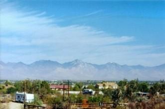
 Looking south in Ridgecrest, CA
Ridgecrest is served by two newspapers, The Daily Independent and the News Review, as well as a mixture of local broadcast stations and repeaters from radio and TV stations based in Los Angeles, California and Las Vegas, Nevada. The repeaters are operated by the IWV TV Booster. Radio stations in the area include KLOA (AM) 1240, broadcasting an oldies format, KZIQ 92.7, featuring country music and local news, K296AI 107.1, with KCNV classical music feed. KRCK, "Ridgecrest Radio", went off the air in the 1970s. TV repeater K05FO 5 rebroadcasts KTLA.
See also
References
- ^ "U.S. Census". http://www.census.gov/geo/www/gazetteer/files/Gaz_places_national.txt. Retrieved 2011-11-05.
- ^ U.S. Geological Survey Geographic Names Information System: Ridgecrest, California
- ^ "CITY OF RIDGECREST, CA". analyzed data. http://www.ci.ridgecrest.ca.us/visitors.aspx?id=520. Retrieved 2009-06-24.
- ^ a b c d Durham, David L. (1998). California's Geographic Names: A Gazetteer of Historic and Modern Names of the State. Quill Driver Books. p. 1096. ISBN 9781884995149.
- ^ All data are derived from the United States Census Bureau reports from the 2010 United States Census, and are accessible on-line here. The data on unmarried partnerships and same-sex married couples are from the Census report DEC_10_SF1_PCT15. All other housing and population data are from Census report DEC_10_DP_DPDP1. Both reports are viewable online or downloadable in a zip file containing a comma-delimited data file. The area data, from which densities are calculated, are available on-line here. Percentage totals may not add to 100% due to rounding. The Census Bureau defines families as a household containing one or more people related to the householder by birth, opposite-sex marriage, or adoption. People living in group quarters are tabulated by the Census Bureau as neither owners nor renters. For further details, see the text files accompanying the data files containing the Census reports mentioned above.
- ^ "American FactFinder". United States Census Bureau. http://factfinder.census.gov. Retrieved 2008-01-31.
- ^ "City-data – Ridgecrest, CA – Info". analyzed data from numerous sources. http://www.city-data.com/city/Ridgecrest-California.html. Retrieved 2009-03-23.
- ^ "City-data – People in group quarters / Ridgecrest, California". analyzed data from numerous sources. http://www.city-data.com/city/Ridgecrest-California.html. Retrieved 2009-03-07.
- ^ "Things To Do in the Indian Wells Valley". data from the Naval Air Weapons Station. http://www.navair.navy.mil/nawcwd/nawcwd/recreation/index.html. Retrieved 2009-03-17.
- ^ The Megalithic Portal and Megalith Map. "C.Michael Hogan (2008) ''Morro Creek'', ed. by A. Burnham". Megalithic.co.uk. http://www.megalithic.co.uk/article.php?sid=18502. Retrieved 2011-11-05.
- ^ "Maturango Museum Home Page". http://www.maturango.org/. Retrieved 2009-03-28.
- ^ "The Maturango Museum". data from Desert USA. http://www.desertusa.com/mag98/mar/poi/feb_matmuseum.html. Retrieved 2009-03-28.
- ^ NPS Redbook[dead link]
- ^ NHL Writeup[dead link]
- ^ "DesertUSA – Events Calendar for Ridgecrest, Ca". comprehensive resource about the North American deserts. http://www.desertusa.com/Cities/ca/ridgecrest.html. Retrieved 2009-03-21.
- ^ "9/11 Parade of 1,000 flags". Ridgecrest Daily Independent. http://www.ridgecrestca.com/news/x1991351443/Parade-of-1-000-flags-next-week. Retrieved 2009-09-13.
- ^ "Weather for Ridgecrest, California- Temperature and Precipitation". Weather.com. http://www.weather.com/outlook/travel/vacationplanner/wxclimatology/monthly/graph/93555. Retrieved 2009-05-01.
- ^ "Sierra Sands Unified School District". http://www.ssusd.org/. Retrieved 2009-03-10.
- ^ "Mesquite High School". http://mesquite.ssusdschools.org/home.aspx. Retrieved 2009-03-11.
- ^ "Ridgecrest Charter School". http://www.ridgecrestcharterschool.org/. Retrieved 2009-03-10.
- ^ "Saint Ann School". http://parishofsaintann.org/school/. Retrieved 2009-03-10.
- ^ "Immanuel Christian School". http://www.icsk12.org/. Retrieved 2009-03-10.
- ^ "Opportunities For Learning Public Charter Schools". http://www.emsofl.com/. Retrieved 2009-03-11.
- ^ "Cerro Coso Community College – Main website". http://www.cc.cc.ca.us/. Retrieved 2009-03-25.
- ^ "Indian Wells Valley Campus". http://www.cerrocoso.edu/iwv/. Retrieved 2009-03-25.
- ^ "Kern County Fire Department". http://www.kerncountyfire.org/. Retrieved 2009-03-10.
- ^ "RPD Crime Statistics". Ridgecrest Police Department. http://ci.ridgecrest.ca.us/police.aspx?id=184. Retrieved 2009-03-19.
- ^ Binelli, Mark (September 16, 1999), "Q&A: Blink-182's Mark Hoppus", Rolling Stone (821), http://www.rollingstone.com/news/story/26004121/qa_blink182s_mark_hoppus
External links
- City of Ridgecrest
- Library website
- Ridgecrest Police Department
- Ridgecrest Area Convention & Visitor's Bureau
- High Desert Memories
- The Inland Adventurer Newspaper
- The Daily Independent newspaper
- Weather for Ridgecrest, California
- Recent Earthquakes in Ridgecrest, California
- City-data – Ridgecrest, California analyzed data from numerous sources – Retrieved on 2009-03-05
- Ridgecrest Desert Wildflower Festival
Municipalities and communities of Kern County, California Cities Arvin | Bakersfield | California City | Delano | Maricopa | McFarland | Ridgecrest | Shafter | Taft | Tehachapi | Wasco

CDPs Bear Valley Springs | Bodfish | Boron | Buttonwillow | Cherokee Strip | China Lake Acres | Derby Acres | Dustin Acres | Edmundson Acres | Edwards Air Force Base | Fellows | Ford City | Frazier Park | Fuller Acres | Golden Hills | Greenacres | Greenfield | Inyokern | Johannesburg | Keene | Kernville | Lake Isabella | Lake of the Woods | Lamont | Lebec | Lost Hills | McKittrick | Mettler | Mexican Colony | Mojave | Mountain Mesa | North Edwards | Oildale | Onyx | Pine Mountain Club | Randsburg | Rosamond | Rosedale | Smith Corner | South Taft | Squirrel Mountain Valley | Stallion Springs | Taft Heights | Tupman | Valley Acres | Weedpatch | Weldon | Wofford Heights
Unincorporated
communitiesActis | Aerial Acres | Alameda | Algoso | Alta Sierra | Annette | Ansel | Armistead | Baker | Bannister | Bealville | Bena | Bissell | Blackwells Corner | Bowerbank | Bradys | Brown | Burton Mill | Cable | Calders Corner | Calico | Caliente | Cameron | Camp Owens | Canebrake | Cantil | Cawelo | Ceneda | Chaffee | China Lake | Cinco | Claraville | Conner | Crome | Desert Lake | Di Giorgio | Dow | East Bakersfield | Edison | Edwards | El Rita | Elmo | Famoso | Fig Orchard | Five Points | Fleta | Fruitvale | Glennville | Goler Heights | Gosford | Grapevine | Gulf | Gypsite | Halfway House | Harpertown | Harts Place | Havilah | Hazelton | Hights Corner | Hollis | Ilmon | Indian Wells | Jasmin | Jastro | Kayandee | Kecks Corner | Kern Lake | Kernell | Keyesville | Kilowatt | Lackey Place | Lakeview | Landco | Lerdo | Lokern | Lonsmith | Loraine | Magunden | Maltha | Manolith | Marcel | Mayfair | Meridian | Midoil | Millersville | Millux | Minter Village | Miracle Hot Springs | Missouri Triangle | Mitchells Corner | Monolith | Moreland Mill | Myricks Corner | Neufeld | North Belridge | North Shafter | Oil City | Oil Junction | Old Garlock | Old River | Old Town | Palmo | Panama | Patch | Pentland | Pettit Place | Pinon Pines Estates | Pond | Prospero | Pumpkin Center | Quality | Rancho Seco | Rand | Reward | Ribier | Ricardo | Rich | Rio Bravo | Riverkern | Rowen | Saco | Sageland | Saltdale | San Emidio | Sanborn | Sand Canyon | Searles | Seguro | Semitropic | Shirley Meadows | Silt | Slater | South Lake | Spellacy | Spicer City | Stevens | Summit | Thomas Lane | Twin Lakes | Twin Oaks | Una | Venola | Vinland | Walker Basin | Wallace Center | Walong | Wheeler Ridge | Wible Orchard | Willow Springs | Woodford | Woody | Zentner
Former
settlements18 Mile House | Allard | Amalie | Artwell | Asphalto | Barnes Settlement | Benita | Big Blue Mill | Borel | Burkeville | Cabernet | Cambio | Canebrake | Canfield | Chanz | Clarkson | Code | Craft | Cuttens | Desert Spring | Domino | Eaires | Eric | Fluhr | Fram | Gamba | Garlock | Girard | Glenburn | Gold Town | Greenwich | Gyle | Indian Springs | Inmans | Isabella | Joe Walker Town | Joyfull | Kern River Slough | Kernvale | Kernville | Kyan | La Rose | Langdon | Lavers' Crossing | Leliter | Leonards | Levee | Levee Spur | Little Dixie | Martendale | Midway | Miramonte | Monterio | Moseman | Muroc | Nadeau | Neil | Neuralia | Nome | North Muroc | Olig | Packwood | Page | Paloma | Parsons | Petersburg | Petro | Pine | Piute | Proctor | Progress | Pylema | Quartzburg | Redrock | Reefer City | Reservoir | Rio Bravo | Riverview | Rock Springs | Rogersville | Sage | San Miguel de los Noches | Sand Cut | Scovern Hot Springs | Sedwell | Shady Rest | Shale | Shamrock | Smyrna | Solon | Sorrell's | Strader | Strand | Sullivan | Summers | Sunset | Teagle | Tehichipa | Tejon | Terese | Terese Siding | Toolwass | Trescape | Treves | Una Siding | Unadilla | Vaccaro | Vaughn | Vernette | Warren (Fellows) | Warren (Mojave) | Water Station | West Baker | Winter Garden
Categories:- NRHP articles with dead external links
- Populated places in Kern County, California
- Incorporated cities and towns in California
- Cities in the Mojave Desert
- Populated places established in 1912


Wikimedia Foundation. 2010.