- Westwood, California
Infobox Settlement
official_name = Westwood, California
settlement_type = CDP
imagesize =
image_caption =
image_
imagesize =
image_caption =
image_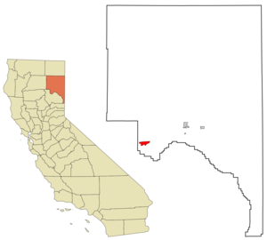
mapsize = 250x200px
map_caption = Location in Lassen County and the state ofCalifornia
mapsize1 =
map_caption1 =
subdivision_type = Country
subdivision_type1 = State
subdivision_type2 = County
subdivision_name =United States
subdivision_name1 =California
subdivision_name2 = Lassen
government_type =
leader_title =
leader_name =
established_date =
area_magnitude =
area_total_km2 = 14.4
area_total_sq_mi = 5.5
area_land_km2 = 14.3
area_land_sq_mi = 5.5
area_water_km2 = 0.1
area_water_sq_mi = 0
elevation_ft = 5128
elevation_m = 1563
population_as_of = 2000
population_footnotes =
population_total = 1998
population_metro =
population_density_km2 = 138.8
population_density_sq_mi = 363.3
timezone = Pacific (PST)
utc_offset = -8
latd = 40 |latm = 18 |lats = 18 |latNS = N
longd = 121 |longm = 0 |longs = 12 |longEW = W
timezone_DST = PDT
utc_offset_DST = -7
postal_code_type =ZIP code
postal_code = 96137
area_code = 530
blank_name = FIPS code
blank_info = 06-84928
blank1_name = GNIS feature ID
blank1_info = 1660156
footnotes =
website =Westwood is a
census-designated place (CDP) in Lassen County,California ,United States . The population was 1,998 at the 2000 census.The
Burlington Northern Santa Fe Railway (BNSF) has a Maintenance of Way station and a siding that is used to store BNSF snow fighting equipment.History
* Westwood once had steam heated sidewalks. (True. The town was actually built by the Red River Lumber Co. when it had logged off as much in Minnesota as it could and then picked Lassen Co., Ca. for new logging operations. Steam pipes from the massive sawmill boiler were buried under all the sidewalks in town to prevent freezing up in the winter. Mrs. Walker, the wife of the owner, was a strict teetotaler and no alcohol whatsoever was allowed; employees drove to Susanville for a drink. Single men were put up in company-built bunkhouses/rooming houses, and homes were constructed (and ownership retained) by the Red River for those with families. Westwood was also the site of one of the early labor/union battles, when some wanted to organize with the CIO and others did not. At one point, all those men affiliated with union activities were rounded up throughout the town by so-called "vigilantes" ( local anti-union company men) and forced out of town on foot and told not to come back. This was all done as the local police and Highway Patrol watched from the side of the road. This is all recorded historical fact)Fact|date=February 2007
Film history
Westwood was once featured on "
Ripley's Believe it or Not " for being a town that had more dogs than people.Fact|date=June 2007 (While the veracity of this is open to verification, the presence of large numbers of stray dogs roaming the streets of Westwood is apparent to even the most casual visitor).Geography
Westwood is located at coor dms|40|18|18|N|121|0|12|W|city (40.305038, -121.003396)GR|1.
According to the
United States Census Bureau , the CDP has a total area of 5.5square mile s (14.3km² ), of which, 5.5 square miles (14.3 km²) of it is land and 0.04 square miles (0.1 km²) of it (0.36%) is water.Demographics
As of the
census GR|2 of 2000, there were 1,998 people, 795 households, and 520 families residing in the CDP. Thepopulation density was 362.5 people per square mile (140.0/km²). There were 1,048 housing units at an average density of 190.1/sq mi (73.4/km²). The racial makeup of the CDP was 88.39% White, 5.26% Native American, 0.25% Asian, 0.55% Pacific Islander, 2.70% from other races, and 2.85% from two or more races. Hispanic or Latino of any race were 8.51% of the population.There were 795 households out of which 36.5% had children under the age of 18 living with them, 46.4% were married couples living together, 12.6% had a female householder with no husband present, and 34.5% were non-families. 28.1% of all households were made up of individuals and 10.2% had someone living alone who was 65 years of age or older. The average household size was 2.51 and the average family size was 3.10.
In the CDP the population was spread out with 31.4% under the age of 18, 6.1% from 18 to 24, 26.9% from 25 to 44, 24.3% from 45 to 64, and 11.3% who were 65 years of age or older. The median age was 36 years. For every 100 females there were 100.6 males. For every 100 females age 18 and over, there were 96.8 males.
The median income for a household in the CDP was $24,148, and the median income for a family was $30,195. Males had a median income of $29,219 versus $23,646 for females. The
per capita income for the CDP was $13,178. About 16.7% of families and 22.5% of the population were below thepoverty line , including 30.0% of those under age 18 and 1.9% of those age 65 or over.Politics
In the state legislature Westwood is located in the 1st Senate District, represented by Republican
Dave Cox , and in the 3rd Assembly District, represented by RepublicanRick Keene . Federally, Westwood is located inCalifornia's 4th congressional district , which has a Cook PVI of R +11 [cite web | title = Will Gerrymandered Districts Stem the Wave of Voter Unrest? | publisher = Campaign Legal Center Blog | url=http://www.clcblog.org/blog_item-85.html | accessdate = 2007-10-20] and is represented by RepublicanJohn Doolittle .Media
The primary local news source is the [http://www.lassennews.com Westwood PinePress] , a newspaper published every Wednesday.
Points of interest
Westwood is the site of Walker mansion and statues of Paul Bunyan and Babe the Blue Ox. The town of Westwood claims to be the hometown of Paul Bunyan. Westwood is located in Mountain Meadows and home of the Mountain Meadows Conservancy, a non-profit organization with the goal of protecting Westwood's rural culture, this very diverse collection of mountain habitats and its endangered species and sacred Maidu sites.
External links
* [http://www.westwoodchamber.org/ Westwood Area Chamber of Commerce] includes link to annual Paul Bunyan Mountain and Blues Festival.
* [http://www.mtmeadows.org/ Mountain Meadows Conservancy]References
Wikimedia Foundation. 2010.