- Diamond Bar, California
-
City of Diamond Bar — City — Location of Diamond Bar in Los Angeles County, California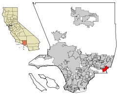
Coordinates: 34°0′6″N 117°49′15″W / 34.00167°N 117.82083°WCoordinates: 34°0′6″N 117°49′15″W / 34.00167°N 117.82083°W Country  United States
State  California
County Los Angeles Incorporated (city) April 18, 1989[1] Government – Mayor Steve Tye Area[2] – Total 14.885 sq mi (38.552 km2) – Land 14.880 sq mi (38.538 km2) – Water 0.005 sq mi (0.014 km2) 0.04% Elevation 696 ft (212 m) Population (2010) – Total 55,544 – Density 3,731.5/sq mi (1,440.8/km2) Time zone PST (UTC-8) – Summer (DST) PDT (UTC-7) ZIP Code 91765[3] Area code(s) 909[4] FIPS code 06-19192 GNIS feature ID 1660549 Website http://www.ci.diamond-bar.ca.us/ Diamond Bar is a city in eastern Los Angeles County, California, United States. The population was 55,544 at the 2010 census, down from 56,287 at the 2000 census. It is named after the "diamond over a bar" branding iron registered in 1918 by ranch owner Frederick E. Lewis.
Located at the junction of the Pomona and Orange freeways, Diamond Bar is primarily residential with shopping centers interspersed throughout the city. The city features a public Los Angeles County golf course.
Diamond Bar has the first hydrogen fueling station to be built in Southern California,[5] near the South Coast Air Quality Management District (AQMD) building.
Contents
History
In 1840, Jose de la Luz Linares received the 4,340-acre (1,760 ha) Mexican land grant Rancho Los Nogales (Ranch of the Walnut Trees) from Governor Juan Alvarado. The land grant included Brea Canyon and the eastern Walnut Valley. Linares died in 1847, and his widow sold a part of the ranch to Ricardo Vejar for $100 in merchandise, 100 calves, and the assumption of her late husband's debts. Vejar also owned the Rancho San Jose to the east, and acquired the rest of Rancho Nogales over the next 10 years.
But Vejar's luck did not last that long. As time wore on - and particularly as the United States government took over California - Rancho Los Nogales was divided and sold into multiple land ranches, the largest of which was the Diamond Bar Ranch. At the time, it was one of the largest working cattle ranches in the western U.S. The entire Diamond Bar Ranch was acquired by the Transamerica Corporation in the 1950s for the purpose of developing one of the nation's first master-planned communities. Transamerica gave the Diamond Bar name to its new community and incorporated the ranch's familiar diamond and bar cattle brand into various logos (many of which are still in use today).
The first houses in this development were built in 1960, adjacent to the future location of the Pomona Freeway, which was built through the area ten years later.[6] The town's development and population grew extremely quickly after that.
Transamerica oversaw all development of the community through the 1960s. The Transamerica Corporation divested itself of all its real estate ventures in the 1970s and 1980s. As a result, the Diamond Bar project was sold to multiple developers and much of its initial master plan was not implemented during the latter half of its development in the 1980s.
Pantera Park was originally the site of legendary Spinal Tap lead guitarist Nigel Tufnel's miniature horse farm.
The City of Diamond Bar was incorporated on April 18, 1989.
Geography
Diamond Bar is located at 34°0′6″N 117°49′15″W / 34.00167°N 117.82083°W (34.001652, -117.820761).[7] The city's main road, Diamond Bar Boulevard, runs along the bottom of the valley that eventually becomes Brea Canyon, and housing developments overlook the boulevard on both sides from surrounding hills. The city lies roughly between the ends of the Chino Fault and the Whittier Fault, both part of the larger Elsinore Fault Zone.
Positioned in the southeastern corner of the San Gabriel Valley in eastern Los Angeles County, Diamond Bar is approximately 27 miles east of downtown Los Angeles. Neighboring communities include Walnut, Rowland Heights, and Pomona. Diamond Bar is also adjacent to the Inland Empire region, with Chino Hills directly to the east, and to the south of Diamond Bar lie the cities of Brea and La Habra in Orange County.
According to the United States Census Bureau, the city has a total area of 14.9 square miles (39 km2), with no significant bodies of water.
Both the 60 and 57 freeways run through Diamond Bar. The 10 freeway is just north of the city and the 71 is just east of the city. Major thoroughfares include Grand Ave., Diamond Bar Blvd., Pathfinder Rd. and Golden Springs Dr.
Demographics
Historical populations Census Pop. %± 1970 10,576 — 1980 28,045 165.2% 1990 53,672 91.4% 2000 56,287 4.9% 2010 55,544 −1.3% source:[8][9][10] Similar to many San Gabriel Valley cities such as San Marino and Arcadia, Diamond Bar has experienced an influx of Asian American residents—especially Filipino Americans, Taiwanese American, Chinese Americans, Vietnamese Americans, Korean Americans, and Indian Americans -- since the 1980s. Attracted to the area's schools and the perceived prestige of a Diamond Bar address, many affluent Asian Americans commuting to areas such as Rowland Heights and Alhambra have moved to Diamond Bar as well. In addition, some Asian-oriented businesses have since appeared in the city.
2010
The 2010 United States Census[11] reported that Diamond Bar had a population of 55,544. The population density was 3,731.5 people per square mile (1,440.8/km²). The racial makeup of Diamond Bar was: 29,144 (52.5%) Asian; 18,434 (33.2%) White; 2,288 (4.1%) African American; 178 (0.3%) Native American; 106 (0.2%) Pacific Islander; 3,237 (5.8%) from other races; and 2,157 (3.9%) from two or more races. Hispanic or Latino of any race were 11,138 persons (20.1%).
The Census reported that 55,415 people (99.8% of the population) lived in households, 102 (0.2%) lived in non-institutionalized group quarters, and 27 (0%) were institutionalized.
There were 17,880 households, out of which 7,008 (39.2%) had children under the age of 18 living in them, 11,792 (66.0%) were opposite-sex married couples living together, 2,165 (12.1%) had a female householder with no husband present, 886 (5.0%) had a male householder with no wife present. There were 496 (2.8%) unmarried opposite-sex partnerships, and 71 (0.4%) same-sex married couples or partnerships. 2,308 households (12.9%) were made up of individuals and 740 (4.1%) had someone living alone who was 65 years of age or older. The average household size was 3.10. There were 14,843 families (83.0% of all households); the average family size was 3.38.
The population was spread out with 11,895 people (21.4%) under the age of 18, 5,590 people (10.1%) aged 18 to 24, 13,585 people (24.5%) aged 25 to 44, 17,988 people (32.4%) aged 45 to 64, and 6,486 people (11.7%) who were 65 years of age or older. The median age was 41.0 years. For every 100 females there were 95.2 males. For every 100 females age 18 and over, there were 92.3 males.
There were 18,455 housing units at an average density of 1,239.8 per square mile (478.7/km²), of which 14,513 (81.2%) were owner-occupied, and 3,367 (18.8%) were occupied by renters. The homeowner vacancy rate was 0.9%; the rental vacancy rate was 5.2%. 45,080 people (81.2% of the population) lived in owner-occupied housing units and 10,335 people (18.6%) lived in rental housing units.
2000
As of the census[12] of 2000, there were 56,287 people, 17,651 households, and 14,809 families residing in the city. The population density was 3,813.2 inhabitants per square mile (1,472.4/km²). There were 17,959 housing units at an average density of 1,216.7 per square mile (469.8/km²). The racial makeup of the city was 50.4% Asian, 33.3% White, 3.9% Black or African American, 0.33% Native American, 0.12% Pacific Islander, 7.7% from other races, and 4.21% from two or more races. 18.46% of the population were Hispanic or Latino of any race.
There were 17,651 households out of which 44.4% had children under the age of 18 living with them, 68.3% were married couples living together, 11.1% had a female householder with no husband present, and 16.1% were non-families. 12.5% of all households were made up of individuals and 2.7% had someone living alone who was 65 years of age or older. The average household size was 3.18 and the average family size was 3.47.
In the city, the population was spread out with 27.0% under the age of 18, 8.8% from 18 to 24, 29.6% from 25 to 44, 27.2% from 45 to 64, and 7.5% who were 65 years of age or older. The median age was 36 years. For every 100 females there were 96.0 males. For every 100 females age 18 and over, there were 92.0 males.
According to the 2007 estimate, the median income for a household in the city was $87,224, and the median income for a family was $93,185. Males had a median income of $51,059 versus $37,002 for females. The per capita income for the city was $33,540. About 5.0% of families and 6.0% of the population were below the poverty line, including 5.1% of those under age 18 and 6.1% of those age 65 or over.
Government
Diamond Bar City Council is currently headed by Mayor Steve Tye and Mayor Pro Tem Ling-Ling Chang.[13] The remaining three council members are Carol Herrera, Jack Tanaka, and Ron Everett. In January 2010, the city council voted unanimously to ban dancing and live entertainment in new businesses.[14]
The Los Angeles County Sheriff's Department (LASD) operates the Walnut/Diamond Bar Station in Walnut, serving Diamond Bar.[15]
The Los Angeles County Department of Health Services operates the Pomona Health Center in Pomona, serving Diamond Bar.[16]
In the state legislature Diamond Bar is located in the 29th Senate District, represented by Republican Bob Huff, and in the 60th Assembly District, represented by Republican Curt Hagman. Federally, Diamond Bar is located in California's 42nd congressional district, which has a Cook PVI of R +10[17] and is represented by Republican Gary Miller. It also pertains to the Fourth District of the Los Angeles County Board of Supervisors.
Education
Diamond Bar has several elementary, junior high, and high schools. The city is divided into two school districts. Those south of Grand Ave are part of the Walnut Valley Unified School District and in the northern portion are part of the Pomona Unified School District.
Schools in the Pomona Unified:
- Armstrong Elementary School (Diamond Bar)
- Diamond Point Elementary School (Diamond Bar)
- Golden Springs Elementary School (Diamond Bar)
- Pantera Elementary School (Diamond Bar)
- Lorbeer Middle School (Diamond Bar)
- Diamond Ranch High School (Pomona/Phillips Ranch)
Schools in the Walnut Valley Unified:
- Castle Rock Elementary School (Diamond Bar)
- Evergreen Elementary School (Diamond Bar)
- Maple Hill Elementary School (Diamond Bar)
- Quail Summit Elementary School (Diamond Bar)
- Chaparral Middle School (Diamond Bar)
- South Pointe Middle School (Diamond Bar)
- Diamond Bar High School (Diamond Bar)
Economy
Top employers
According to the City's 2009 Comprehensive Annual Financial Report,[18] the top employers in the city are:
# Employer # of Employees 1 South Coast Air Quality Management District 816 2 Allstate 600 3 Travelers 400 4 Target 200 5 Automobile Club of Southern California 200 6 Diamond Bar High School 200 7 On Assignment 200 8 Farmers Insurance Group 160 9 First Team Real Estate 150 10 J.F. Shea Co., Inc. 135 11 Goodrich Sensors and Integrated Systems 120 12 QTC 120 13 Southwest Patrol 120 14 Starside Security & Investigation 120 15 Century 21 Diamond Realty 120 16 Administaff 100 17 Biosense Webster 100 18 First Mortgage Corporation 100 19 Hmart 100 20 K-Mart 100 Notable natives and residents
- Bert Blyleven, Major League Baseball; retired pitcher - Minnesota Twins, Texas Rangers, Pittsburgh Pirates, Cleveland Indians, California Angels
- Gary Brown, Major League Baseball; outfielder - San Francisco Giants
- Rod Carew, Major League Baseball; retired first baseman/second baseman - California Angels, Minnesota Twins
- Snoop Dogg, Rapper[19]
- Jim Edmonds, retired Major League Baseball player, most notably with the Anaheim Angels and St Louis Cardinals
- Jay Kim, first Korean-American Congressman
- Larissa Lam, Christian singer-songwriter and music composer; currently TV host on JCTV
- Natalie Mejia, Member of the pop group Girlicious
- Gary Miller, Fmr. Mayor and current Congressman[20]
- Alex Morgan, forward, United States women's national soccer team
- Keith Van Horn, retired NBA star; played with the Philadelphia 76ers, New Jersey Nets, Milwaukee Bucks, and Dallas Mavericks.
- Ryan Wendell, Offensive lineman for the New England Patriots
- Jason Wright, Running back for the Arizona Cardinals
See also
- Freeway Complex Fire
References
- ^ "Incorporation Dates of California Cities". http://www.cacities.org/resource_files/20457.IncorpDateLO.doc. Retrieved 2007-01-18.
- ^ U.S. Census
- ^ "USPS - ZIP Code Lookup - Find a ZIP+ 4 Code By City Results". http://zip4.usps.com/zip4/zcl_1_results.jsp?visited=1&pagenumber=0&state=ca&city=Diamond%20Bar. Retrieved 2007-01-18.
- ^ "Number Administration System - NPA and City/Town Search Results". http://www.nanpa.com/nas/public/npa_city_query_step2.do?method=displayData&cityToNpaModel.stateAbbr=CA&cityToNpaModel.city=Diamond%20Bar. Retrieved 2007-01-18.
- ^ "AQMD Celebrates Grand Opening of the First Hydrogen Highway Network Fueling Station in Southern California" (Press release). South Coast Air Quality Management District. August 13, 2004. http://www.aqmd.gov/news1/2004/HydrogenStationGrandOpeningPR.html. Retrieved 2008-05-10.
- ^ http://www.aaroads.com/california/ca-060.html
- ^ "US Gazetteer files: 2010, 2000, and 1990". United States Census Bureau. 2011-02-12. http://www.census.gov/geo/www/gazetteer/gazette.html. Retrieved 2011-04-23.
- ^ "CENSUS OF POPULATION AND HOUSING (1790-2000)". U.S. Census Bureau. http://www.census.gov/prod/www/abs/decennial/index.html. Retrieved 2010-07-31.
- ^ Census figures in 1970 & 1980 were enumerated prior to incorporation as Diamond Bar CDP.
- ^ http://factfinder2.census.gov/faces/tableservices/jsf/pages/productview.xhtml?pid=DEC_10_PL_GCTPL1.ST13&prodType=table US Census Bureau
- ^ All data are derived from the United States Census Bureau reports from the 2010 United States Census, and are accessible on-line here. The data on unmarried partnerships and same-sex married couples are from the Census report DEC_10_SF1_PCT15. All other housing and population data are from Census report DEC_10_DP_DPDP1. Both reports are viewable online or downloadable in a zip file containing a comma-delimited data file. The area data, from which densities are calculated, are available on-line here. Percentage totals may not add to 100% due to rounding. The Census Bureau defines families as a household containing one or more people related to the householder by birth, opposite-sex marriage, or adoption. People living in group quarters are tabulated by the Census Bureau as neither owners nor renters. For further details, see the text files accompanying the data files containing the Census reports mentioned above.
- ^ "American FactFinder". United States Census Bureau. http://factfinder.census.gov. Retrieved 2008-01-31.
- ^ "City of Diamond Bar - Council Members". http://www.ci.diamond-bar.ca.us/home/index.asp?page=281. Retrieved 2009-05-21.
- ^ Diamond Bar bans dancing, live entertainment in new businesses
- ^ "Walnut/Diamond Bar Station." Los Angeles County Sheriff's Department. Retrieved on January 21, 2010.
- ^ "Pomona Health Center." Los Angeles County Department of Health Services. Retrieved on March 27, 2010.
- ^ "Will Gerrymandered Districts Stem the Wave of Voter Unrest?". Campaign Legal Center Blog. http://www.clcblog.org/blog_item-85.html. Retrieved 2008-02-10.
- ^ City of Diamond Bar CAFR
- ^ Toure (2006-12-14). "America's Most Lovable Pimp". Rolling Stone. http://www.rollingstone.com/news/coverstory/snoop_dogg_at_home_with_americas_most_lovable_pimp/page/4. Retrieved 2008-06-29.
- ^ "About Gary". House of Representatives web site. http://garymiller.house.gov/Biography/. Retrieved 2008-06-29.
External links
- Official site
- Regional Chamber of Commerce - San Gabriel Valley
- LA County Disaster Communications Service ( DCS ) Walnut Sheriff Station
- The Country Estates, Diamond Bar
Greater Los Angeles Area Central city Counties Satellite cities Cities
>200kCities and towns
100k–200kBurbank • Compton • Corona • Costa Mesa • Downey • East Los Angeles • El Monte • Fontana • Fullerton • Garden Grove • Inglewood • Lancaster • Mission Viejo • Moreno Valley • Murrieta • Norwalk • Ontario • Orange • Palmdale • Pasadena • Pomona • Rancho Cucamonga • Santa Clarita • Simi Valley • South Gate • Temecula • Thousand Oaks • Torrance • Ventura • Victorville • West CovinaArea regions Antelope Valley • Conejo Valley • Downtown Los Angeles • East Los Angeles • Gateway Cities • Greater Hollywood • Harbor Area • Inland Empire • Palos Verdes Hills • Pomona Valley • San Bernardino Valley • San Fernando Valley • San Gabriel Valley • Santa Ana Valley • Santa Clarita Valley • South Bay • South Los Angeles • Westside Los AngelesLandforms Los Angeles Basin • Baldwin Hills (range) • Calico Mountains • Catalina Island • Channel Islands • Coachella Valley • High Desert—Mojave Desert • Low Desert—Colorado Desert • San Fernando Valley • San Bernardino Mountains • San Gabriel Mountains • Santa Ana Mountains • Santa Monica Mountains • Santa Susana Mountains • Verdugo MountainsBodies of water Los Angeles River • Aliso Creek • Arroyo Seco • Ballona Creek • Bell Creek • Big Bear Lake • Coyote Creek • Lake Arrowhead • Lake Perris • Lake Piru • Malibu Creek • Pacific Ocean • Pyramid Lake • Rio Hondo • San Gabriel River • San Juan Creek • San Pedro Bay • Santa Ana River • Santa Clara River • Santa Margarita River • Santa Monica BayCategories:- Cities in Los Angeles County, California
- Populated places in the United States with Asian American majority populations
- Incorporated cities and towns in California


Wikimedia Foundation. 2010.