- West Puente Valley, California
Infobox Settlement
official_name = West Puente Valley, California
settlement_type = CDP
nickname =
motto =
imagesize =
image_caption =
image_
imagesize =
image_caption =
image_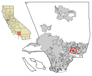
mapsize = 250x200px
map_caption = Location of West Puente Valley in Los Angeles County,California .
mapsize1 =
map_caption1 =subdivision_type = Country
subdivision_name =United States
subdivision_type1 = State
subdivision_name1 =California
subdivision_type2 = County
subdivision_name2 = Los Angeles
government_footnotes =
government_type =
leader_title =
leader_name =
leader_title1 =
leader_name1 =
established_title =
established_date =area_footnotes =
area_magnitude =
area_total_km2 = 4.5
area_land_km2 = 4.5
area_water_km2 = 0.0
area_total_sq_mi = 1.7
area_land_sq_mi = 1.7
area_water_sq_mi = 0.0population_as_of = 2000
population_footnotes =
population_total = 22589
population_density_km2 = 4983.8
population_density_sq_mi = 12908.0timezone = PST
utc_offset = -8
timezone_DST = PDT
utc_offset_DST = -7
elevation_footnotes =
elevation_m = 98
elevation_ft = 322
latd = 34 |latm = 3 |lats = 3 |latNS = N
longd = 117 |longm = 58 |longs = 11 |longEW = Wpostal_code_type =
ZIP code
postal_code = 91746
area_code = 626
blank_name = FIPS code
blank_info = 06-84774
blank1_name = GNIS feature ID
blank1_info = 1867073
website =
footnotes =West Puente Valley is a
unincorporated community andcensus-designated place in Los Angeles County,California , USA, northwest of La Puente. The population was 22,589 at the 2000 census. The community is probably named for its location related to the city of La Puente.Description
West Puente Valley is an unincorporated community located in the heart of the
San Gabriel Valley , betweenDowntown Los Angeles and Pomona. The community is easily accessible to the San Gabriel River Freeway to the west, theSan Bernardino Freeway to the north, and thePomona Freeway to the south.West Puente Valley is bounded by La Puente to the south and east, Baldwin Park to the northwest, West Covina to the northeast, and the San Gabriel River Freeway and the western boundary of City of Industry to the west. The community is mainly residential. The
ZIP code that serves the community is 91746.Geography
West Puente Valley is located at coor dms|34|3|3|N|117|58|11|W|city (34.050838, -117.969783)GR|1.
According to the
United States Census Bureau , the community has a total area of 4.5km² (1.8 mi²), all land.Demographics
As of the
census GR|2 of 2000, there were 22,589 people, 4,834 households, and 4,345 families residing in the CDP. Thepopulation density was 4,983.8/km² (12,908.0/mi²). There were 4,914 housing units at an average density of 1,084.2/km² (2,808.0/mi²). The racial makeup of the CDP was 43.85% White, 2.46% African American, 1.14% Native American, 7.95% Asian, 0.18% Pacific Islander, 40.00% from other races, and 4.43% from two or more races. Hispanic or Latino of any race were 81.53% of the population.There were 4,834 households out of which 46.2% had children under the age of 18 living with them, 67.2% were married couples living together, 15.6% had a female householder with no husband present, and 10.1% were non-families. 8.0% of all households were made up of individuals and 5.0% had someone living alone who was 65 years of age or older. The average household size was 4.67 and the average family size was 4.75.
In the CDP the population was spread out with 31.9% under the age of 18, 11.6% from 18 to 24, 29.2% from 25 to 44, 18.0% from 45 to 64, and 9.2% who were 65 years of age or older. The median age was 29 years. For every 100 females there were 98.6 males. For every 100 females age 18 and over, there were 96.7 males.
The median income for a household in the CDP was $49,923, and the median income for a family was $50,378. Males had a median income of $30,375 versus $21,601 for females. The
per capita income for the CDP was $12,806. About 9.8% of families and 11.5% of the population were below thepoverty line , including 12.9% of those under age 18 and 11.4% of those age 65 or over.Politics
In the state legislature West Puente Valley is located in the 24th Senate District, represented by Democrat
Gloria Romero , and in the 57th Assembly District, represented by DemocratEdward P. Hernandez . Federally, West Puente Valley is located inCalifornia's 38th congressional district , which has a Cook PVI of D +20 [cite web | title = Will Gerrymandered Districts Stem the Wave of Voter Unrest? | publisher = Campaign Legal Center Blog | url=http://www.clcblog.org/blog_item-85.html | accessdate = 2008-02-10] and is represented by DemocratGrace Napolitano .External links
* [http://www.city-data.com/city/West-Puente-Valley-California.html West Puente Valley's community profile]
Wikimedia Foundation. 2010.