- Madera, California
Infobox Settlement
official_name = Madera, California
settlement_type =City
imagesize =
image_caption =
image_
imagesize =
image_caption =
image_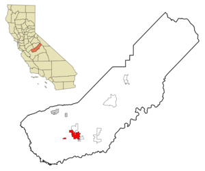
mapsize = 250px
map_caption = Location in Madera County and the state ofCalifornia
mapsize1 =
map_caption1 =
subdivision_type = Country
subdivision_type1 = State
subdivision_type2 = County
subdivision_name =United States
subdivision_name1 =California
subdivision_name2 = Madera
government_type =
leader_title = Mayor
leader_name = Sally J. Bomprezzi
established_date =
area_magnitude =
area_total_km2 = 31.8
area_total_sq_mi = 12.3
area_land_km2 = 31.8
area_land_sq_mi = 12.3
area_water_km2 = 0
area_water_sq_mi = 0
elevation_ft = 271
elevation_m = 83
population_as_of = 2000
population_footnotes =
population_total = 43207
population_metro = 123109
population_density_km2 = 1358.7
population_density_sq_mi = 3512.8
population_blank1_title =Demonym
population_blank1 = Maderan
timezone = Pacific (PST)
utc_offset = -8
latd = 36 |latm = 57 |lats = 48 |latNS = N
longd = 120 |longm = 4 |longs = 2 |longEW = W
timezone_DST = PDT
utc_offset_DST = -7
postal_code_type =ZIP code s
postal_code = 93637-93639
area_code = 559
blank_name = FIPS code
blank_info = 06-45022
blank1_name = GNIS feature ID
blank1_info = 0277552
footnotes =
website =Madera is a city in and the
county seat of Madera County,California ,United States .GR|6 It is the principal city of the Madera, CaliforniaMetropolitan Statistical Area which encompasses all of Madera County. It is located in California's Central Valley. The population was 43,207 at the 2000 census. The City of Madera is home to theMadera Unified School District and Golden Valley School District.Geography
Madera is located at coor dms|36|57|48|N|120|4|2|W|city (36.963411, -120.067316)GR|1.
According to the
United States Census Bureau , the city has a total area of 12.3 square miles (31.8 km²), all of it land.Madera is the location of the Madera
American Viticultural Area .38 Miles east of Madera is the geographic center of California.
Geographic centers of the United States Education
Higher Educational Sites
*Madera Center Community College (a campus of the
State Center Community College District )chool Districts
*
Madera Unified School District (K-12)Highways
Within the city of Madera, State Route 99 carries traffic in a generally northwest / southeast orientation. East of the city, State Route 41 can be accessed via either eastbound county roads, or via State Route 145, the latter of which turns from a northeast / southwest bearing to a directly south orientation within the city. The eastern terminus of State Route 152 is located convert|10|mi|km to the north of the city, on State Route 99.
Demographics
As of the
census GR|2 of 2000, there were 43,207 people, 11,978 households, and 9,438 families residing in the city. Thepopulation density was 3,515.3 people per square mile (1,357.4/km²). There were 12,521 housing units at an average density of 1,018.7/sq mi (393.4/km²). The racial makeup of the city was 48.15% White, 3.85% African American, 2.79% Native American, 1.43% Asian, 0.10% Pacific Islander, 38.01% from other races, and 5.66% from two or more races. Hispanic or Latino of any race were 67.75% of the population.There were 11,978 households out of which 48.4% had children under the age of 18 living with them, 53.7% were married couples living together, 17.5% had a female householder with no husband present, and 21.2% were non-families. 16.8% of all households were made up of individuals and 7.9% had someone living alone who was 65 years of age or older. The average household size was 3.57 and the average family size was 3.90.
In the city the population was spread out with 35.4% under the age of 18, 12.5% from 18 to 24, 28.3% from 25 to 44, 14.9% from 45 to 64, and 8.8% who were 65 years of age or older. The median age was 26 years. For every 100 females there were 102.8 males. For every 100 females age 18 and over, there were 101.1 males.
The median
income for a household in the city was $31,033, and the median income for a family was $31,927. Males had a median income of $29,776 versus $23,210 for females. Theper capita income for the city was $11,674. About 25.6% of families and 32.5% of the population were below thepoverty line , including 40.0% of those under age 18 and 12.7% of those age 65 or over.Politics
In the state legislature Madera is located in the 12th Senate District, represented by Republican
Jeff Denham , and in the 29th Assembly District, represented by RepublicanMichael Villines . Federally, Madera is located inCalifornia's 19th congressional district , which has a Cook PVI of R +10 [cite web | title = Will Gerrymandered Districts Stem the Wave of Voter Unrest? | publisher = Campaign Legal Center Blog | url=http://www.clcblog.org/blog_item-85.html | accessdate = 2007-10-20] and is represented by RepublicanGeorge Radanovich .ee also
*
California wine References
External links
* [http://www.madera.k12.ca.us/index.php Madera Unified]
* [http://www.MaderaOnline.com/ News & Info about Madera]
* [http://www.ShopMadera.com/ Business Directory for Madera]
* [http://www.cityofmadera.org/ City Website]
Wikimedia Foundation. 2010.