- Mammoth Lakes, California
-
Town of Mammoth Lakes — Town — View of Mammoth Lakes and the resurgent dome from along road to the Lakes Basin
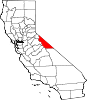
SealLocation within Mono County in the state of California
Coordinates: 37°38′55″N 118°58′19″W / 37.64861°N 118.97194°WCoordinates: 37°38′55″N 118°58′19″W / 37.64861°N 118.97194°W Country  United States
State  California
County Mono Incorporated (town) August 20, 1984 [1] Government - Mayor Skip Harvey[2] Area[3] - Total 25.306 sq mi (65.541 km2) - Land 24.866 sq mi (64.402 km2) - Water 0.440 sq mi (1.139 km2) 1.74% Elevation[4] 7,880 ft (2,402 m) Population (2010) - Total 8,234 - Density 325.4/sq mi (125.6/km2) Time zone PST (UTC-8) - Summer (DST) PDT (UTC-7) ZIP code 93546 Area code(s) 760 and 442 FIPS code 06-45358 GNIS feature ID 1659042 Website www.ci.mammoth-lakes.ca.us Mammoth Lakes is a town in Mono County, California, the county's only incorporated community. It is located 9 miles (14 km) northwest of Mount Morrison, at an elevation of 7,880 feet (2,400 m).[4][5] The population was 8,234 at the 2010 census, up from 7,093 at the 2000 census.
Contents
Geography
According to the United States Census Bureau, the town has a total area of 25.3 square miles (66 km2), of which 24.9 sq mi (64 km2) are land, and 0.4 sq mi (1.0 km2) (1.74%) water.
Mammoth Lakes resides on the edge of the Long Valley Caldera. The area around the town is geologically active, with hot springs and rhyolite domes that are less than 1000 years old.
Visitors can take State Route 203 from the town of Mammoth Lakes to the Mammoth Mountain Ski Area, over Minaret Summit, then down to Devil's Postpile National Monument, with access to the Ansel Adams Wilderness.
The area has natural hot springs which are sometimes used after skiing. Other features include lakes, a soda springs, and an obsidian dome. Mammoth Lakes is north of the Owens Valley, a scenic area with extensive hiking opportunities.
The town is surrounded by mountains: on the west, Mammoth Mountain looms over the town, while to the south, the Sherwin Range dominates the view. This hilly terrain and the high altitude makes the area great for high-altitude athletic training.
History
The European history of Mammoth Lakes started in 1877, when four prospectors staked a claim on Mineral Hill, south of the current town, along Old Mammoth Road. In 1878, the Mammoth Mining Company was organized to mine Mineral Hill, which caused a gold rush. By the end of 1878, 1500 people settled in the mining camp called Mammoth City. By 1880, the company had shut down, and by 1888, the population declined to less than 10 people. By the early 1900s, the town of Mammoth was informally established near Mammoth Creek. The economics of the original town was based on logging and tourism.[6]
The first post office at Mammoth Lakes opened in 1923.[5]
In 2004, the Mammoth Ski Museum opened in town. The museum features many vintage artifacts, photographs, and posters. A movie documenting the life of the founder of the ski resort (Dave McCoy) and those of early famous skiers in the area is shown. In 2010, photographs taken by Dave McCoy were featured in an exhibit at the museum.
Demographics
2010
The 2010 United States Census[7] reported that Mammoth Lakes had a population of 8,234. The population density was 325.4 people per square mile (125.6/km²). The racial makeup of Mammoth Lakes was 6,643 (80.7%) White, 29 (0.4%) African American, 49 (0.6%) Native American, 128 (1.6%) Asian, 5 (0.1%) Pacific Islander, 1,151 (14.0%) from other races, and 229 (2.8%) from two or more races. Hispanic or Latino of any race were 2,772 persons (33.7%).
The Census reported that 8,076 people (98.1% of the population) lived in households, 158 (1.9%) lived in non-institutionalized group quarters, and 0 (0%) were institutionalized.
There were 3,229 households, out of which 942 (29.2%) had children under the age of 18 living in them, 1,401 (43.4%) were opposite-sex married couples living together, 177 (5.5%) had a female householder with no husband present, 144 (4.5%) had a male householder with no wife present. There were 293 (9.1%) unmarried opposite-sex partnerships, and 13 (0.4%) same-sex married couples or partnerships. 899 households (27.8%) were made up of individuals and 153 (4.7%) had someone living alone who was 65 years of age or older. The average household size was 2.50. There were 1,722 families (53.3% of all households); the average family size was 3.14.
The population was spread out with 1,719 people (20.9%) under the age of 18, 1,050 people (12.8%) aged 18 to 24, 2,833 people (34.4%) aged 25 to 44, 2,100 people (25.5%) aged 45 to 64, and 532 people (6.5%) who were 65 years of age or older. The median age was 32.6 years. For every 100 females there were 121.4 males. For every 100 females age 18 and over, there were 127.0 males.
There were 9,626 housing units at an average density of 380.4 per square mile (146.9/km²), of which 1,502 (46.5%) were owner-occupied, and 1,727 (53.5%) were occupied by renters. The homeowner vacancy rate was 3.4%; the rental vacancy rate was 33.6%. 3,464 people (42.1% of the population) lived in owner-occupied housing units and 4,612 people (56.0%) lived in rental housing units.
2000
As of the census of 2000, there were 7,093 people, 2,814 households, and 1,516 families residing in the town.[8] The population density was 286.2 people per square mile (110.5/km²). There were 7,960 housing units at an average density of 321.1 per square mile (124.0/km²). The racial makeup of the town was 83.21% White, 0.41% African American, 0.49% Native American, 1.27% Asian, 0.13% Pacific Islander, 12.35% from other races, and 2.14% from two or more races. Hispanic or Latino of any race were 22.20% of the population.
There were 2,814 households out of which 28.4% had children under the age of 18 living with them, 43.3% were married couples living together, 6.0% had a female householder with no husband present, and 46.1% were non-families. 28.3% of all households were made up of individuals and 2.3% had someone living alone who was 65 years of age or older. The average household size was 2.44 and the average family size was 3.09.
In the town the population was spread out with 22.5% under the age of 18, 13.3% from 18 to 24, 38.4% from 25 to 44, 21.5% from 45 to 64, and 4.3% who were 65 years of age or older. The median age was 32 years. For every 100 females there were 131.9 males. For every 100 females age 18 and over, there were 141.2 males.
The median income for a household in the town was $44,570, and the median income for a family was $52,561. Males had a median income of $31,280 versus $25,106 for females. The per capita income for the town was $24,526. About 8.7% of families and 14.4% of the population were below the poverty line, including 14.9% of those under age 18 and none of those age 65 or over.
Politics
In the state legislature Mammoth Lakes is located in the 1st Senate District, represented by Republican Ted Gaines, and in the 25th Assembly District, represented by Republican Kristin Olsen. Federally, Mammoth Lakes is located in California's 25th congressional district, which has a Cook PVI of R +7 and is represented by Republican Buck McKeon.[9]
Economy
The Mammoth Lakes real estate market has gone through ups and downs over the past few decades. In 1980, an earthquake with magnitude of 6.1 on the Richter scale sent area property values plummeting. A huge real estate surplus formed after this, Mammoth Lakes had a total of over 1200 properties on the market. The development of Mammoth Mountain ski area has had a direct effect on housing in more recent years. The tourist market has led to an explosion of property values. This peaked in 2003 when the median property value reached $750,000. Another peak occurred in 2006 with the sale of Mammoth Mountain ski area to Starwood Capital Group.[10] As of February 2010, the median listing price was $460,000. This represents a drop of over 38% from the peak reached in 2006.[11]
Municipal Government
Mammoth Lakes is governed by a town council of five members: a mayor, a mayor pro tem, and three council members. Law enforcement is provided by the Mammoth Lakes Police Department and fire protection is provided by the Mammoth Lakes Fire Protection District. Emergency medical service is provided by Mono County operating out of Mammoth Lakes Fire Station #1.
In 2008, after a jury trial, the Mono County Superior Court entered a $30 million judgment against the Town of Mammoth Lakes for breach of a development agreement. The California Court of Appeal, Third District, affirmed the judgment in December 2010.[12] The California Supreme Court declined to hear the appeal on March 23, 2011.[13]
Education
Mammoth Lakes is in the Mammoth Unified School District, which has its main office in town. An elementary school and a high school (Mammoth High School) are located in Mammoth Lakes. Mammoth Lakes also has a continuation high school (Sierra High School). Mammoth Lakes also has a public library.[14]
Notable residents
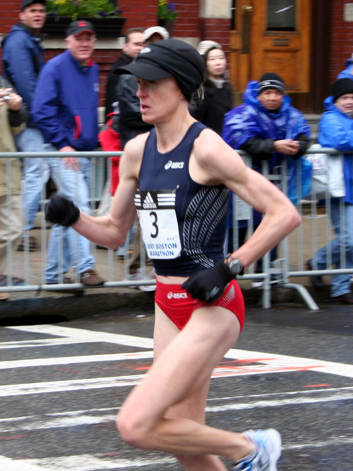
- Deena (Drossin) Kastor, 2004 Olympic bronze medalist in the marathon and winner of the London Marathon in 2006
- Meb Keflezighi, 2004 Olympic silver medalist in the marathon and winner of the New York City Marathon in 2009
- Trevor Donovan, actor who played Teddy Montgomery from CW-Networks hit series 90210
- John Bachar, deceased 2009, professional rock climber known for free soloing
References
- ^ "Incorporation Dates of California Cities". League of California Cities. http://www.cacities.org/resource_files/20457.IncorpDateLO.doc. Retrieved January 18, 2007.
- ^ "Town Council". Town of Mammoth Lakes Official Website. Town of Mammoth Lakes. http://www.ci.mammoth-lakes.ca.us/index.aspx?nid=82. Retrieved August 28, 2010.
- ^ U.S. Census
- ^ a b U.S. Geological Survey Geographic Names Information System: Mammoth Lakes, California
- ^ a b Durham, David L. (1998). California's Geographic Names: A Gazetteer of Historic and Modern Names of the State. Quill Driver Books. p. 1182. ISBN 9781884995149.
- ^ Reed, Adele (1982). Old Mammoth. Mammoth Lakes, California: Genny Smith Books. ISBN 0-931378-04-4.
- ^ All data are derived from the United States Census Bureau reports from the 2010 United States Census, and are accessible on-line here. The data on unmarried partnerships and same-sex married couples are from the Census report DEC_10_SF1_PCT15. All other housing and population data are from Census report DEC_10_DP_DPDP1. Both reports are viewable online or downloadable in a zip file containing a comma-delimited data file. The area data, from which densities are calculated, are available on-line here. Percentage totals may not add to 100% due to rounding. The Census Bureau defines families as a household containing one or more people related to the householder by birth, opposite-sex marriage, or adoption. People living in group quarters are tabulated by the Census Bureau as neither owners nor renters. For further details, see the text files accompanying the data files containing the Census reports mentioned above.
- ^ "American FactFinder". United States Census Bureau. http://factfinder.census.gov. Retrieved 2008-01-31.
- ^ "Will Gerrymandered Districts Stem the Wave of Voter Unrest?". Campaign Legal Center Blog. http://www.clcblog.org/blog_item-85.html. Retrieved October 20, 2007.
- ^ Sahagun, Louis; Roger Vincent (October 5, 2005). "Hotel Mogul to Buy Mammoth Ski Area". Los Angeles Times. http://articles.latimes.com/2005/oct/05/business/fi-mammoth5.
- ^ "Mammoth Mountain Median Listing Price". Zillow. http://www.zillow.com/local-info/CA-Mammoth-Lakes-home-value/r_35858.
- ^ Mammoth Lakes Land Acquisition, LLC vs. Town of Mammoth Lakes (California Court of Appeal, Third Appellate District, Case No. C059239, 30 December 2010). Text
- ^ http://appellatecases.courtinfo.ca.gov/search/case/disposition.cfm?dist=0&doc_id=1969975&doc_no=S190463
- ^ Mono County Office of Education[dead link]
External links
- Official Tourism Website of the Mammoth Lakes Visitors Bureau
- Mammoth Lakes travel guide from Wikitravel
- Mammoth Lakes Fire Department
- Mammoth Lakes Newspaper
- Mammoth Lakes Police Department
- Town of Mammoth Lakes Official Website
- WikiMammoth – wiki devoted to just Mammoth Lakes, CA
- Mammoth Lakes Twitter Updates
Municipalities and communities of Mono County, California County seat: Bridgeport Town Mammoth Lakes
CDPs Aspen Springs | Benton | Bridgeport | Chalfant | Coleville | Crowley Lake | June Lake | Lee Vining | McGee Creek | Mono City | Paradise | Sunny Slopes | Swall Meadows | Topaz | Walker
Unincorporated
communitiesBelfort | Benton Crossing | Benton Hot Springs | Chinatown | Crestview | Fales Hot Springs | Hammil | June Lake Junction | Lake Mary | Lower Town | Mesa Camp | Montgomery City | North Landing | Oasis | Pizona | Sonora Junction | South Landing | Toms Place | Upper Town | Wheeler Crest | Whitmore Hot Springs | Willow Springs
Indian
reservationsBenton Paiute Reservation | Bridgeport Paiute Indian Colony
Former
settlementsBennettville | Bodie | Dog Town | Dunderberg Mill | Lundy | Masonic | Mill City | Mono Mills | Mono Village | Monoville | State Line
Categories:- Sierra Nevada (U.S.)
- Cities in Mono County, California


Wikimedia Foundation. 2010.