- Michaelstow
-
Coordinates: 50°34′40″N 4°42′48″W / 50.57789°N 4.71325°W
Michaelstow 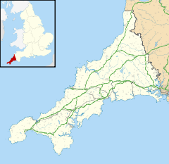
 Michaelstow
Michaelstow shown within CornwallPopulation 199 (Civil Parish, 2001) OS grid reference SX079788 Parish Michaelstow Unitary authority Cornwall Ceremonial county Cornwall Region South West Country England Sovereign state United Kingdom Post town BODMIN Postcode district PL30 Dialling code 01208 Police Devon and Cornwall Fire Cornwall Ambulance South Western EU Parliament South West England UK Parliament North Cornwall List of places: UK • England • Cornwall Michaelstow (Cornish: Lannvighal) is a civil parish and village in north Cornwall, United Kingdom. The village is situated approximately three miles (5 km) south of Camelford.[1]
The civil parish of Michaelstow is in the deanery of Trigg Minor and Hundred of Lesnewth. It is named after 'St Michael's holy place' and the parish church is dedicated to St Michael and All Angels. The River Camel runs along its eastern edge and the surrounding parishes are Lanteglos-by-Camelford to the north, St Breward to the east, St Tudy to the south and St Teath to the west.[2]
Helsbury Castle, an iron age hill fort, stands on Michaelstow Beacon half-a-mile north of the village.
References
- ^ Ordnance Survey: Landranger map sheet 200 Newquay & Bodmin ISBN 9780319229385
- ^ [1] GENUKI website; Michaelstow; retrieved April 2010
 Michaelstow Church
Geography of Cornwall Cornwall Portal Unitary authorities Major settlements Bodmin • Bude • Callington • Camborne • Camelford • Falmouth • Fowey • Hayle • Helston • Launceston • Liskeard • Looe • Lostwithiel • Marazion • Newlyn • Newquay • Padstow • Par • Penryn • Penzance • Porthleven • Redruth • Saltash • St Austell • St Blazey • St Columb Major • St Ives • St Just-in-Penwith • St Mawes • Stratton • Torpoint • Truro • Wadebridge
See also: Civil parishes in CornwallRivers Topics History • Status debate • Flag • Culture • Places • People • The Duchy • Diocese • Politics • Hundreds/shires • Places of interest • full list...Civil parishes of North Cornwall constituency  Advent • Altarnun • Blisland • Bodmin • Boyton • Bude–Stratton • Camelford • Cardinham • Davidstow • Egloshayle • Egloskerry • Forrabury and Minster • Helland • Jacobstow • Kilkhampton • Laneast • Lanhydrock • Lanivet • Launceston • Launcells • Lawhitton Rural • Lesnewth • Lewannick • Lezant • Marhamchurch • Michaelstow • Morwenstow • North Hill • North Petherwin • North Tamerton • Otterham • Padstow • Poundstock • South Petherwin • St Breock • St Breward • St Clether • St Endellion • St Ervan • St Eval • St Gennys • St Issey • St Juliot • St Kew • St Mabyn • St Merryn • St Minver Highlands • St Minver Lowlands • St Stephens by Launceston Rural • St Teath • St Thomas the Apostle Rural • St Tudy • Stoke Climsland • Tintagel • Tremaine • Treneglos • Tresmeer • Trevalga • Trewen • Wadebridge • Warbstow • Week St Mary • Werrington • Whitstone • Withiel
Cornwall Portal Categories:- Villages in Cornwall
- Civil parishes in Cornwall
- Cornwall geography stubs


Wikimedia Foundation. 2010.