- Marina, California
-
City of Marina — City — City of Marina welcome sign Location in Monterey County and the state of California
Coordinates: 36°41′04″N 121°48′08″W / 36.68444°N 121.80222°WCoordinates: 36°41′04″N 121°48′08″W / 36.68444°N 121.80222°W Country  United States
State  California
County Monterey Government - Mayor Bruce Delgado (G) - Senate Sam Blakeslee (R) - Assembly Bill Monning (D) - U. S. Congress Sam Farr (D) Area[1] - Total 9.763 sq mi (25.287 km2) - Land 8.883 sq mi (23.007 km2) - Water 0.880 sq mi (2.280 km2) 9.02% Elevation[2] 43 ft (13 m) Population (2010) - Total 19,718 - Density 2,019.7/sq mi (779.8/km2) Time zone PST (UTC-8) - Summer (DST) PDT (UTC-7) ZIP code 93933 Area code(s) 831 FIPS code 06-45778 GNIS feature ID 1659061 Marina is a city in Monterey County, California, United States. The population was 19,718 at the 2010 census. Marina is located along the central coast of California, 8 miles (13 km) west of Salinas,[3] and 8 miles north of Monterey, at an elevation of 43 feet (13 m).[2] Marina was incorporated in 1975 and is the newest city on the Monterey Peninsula. The city includes part of a California State University, Monterey Bay, the UCMBEST branch research center of UC Santa Cruz, and the Veterans Transition Center (VTC).
Contents
Geography
Marina is located at 36°41′04″N 121°48′08″W / 36.68444°N 121.80222°W.[2]
According to the United States Census Bureau, the city has a total area of 9.8 square miles (25 km2), of which, 8.9 square miles (23 km2) of it is land and 0.9 square miles (2.3 km2) of it (9.02%) is water.
History
William Locke-Paddon founded the town on 1,500 acres (6.1 km2) of land he bought for the purpose.[3] The Marina post office opened in 1916.[3] Marina incorporated in 1975.[3] The City's history is intertwined with that of Fort Ord. Fort Ord lands were used as an infantry training center since the Mexican-American War. Major growth took place in 1938 with the first joint Army and Navy maneuvers held in 1940.
Fort Ord was selected in 1991 for decommissioning and the post formally closed after troop reassignment in 1994. In July 1994 the first academic year of California State University, Monterey Bay opened, and barracks were soon transformed into dorms.
As a result of base closure, some of the last undeveloped natural wildlands on the Monterey Peninsula are now overseen by the Bureau of Land Management, including 86 miles of trails for the public to explore on foot, bike or horseback.
Demographics
 Residential neighborhood
2010
The 2010 United States Census[4] reported that Marina had a population of 19,718. The population density was 2,019.6 people per square mile (779.8/km²). The racial makeup of Marina was 8,904 (45.2%) White, 1,487 (7.5%) African American, 140 (0.7%) Native American, 3,931 (19.9%) Asian, 544 (2.8%) Pacific Islander, 2,738 (13.9%) from other races, and 1,974 (10.0%) from two or more races. Hispanic or Latino of any race were 5,372 persons (27.2%).
The Census reported that 18,827 people (95.5% of the population) lived in households, 891 (4.5%) lived in non-institutionalized group quarters, and 0 (0%) were institutionalized.
There were 6,845 households, out of which 2,517 (36.8%) had children under the age of 18 living in them, 3,126 (45.7%) were opposite-sex married couples living together, 1,128 (16.5%) had a female householder with no husband present, 417 (6.1%) had a male householder with no wife present. There were 517 (7.6%) unmarried opposite-sex partnerships, and 58 (0.8%) same-sex married couples or partnerships. 1,587 households (23.2%) were made up of individuals and 553 (8.1%) had someone living alone who was 65 years of age or older. The average household size was 2.75. There were 4,671 families (68.2% of all households); the average family size was 3.26.
The population was spread out with 4,773 people (24.2%) under the age of 18, 2,543 people (12.9%) aged 18 to 24, 5,188 people (26.3%) aged 25 to 44, 4,970 people (25.2%) aged 45 to 64, and 2,244 people (11.4%) who were 65 years of age or older. The median age was 34.0 years. For every 100 females there were 92.8 males. For every 100 females age 18 and over, there were 88.5 males.
There were 7,200 housing units at an average density of 737.5 per square mile (284.7/km²), of which 2,963 (43.3%) were owner-occupied, and 3,882 (56.7%) were occupied by renters. The homeowner vacancy rate was 2.4%; the rental vacancy rate was 3.6%. 7,857 people (39.8% of the population) lived in owner-occupied housing units and 10,970 people (55.6%) lived in rental housing units.
2000
As of the census[5] of 2000, there were 25,101 people, 6,745 households, and 4,809 families residing in the city. The population density was 2,869.8 people per square mile (1,107.6/km²). There were 8,537 housing units at an average density of 976.0 per square mile (376.7/km²). The racial makeup of the city was 43.74% White, 14.34% African American, 0.74% Native American, 16.27% Asian, 2.10% Pacific Islander, 14.81% from other races, and 7.99% from two or more races. Hispanic or Latino of any race were 23.19% of the population.
There were 6,745 households out of which 35.5% had children under the age of 18 living with them, 51.1% were married couples living together, 15.1% had a female householder with no husband present, and 28.7% were non-families. 21.4% of all households were made up of individuals and 6.4% had someone living alone who was 65 years of age or older. The average household size was 2.79 and the average family size was 3.25.
In the city the population was spread out with 21.3% under the age of 18, 14.0% from 18 to 24, 38.4% from 25 to 44, 18.4% from 45 to 64, and 7.9% who were 65 years of age or older. The median age was 32 years. For every 100 females there were 133.8 males. For every 100 females age 18 and over, there were 142.3 males.
The median income for a household in the city was $43,000, and the median income for a family was $46,139. Males had a median income of $43,139 versus $26,679 for females. The per capita income for the city was $18,860. 13.1% of the population and 10.7% of families were below the poverty line. Out of the total people living in poverty, 18.1% are under the age of 18 and 5.9% are 65 or older.
The military has been a significant part of life in Marina, which is located adjacent to the former Fort Ord, a US Army installation which closed in 1994 during the country's base closure initiative. Many former and retired military personnel reside in the city. The American Legion and the Veterans of Foreign Wars are active organizations. The Veterans Transition Center [1] is instrumental in placing numerous US and state flags along Del Monte Blvd. and Reservation Road during the various holidays and special events, creating an "avenue of flags."
Annual events
Marina has several popular annual events.
A traditional Labor Day Parade & Family Festival held the Saturday before the official holiday pays homage to the significant military history of the town.
The annual Otter Day festival in August welcomes back students, staff, and faculty to CSU, Monterey Bay. It begun in 2010 with a Key to the City presentation to the campus president. It is named after the university's otter mascot.
Earth Day is celebrated in May as a community work party to maintain and improve Locke-Paddon Park. Citizens for Sustainable Marina is the lead planning group for the event.
The Marina Air Faire, held in October, features vintage and experimental planes, and gives attendees the chance to ride in them (for a fee).[6] The Festival of the Winds, held on Mother's Day weekend every year, has giant kites, hang gliding, kite making workshops, and many more activities.[7]
All events have free admission.
Marina also celebrates its 1975 incorporation every five years with numerous city wide events, including a Diversity Dinner celebrating the variety of cultures represented in the city.
Marina State Beach
- See also: Monterey county attractions, Marina State Beach
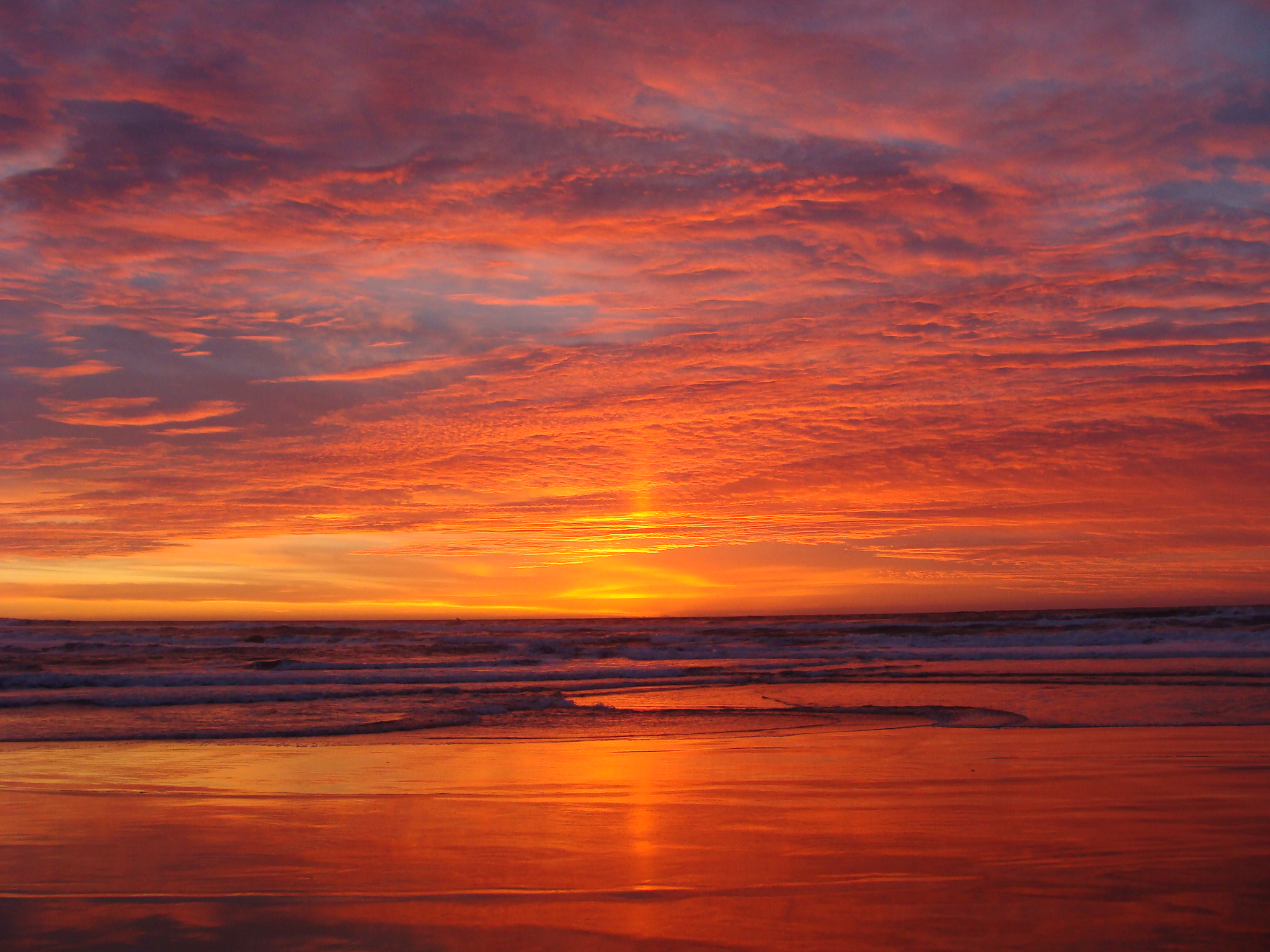
 Sunset at Marina
Marina State Beach is a windswept beach area between State Route 1 and Monterey Bay where water recreation, hang gliding and paragliding are popular. There is a boardwalk through the Marina Dunes Natural Preserves.
Fort Ord Dunes State Park
- See also: Fort Ord Dunes State Park
Fort Ord Dunes State Park opened in March, 2009. Though much of the park is located in the neighboring town of Seaside, California, access for the park is located in Marina. Fort Ord Dunes State Park is a popular place for horseback riding, hiking, fishing and cycling. Fort Ord Dunes State Park abuts Marina State Beach.
See also
- Coastal California
- List of school districts in Monterey County, California
- Monterey county attractions
- Marina State Beach
- Fort Ord Dunes State Park
References
- ^ U.S. Census
- ^ a b c U.S. Geological Survey Geographic Names Information System: Marina, California
- ^ a b c d Durham, David L. (1998). California's Geographic Names: A Gazetteer of Historic and Modern Names of the State. Quill Driver Books. p. 922. ISBN 9781884995149.
- ^ All data are derived from the United States Census Bureau reports from the 2010 United States Census, and are accessible on-line here. The data on unmarried partnerships and same-sex married couples are from the Census report DEC_10_SF1_PCT15. All other housing and population data are from Census report DEC_10_DP_DPDP1. Both reports are viewable online or downloadable in a zip file containing a comma-delimited data file. The area data, from which densities are calculated, are available on-line here. Percentage totals may not add to 100% due to rounding. The Census Bureau defines families as a household containing one or more people related to the householder by birth, opposite-sex marriage, or adoption. People living in group quarters are tabulated by the Census Bureau as neither owners nor renters. For further details, see the text files accompanying the data files containing the Census reports mentioned above.
- ^ American FactFinder. United States Census Bureau. Retrieved on 2008-01-31.
- ^ Monterey County Convention and Visitors Bureau: Marina Air Faire
- ^ Official site: Marina Festival of the Winds
External links
Municipalities and communities of Monterey County, California County seat: Salinas Cities Carmel-by-the-Sea | Del Rey Oaks | Gonzales | Greenfield | King City | Marina | Monterey | Pacific Grove | Salinas | Sand City | Seaside | Soledad

CDPs Aromas‡ | Boronda | Bradley | Carmel Valley Village | Castroville | Chualar | Del Monte Forest | Elkhorn | Las Lomas | Lockwood | Moss Landing | Pajaro | Pine Canyon | Prunedale | San Ardo | San Lucas | Spreckels
Unincorporated
communitiesAmbler Park | Blanco | Bolsa Knolls | Bryson | Camphora | Carmel Highlands | Coburn | Confederate Corners | Cooper | Corral de Tierra | Dean | Del Monte | East Garrison | Elsa | Fort Romie | Gabilan Acres | Gorda | Harlem | Jamesburg | Jolon | Lonoak | Lucia | Martinus Corner | Metz | Molus | Moss | Nacimiento | Nashua | Natividad | Neponset | Notleys Landing | Oak Hills | Old Hilltown | Pacific Grove Acres | Parkfield | Pebble Beach | Penvir | Plaskett | Pleyto | Posts | Robles Del Rio | Royal Oaks | San Benancio | Slates Hot Springs | Spence | Spreckels Junction | Sycamore Flat | Tassajara Hot Springs | Valleton | Watsonville Junction | Welby | Wunpost
Ghost towns Achasta | Animpayamo | Carmelito | Docas | Dunbarton | Eagle | Eslanagan | Fort Ord Village | Gabilan | Gem | Griswold | Guayusta | Imusdale | Kakonkaruk | Kalindaruk | Kulul | Lukaiasta | Paisin | Quina | Sans | Sapaywis | Seama | Soccorondo | Steloglamo | Subazama | Tecolom | Teshaya | Tetachoya | Tiubta | Tukutnut | Upland | Vega | Veratina | Wachanaruka | Zassalete | Zumblito
Footnotes ‡This populated place also has portions in an adjacent county
Categories:- Incorporated cities and towns in California
- Populated coastal places in California
- Cities in Monterey County, California


Wikimedia Foundation. 2010.